val verde pecos river - texas parks and wildlife … · historic park, though not on the pecos...
TRANSCRIPT

Figure 33. Ecologically significant Pecos River (TNRCC classified stream segment 2310 and part of 2311), Devils River (within TNRCC classified stream segment 2309), and San Felipe Creek (TNRCC classified stream segment 2313) stream segments in Val Verde County (scale: 1 inch = 10 miles; Base map source: TxDOT county files).
VAL VERDE
MEXICO
Pecos
River
Devil's
River
Rio Grande
InternationalAmistad
Reservoir
Devil's River SNA
Seminole Canyon SHP
<N
Dolan Falls Preserve
Rio Grande
%g189
%g2523Sa
nFelip
e Cr.
Del Rio
Amistad National Recreation Area
(/377
(/90
(/90
(/90
(/277
Comstock
41

42
Pecos River
The Pecos River rises on the eastern slope of the Santa Fe Mountain Range in Mora County New Mexico. It entersthe State of Texas at the state line in Loving County at Red Bluff Lake; meanders in a general southeasterly courseapproximately 170 miles through a narrow alluvial valley to Sheffield. From this point it continues in a southeasterlycourse 90 miles through a deep box canyon to its junction with the Rio Grande 10 miles west of Comstock, in ValVerde County. Its principal tributaries are Toyah and Comanche creeks in Texas and Delaware Creek just north ofthe New Mexico-Texas state line. These creeks are intermittent. The Pecos River is the principal tributary of thelower Rio Grande. There are no power developments along the stream in Texas, but considerable water is divertednear Pecos and Grandfalls for irrigation24. The significant stream segment on the Pecos River is within the TransPecos (Chihuahuan Desert) ecoregion. It begins at Val Verde/Crockett County line downstream to a point 0.4 milesdownstream of the confluence with Painted Canyon in Val Verde County (Fig. 33). The ecological significance ofthis segment is based upon the following criteria:
1. Biological function – The aquatic and riparian habitats associated with the river (Figs. 34&35) support adiverse assemblage of invertebrates, reptiles, fish, birds, and plants. The three ecological zones mentioned inthe Devil’s River account also overlap along this segment of the Pecos River. Riparian gallery forests includesalt cedar, oaks, willows, huisache, baccharis and many other brush species.
2. Hydrologic function – The Pecos River runs into the upper end of International Amistad Reservoir. Theriparian habitats along the segment help filter runoff, attenuate peak flood flows, and regulate baseflow.
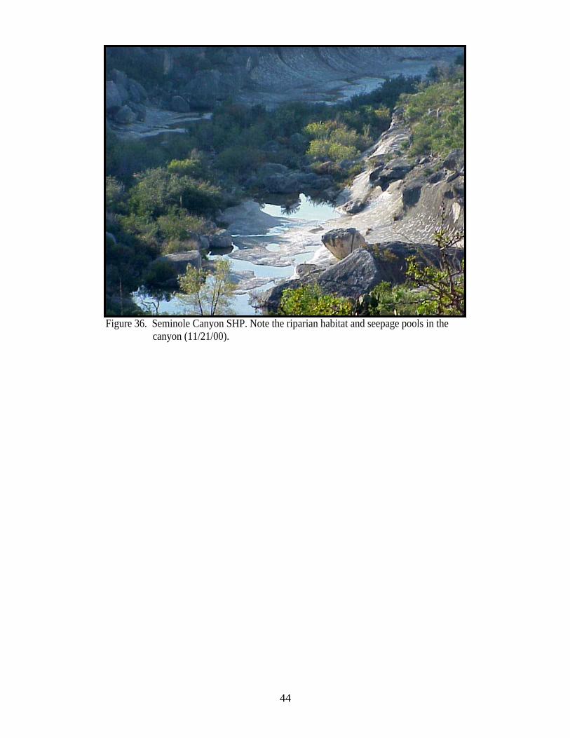
3. Riparian conservation area – Amistad National Recreation Area (NPS) extends up the river from the RioGrande to Shumla Bend just downstream from the confluence with Painted Canyon. Seminole Canyon StateHistoric Park, though not on the Pecos River, fronts Amistad Reservoir just below the confluence of thePecos with the Rio Grande (Fig. 36). Both of these sites have been nominated for inclusion in the Heart ofTexas Wildlife Trail.
4. High water quality/exceptional aquatic life/high aesthetic value – This segment has exceptional aestheticvalue including spectacular limestone canyon formations. Many rock shelters and a few caves contain burnedrock middens, pictographs, and petroglyphs14.
5. Threatened or endangered species/unique communities – The following rare species associated with aquaticor riparian habitats may occur in or along this segment: The Black-capped vireo (Fed.E,St.E), Interior leasttern (Fed.E, St.E), and Zone-tailed hawk (St.T), all use riparian habitats for nesting. The Rio Grande darter(St.T)10, and Proserpine shiner (St.T)10,11; the Indigo snake (St.T) and Big Bend blackhead snake (St.T) arefound in riparian and/or aquatic habitats in this region.

43
Figure 34. Pecos River confluence with the Rio Grande from US 90 high bridge in ValVerde County (11/21/00).
Figure 35. Pecos River confluence with the Rio Grande. Note the expansion of riparianbrush (mostly salt cedar) apparent in the photo in Fig. 34. Source: SeminoleCanyon DOQ, 1995, 1 m CIR.
44
Figure 36. Seminole Canyon SHP. Note the riparian habitat and seepage pools in thecanyon (11/21/00).