vessel monitoring system
TRANSCRIPT

Adi B. Wicaksono
Pre-Departure TrainingI / A / L / F
Jakarta, 24 June 2013
Vessel Monitoring
System

TERRITORIAL WATERS
INDONESIA EEZ BORDER
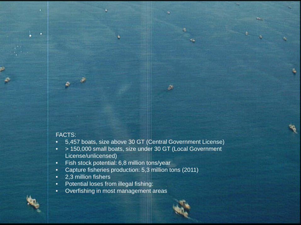
FACTS:• 5,457 boats, size above 30 GT (Central Government License)• > 150,000 small boats, size under 30 GT (Local Government
License/unlicensed)• Fish stock potential: 6,8 million tons/year• Capture fisheries production: 5,3 million tons (2011) • 2,3 million fishers• Potential loses from illegal fishing:• Overfishing in most management areas

Objectives of VMS implementation:
1.To monitor fishing vessels and fish carrier vessels’ position and activity at sea by transmitter/ platform installation with satellite based system
2.To improve management of fish resources optimization
3.To increase the compliance of fishing boats of the provisions of the legislation in force
4.Sustainable and responsible fisheries resource utilization.

Fishing Vessels
VMS Satellites
GPS Satellites
Ground Station
Main Server
Internet
Fishing Monitoring
Center
Fishing vessels transmit their GPS position to VMS satellite
The data are downloaded from satellite by a ground station
Ground station sends data to Fishing Monitoring Center
Fishing company track their fleet by access website
Vessel Monitoring System
Boat owner
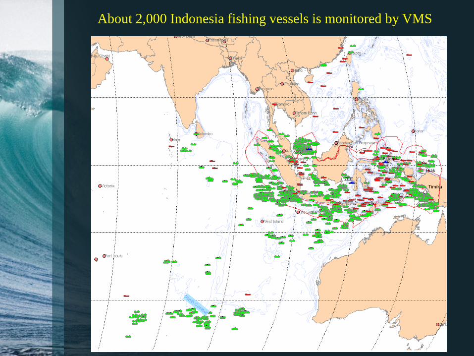
About 2,000 Indonesia fishing vessels is monitored by VMS

Some indications that are detected by VMS
• Red line, lower speed
• Zigzag pattern
Fishing activity
• Entering territorial waters
• Forbidden for big one
Fishing outside their areas
• Speed = 0• For long
time period
Trans-shipment at sea
• Pair trawls• Always
together in pairs
Forbidden fishing gears

Thank you for your kind attentions
Adi B. WicaksonoClass: AAS/6M2
Presented as speaking assignmentEnglish for Academic Purposes
I / A / L / FJakarta, 2013