water and environmental research institute of the … and environmental research institute of the...
TRANSCRIPT

Water and Environmental Research Institute of theWestern Pacific
Annual Technical ReportFY 2016
Water and Environmental Research Institute of the Western Pacific Annual Technical Report FY 20161

Introduction
The Water & Environmental Research Institute of the Western Pacific (WERI) is one of the 54 water researchinstitutes established by U.S. Congressional legislation at each Land Grant University in the United States andits territories. Chartered in 1975, WERI is now in its 42nd year of operation.
WERI’s Federal Charter: WERI’s mission is to seek solutions through research, teaching, and outreachprograms to improve exploration, production, distribution, and management of regional freshwater resources,with the ultimate aim of enhancing the prosperity and the quality of life for the citizens of Guam and theregional island nations. WERI research and educational activities are sponsored by a variety of federal andlocal funding sources, but the institute was originally created to administer Department of Interior funds (viathe US Geological Survey) under Section 104-B of the Water Resources Research Act. WERI hasresponsibility for three 104-B base grants: one each for Guam, the Commonwealth of the Northern MarianaIslands (CNMI), and the Federated States of Micronesia (FSM). This report summarizes WERI's regionalactivities under the USGS 104-B base grant program for the period March 1, 2016 to February 28, 2017(FY16).
WERI’s Local Mandates: Since 1998, WERI has also administered two locally-funded programs: the GuamComprehensive Water Monitoring Program (CWMP), established under Guam Public Law 24-161, and theGuam Hydrologic Survey Program (GHS), established under Guam Public Law 24-247. These programsprovide for island-wide hydrologic data collection and analysis in partnership with the USGS Pacific IslandWater Science Center in Honolulu, Hawaii. The data, along with other basic and historical data are maintainedin the Northern Guam Lens Aquifer Database, which is the foundation for WERI’s aquifer mapping andgroundwater modeling programs. With the information and understanding gained from these programs, WERIprovides technical support services, including annual workshops and field trips, for Guam’s public and privatesector water resources professionals.
WERI’s Research and Teaching Activities: Expertise at WERI spans the natural water cycle and the spectrumof human water use. Research specialties and graduate instruction offered include tropical meteorology,surface water hydrology, groundwater hydrology, water distribution systems, watershed management and soilerosion and mitigation, wastewater treatment, water quality, and the application of geospatial analysis to waterresources problems. In support of these activities, WERI operates a state-of-the-art water analyticallaboratory, and a geographical information systems laboratory. WERI faculty contribute to graduateinstruction and student thesis research within the university’s Environmental Science and Biology programs.WERI is also making a central contribution to the launching of the university’s new School of Engineering byassisting with undergraduate instruction, student advisement, faculty recruitment, facilities planning, andliaison with regional and stateside partner universities.
Staffing: WERI is led by a full-time director appointed from among its faculty for three years at a time. Thedirector’s office is supported by a secretary and administrative assistant. WERI has six permanent faculty (oneof whom is currently serving as Interim Dean of the School of Engineering) and two emeritus faculty. Itswater quality laboratory is staffed by a laboratory manager, chemist, and technician. The CWMP and GHSprograms are managed by WERI’s groundwater hydrologist with the assistance of a Ph.D. research associate.WERI researchers currently support seven graduate research assistants who are completing their MS degreesin the UOG Environmental Science program.
Funding and Sources: During FY2016, WERI faculty served as principal investigators and/or advisors onmore than twenty research, training, and outreach activities with a total budget of approximately $1.5M.Funding sources for these projects, in addition to the US Geological Survey, included the National Oceanicand Atmospheric Administration, the National Weather Service, the National Science Foundation, USGS
Introduction 1

Pacific Islands Climate Science Center, the US Department of Defense, and local agencies including theGuam Legislature, Guam Waterworks Authority, Guam Bureau of Statistics and Plans, and the GuamEnvironmental Protection Agency.
Introduction 2

Research Program Introduction
WERI has three community advisory councils that provide stakeholder advice and assistance for settingresearch goals and priorities, especially for the USGS 104-B program. The Guam Advisory Council includesrepresentatives from local and federal civil agencies and military environmental and engineering offices thatdeal with water resources issues, as well as colleagues in the university research community. The advisorycouncils for the Commonwealth of the Northern Mariana Islands (CNMI) and the Federated States ofMicronesia (FSM) include representatives from government departments that deal with water resources,private sector engineers, environmental regulators, faculty from the local colleges, and other University ofGuam research faculty who work on these islands. The duties of the advisory councils are to identify researchand training needs for each region. WERI maintains a list of each region’s needs, which is updated after eachannual meeting.
WERI held advisory council meetings in September through October 2015. Each council examined theresearch, education, and training priorities identified in past years and added or amended where appropriate.In early November, a Request for Proposals (RFP) letter was sent out by e-mail to over two hundred (200)regional representatives in Guam, the CNMI and FSM. Recipients included past and present advisory councilmembers; faculty members at the University of Guam, the Northern Marianas College in Saipan and theCollege of Micronesia in Pohnpei, and water resource professionals from government agencies.
In December 2015, four regional review panels, each composed of well-qualified water resourcesprofessionals and advisory council members, evaluated the proposals and submitted their scores andcomments to the WERI Director. The proposal scores were then tabulated and the projects ranked indescending order of average score. Projects approved for funding were selected based on their regionalranking and availability of funds.
Research Program Introduction
Research Program Introduction 1

Expansion of baseline data for the Northern Guam LensAquifer and evaluation of innovative treatments to reducecontaminant input to the aquifer
Basic Information
Title: Expansion of baseline data for the Northern Guam Lens Aquifer and evaluation ofinnovative treatments to reduce contaminant input to the aquifer
Project Number: 2016GU296BStart Date: 3/1/2016End Date: 2/28/2017
Funding Source: 104BCongressional
District: N/A
ResearchCategory: Engineering
Focus Categories: Nitrate Contamination, Groundwater, TreatmentDescriptors: None
PrincipalInvestigators: Joe Rouse, Nathan C Habana, John W. Jenson
Publications
There are no publications.
Expansion of baseline data for the Northern Guam Lens Aquifer and evaluation of innovative treatments to reduce contaminant input to the aquifer
Expansion of baseline data for the Northern Guam Lens Aquifer and evaluation of innovative treatments to reduce contaminant input to the aquifer1

PROJECT SYNOPSIS REPORT Project Title: Expansion of baseline data for the Northern Guam Lens Aquifer and
evaluation of innovative treatments to reduce contaminant input to the aquifer.
Problem and Research Objectives
The Northern Guam Lens Aquifer (NGLA) is Guam’s primary source of freshwater
for potable use. This porous limestone formation currently provides approximately
90% of the island’s municipal water supply. Aggressive production of groundwater
has grown to 40 million gallons per day. With water demand rising and concerns
over water quality increasing, proper management of this freshwater lens has become
critical to the welfare of the island’s increasing population of residents and tourists.
Preliminary inquiries have suggested that contaminants from anthropogenic sources
are showing up in the NGLA. Much more baseline data is needed, though, to
determine if the problem is greater in zones with sewer collection lines, or in zones
that rely on household septic tanks. In addition, the determination of whether or not
contaminant levels are increasing, has not been adequately addressed. This too, begs
for the need to get more data from wells servicing the NGLA.
In conjunction with the above, the effectiveness of septic tanks, which are so
prevalent over Northern Guam, is also an issue of concern. Septic tanks are not
known to provide much treatment, other than the removal of readily settleable
suspended solids, and it is not known how many of the existing tanks are even
discharging to adjoining tile fields as intended. It is through the process of
percolating evenly over the tile field that the actual reduction in contaminant loadings
via natural processes is meant to occur. As an alternative to traditional septic tanks,
consideration is increasingly given to use of single-family prefabricated, packaged
treatment units, which achieve secondary to advance levels of treatment, and as such
if applied to Northern Guam, would serve to greatly reduce the potential of
contamination reaching the NGLA.
This proposal responds to the critical needs expressed at the Advisory Council
Meeting to conduct research on spatial and temporal trends in levels of contaminants
in Guam’s groundwater, as well as the need for baseline studies on continuous levels
of nitrogenous compounds, etc. with respect to time and location. In addition, it
addresses the need for evaluation of pilot studies of innovative wastewater treatment
units as alternatives to conventional septic tanks for individual homes.
The objective of the proposed project is to produce a report that will offer further
enlightenment as to the transport and fate of contaminants of anthropogenic sources
in the sub-surface, and anticipated trends for the near future. These results will
strengthen modeling capabilities addressing the water quality of the NGLA, thus
being of importance to human safety.

Methodology
The methods employed over the course of this project incorporated civil and
environmental engineering fieldwork. Fieldwork consisted of setting up testing
equipment for on-site data collection at well heads servicing the NGLA.
Furthermore, influent and effluent samples of package treatment plants in Northern
Guam were collected and transported to the laboratory (at WERI, UOG) for water
quality analyses. Prior to conduction any activities, meetings were held with officials
of the Guam Waterworks Authority to get permission to set up testing equipment at
well-head locations in Northern Guam. Upon completion of the fieldwork and
laboratory testing, all information was processed and evaluated. Finally, results of
this study would be presented at environmental conferences and published in a WERI
Technical Report to be made available to all authorized stakeholders.
Principal Findings and Significance
Preliminary inquiries have suggested that contaminants from anthropogenic sources
are showing up in the NGLA. From the data obtained here it is not evident that
ammonium and nitrate levels in the environment are changing with time. Results do
show, though, that ammonium is nearly absent in the groundwater, indicating that
biologically induced nitrification is occurring in the environment. The presence of
low levels of nitrate (ca. 4 to 5 mg N/L) corroborate this, though there is no clear
indication yet that denitrification is occurring, versus dilution. It is essential that
these issues be further studied before actions are taken to extend sewer collection
lines or even build new wastewater plants in Northern Guam. In addition, the
effectiveness of septic tanks is also an issue of concern. As an alternative to
traditional septic tanks, consideration is increasingly given to use of single-family
prefabricated, packaged treatment units. These units could serve to reduce the
potential of contamination reaching the water table, and indeed test results of effluent
from a prefab-unit on island show far cleaner discharge (chemical oxygen demand
(COD), ca. 100 mg/L) as compared to effluent from a conventional septic tank (COD,
ca. 400 mg/L). Further comparative testing is to be conducted.

Exploring the natural limits of the Northern Guam LensAquifer: A step toward optimum sustainable management,Phase 3 � model implementation: determining ultimate yield
Basic Information
Title: Exploring the natural limits of the Northern Guam Lens Aquifer: A step toward optimumsustainable management, Phase 3 � model implementation: determining ultimate yield
Project Number: 2016GU297BStart Date: 3/1/2016End Date: 2/28/2017
Funding Source: 104BCongressional
District: N/A
ResearchCategory: Ground-water Flow and Transport
Focus Categories: Groundwater, Hydrology, HydrogeochemistryDescriptors: None
PrincipalInvestigators: Nathan C Habana, John W. Jenson
Publications
There are no publications.
Exploring the natural limits of the Northern Guam Lens Aquifer: A step toward optimum sustainable management, Phase 3 � model implementation: determining ultimate yield
Exploring the natural limits of the Northern Guam Lens Aquifer: A step toward optimum sustainable management, Phase 3 � model implementation: determining ultimate yield1

PROJECT SYNOPSIS REPORT
Project Title: Exploring the natural limits of the Northern Guam Lens Aquifer: A step
toward optimum sustainable management; Phase 3 – model implementation: determining
ultimate yield
Problem and Research Objectives:
The Northern Guam Lens Aquifer (NGLA) provides 90% of Guam’s drinking water. The
anticipated addition of US Marine Corps activities will require additional production,
while ongoing economic growth will further increase demand. Policy makers and water
managers want to know the volumes of water that can be sustainably withdrawn from
various parts of the aquifer, and how increased withdrawal will affect salinity. This phase
of WERI’s ongoing modeling program, in partnership with USGS, explores combinations
of volume and quality that might be obtained if the current number of production wells
(about 130) was installed exclusively in the para-basal zone of the aquifer, where the
freshwater lens is underlain by impermeable volcanic rock rather than saltwater.
Methodology
The three-dimensional steady state numerical (SUTRA-3D) model of the NGLA
developed by USGS and WERI during 2010-2013 to assess the performance of the
current system (Gingerich and Jenson, 2010; Gingerich, 2013) is now being used to
explore the ultimate hydrologic capacity of the aquifer, i.e., what quantity and quality of
water could be extracted if well placement was not restricted by land-use or accessibility
to roads and power, but was rather based solely on where hydrogeologic conditions are
best. For this project, 130 hypothetical wells are set 25 ft and 40 ft below mean sea level,
and pumped at increments of 100 gpm up to a maximum output of 500 gpm or maximum
salinity of 250 mg/l chloride (a USEPA secondary water quality standard).
Principal Findings and Significance
Groundwater models can explore the outcomes for hypothetical well configurations that
cannot be tested in a real aquifer system. This project so far shows that confining
production to the parabasal zone could result in much greater yields for the same or lower
average chloride concentrations. Initial simulation results with 130 parabasal wells
showed that 76 MGD could be obtained with acceptable chloride concentrations—nearly
double the amount currently produced by the real system.
References
Gingerich, S. B. and J.W. Jenson, 2010, Groundwater availability study for Guam; goals,
approach, products, and schedule of activities: U.S. Geological Survey Fact Sheet 2010–
3084.
Gingerich, S. B., 2013, The effects of withdrawals and drought on groundwater
availability in the Northern Guam Lens Aquifer, Guam: US Geological Survey Scientific
Investigations Report 5216.

Enhancing Predictions of Average Flow and Flow DurationCurves at Ungauged Stream Sites in Guam Using the USGSSouth Guam Streamflow Model
Basic Information
Title: Enhancing Predictions of Average Flow and Flow Duration Curves at Ungauged StreamSites in Guam Using the USGS South Guam Streamflow Model
Project Number: 2016GU298BStart Date: 3/1/2016End Date: 2/28/2017
Funding Source: 104BCongressional
District: N/A
ResearchCategory: Climate and Hydrologic Processes
Focus Categories: Hydrology, Surface Water, Water QuantityDescriptors: None
PrincipalInvestigators: Leroy F. Heitz, Shahram Khosrowpanah, Mark Lander
Publications
There are no publications.
Enhancing Predictions of Average Flow and Flow Duration Curves at Ungauged Stream Sites in Guam Using the USGS South Guam Streamflow Model
Enhancing Predictions of Average Flow and Flow Duration Curves at Ungauged Stream Sites in Guam Using the USGS South Guam Streamflow Model1

PROJECT SYNOPSIS REPORT Project Title: Enhancement of Duration Curve Predictions in South Guam Using Short
Time Low Flow Measurements
Problem and Research Objectives
In order to properly carry out good water resources management on Guam, it is necessary
to be able to define the variability of flow available in Guam’s streams. This is normally
done by direct analyses of streamflow data for the stream in question or by applying
some sort of inferential technique from a gaged to an ungaged stream or from a gaged
location on a stream to an ungaged location on that same stream. The problem on Guam,
as in most locations, is that stream flow information is not available for all possible sites
where information is required. The objective of this study was to provide a better means
of estimating the variability of flow at ungaged locations that are likely to become
candidate sites for water resources investigations. The study concentrated on using the
historical record at presently active stream gage sites to predict duration curves at
ungaged sites.
Methodology
This project was divided into six phases as listed below:
1. Choose gaged stream sites and study periods to be used in the analysis.
2. Develop flow duration curves and parametric flow duration curves for the gaged
stream sites. The parametric curves were used for predicting duration curves for
ungaged sites in South Guam.
3. Develop a means of predicting average flow and flow duration values at ungaged
points on streams in South Guam.
4. Develop a set of GIS based maps showing the location and flow information for
all stream reaches and segments.
5. Test the hypothesis that dry season low flow high exceedance values can be
predicted at an ungaged site by averaging the exceedance values of gaged flows
for the same day.
6. Measure the streamflow at several ungaged sites during dry season and develop
duration curves for the measured sites along with estimates of the dry season
duration values using the average duration values at the gaged sites.
Principal Findings and Significance
The information provided by the study and its accompanying GIS data bases can be most
helpful to those performing studies such as the evaluation of surface water resources for
water supply studies, hydropower design, and planning studies, low flow studies such as
in-stream flow requirements and other studies where it is desirable to define the
variability of the flows in streams. The low flow measurement methodology developed
enables water resources managers to better predict the low flow high exceedance
percentage flows at ungaged sites. The methodology involves making low flow
measurements at the site of interest. The flow duration exceedance percentage for the
measured flow is determined by averaging the exceedance percentages for flows at the
gaged sites for the same day as the ungaged site flow measurement was made.

Identification and Delineation of Land-Based MercurySources Impacting Fisheries in the Southern CentralCoastal Region of Saipan Lagoon
Basic Information
Title: Identification and Delineation of Land-Based Mercury Sources Impacting Fisheries inthe Southern Central Coastal Region of Saipan Lagoon
Project Number: 2016GU299BStart Date: 3/1/2016End Date: 2/28/2017
Funding Source: 104BCongressional
District: N/A
Research Category: Water QualityFocus Categories: Toxic Substances, Water Quality, Non Point Pollution
Descriptors: NonePrincipal
Investigators: Gary Denton, Michael Trianni, Michael C Tenorio, Hyun-Jong Hahm
Publications
There are no publications.
Identification and Delineation of Land-Based Mercury Sources Impacting Fisheries in the Southern Central Coastal Region of Saipan Lagoon
Identification and Delineation of Land-Based Mercury Sources Impacting Fisheries in the Southern Central Coastal Region of Saipan Lagoon1

(3)12
3
Sa
ipan
Lag
oon
4
5
6
7
21
SaipanSusupe
San Jose
Gualo Rai
Garapan
0.000
0.050
0.100
0.150
0.200
0.250
1 2 3 4 5 6 7
Tota
l Hg
(µg/
g w
et
we
igh
t)
Zone
(21)
(5)
(10)
(22)
(29)
(10)(3)
A B
Gualo Rai Rd.
Quartermaster Rd.
Microl Rd.
PROJECT SYNOPSIS REPORT
Project Title: Identification and Delineation of Land-Based Mercury Sources Impacting
Fisheries in the Southern Central Coastal Region of Saipan Lagoon
Problem and Research Objectives
The southern half of Saipan Lagoon is heavily impacted by urban runoff that primarily flows
from roads (paved and unpaved) and properties (residential and commercial) within 0.5 km of
the coast. Frequent mercury (Hg) detections have previously been reported in stormdrain
discharges in this part of the lagoon (Environet Inc. 2007). Such findings are unusual because Hg
is rarely detected in runoff outside of industrialized areas (USEPA 1983). Denton et al. (2014)
noted unusual Hg distribution profiles in sediments from Saipan Lagoon and concluded that
inputs washed into the ocean from land-based sources were superimposed upon a scattering of
Hg contamination emanating from within the lagoon itself. They attributed this anomaly to the
extensive use of Hg in artillery shells and other explosive devices manufactured during WWII,
and to the heavy shelling of Japanese defenses positioned along the shoreline of the lagoon prior
to the US invasion in 1944. This historic battle left behind a Hg footprint that remains on the
island to this day (Denton et al. 2016) and almost certainly accounts for the unusual Environet
findings noted above. Studies to delineate Hg hot-spots within the lagoon and determine their
impact on marine resources harvested for food are ongoing (Denton et al. 2006, 2009, 2010,
2011 a&b). The current study was prompted by the discovery of elevated Hg levels in emperor
fish (Lethrinus atkinsoni) from waters just north of the invasion beaches. These data are
summarized in Fig 1 (see zone 7 plot) together with levels found in fish from more industrially
impacted waters further north. The objectives of this work were to extend the Hg database for
fish within zone 7 and evaluate drainage pathway deposits within the corresponding catchment
area. The ultimate goal was to identify primary land- and/or lagoon-based Hg sources of concern.
Figure 1: A = Emperor Fish capture zones; B = Mean Hg levels in muscle of standardized 20-cm fish; (# = n)

Methodology
Zone 7 was arbitrarily defined by a third party who procured the original fish samples for
mercury analysis in 2004 (Denton et al. 2010). It extends from Gualo Rai Road to Microl Road,
a linear distance of approximately 2.8 kilometers. Twelve stormdrains discharge directly into the
lagoon within this zone. Eight of the drains occur between Gualo Rai Road and Quartermaster
Road (see Fig. 1) and include all outlets monitored during the aforementioned Environet study.
During the present investigation surface deposits were taken from 29 sampling points along
drainage pathways servicing all eight of these stormdrains. The deposits were scooped up in
hand-held, pre-cleaned polypropylene vials and deep frozen within three hours of collecting.
Visually they ranged in color and texture from light brown gravelly sand to darker clay
substrates with varying amounts of organic matter. In the laboratory the thawed samples were
dried to constant weight at 40oC and disaggregated by gently needing between finger and thumb
in clean Ziploc bags. They were then sieved through a 1 mm nylon screen prior to digesting in a
2:1 mixture of concentrated nitric and sulfuric acids at 100oC for three hours.
The dominant emperor fish encountered in Saipan lagoon are L. atkinsoni and L. harak. Both
species are nocturnal feeders and have restricted foraging ranges. Hence they provide a useful
means of determining spatial differences in Hg availability over relatively short distances. They
also have similar food preferences, growth rates and Hg affinities, which permit both species to
be used in tandem for pollution monitoring and assessment purposes. In the current study, 21 fish
were taken from four discrete locations within zone 7 between Quartermaster Road and Microl
Road (Fig 1). All captured specimens were L. harak with the exception of one L. atkinsoni.
Individual fork lengths ranged from 12.5-28.0 cm with an overall average body length of 19.3
cm. The fish were immediately chilled after capture and transported to the laboratory in insulated
containers for processing. After weighing and measuring, axial muscle was removed on the left-
hand side of each fish directly below the dorsal fin. The excised tissue was digested in the same
hot acid mixture as described above for sediments.
All drainage pathway deposits and fish samples were analyzed for Hg by flameless (cold vapor)
atomic absorption spectroscopy (AAS) using the syringe techniques described by Stainton
(1971). Calibration standards (5-20 ng/l) were made up in 10% nitric acid containing 0.05%
potassium dichromate as a preservative (Feldman 1974). Approximately 10% of all samples
were run in duplicate and were accompanied by appropriate method blanks and matrix spikes.
Accuracy and precision estimates were based on Hg recoveries from certified standard reference
materials and were within acceptable limits.
Principal Findings and Significance
Mercury levels in all drainage pathway deposits are summarized in Table 1. Overall levels were
low and ranged from 2.45-76.8 ng/g dry weight (average: 17.6 ng/g). Baseline Hg levels in
Saipan soils normally hover around 30 ng/g and rarely exceed 50 ng/g (Denton et al. 2016).
Clean sandy deposits are typically an order of magnitude lower (Denton et al. 2014). The only
sample to exceed 50 ng/g was retrieved ~100 m inside Pumpkin Street, which runs parallel to a
car dealership and down gradient of auto repair/storage facilities. The evidence obtained suggests
no major land-based sources of Hg are currently impacting the lagoon along this stretch of
coastline. These results confirm earlier findings of little more than light Hg enrichment in beach
sediments down gradient of zone 7 stormdrain discharge points (Denton et al. 2014).

0
20
40
60
80
100
120
140
0 100 200 300 400 500 600
Tota
l Hg
(ng
/g d
ry w
t.)
Offshore Distance (m)
Figure 2: Mercury levels in sediments collected
along a seaward transect originating from storm
drain 2. Plots are geometric means; whiskers are
concentration ranges (from Denton et al. 2014)
1 11' 42.20" N 42' 59.55" E 4 Mean: 4.49(Gualo Rai Road) Range: 2.36-8.67
2 11' 36.63" N 42' 59.35" E 3 Mean: 4.03(Pupula Drive) Range: 3.76-4.29
3 11' 31.84" N 42' 58.33" E 3 Mean: 17.7(Cabrera Center) Range: 7.98-27.3
4 11' 25.15" N 42' 55.89" E 4 Mean: 18.6(Dotse Place - Moylan's Insurance) Range: 9.20-30.1
5 11' 19.94" N 42' 54.86" E 3 Mean: 19.0Chaioti Place - China House restaurant Range: 13.3-24.6
6 11' 04.06" N 42' 51.89" E 4 Mean: 29.2(Pumpkin Street - Triple J car dealership) Range: 5.0-76.0
7 11' 01.04" N 42' 51.09" E 3 Mean: 16.9(50 m south of Triple J) Range: 6.92-27.0
8 10' 51.29" N 42' 49.03" E 5 Mean: 24.6(Quartermaster Road) Range: 11.9-40.5
aAll the above storm drains pass under Beach Road, the main coastal highway, and discharge directly into Saipan Lagoon. Highway
Highway runoff on the landward side of Beach Road is channeled into underlying drains via gratings set into the roadside storm gutterbDeposits were removed at intervals for analysis along all major drainage pathways servicing the above stormdrains
Stormdrain Number
(Location/Landmark)a
Coastal Coordinates.
(15oN 145
oE min/sec)
StatisticHg Levels
(ng/g)
Drainage
Pathwaysb
Table 1: Mercury Levels in Drainage Pathway Deposits Examined
Mercury levels in the fish typically show a
strong positive, non linear relationship with
size. The pooled datasets obtained here were
thus log-transformed and normalized to a
standard 20-cm fish length using regression
analysis. Baseline Hg levels in emperor fish of
this standardized size are around 0.050 μg/g.
The value obtained during the present work
was 0.056 μg/g and suggests relatively clean
conditions prevail within the area examined.
The elevated Hg levels noted earlier in fish
from this zone thus remain an enigma.
Unfortunately, records of exactly where in
zone 7 the original fish were captured are not
available. It is known, however, that they were
collected by boat, which suggests they may
have been taken some distance offshore. This
is important because a major Hg hotspot was
recently discovered out from stormdrain 2 (see
Fig. 2 opposite) and is believed to be an
artifact of WWII as alluded to earlier. Having
now ruled out the possibility of any significant
land-based Hg sources entering the lagoon
along this stretch of coastline, we are inclined to believe that the elevated Hg levels previously
encountered in emperor fish from zone 7, were from individuals captured in the vicinity of this
impacted offshore area. This hypothesis remains to be confirmed.

Literature Cited
Denton, G.R.W., Emborski, C.A., Hachero, A.A.B., Masga, R.S., and Starmer, J.A. (2016).
Impact of WWII Dumpsites on Saipan (CNMI): Heavy Metal Status of Soils and Sediments.
Environmental Science and Pollution Research, 23: 11339-11348.
Denton, G.R.W., Emborski, C.A., Habana, N.C., Starmer J.A. (2014). Influence of Urban
Runoff, Inappropriate Waste Disposal Practices and WWII on the Heavy Metal Status of
Sediments in the Southern Half of Saipan Lagoon, Saipan, CNMI. Marine Pollution Bulletin,
81: 276-281.
Denton, G.R.W. Trianni, M.S., Bearden, B.G., Houk, P.C., Starmer J.A. (2011a). Tracking down
an Unusual Source of Mercury Enrichment in Fish from Saipan Lagoon, Saipan,
Commonwealth of the Northern Mariana Islands. Proceedings of the 2011 International
Symposium on Environmental Science and Technology, Dongguan, Guangdong Province,
China, June 1-4, 2011. In: Li, S., Wang, W., Niu, P., Ann, Y. (Eds), Environmental Sciences
and Technology, Vol. III. Science Press USA Inc., pp. 983-997.
Denton, G.R.W. Trianni, M.S., Bearden, B.G., Houk, P.C., Starmer J.A. (2011b). Impact of a
Medical Waste Incinerator on Mercury Levels in Lagoon Fish from a Small Tropical Island
in the Western Pacific. Journal of Toxicology and Environmental Health Part A, 74, 823–
827.
Denton, G.R.W., Trianni, M.S. and Tenorio, M.C. (2010). Impact of Land-Based Sources of
Pollution on Coastal Water Quality of Saipan, Commonwealth of the Northern Mariana
Islands (CNMI): Arsenic, Mercury and PCBs in Popular Table Fish from Saipan Lagoon.
WERI Technical Report No. 130, 98 pp.
Denton, G.R.W. and R.J. Morrison (2009). Impact of a Coastal Dump in a Tropical Lagoon on
Trace Metal Levels in Surrounding Marine Biota: A Case Study from Saipan, Northern
Mariana Islands (CNMI). Marine Pollution Bulletin, 58: 424-455.
Denton, G.R.W., Bearden, B.G., Concepcion, L.P., Wood, H.R., Morrison, R.J. (2006).
Contaminant Assessment of Surface Sediments from Tanapag Lagoon, Saipan,
Commonwealth of the Northern Mariana Islands. Marine Pollution Bulletin, 52: 696-710.
Environet Inc. (2007). Draft Environmental Restoration Report, Aquatic Ecosystem Restoration
Study, at Saipan, Commonwealth of Northern Marianas Islands. Prepared for US Army Core
of Engineers, Honolulu Engineering District by Environet Inc., Honolulu, Hawaii, under
Contract No. DACA83-00-D-0037, February, 2007. 126 pp.
Feldman, C. (1974). Preservation of Dilute Mercury Solutions. Analytical Chemistry, 46: 99-
102.
Stainton, M.P. (1971). Syringe Procedure for the Transfer of Nanogram Quantities of Mercury
Vapor for Flameless Atomic Absorption Spectrophotometry. Analytical Chemistry, 43: 625-
627.
USEPA (1983). Results of the Nationwide Urban Runoff Program, Volume I, Final Report.
Water Planning Division, U.S. Environmental Protection Agency, NTIS No PB84-185552,
Washington, D.C.
Real-time investigation of the impacts of the 2015-16 ElNiño on water resources in the CNMI
Basic Information
Title: Real-time investigation of the impacts of the 2015-16 El Niño on water resources inthe CNMI
Project Number: 2016GU300BStart Date: 3/1/2016End Date: 2/28/2017
Funding Source: 104BCongressional
District: N/A
Research Category: Climate and Hydrologic ProcessesFocus Categories: Drought, Climatological Processes, Water Quantity
Descriptors: NonePrincipal
Investigators: Mark Lander, Shahram Khosrowpanah
Publication
Pacific ENSO Update: A Quarterly Bulletin of the Pacific El Nino-Southern Oscillation ApplicationsClimate (PEAC) Center, 3rd Quarter 2016, Vol. 22 No. 3.(www.weather.gov/media/peac/PEU/PEU_v22_n3.pdf) (Principal Author: M.A. Lander)
1.
Real-time investigation of the impacts of the 2015-16 El Niño on water resources in the CNMI
Real-time investigation of the impacts of the 2015-16 El Niño on water resources in the CNMI 1

PROJECT SYNOPSIS REPORT
Project Title: Real-time investigation of the impacts of the 2015-16 El Niño on water resources
in the CNMI
Problem and Research Objectives
The major El Niño event of 2015-16 reached its peak (Rasmussen and Carpenter 1982,
Ropelewski and Halpert 1987, and PEAC 2015) in December 2015. Commonly used indices of
El Niño rose to levels seen only two other times in the past 60 years: the epic El Niño events of
1982-83 and 1997-98. All the Mariana Islands from Guam through the Commonwealth of the
Northern Mariana Islands (CNMI) are vulnerable to damaging extremes of weather during the
roughly 18-month course of an El Niño event. The year 2015 indeed saw weather extremes, with
several named tropical storms and typhoons passing through regional waters. A particularly
severe typhoon (Typhoon Soudelor) heavily damaged Saipan during the night of August 02-03.
This typhoon was at the Category 4 level of intensity and caused severe damage on Saipan.
Shortly after the event, Dr. Mark Lander and Mr. Charles P. “Chip” Guard compiled a
meteorological assessment of Souderlor on Saipan (Guard and Lander 2015). Another storm in
mid-October (Tropical Storm Champi) dumped enormous amounts of rainfall on Tinian and
Saipan, with some additional wind damage. Rain gauges installed on Saipan by Dr. Lander for a
previous USGS project were destroyed in Soudelor. Saipan is still recovering from the typhoons
of 2015. To make matters worse, in the first half of 2016, widespread dry conditions that
typically follow a strong El Niño occurred on Saipan and on the other islands of the CNMI.
Streamflow was sharply reduced, forests and grasslands dried to the point that wildfires became
a problem, and there were deleterious impacts to the municipal water supply.
The project objective was to monitor the progress of the impact of the El Niño drought on Saipan
while the drought was in-progress! The WERI team conducted site visits and interviewed
several local water resource managers. Preliminary one-on-one and small-group discussions
have been had by the WERI project team on routine visits to Saipan, but there are plans in-place
for a more comprehensive workshop to discuss the findings with local water resource managers,
local educators, local media representatives and the general public.
References
Pacific ENSO Applications Climate Center (PEAC Center), 2015: Pacific ENSO Newsletter
Quarter 4, 2015 Vol. 21, No. 4 (November 2015). U.S.-Affiliated Pacific Islands Current
Conditions and Island Variability Summaries.
http://www.weather.gov/media/peac/PEU/PEU_v21_n4.pdf
Rasmussen, E.M. and T.H. Carpenter, 1982: Variations in Tropical Sea Surface Temperature
and Surface Wind Fields Associated with the [ENSO]. Mon. Wea. Rev., 110, pp 354-384.
Ropelewski, C.F., and M. S. Halpert, 1987: Global and Regional Scale Precipitation Patterns
Associated with the El Niño/Southern Oscillation. Mon. Wea. Rev., 115, 1606–1626.
doi: http://dx.doi.org/10.1175/1520-0493(1987)115<1606:GARSPP>2.0.CO;2

Methodology
The WERI project team has completed a comprehensive meteorological and hydrological
assessment of the harmful impacts to Saipan’s water resources by the adverse weather associated
with the 2015-16 El Niño (including the continual passage of tropical cyclones in 2015, and the
extended drought of 2016). The content for the assessment was obtained during several on-site
visits (from August 2015 through 2016) that featured field trips and face-to-face meetings with
CNMI water resource managers. The WERI project team has a close working relationship with
CUC laboratory personnel and with other agencies. Very useful post-Typhoon Soudelor
recovery data and statistics of the impacts to the quantity and quality of the Saipan’s municipal
water supply through the period of the 2016 drought were obtained in meetings with the CUC
water utility director J. Riegel and U.S. Public Health Service Officer (and Saipan BECQ
advisor), Captain (O6) Derek Chambers. Efforts taken by local water resource managers to
recover from the severe damage of Typhoon Soudelor and to prepare for, and withstand, the
drought of 2016 were catalogued. The WERI project team also spent time exploring the island
of Saipan to visualize the impacts of extensive wildfire, and to examine the condition of
important water sources (e.g., the Donni Spring). The compiled information obtained in the on-
site interviews and field trips form a large part of the project assessment report. Workshops
prepared to discuss the findings at each locale with local water resource managers have yet to be
arranged; although preliminary findings were presented at the 2016 CNMI water resources
advisory council meeting, and other ad hoc meetings with CUC managers and BECQ personnel.
Principal Findings and Significance
1. Climatic data for Saipan (at the NOAA first-order site at the Saipan International Airport, and
from other local and WERI project-sponsored sites) was obtained and analyzed to place the
2015-16 strong El Niño event into its historical context. Whereas at Micronesia locations to the
west of the CNMI (e.g., Palau and Yap -- about 1000 km west-southwest of Saipan) the
prolonged dryness during 2015 into 2016 broke many historical records and caused severe
ecological damage and degradation of municipal water supplies, the dryness of 2016 was not a
record historical extreme value, but was in the lowest quintile of the (somewhat piecemeal)
climate record at Saipan.
2. Although rainfall accumulations for several months were in the lower 20% of the historical
distribution, the impacts of the 2016-16 drought were moderately severe on Saipan and other
islands of the CNMI. During the course of the 2016 drought, Saipan water resources were
managed well, particularly after major system repairs were made after the severe impacts and
damage by Typhoon Soudelor; however, there were some water system disruptions. The biggest
problem was the complete loss of water from the Donni Spring, which went totally dry by May
2016. The Donni Spring is a major source of potable water for Garapan (Saipan’s most
extensively developed tourism site). Twenty-four hour water availability was cut-off there and
not restored until abundant rainfall returned in August 2016.
3. There were extensive wildfires across Saipan during the late spring of 2016. Hundreds of
acres were scorched in several major fires along the high ground along the ridge from Capitol
Hill to Marpi. The WERI team was on-site during a major fire that burned through grasslands
and ironwood pine forests on the slopping terrain east of Capitol Hill.

4. Saipan and the other islands of the CNMI were well-prepared for dry conditions during the
first half of 2016. Forecasts of impending El Niño drought conditions were provided to Saipan
water resource managers well in advance of the onset of dry conditions, based in-part by early
outreach efforts of the regional and local weather office, and the outreach efforts of the WERI
project team and the project PI (wearing his hat as a member of the Pacific ENSO Applications
Climate (PEAC) Center). In his PEAC role, the WERI project PI provides long-lead forecasts of
rainfall, typhoon distribution and sea level to all regions of Micronesia and to American Samoa.
5. The WERI project team is still developing outreach material (e.g., PowerPoint presentations,
and informational hand-outs) detailing the impacts of ENSO-related drought in the CNMI. These
will be used in future visits-of-opportunity within the CNMI, with the arrangement at the next
water advisory council meeting of a special workshop on “climate, climate change and drought
impacts in the CMNI”.
6. The final WERI technical report containing the description of this project and its findings is in
preparation.

Beneficial use of Piggery Waste with a Focus on EnergyProduction
Basic Information
Title: Beneficial use of Piggery Waste with a Focus on EnergyProduction
Project Number: 2016GU303BStart Date: 3/1/2016End Date: 2/28/2017
Funding Source: 104BCongressional District: N/A
Research Category: Social SciencesFocus Categories: Wastewater, Management and Planning, Treatment
Descriptors: NonePrincipal Investigators: Joe Rouse, Hyun-Jong Hahm
Publications
There are no publications.
Beneficial use of Piggery Waste with a Focus on Energy Production
Beneficial use of Piggery Waste with a Focus on Energy Production 1

PROJECT SYNOPSIS REPORT Project Title: Beneficial use of piggery waste with a focus on energy production.
Problem and Research Objectives
In the Federated States of Micronesia (FSM), pig farming is a common agricultural
practice. Due to a lack of oversite, the actual density of the animals is unknown and
the impact on the environment is difficult to quantify, though it is commonly believed
that runoff from all sizes of such operations does have a detrimental effect on river
and coastal water quality. With proper management and treatment, manure can be
used as a fertilizer or soil conditioner. This has the added benefit of abating air and
water pollution and leading to improved human and animal health. Problem-solving
strategies for local communities are known to be more effective when they stem from
an understanding of regional knowledge and practices. This can include traditional
environmental or ecological knowledge, rural knowledge, and farmers’ knowledge,
which is often endangered since it is transmitted by word of mouth in oral cultures, as
in the FSM. This project, therefore, also attempts to collect pig farmers’ knowledge
addressing their farming practices and related impacts on the environment.
This proposal responds to the critical needs expressed at the Advisory Council
Meeting to conduct research on the impact of pig pens on public health and to
investigate the development of innovative pig waste disposal systems that emphasize
‘value added’ benefits (e.g., methane gas collection and use). In addition, it
potentially addresses the need to refine educational materials on relevant aspects of
environmental stewardship, including innovative ideas such as the implementation of
portable pig pens. The objective of this project is to produce a report that will
empower the local people to further enhance their independence from use of
petroleum products, protect their environment, and improve their overall standard of
living.
Methodology
The methods employed over the course of this project incorporated civil and
environmental engineering fieldwork. Prior to commencing fieldwork, points of
contact in each state were be established to clarify the purpose of the investigation.
The actual fieldwork started by gathering information about locations and specific
details of pig pens and farming operations. As permissible, dimensions were
measured and photographs were taken for inclusion in the final report. Every effort
was be made to obtain a complete overview of the regional pig farming practices as
pertaining to production and handling of related waste. As possible, the opinions and
expectations of local farmers and operators were collected to glean cultural
perspectives. Prior to leaving any particular area, findings were reconsidered to see if
any outstanding questions or problems still needed to be dealt with.

Principal Findings and Significance
In Micronesia, pig farming is a common practice. Households may have one to three
animals for personal use and sometimes as many as ten. Results of field surveys on the
main island of Pohnpei State revealed considerable progress in applying composting
practices for constructive use of pig waste by NGOs. In addition, over the past three
years 25 household-scale anaerobic digesters have been installed with assistance from a
Chinese Aid project, which would not otherwise have been possible. However, in Yap
State, much less progress has been made mainly due to cultural concerns, including
some hesitation in allowing for input from a foreign government. Conversations with
the local Yapese, though, revealed a great interest in making progress in this area with
some first fruits of their entrepreneurial spirit already evident. Of unique interest was
the discovery of the ruins of a digester plant at a defunct piggery that incorporated a
clever arrangement of biogas collection and treatment of digester effluent by using
hydroponics in one compact, self-sustaining framework. The owner of the property
expressed an interest in restoring the plant to use for educational purposes. It is hoped
that this discovery can be employed to educate the local community and further
encourage ecologically minded waste management on the island. A WERI Technical
Report will be developed to bring this vision to fruition.

Real-time investigation of the impacts of the 2015-16 ElNiño on water resources in the FSM
Basic Information
Title: Real-time investigation of the impacts of the 2015-16 El Niño on water resources inthe FSM
Project Number: 2016GU304BStart Date: 3/1/2016End Date: 2/28/2017
Funding Source: 104BCongressional
District: N/A
Research Category: Climate and Hydrologic ProcessesFocus Categories: Drought, Climatological Processes, Water Quantity
Descriptors: NonePrincipal
Investigators: Mark Lander, Shahram Khosrowpanah
Publication
Pacific ENSO Update: A Quarterly Bulletin of the Pacific El Nino-Southern Oscillation ApplicationsClimate (PEAC) Center, 3rd Quarter 2016, Vol. 22 No. 3.(www.weather.gov/media/peac/PEU/PEU_v22_n3.pdf) (Principal Author: M.A. Lander)
1.
Real-time investigation of the impacts of the 2015-16 El Niño on water resources in the FSM
Real-time investigation of the impacts of the 2015-16 El Niño on water resources in the FSM 1

PROJECT SYNOPSIS REPORT
Project Title: Real-time investigation of the impacts of the 2015-16 El Niño on water resources
in the FSM
Problem and Research Objectives
The major El Niño event of 2015-16 reached its peak (Rasmussen and Carpenter 1982,
Ropelewski and Halpert 1987, and PEAC 2015) in December 2015. Commonly used indices of
El Niño rose to levels seen only two other times in the past 60 years: the epic El Niño events of
1982-83 and 1997-98. All states of the FSM are vulnerable to damaging extremes of weather
during the roughly 18-month course of an El Niño event. Through the first year of a strong El
Niño, the region typically experiences an abundance of typhoons, other extremes of heavy
rainfall, and high surf raised by the typhoons and unusual monsoonal winds. The year 2015
indeed saw such conditions, with nearly all the islands of the FSM experiencing damaging
effects from typhoons and other severe weather conditions. Two particularly intense typhoons
caused severe damage: Typhoon Maysak destroyed much of Ulithi Atoll in April, and a month
later, Typhoon Dolphin tracked across the Chuuk Lagoon, bringing destructive winds to most of
the islands therein. In the first few months of the calendar year that follows a strong El Niño (as
was the case during the first half of 2016), the rainfall across all of Micronesia tends to be well
below normal. Sharply reduced rainfall can quickly become a life-threatening emergency as
reservoirs and rain catchment systems run dry, and agricultural plants are damaged. This is
especially true on atolls where the water lenses are thin and rain catchment is a prominent source
of drinking water. Micronesia-wide severe droughts in 1983, 1992 and 1998 required the
deployment of U.S. military assets to the islands of the FSM to help transport and generate
drinking water supplies.
The project objective was to monitor the progress of the impact of the 2015-16 El Niño drought
on the islands of the FSM while the drought was in-progress! The WERI team conducted site
visits and conducted interviews with local water resource managers. Visits to Pohnpei and Yap
were taken during June 2016 and October 2016, respectively. The WERI team interviewed
personnel from a wide variety of sectors, including: the local government executive branch
(Office of the Governor and of the Lt, governor); local office of the National Weather Service;
water utility managers; the local fire department; local media; local environmental protection
agency managers; and, health officials. The WERI team also extensively explored the islands to
examine the water utility physical infrastructure (such as municipal reservoirs), the extent of
wildfire and other physical manifestations of drought. Workshops prepared to discuss the
findings at each locale with local water resource managers have yet to be arranged; although
preliminary findings were presented at the 2016 water resources advisory council meetings
In summary, the WERI team performed the following tasks:
(1) Traveled to Yap and Pohnpei in June 2016 and October 2016, respectively. A trip to Kosrae
is to be completed by the end of May 2017;

(2) Visited with representatives of water resource management (e.g. water treatment facility
operators) to get a detailed picture of the impacts in each state of the 2015-16 El Niño-related
typhoons, extreme rains, sea inundations and drought.
(3) Determined the efficacy of practices taken to lessen the impacts of the 2015-16 El Niño.
(4) Developed an outreach itinerary for group discussion of drought during FSM visits.
Methodology
The WERI project team has a good working relationship with all FSM weather officer staff and
managers. The project PI also works closely with NOAA’s Guam Weather Forecast Office
Warning Coordination Meteorologist. This allows the project PI to have access to the most
complete set of climate records available in the FSM. The project PI is a member of the Pacific
ENSO Applications Climate (PEAC) Center, with ongoing duties to provide operational long-
range climate forecasts to Guam, the CNMI, FSM, Palau, the RMI, and American Samoa.
NOAA is currently attempting to place the U.S.-affiliated Pacific Islands onto the U.S. National
Drought Monitor. The information gathered in the proposed project will help to inform the
organizers and authors of the Drought Monitor. The good working relationship with the
meteorological partners helped the team develop the background material to inform their
assessment of the impacts of the 2015-16 El Niño in each of the FSM states.
The WERI project team also has good working relationships with FSM water resource managers,
regulators and administrators. They have extensive field experience in each of the FSM states
through their participation with the water utilities personnel and other non-governmental
organizations (e.g., the Conservation Society of Pohnpei) in USGS-funded studies of local
watersheds
The principal accomplishment of this project is a comprehensive meteorological and
hydrological assessment in each of the FSM states of the harmful impacts to water resources by
the adverse weather associated with the 2015-16 El Niño. Most of the content forming the
assessment was obtained during on-site visits and in face-to-face meetings of the WERI project
team with water resource managers of the FSM states. Efforts taken by local water resource
managers to recover from and mitigate the harm done by this event were studied and form a
large part of the team assessment. The final set of outreach products and the project WERI
technical report are all in draft form, and should be in final publication by July 2017.
Principal Findings and Significance
1. Climatic data for all FSM first-order stations was obtained and analyzed to place the 2015-16
strong El Niño event into its historical context. Whereas at Palau (about 600 km west-southwest
of Yap State) the prolonged dryness during 2015 into 2016 broke many historical records and
caused severe ecological damage and degradation of municipal water supplies, the dryness was
not an historical record-breaking extreme at Yap, Chuuk, Pohnpei or Kosrae. However, in some
carefully arranged statistics, such as the rainfall during certain months, or during certain arbitrary
multi-month periods, the 2015-2016 statistics could be manipulated to show that the dryness
during some of 2015-16 was near record-low values.

2. Although rainfall accumulations for several months were in the lower 10% of the historical
distribution, the impacts of the 2016-16 drought were not severe at Yap Island, and the water
resources were managed well there. Some impacts included the near depletion of the Yap Island
municipal reservoir and some very large wildfires. On account of wells, and three one-million
gallon water tanks (providing a 90-day supply when all three are full), the municipal water
supplies were adequate to last for the duration of the drought. Voluntary conservation measures
were put in-place. Some of the Yap State outer islands (e.g., Ulithi, Fais, Woleai, Euripik and
Lamotrek) had more serious impacts from prolonged dry weather and were in need of emergency
transport of drinking water and Reverse-Osmosis (RO) equipment. The logistics of the
emergency provision of potable water was handled by the local office of the International
Organization for Migration (IOM).
3. The impacts of rainfall reduction on Pohnpei Island and throughout Pohnpei State during dry
phase the 2016-16 El Niño were not severe. The islands were well-prepared for dry conditions,
and an El Niño task force was set-up on Pohnpei Island well in advance of the onset of dry
conditions (based in-part by early efforts of the regional and local weather office, and the
outreach efforts of the Pacific ENSO Applications Climate (PEAC) Center (the WERI project PI
is also a member of the PEAC team). When dry conditions arrived in January 2016, there were
some minor wild fires. Municipal water supply was largely unaffected, but a brief interruption
of the municipal water supply on Pohnpei Island was caused by a diversion of water from the
Nanpil Reservoir to test the Hydropower plant at a time when flow in the Nanpil River was too
low to quickly replenish the supply to the threshold level of the diversion channel to the water
treatment plant. On the near-equator atoll of Kapingamarangi, a later dry spell (September
through November 2016) caused depletion of on-site drinking water supply, and emergency
water supplies had to be delivered there by shipping from Pohnpei Island.
4. Although prolonged dryness on Kosrae and in Chuuk State for several months at the end of
2015 through the first half of 2016 resulted in the some of the lowest multi-month rainfall totals
in their historical record, there were no serious ecological impacts or disruptions to the municipal
water supply. The WERI team has only recently visited these locations, and the nature of the
impacts there is still being analyzed.
5. Development of outreach material (e.g., PowerPoint presentations, and informational hand-
outs) is ongoing. These will be used in visits-of-opportunity within the FSM.
6. The final WERI technical report containing the description of this project and its findings is in
preparation.

Information Transfer Program Introduction
WERI’s research focuses on local water resources problems and issues identified largely through discussionswith regional stakeholders at our annual advisory council meetings. Disseminating research results andinsights gained from them to our stakeholders is a top priority for WERI researchers. Our principal audiencesinclude engineers and managers in the local water utilities and the engineering and environmental consultingfirms that support them; environmental managers and regulators in local and federal agencies, including localmilitary installations; local legislators and other policy makers; and increasingly, local secondary and primaryschool teachers. Institutional technical reports remain a primary vehicle for transmitting information to ourtarget audiences, many of whom are remotely situated and do not have access to the scientific literature, orrequire a greater degree of detail than is normally permissible in a standard journal publication. WERItechnical reports are also published on the WERI website (www.weriguam.org) from which they can bedownloaded. WERI faculty also continue to be major and effective participants in water-related law andpolicy making on Guam by serving as committee members and chairs on inter-agency advisory boards and bygiving invited testimony at legislative oversight hearings.
Every WERI faculty member attends at least one national or international professional meeting, conference,workshop each year in North America, Asia, or Europe. We continue to improve the WERI website, whichhas become our primary link to the professional and educational communities, both at home and abroad, andis now accessible to the great majority of our stakeholders throughout the region, including even some of themore remote islands. Our annual advisory council meetings in Guam, the CNMI, and the FSM bring togetherpeople who typically have little to no contact with one another during the rest of the year. These meetingshave become important annual local conferences for information exchange and discussion on common issues,problems and needs in the water resources arena. WERI remains committed to teaching and training thetomorrow’s water resources professionals, in addition to conducting workshops, courses and seminars for thecurrent professional community. Educating students and teachers on the importance fresh water resourcemanagement and conservation remains one of the institute's high priorities.
Information Transfer Program Introduction
Information Transfer Program Introduction 1

Building the Resilience of Communities and theirEcosystems to the Impacts of Climate Change through anIntegrated Natural Resource Management, Education, andOutreach campaign in Pohnpei, Federated States ofMicronesia
Basic Information
Title:Building the Resilience of Communities and their Ecosystems to the Impacts of ClimateChange through an Integrated Natural Resource Management, Education, and Outreachcampaign in Pohnpei, Federated States of Micronesia
Project Number: 2016GU301BStart Date: 3/1/2016End Date: 2/28/2017
Funding Source: 104BCongressional
District: N/A
ResearchCategory: Not Applicable
FocusCategories: Drought, Groundwater, Water Quantity
Descriptors: NonePrincipal
Investigators: Francisca Sohl Obispo, Joseph Eugene
Publications
There are no publications.
Building the Resilience of Communities and their Ecosystems to the Impacts of Climate Change through an Integrated Natural Resource Management, Education, and Outreach campaign in Pohnpei, Federated States of Micronesia
Building the Resilience of Communities and their Ecosystems to the Impacts of Climate Change through an Integrated Natural Resource Management, Education, and Outreach campaign in Pohnpei, Federated States of Micronesia1

PROJECT SYNOPSIS REPORT
Project Title: Building the Resilience of Communities and their Ecosystems to the
Impacts of Climate Change through an Integrated Natural Resource Management,
Education, and Outreach campaign in Pohnpei, Federated States of Micronesia
Problem and Research Objectives
The small island developing state of Pohnpei, in the Federated States of Micronesia
(FSM), located in the north Pacific region, is directly facing challenges associated with
climate variability and change. Notable climate change impacts are: extreme
temperatures, sea level rise, ocean acidification, drought, storm surges, coastal inundation
and salinization of water lenses and heavy rainfall leading to flooding and landslides.
Such impacts are threatening marine and terrestrial environments, which include water
resources and livelihoods that depend on them. Pohnpei has also experienced the cyclical
effects of the EL Nino/Southern Oscillation (ENSO)-related weather anomalies. Such
climate variability is associated with drought, which often leads to: water shortages, crop
failures, food shortages and fires.
This project aims to build the resilience of vulnerable communities in Pohnpei to climate
change and natural hazards. Utilizing an ad-hoc group called Pohnpei Climate Change
Outreach Committee (PCCOC), which is comprised of local partners and key community
champions led by CSP, this committee’s existing presence in Pohnpei and expertise in
climate change adaptation and disaster preparedness is essential to ongoing efforts. CSP
and partners will target at least two but not limited specific communities and school age
children across Pohnpei under the proposed project.
Methodology
CSP has prior experience engaging communities in participatory climate adaptation
initiatives. CSP previously conducted the participatory Hazard, Vulnerability, Capacity,
Mapping exercise with communities in Pohnpei to support the IOM Climate Adaptation,
Disaster Risk Reduction and Education (CADRE) program and the European Union
funded GCCA participatory V&A process to facilitate climate adaptation. CSP is
planning to create a hybrid process based on what aspects worked best in the past. A
guideline document regarding the specific methodology and order of operations for
community engagement under The Building the Resilience of Communities and their

Ecosystems to the Impacts of Climate Change through an Integrated Natural Resource
Management, Education, and Outreach campaign in Pohnpei, Federated States of
Micronesia project will be developed in coordination with the donor prior to the roll out
of implementation. CSP hopes to maintain inclusion of traditional leaders, respect for
traditional culture, historical time line activity, and community profile worksheet as
components of the agreed approach as these elements were important for success of the
activity in the past. Another important technique to ensure active and diverse
participation in the exercise is to divide women, men, girls, and boys into distinct
working groups. CSP will work directly with Pohnpei Environmental Protection Agency
(EPA) and forest rangers to collect data on ground water supply. These data will be
analyzed by EPA staff and the result will be share with the communities and at the same
time to support water policies.
Principal Findings and Significance
1.1. Project steering committee (PSC) meetings to select schools and communities
benefiting from the Building the Resilience of communities and their ecosystems to
the impacts of climate change through and integrated natural resources
management, education and outreach on campaign in Pohnpei. March -April 2016.
CSP was able to organize partnership meeting with Pohnpei Climate Change Committee
to select schools and communities that the committee can work with on the climate
change outreach campaign. CSP and partners has met and agreed to work with at least
two communities and schools on the climate change outreach. Based on the selected
communities, the climate change committee has scheduled visits with the communities
and completed climate change outreach program with two communities and the schools.
CSP and partners has completed community climate change outreach visit with one
community in Madolenihmw and one community in Kitti. And CSP has work with 28
public schools in Pohnpei and completed the school year 2016 -2017 with climate change
outreach program.
For the objective development and endorsement of a household survey template related to
climate change adaptation practices in selected communities. CSP and partners has
completed the household survey for two selected communities. With these two
communities, CSP and partners has worked with these two communities and conducted a
climate change adaptation plan for two days workshop with each community. Through

the workshop the two communities has identified the impact of climate change and at the
same time find ways to help cope with these impacts. Both communities identified that
when there’s drought or no rain for two weeks or more they have problem with water.
They have shortage of water.
Integration of climate change adaption into the Green Road Show curriculum for
grade- September-November 2016. Creation of local language posters for
information campaign-July-August 2016.
The GRS Educators was able to successfully complete one round of school visit for the
second quarter of the school year.
1. The visit covered waste management and climate change in Pohnpei. Specific subject
regarding waste management and climate change in Pohnpei includes:
Managing waste in Pohnpei
How to use the 4R’s (Reuse, Reduce, Refuse, and Recycle)
Non-Biodegradable waste affecting and causing problems to Pohnpei ecosystems.
What is climate change
What are the effects of climate change
How to cope with climate change in Pohnpei
Based on the needs for the green road show CSP has developed a green road show
booklet for the schools. This booklet consist of all the topics that needed for the 5th
graders.
Survey and collect data in regards to climate change (drought) effect on ground
water and springs-May-July 2016.
The Pohnpei Forest Rangers conducted survey and data collection in regards to the
watershed forest monitoring and climate change effect on ground water and springs. With
this survey data collection they have identified several sites that have ground water and
springs. The monitored sites in Madolenihmw were Pihs, Nihpit, Sapwalap and Senpehn.
And in U the monitored sites were Nawelin Rohi, Tipwen and Pahntakai. They have
identified 6 ground water from Madolenihmw and 5 from U forest. For these springs they
have notice that if there’s rain than these ground water or springs has water if no rain than
there’s no water. With these survey they have identified that the streams are not the same
as before as well.

Information Transfer
Basic Information
Title: Information TransferProject Number: 2016GU305B
Start Date: 3/1/2016End Date: 2/28/2017
Funding Source: 104BCongressional District: N/A
Research Category: Not ApplicableFocus Categories: Education, Management and Planning, None
Descriptors: NonePrincipal Investigators: Shahram Khosrowpanah
Publications
A Natural Resources Atlas of Southern Guam: www.hydroguam.net, Water & EnvironmentalResearch Institute of the Western Pacific, University of Guam, Mangilao, Guam.
1.
A Digital Atlas of Northern Guam: www.hydroguam.net, Water & Environmental Research Instituteof the Western Pacific, University of Guam, Mangilao, Guam.
2.
Denton, G.R.W., 2016, Fish Sentinels Identify Mercury Hotspots in Saipan Lagoon, Asia-PacificAcademy of Science Conference, November 15-17, 2016, Saipan
3.
Khosrowpanah, Sh., 2016, UOG Emerging School of Engineering: Training Tomorrow's Engineers toMeet Today's Community Needs, Asia-Pacific Academy of Science Conference, November 15-17,2016, Saipan.
4.
Khosrowpanah, Sh., 2016, Developing Stage-to-Flow Relationships of the Toguan River, Guam,Asia-Pacific Academy of Science Conference, November 15-17, 2016, Saipan.
5.
Information Transfer
Information Transfer 1
PROJECT SYNOPSIS REPORT
WERI recognizes that disseminating our research findings to our community stakeholders and to
our colleagues in the scientific and professional communities is the essential final step for
effective research. We also recognize that technical information must be communicated not only
to a broad audience but also in ways that make it accessible and comprehensible to people in
many disciplines, and at educational levels ranging from elementary school students to fellow
researchers. Information transfer media include paper brochures and pamphlets as well as web
sites, by which we publish or provide access to technical reports, journal articles, and book
chapters. We also provide articles and interviews to local news media. The audience for the
results of USGS sponsored research is widely varied geographically and by education level.
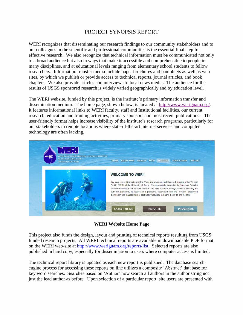
The WERI website, funded by this project, is the institute’s primary information transfer and
dissemination medium. The home page, shown below, is located at http://www.weriguam.org/.
It features informational links to WERI faculty, staff and Institutional facilities, our current
research, education and training activities, primary sponsors and most recent publications. The
user-friendly format helps increase visibility of the institute’s research programs, particularly for
our stakeholders in remote locations where state-of-the-art internet services and computer
technology are often lacking.
WERI Website Home Page
This project also funds the design, layout and printing of technical reports resulting from USGS
funded research projects. All WERI technical reports are available in downloadable PDF format
on the WERI web-site at http://www.weriguam.org/reports/list. Selected reports are also
published in hard copy, especially for dissemination to users where computer access is limited.
The technical report library is updated as each new report is published. The database search
engine process for accessing these reports on line utilizes a composite ‘Abstract’ database for
key word searches. Searches based on ‘Author’ now search all authors in the author string not
just the lead author as before. Upon selection of a particular report, site users are presented with

the complete abstract, which may be viewed prior to downloading the main report. An example
is shown below.
WERI Reports Page
Because of Guam’s remote location, and the escalating costs of air travel, it is difficult and costly
for researchers to present their findings at technical conferences and symposiums in other parts
of the Globe. A portion of the current Information Transfer Project was earmarked for off-island
travel expenses for WERI researchers and graduate students presenting refereed professional
papers on current or past USGS 104-B projects.
Since 2005, WERI has maintained a unique digital resource for Guam, at www.hydroguam.net.
This project began with the Natural Resources Atlas of Southern Guam, which was inspired by
the need for up-to-date baseline information for sustainable natural resource management and
development. Its mission was to provide a comprehensive picture of the natural resources found
within the fourteen southern Guam watersheds and make that information instantly available to
users. The atlas proved to be a highly effective data dissemination hub, as well as a much-used
awareness and educational tool. At its core lay a wide range of Geographical Information System
(GIS) data for southern Guam, providing valuable support for resource management and
research, including hydrologic modeling, pollution prevention, soil conservation, and coastal
zone management. The tool became very popular in Guam thanks to its simple and user-friendly
data dissemination approach: all geospatial data are stored and formatted in such a way that the
full content is freely accessible on the Internet via www.hydroguam.net address. Within a
relatively short time, the Natural Resources Atlas of Southern Guam became so successful that in
2012 it inspired a follow-on project, which was to develop a comparable resource for Northern
Guam. That work was completed in late 2013. In 2014, the southern Guam was updated to
reflect the new additional information. The new product is entitled Digital Atlas of Northern
Guam and encompasses many of the strengths of the previously created Natural Resources Atlas
of Southern Guam with a series of significant improvements. The Digital Atlas of Northern

Guam is freely accessible on the Internet via: www.hydroguam.net address. The web interface
offers a range of textual, graphical, statistical, and geographic information to any interested user.

USGS Summer Intern Program
None.
USGS Summer Intern Program 1

Student Support
Category Section 104 BaseGrant
Section 104 NCGPAward
NIWR-USGSInternship
SupplementalAwards Total
Undergraduate 1 0 0 0 1Masters 4 0 0 0 4
Ph.D. 0 0 0 0 0Post-Doc. 0 0 0 0 0
Total 5 0 0 0 5
1

Notable Awards and Achievements
WERI Graduate Research Assistant Kaylyn K. Bautista received the 2017 University of Guam President'sAward for the Outstanding Graduate Thesis of Academic Year 2016-2017, for her Master's of Science Thesisin Environmental Science, "Vadose Hydrology of Jinapsan Cave, North Guam."
WERI Graduate Research Assistant Ida Shalilian received a 2017 Student Travel Grant from the ResearchCorporation of the University of Guam to extend the work on her Master's of Science Thesis in EnvironmentalScience, "Hydrogeology of Finegayan Basin, Northern Guam Lens Aquifer."
Notable Awards and Achievements 1

Publications from Prior Years
2011GU200B ("Environmental Impact of FUDS and Brownfields Sites in Watersheds on the EasternSide of Saipan. Phase 1: Contaminant Analysis of Soil and Sediments") - Articles in RefereedScientific Journals - Denton, Gary R.W., Carmen A. Emborski, April A.B. Hachero, Ray S Masga,and John A. Starmer, 2016. Impact of WWII Dumpsites on Saipan: Heavy Metal Status of Soils andSediments. Environmental Pollution and Research, 23: 11339-11348
1.
2014GU275B ("Impact of Stormwater Discharges and WWII on the Mercury Status of Fish from theSouthern Section of Saipan Lagoon") - Other Publications - Denton, Gary R.W., and Jennifer Cruz,2016, Fish Sentinels Identify Mercury Hot-Spots in Saipan Lagoon. (Abstract) Asia Pacific Academyof Science, Education and Environmental Management (APASEEM) Annual Conference, AmericanMemorial Park Auditorium, Saipan, November 15-17, 2016.
2.
2015GU285B ("Impact of Multiple Mercury Sources on Edible Quality of Fish from AmericanMemorial Park Nearshore Waters, Saipan, CNMI") - Water Resources Research Institute Reports -Gary R.W., Michael J. Gawel, Justin S. Mills, Karl G. Brookins, 2017, Heavy Metal Assessment ofSelected Biota from American Memorial Park Nearshore Waters, Saipan, Commonwealth of theNorthern Mariana Islands (CNMI). Water and Environmental Research Institute (WERI) TechnicalReport No. 162, University of Guam, Mangilao, Guam, 56 pp.
3.
2015GU289B ("Continuation and expansion of data collection for sewage treatment pilot study onYap with addition of a composting pilot test for reuse of waste sludge") - Other Publications - Rouse,J.D., 2016, “Use of Sustainable Methods for Municipal Wastewater Treatment and Reuse of ExcessSludge on the Island of Yap,” Island Sustainability Conference: Islanded Communities, of the Univ.of Guam & the Univ. of Alaska Fairbanks. Tumon, Guam, April 11-15, 2016.
4.
2015GU289B ("Continuation and expansion of data collection for sewage treatment pilot study onYap with addition of a composting pilot test for reuse of waste sludge") - Water Resources ResearchInstitute Reports - Rouse, J.D., 2016, “Biofilm Pilot Study for Sewage Treatment with Composting ofWaste Sludge on Yap,” University of Guam, WERI. Technical Report No. 161, Oct. 2016, 23 pages.
5.
2015GU284B ("Exploring the natural limits of the Northern Guam Lens Aquifer: A step towardoptimum sustainable management, Phase 2�implementation of a numerical model") - OtherPublications - Habana, N.C., J.W. Jenson, and S.B. Gingerich, 2015, Abstracts and Program:Exploring Best-Practice Capacities for the Northern Guam Lens Aquifer. Second Conference onWater Resources Sustainability Issues on Tropical Islands, 1-3 December 2015, Honolulu, Hawaii.
6.
2014GU271B ("Prediction of Flow Duration Curves at Ungaged Stream Sites in Guam") - OtherPublications - Heitz, L. and S. Khosrowpanah, 2015, Using a Geographic Information System toPredict Flow Duration Curves at Ungaged Stream Sites in Guam, Second Conference on WaterResources Sustainability Issues on Tropical Islands, 1-3 December 2015, Honolulu, Hawaii.
7.
2015GU284B ("Exploring the natural limits of the Northern Guam Lens Aquifer: A step towardoptimum sustainable management, Phase 2�implementation of a numerical model") - OtherPublications - Habana, N.C., J.W. Jenson, and S.B. Gingerich, 2015, Abstracts and Program:Exploring Best-Practice Capacities for the Northern Guam Lens Aquifer. Second Conference onWater Resources Sustainability Issues on Tropical Islands, 1-3 December 2015, Honolulu, Hawaii.
8.
2015GU284B ("Exploring the natural limits of the Northern Guam Lens Aquifer: A step towardoptimum sustainable management, Phase 2�implementation of a numerical model") - OtherPublications - Habana, N.C., J.W. Jenson, and S.B. Gingerich, 2016, Exploring the UltimateCapacities of the Northern Guam Lens Aquifer: With Some New Ways of Thinking AboutSustainable Limits, Presentation to Guam Waterworks Authority senior management, 19 January2016, Fadian, Guam.
9.
2015GU284B ("Exploring the natural limits of the Northern Guam Lens Aquifer: A step towardoptimum sustainable management, Phase 2�implementation of a numerical model") - OtherPublications - Habana, N.C., J.W. Jenson, and S.B. Gingerich, 2016, Exploring the Ultimate
10.
Publications from Prior Years 1

Capacities of the Northern Guam Lens Aquifer: With Some New Ways of Thinking AboutSustainable Limits, Presentation to WERI Guam Advisory Council, 17 November 2016, Tumon,Guam.2011GU194B ("Comprehensive Analysis of Salinity Trends in Northern Guam Lens Aquifer") -Other Publications - Simard, C.A., J.W. Jenson, M.A, Lander, M.Q. McDonald, & N.C. Habana,2016, Salinity in the Northern Guam Lens Aquifer: Natural and Human Factors, American WaterWorks Association-Hawaii Section,Western Pacific Subsection, Annual Conference, 11-12 April2016, Tumon, Guam.
11.
2011GU194B ("Comprehensive Analysis of Salinity Trends in Northern Guam Lens Aquifer") -Conference Proceedings - Simard, C.A., J.W. Jenson and M.A. Lander, 2015, Analysis of Salinity inthe Northern Guam Lens Aquifer, Proceedings of the 16th Symposium on the Geology of theBahamas and other Carbonate Regions, Gerace Research Center, San Salvador Island, Bahamas.
12.
2014GU280B ("Sustainable Conjunctive use of Groundwater and Rain Catchment Water underVariable Climatic Scenarios for Atoll Island Communities") - Water Resources Research InstituteReports - Wallace, C.D., R.T. Bailey, and J.W. Jenson, 2015, Atoll Island Freshwater Resources:Modeling, Analysis, and Optimization, WERI Technical Report #155, 147 p.
13.
2014GU270B ("One-Day Field Course for Water Resource Professionals and Island Educators, withEducational Webpage on the Northern Guam Lens Aquifer") - Other Publications - Jenson, J.W., N.C.Habana, 2016, Limestones of Guam: Geologic Characteristics and Engineering Properties,Presentation to Guam Chapter, Society of American Military Engineers, 18 August 2016, Tumon,Guam.
14.
Publications from Prior Years 2