wisfirs application ann schachte gis coordinator division of forestry wisconsin dnr wisfirs...
TRANSCRIPT
WisFIRS Application
Ann SchachteGIS CoordinatorDivision of ForestryWisconsin DNR
WisFIRSWisconsin Forest Inventory & Reporting System
June 6, 2014
An Overview of the
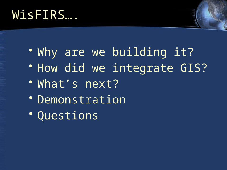
• Why are we building it? • How did we integrate GIS? • What’s next?• Demonstration• Questions
WisFIRS….
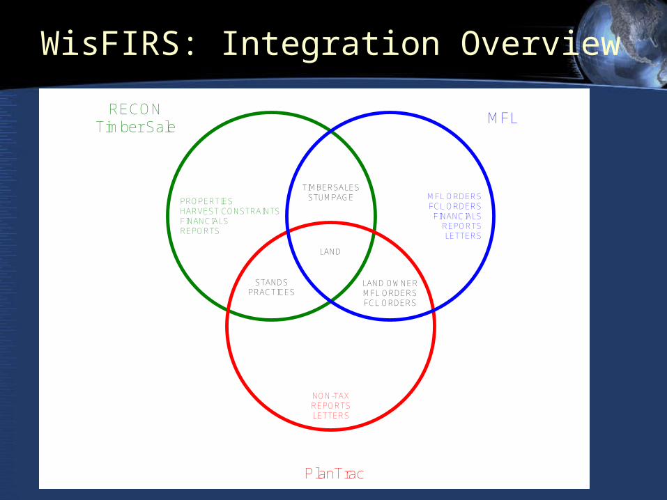
RECONTimber Sale
MFL
PlanTrac
LAND
PROPERTIESHARVEST CONSTRAINTSFINANCIALSREPORTS
MFL ORDERSFCL ORDERS
FINANCIALSREPORTSLETTERS
NON-TAXREPORTSLETTERS
TIMBERSALESSTUMPAGE
LAND OWNERMFL ORDERSFCL ORDERS
STANDSPRACTICES
GIS Integration
WisFIRS: Integration Overview
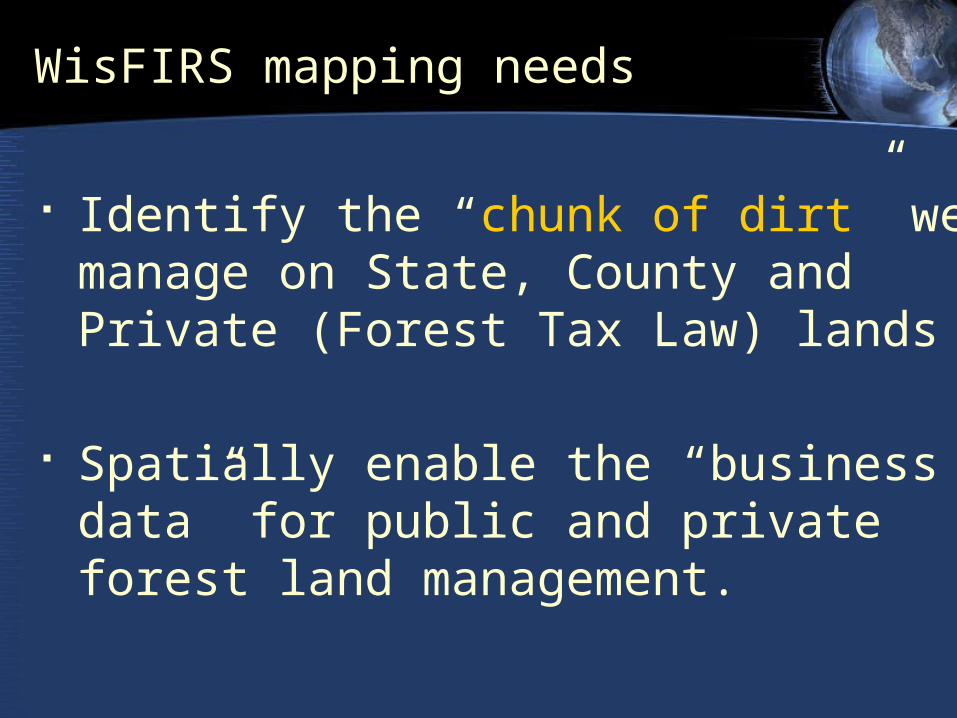
WisFIRS mapping needs
Identify the “chunk of dirt” we manage on State, County and Private (Forest Tax Law) lands
Spatially enable the “business data” for public and private forest land management.

Forest Ownership in Wisconsin
• Non Industrial Private Landowners = 57%
• Industrial Landowners = 11%
• Private Corps. = 4%
State5%County
15%
Federal10%
Private57%
Private Corps
4%
Industry7%
Tribal2%
Public Ownership = 30%
Private Ownership = 70%
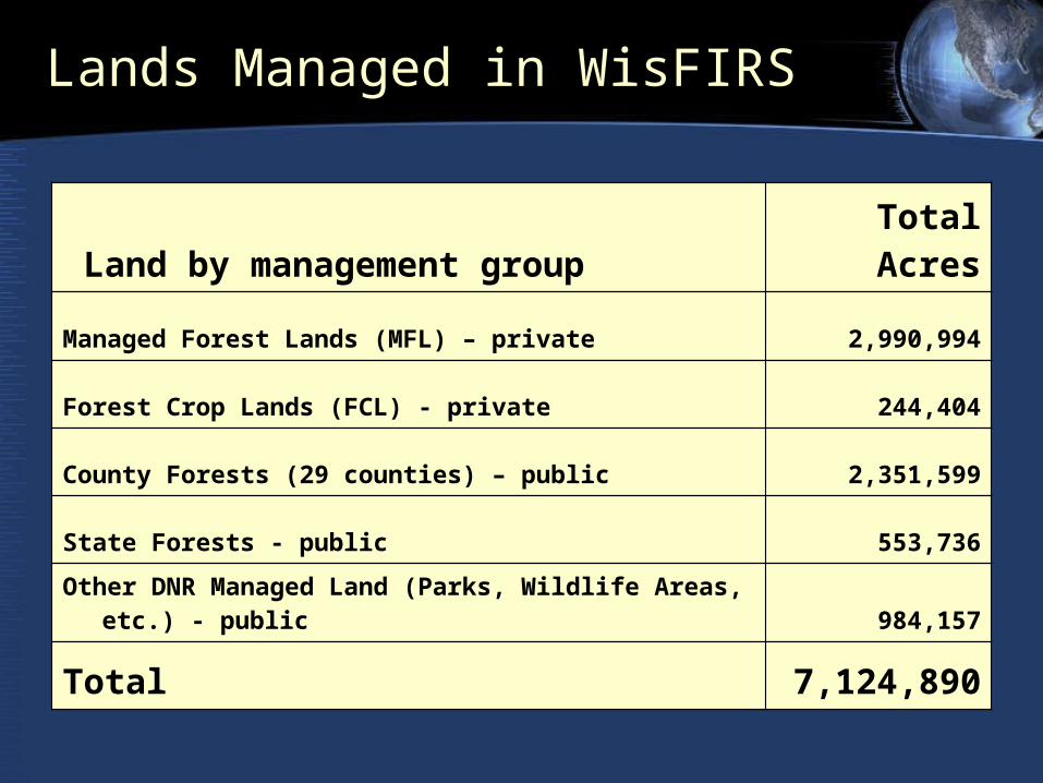
Lands Managed in WisFIRS
Land by management group Total Acres
Managed Forest Lands (MFL) – private 2,990,994
Forest Crop Lands (FCL) - private 244,404
County Forests (29 counties) – public 2,351,599
State Forests - public 553,736
Other DNR Managed Land (Parks, Wildlife Areas, etc.) - public 984,157
Total 7,124,890
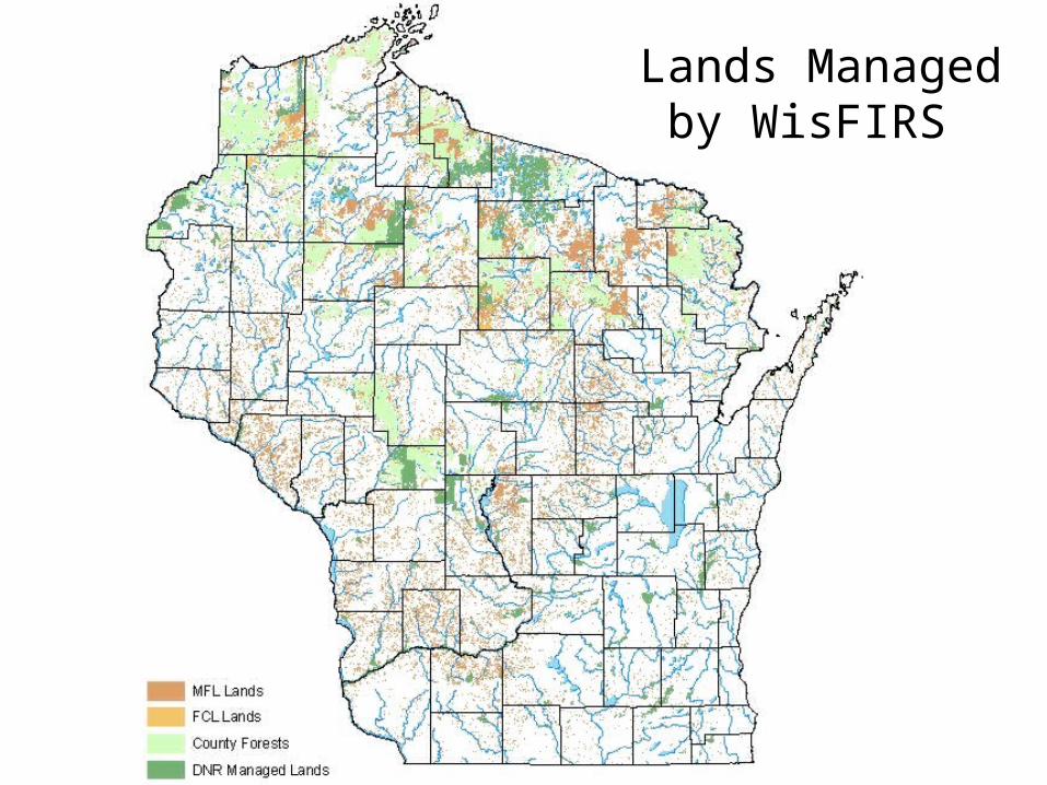
Lands Managed by WisFIRS

Our user community…
WisFIRS Public Lands users are located in various offices around the state:
- 230 DNR foresters (Internal to DNR network)
- 70 County foresters (external to DNR network)
WisFIRS Private Lands users – 170 independent consulting foresters (external to DNR network)

WisFIRS: Project Summary
WisFIRS will enable foresters to:• Store data collected in the field• Use a Template for Management Plans• Plan & Track practices and treatments
• e.g. Mandatory Practices, Rx burning• Report accomplishments• Renew Cooperating Forester status• Administer MFL program • Calculate payments to municipalities…
… and much more!
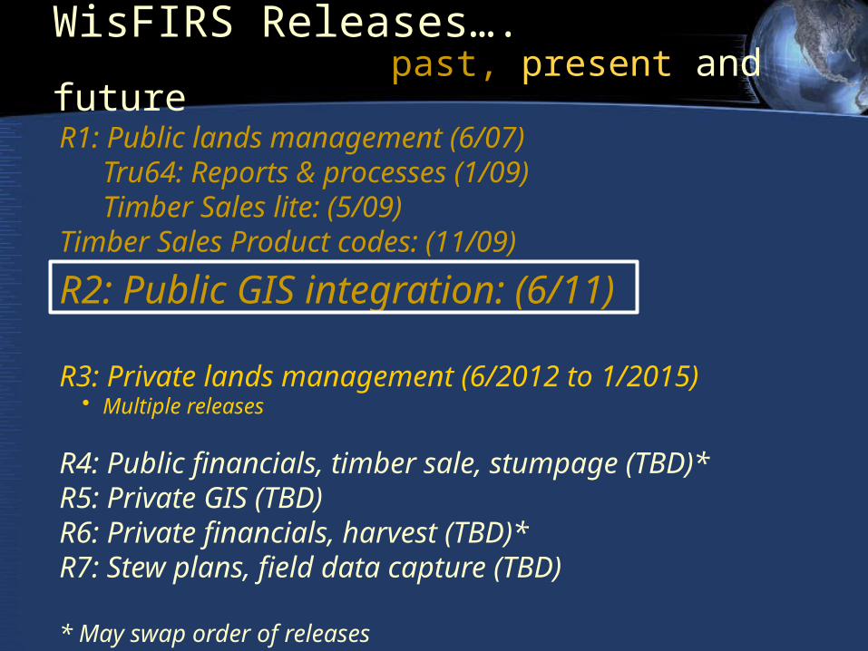
WisFIRS Releases…. past, present and future
R1: Public lands management (6/07)Tru64: Reports & processes (1/09)Timber Sales lite: (5/09)
Timber Sales Product codes: (11/09)
R2: Public GIS integration: (6/11)
R3: Private lands management (6/2012 to 1/2015)• Multiple releases
R4: Public financials, timber sale, stumpage (TBD)*R5: Private GIS (TBD)R6: Private financials, harvest (TBD)*R7: Stew plans, field data capture (TBD)
* May swap order of releases
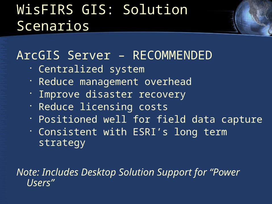
WisFIRS GIS: Solution Scenarios
ArcGIS Server – RECOMMENDED• Centralized system• Reduce management overhead• Improve disaster recovery• Reduce licensing costs• Positioned well for field data capture• Consistent with ESRI’s long term strategy
Note: Includes Desktop Solution Support for “Power Users”
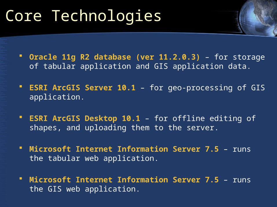
Core Technologies
Oracle 11g R2 database (ver 11.2.0.3) – for storage of tabular application and GIS application data.
ESRI ArcGIS Server 10.1 – for geo-processing of GIS application.
ESRI ArcGIS Desktop 10.1 – for offline editing of shapes, and uploading them to the server.
Microsoft Internet Information Server 7.5 – runs the tabular web application.
Microsoft Internet Information Server 7.5 – runs the GIS web application.
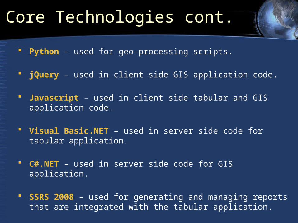
Core Technologies cont.
Python – used for geo-processing scripts.
jQuery – used in client side GIS application code.
Javascript – used in client side tabular and GIS application code.
Visual Basic.NET – used in server side code for tabular application.
C#.NET – used in server side code for GIS application.
SSRS 2008 – used for generating and managing reports that are integrated with the tabular application.
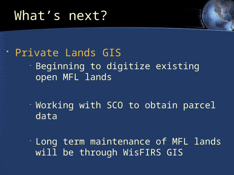
What’s next?
Private Lands GIS - Beginning to digitize existing open MFL lands
- Working with SCO to obtain parcel data
- Long term maintenance of MFL lands will be
through WisFIRS GIS
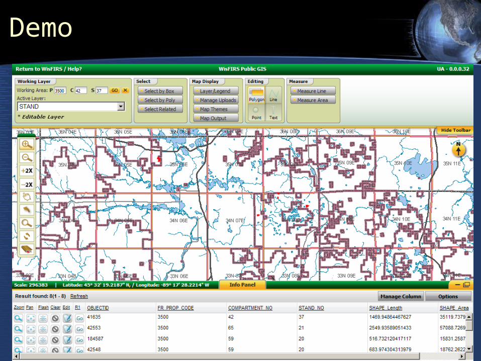
Demo