demonstrate an understanding of wave processes in eroding a coastline and re-sorting and depositing...
TRANSCRIPT


• Demonstrate an understanding of wave processes in eroding a coastline and re-sorting and depositing materials removed through erosion. Candidates should understand the types of waves (constructive and destructive) and the components of waves, swash and backwash. The erosional processes of wave action should include an understanding of corrasion, hydraulic action, corrosion and attrition.
Transport of material along a coastline should be appreciated; onshore and offshore movements together with an understanding of movement along a coastline (longshore drift). The action of wind in shaping coastal sand dunes should also be understood.
• Describe and explain the landforms associated with these processes.
• Describe the conditions required for the development of coral reefs.
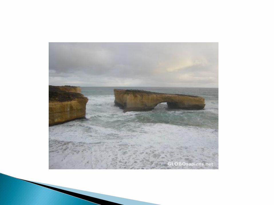
• Describe fringing and barrier reefs and atolls. A study should be made of the following coastal landforms: Cliffs, wave-cut platforms, caves, arches, stacks, bay and headland
coastlines, beaches, spits and bars, coastal sand dunes and marsh.

Powerful swash moves material up beach;Weak backwash does not get chance/have energy to remove it; or swash is stronger than backwash. Therefore beach material builds up over time;Larger material carried further up beach;Gentle slope reduces speed – causes sedimentation;

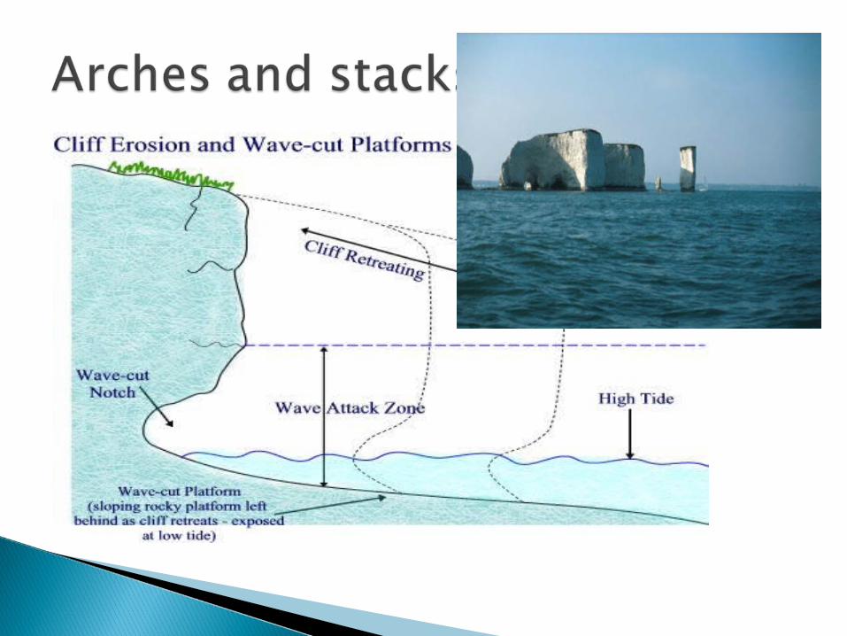
Abrasion, hydraulic action, attrition and solution
These depend upon the energy of the wave, i.e. they are strongest during high tides and storms

Cliffs and wave cut platforms

There are hard/soft rocks (or examples) outcropping/rocks of different resistance;
rocks at right angles to coast; discordant coastline; bays formed in soft rocks,
Headlands hard rocks; differential erosion occurs; soft rocks worn more
rapidly/hard rocks worn less rapidly etc
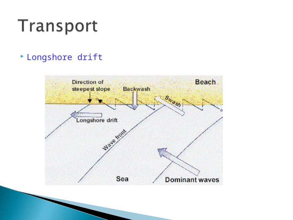
Longshore drift

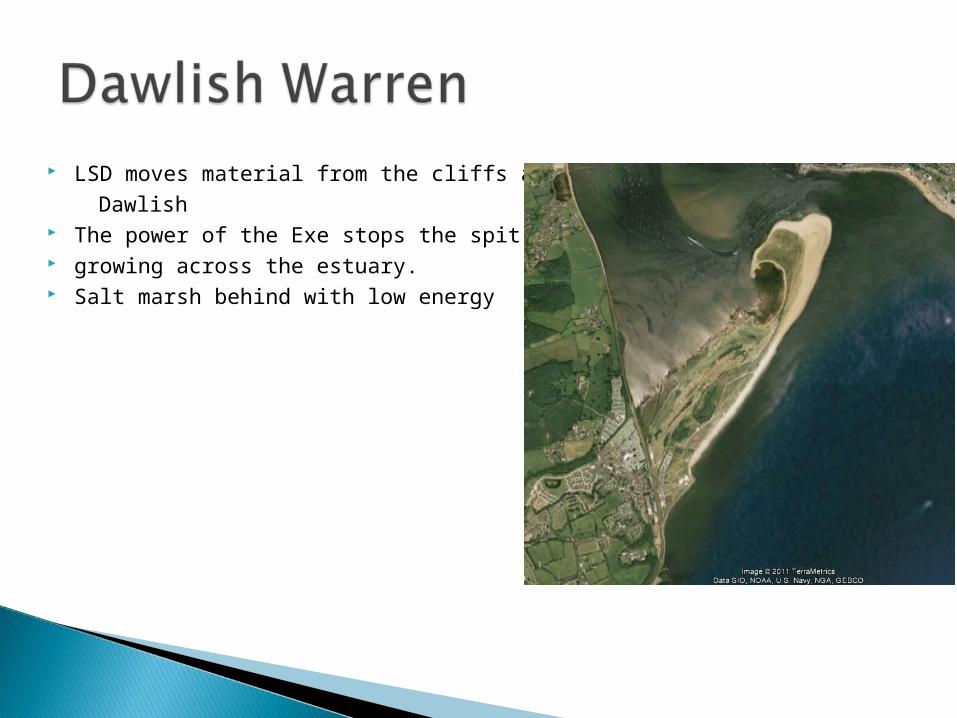
LSD moves material from the cliffs at Dawlish The power of the Exe stops the spit growing across the estuary. Salt marsh behind with low energy

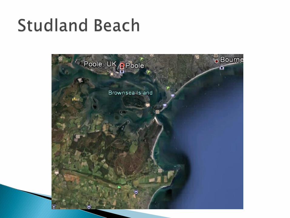
deposition by wind as energy of winds blowing from Poole Bay is reduced,
Easterly onshore winds pick up dry sand from the beach,
obstruction on beach/pebble/seaweed causes eddies/sheltered area; marram grass
colonizes dunes and traps further sand etc.

Deposition of sediment/alluvium by river, as speed of flow reduced when it reaches Gulf of Mexico so it slows down and cannot carry load, especially as river is heavily laden with silt due to it eroding its banks in states such as Missouri,
absence of major tidal flows or currents in Gulf of Mexico,
impact of salt water causes further deposition,
growth of vegetation raises it above sea level,
distributaries form as the channel splits south of New Orleans
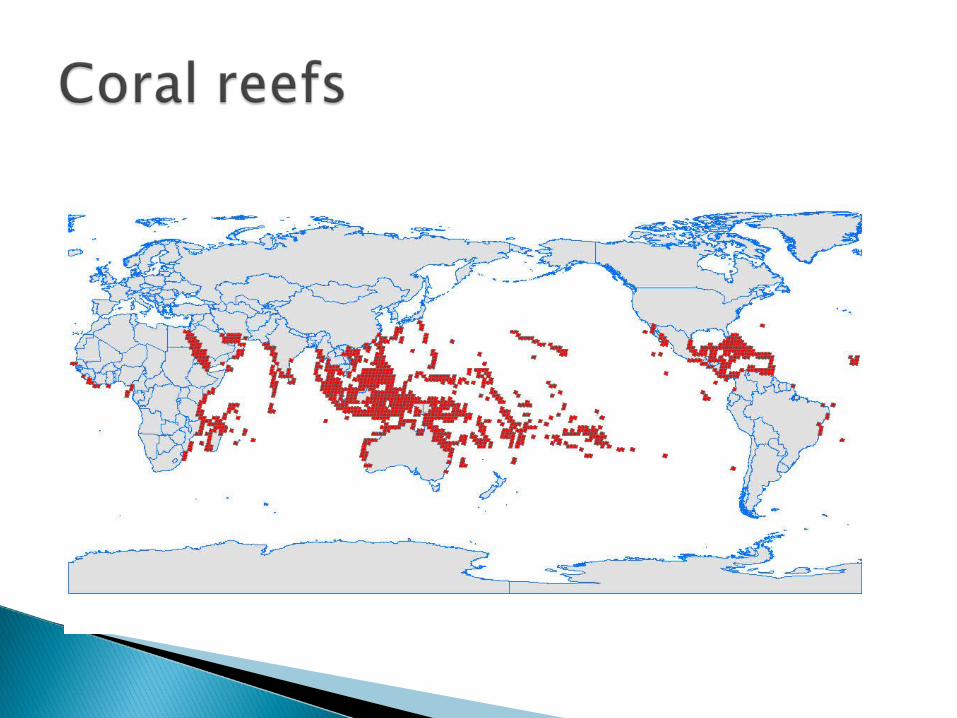
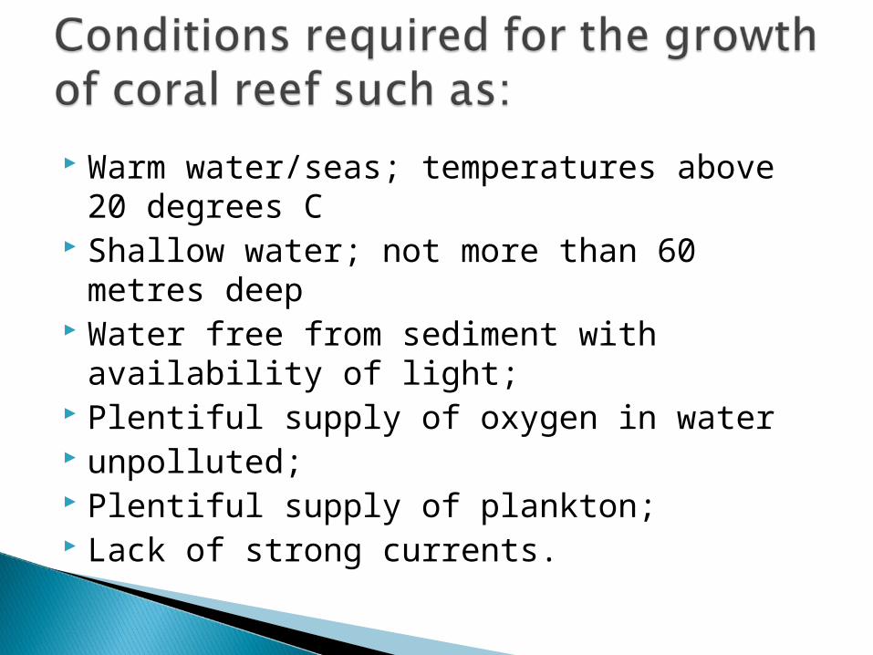
Warm water/seas; temperatures above 20 degrees C
Shallow water; not more than 60 metres deep
Water free from sediment with availability of light;
Plentiful supply of oxygen in water unpolluted; Plentiful supply of plankton; Lack of strong currents.


We can look at the reefs off Mombasa which form part of the Mombasa Marine park. Here the average water temperatures vary between 25°C and 31°C. the water off Jomo Kenyatta beach is shallow, less than 10 m at 500m off shore. There is no sedimant from any nearby rivers and the strict pollution laws mean that the water has a plentiful supply of oxygen