2015 ppa conference beyond maps: solving issues and...
TRANSCRIPT

2015 PPA Conference
Beyond Maps: Solving Issues and
Shaping Communities with GIS
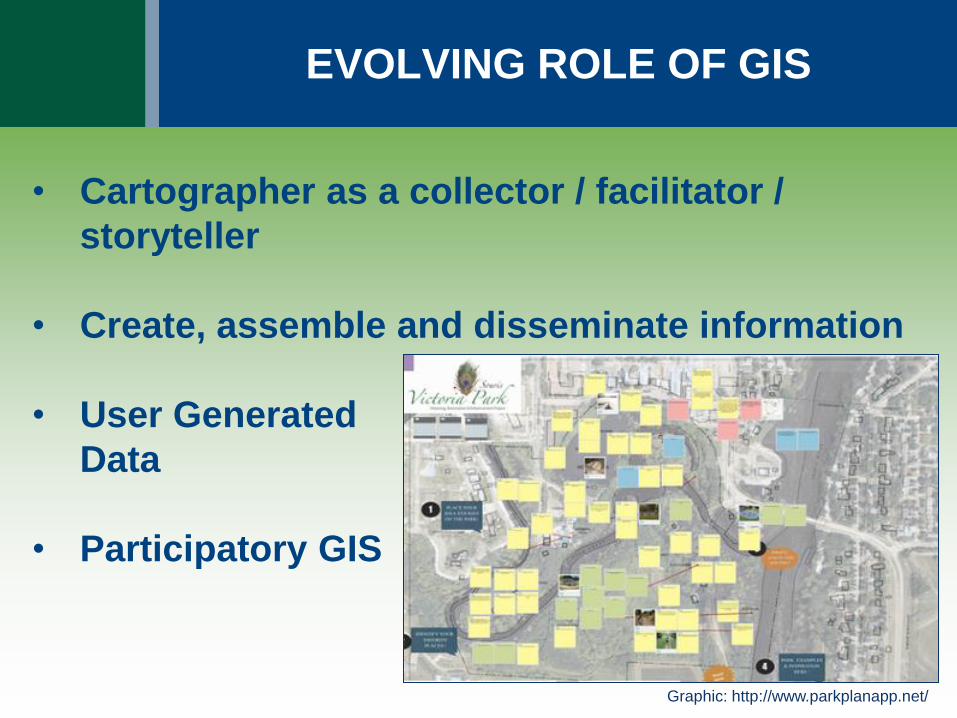
EVOLVING ROLE OF GIS
• Cartographer as a collector / facilitator /
storyteller
• Create, assemble and disseminate information
• User Generated
Data
• Participatory GIS
Graphic: http://www.parkplanapp.net/

EVOLVING ROLE OF GIS
• Visualize impact of policies /decisions
• Target highest areas of need
• Determine market potential
Graphics: www.esri.com/industries/planning
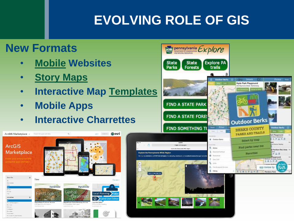
EVOLVING ROLE OF GIS
New Formats
• Mobile Websites
• Story Maps
• Interactive Map Templates
• Mobile Apps
• Interactive Charrettes
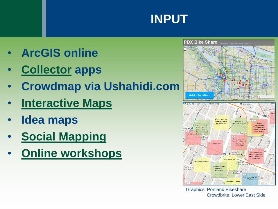
INPUT
• ArcGIS online
• Collector apps
• Crowdmap via Ushahidi.com
• Interactive Maps
• Idea maps
• Social Mapping
• Online workshops
Graphics: Portland Bikeshare
Crowdbrite, Lower East Side
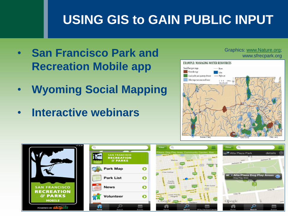
USING GIS to GAIN PUBLIC INPUT
• San Francisco Park and
Recreation Mobile app
• Wyoming Social Mapping
• Interactive webinars
Graphics: www.Nature.org;
www.sfrecpark.org
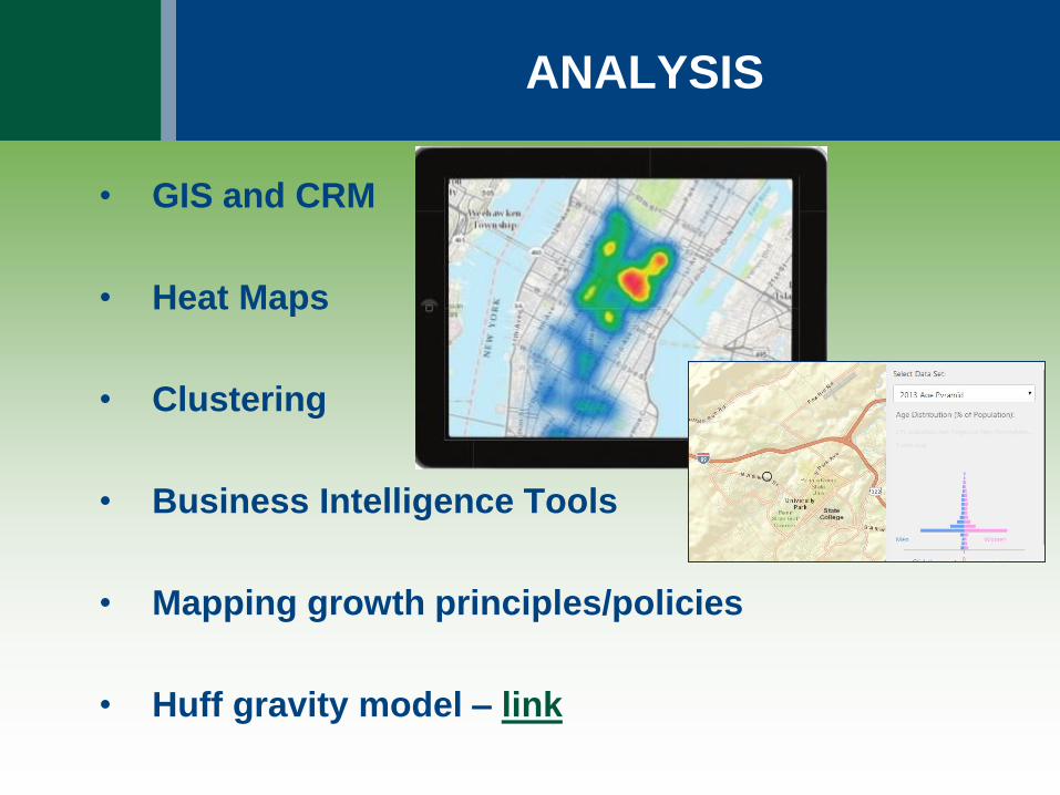
ANALYSIS
• GIS and CRM
• Heat Maps
• Clustering
• Business Intelligence Tools
• Mapping growth principles/policies
• Huff gravity model – link
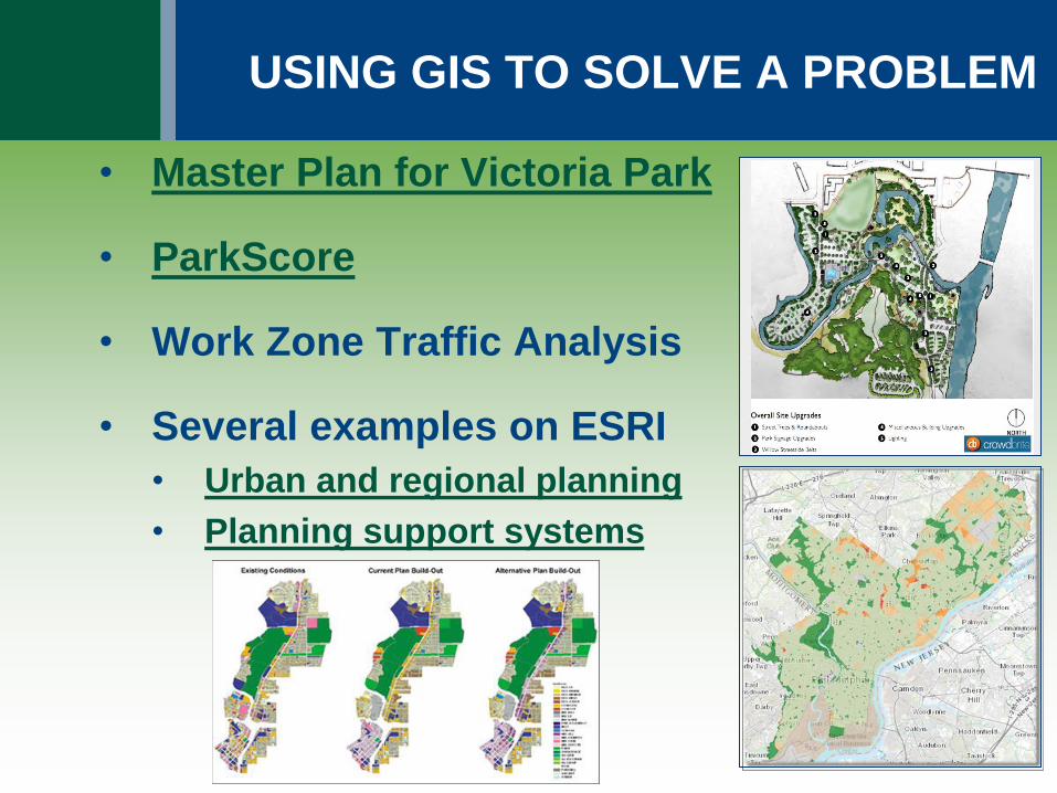
USING GIS TO SOLVE A PROBLEM
• Master Plan for Victoria Park
• ParkScore
• Work Zone Traffic Analysis
• Several examples on ESRI
• Urban and regional planning
• Planning support systems

OUTPUT
• Dashboards
• Interactive Maps
• Story Maps
Graphics: www.esri.com; www.dcnr.pa.gov
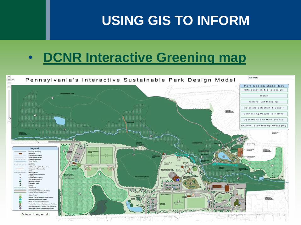
USING GIS TO INFORM
• DCNR Interactive Greening map

USING GIS to MARKET
• Geotriggers
• Business Analyst
• Community Analyst
• ESRIs Tapestry
• Blogging
• Web Maps
Graphic: www.esri.com
www.geoawesome.com
ADVANTAGES of USING GIS
• Centralizes a wealth of information
• Handles spatial complexity
• Flexible
• Interactive
• Makes public data accessible
• Visualization is compelling
• Deployment much simpler now

LIMITATIONS of USING GIS
• Data availability
• Data reliability (too much of a good thing)
• Data management
• Cost
• Marginalization of some citizens
• Lack of general understanding
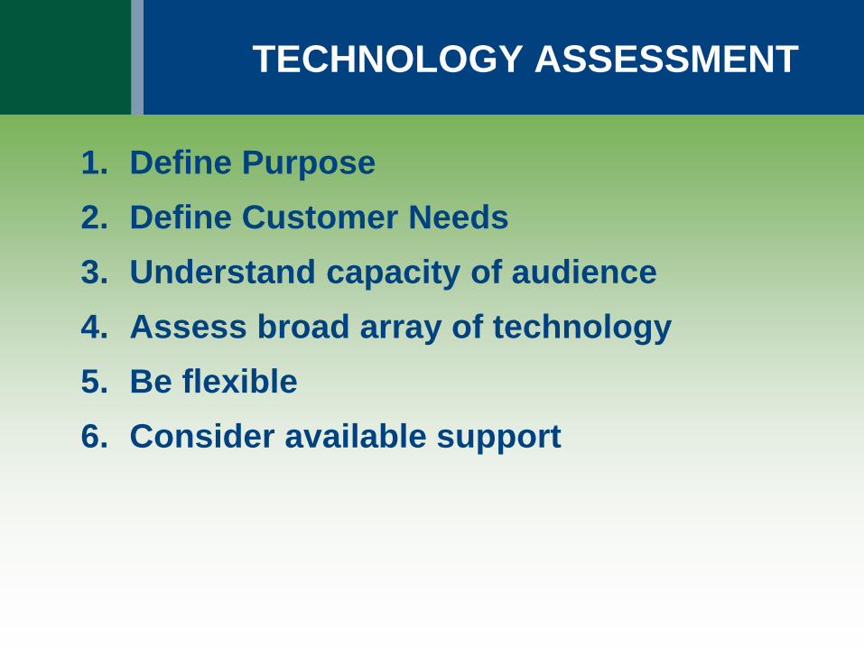
TECHNOLOGY ASSESSMENT
1. Define Purpose
2. Define Customer Needs
3. Understand capacity of audience
4. Assess broad array of technology
5. Be flexible
6. Consider available support

2015 PPA Conference
Kelly Rossiter, AICP [email protected]
Mike Bialousz [email protected]
Beyond Maps: Solving Issues and
Shaping Communities with GIS