6 moore nopp presentation-final
TRANSCRIPT

Marine ArchaeologyMarine ArchaeologyJames D. Moore III, Ph.D.James D. Moore III, Ph.D.
December 13, 2011December 13, 2011
Bureau of Ocean Energy ManagementBureau of Ocean Energy ManagementDivision of Environmental SciencesDivision of Environmental Sciences
Environmental Studies ProgramEnvironmental Studies ProgramOffice Phone: 703Office Phone: 703--787787--16511651
EE--mail: mail: [email protected]@boem.gov
Importance of ArchaeologyImportance of Archaeology
The surveying of artifacts allows The surveying of artifacts allows researchers to determine past cultural researchers to determine past cultural behavior in the absence of historical behavior in the absence of historical informationinformation
Artifacts are nonArtifacts are non--renewable resources that renewable resources that are physical representations of our pastare physical representations of our past
Material remains are indicative of specific Material remains are indicative of specific cultural, technological, and economic cultural, technological, and economic changes through historychanges through history
BOEMBOEM’’ss Responsibility for Protecting Responsibility for Protecting Submerged Cultural ResourcesSubmerged Cultural Resources
National Historic Preservation Act National Historic Preservation Act (NHPA), Section 106(NHPA), Section 106
Executive Order 11593Executive Order 11593Notice to Lessees (NTL) stipulating Notice to Lessees (NTL) stipulating
areas of avoidance due to cultural areas of avoidance due to cultural sensitivitysensitivity
LesseesLessees required to survey and required to survey and report findingsreport findings

Interdisciplinary Collaboration for Interdisciplinary Collaboration for Understanding Underwater Understanding Underwater SiteSite--Formation ProcessesFormation Processes
Technological advances are allowing Technological advances are allowing access to sites in deeper watersaccess to sites in deeper waters
TimeTime--dependent mechanisms dependent mechanisms transfer artifacts into spatial contexts transfer artifacts into spatial contexts that must be interpretedthat must be interpreted
Marine environments affect the perception Marine environments affect the perception of archaeological contextsof archaeological contexts
Materials degrade at variable ratesMaterials degrade at variable rates
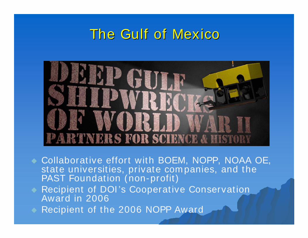
The Gulf of MexicoThe Gulf of Mexico
Collaborative effort with BOEM, NOPP, NOAA OE, state universities, private companies, and the PAST Foundation (non-profit)
Recipient of DOI’s Cooperative Conservation Award in 2006
Recipient of the 2006 NOPP Award
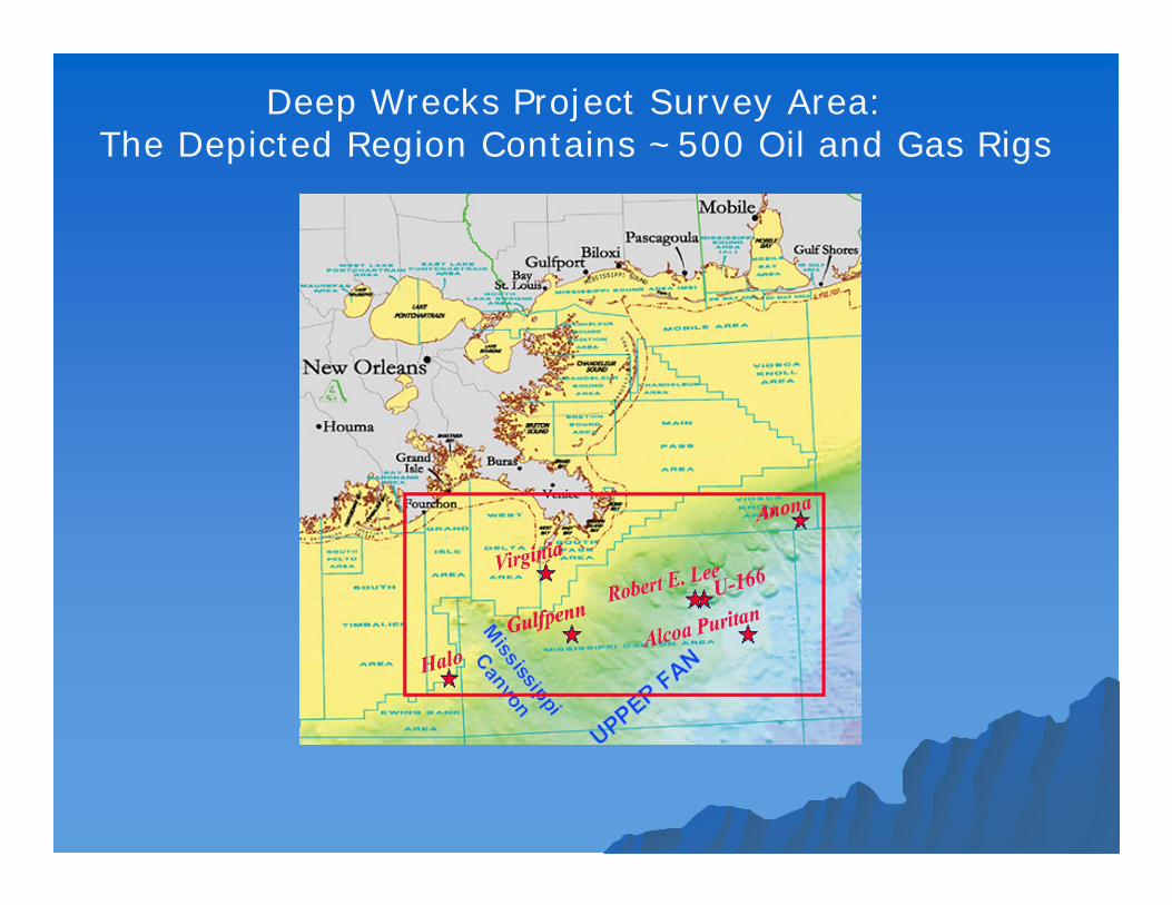
Deep Wrecks Project Survey Area:The Depicted Region Contains ~500 Oil and Gas Rigs
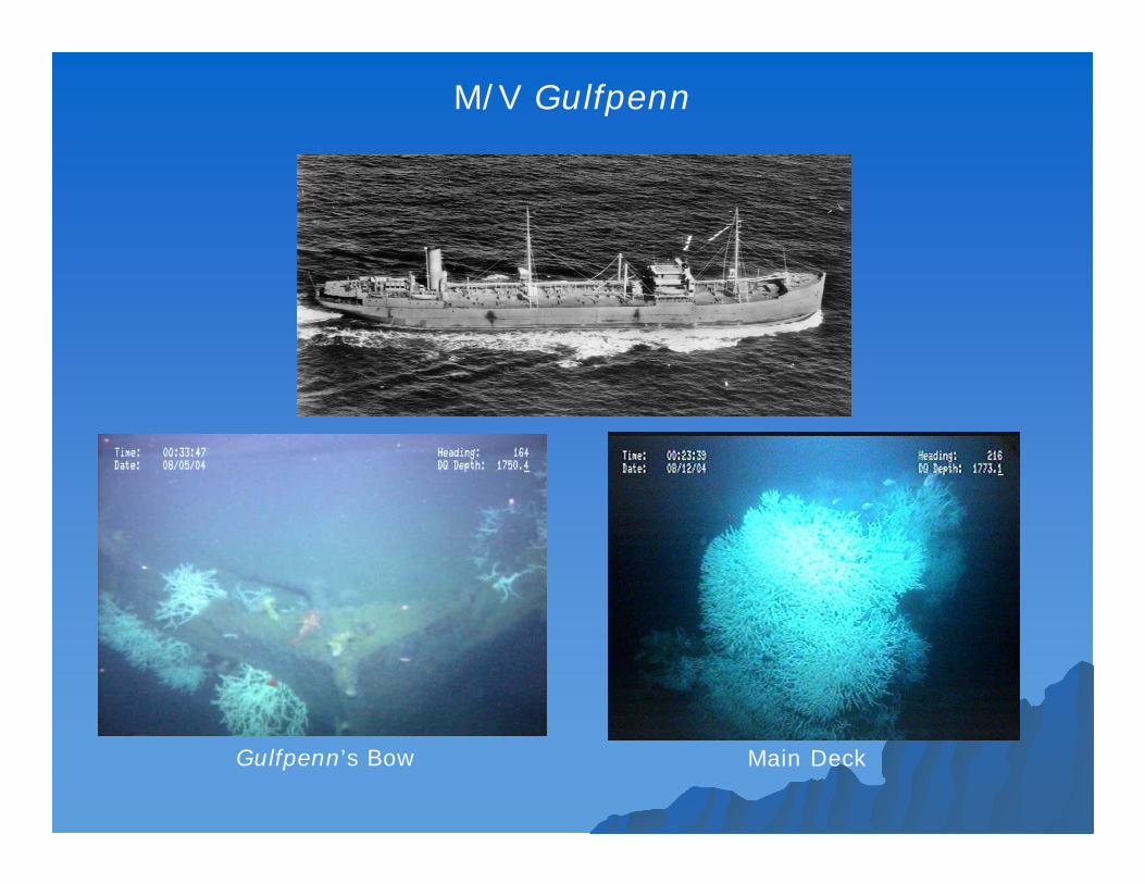
M/V Gulfpenn
Gulfpenn’s Bow Main Deck
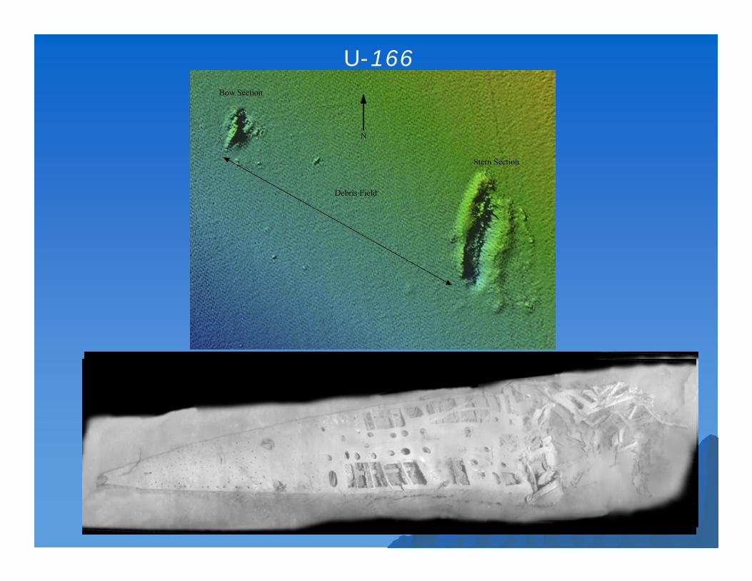
U-166
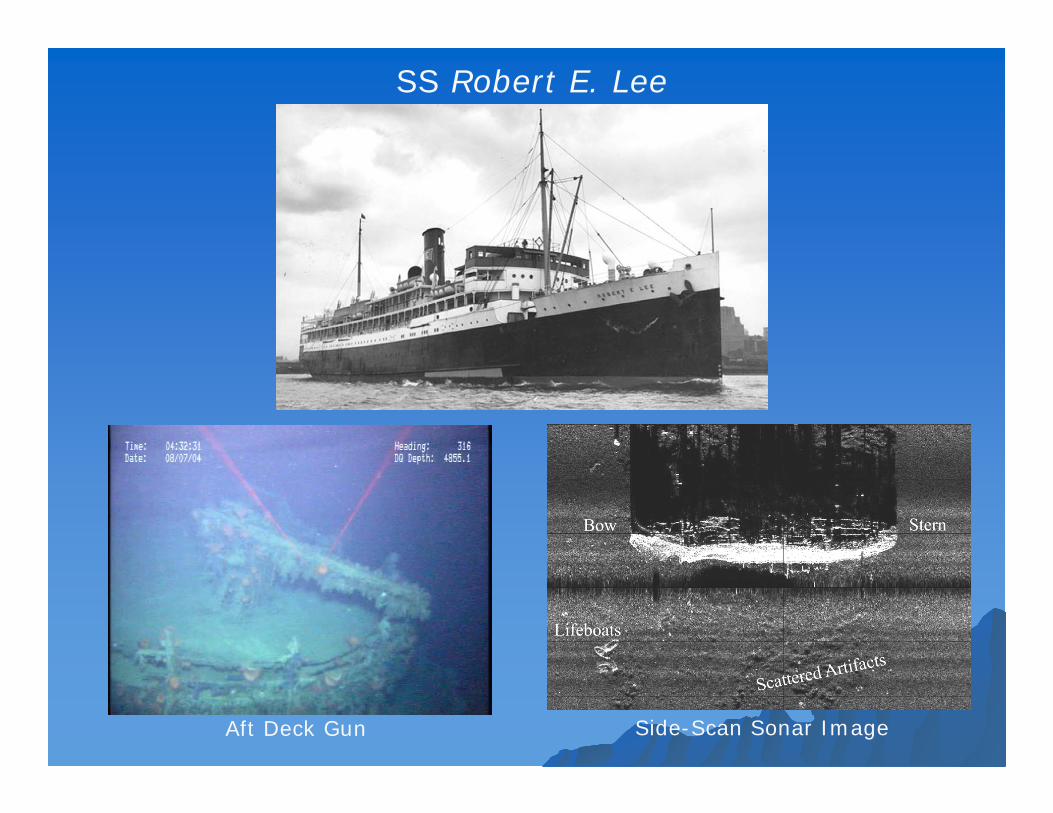
SS Robert E. Lee
Aft Deck Gun Side-Scan Sonar Image

The Gulf of Mexico (cont.)The Gulf of Mexico (cont.)Mardi Gras Shipwreck Site
(Located in the Vicinity of the U-166 and Robert E. Lee)
Bow
Stern
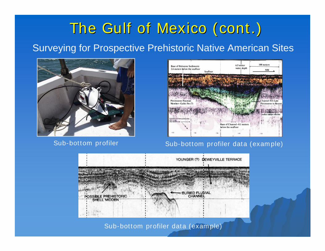
The Gulf of Mexico (cont.)The Gulf of Mexico (cont.)
Sub-bottom profiler Sub-bottom profiler data (example)
Sub-bottom profiler data (example)
Surveying for Prospective Prehistoric Native American Sites
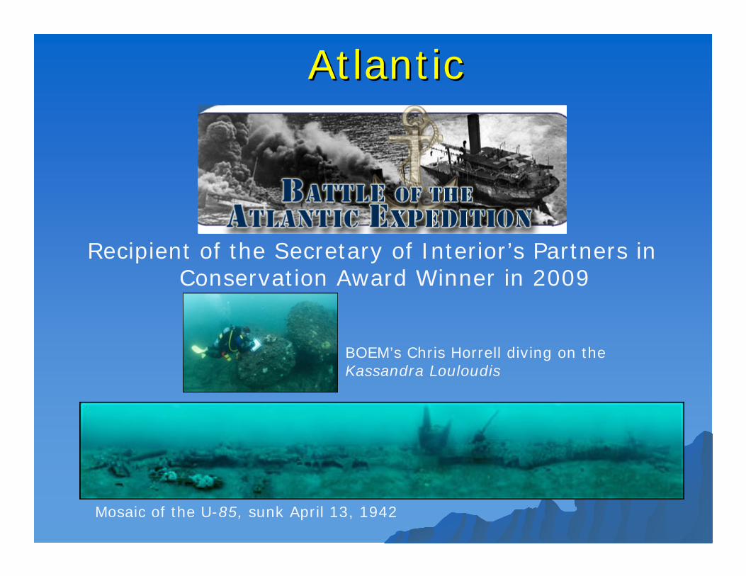
AtlanticAtlantic
Recipient of the Secretary of Interior’s Partners in Conservation Award Winner in 2009
Mosaic of the U-85, sunk April 13, 1942
BOEM’s Chris Horrell diving on the Kassandra Louloudis
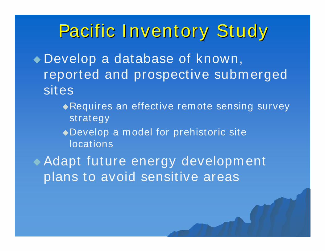
Pacific Inventory StudyPacific Inventory StudyDevelop a database of known,
reported and prospective submerged sites
Requires an effective remote sensing survey strategy
Develop a model for prehistoric site locations
Adapt future energy development plans to avoid sensitive areas

Assessing Visual Impacts from Assessing Visual Impacts from Coastal Historic Properties Coastal Historic Properties
Shoreline view of a wind facility(closest turbine is 7.1 miles)
Shoreline view of a wind facility(closest turbine is 4.6 miles)

Management for Potentially Polluting Management for Potentially Polluting WrecksWrecks
USS Mississinnewa
SS Jacob Luckenbach
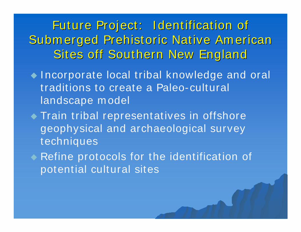
Future Project: Identification of Future Project: Identification of Submerged Prehistoric Native American Submerged Prehistoric Native American
Sites off Southern New EnglandSites off Southern New England
Incorporate local tribal knowledge and oral traditions to create a Paleo-cultural landscape model
Train tribal representatives in offshore geophysical and archaeological survey techniques
Refine protocols for the identification of potential cultural sites
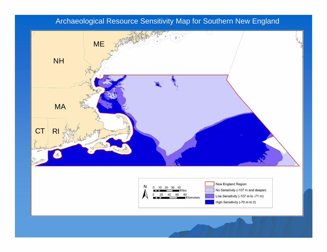
RI
MA
CT
NH
ME
Archaeological Resource Sensitivity Map for Southern New England

Thank YouThank You