chapter 6: development areas - dlrcoco.ie · 62 chapter 6: development areas 6 ... this chapter...
TRANSCRIPT
Chapter 6: Development Areas
Chapter 6: Development Areas62
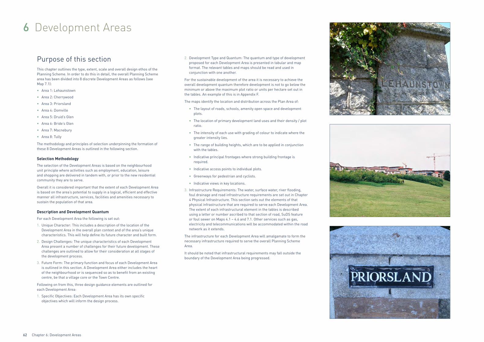
6 Development Areas
Purpose of this sectionThis chapter outlines the type, extent, scale and overall design ethos of the Planning Scheme. In order to do this in detail, the overall Planning Scheme area has been divided into 8 discrete Development Areas as follows (see Map 7.1):
• Area 1: Lehaunstown
• Area 2: Cherrywood
• Area 3: Priorsland
• Area 4: Domville
• Area 5: Druid’s Glen
• Area 6: Bride’s Glen
• Area 7: Macnebury
• Area 8: Tully
The methodology and principles of selection underpinning the formation of these 8 Development Areas is outlined in the following section.
Selection Methodology
The selection of the Development Areas is based on the neighbourhood unit principle where activities such as employment, education, leisure and shopping are delivered in tandem with, or prior to the new residential community they are to serve.
Overall it is considered important that the extent of each Development Area is based on the area’s potential to supply in a logical, efficient and effective manner all infrastructure, services, facilities and amenities necessary to sustain the population of that area.
Description and Development Quantum
For each Development Area the following is set out:
1. Unique Character: This includes a description of the location of the Development Area in the overall plan context and of the area’s unique characteristics. This will help define its future character and built form.
2. Design Challenges: The unique characteristics of each Development Area present a number of challenges for their future development. These challenges are outlined to allow for their consideration at all stages of the development process.
3. Future Form: The primary function and focus of each Development Area is outlined in this section. A Development Area either includes the heart of the neighbourhood or is sequenced so as to benefit from an existing centre, be that a village core or the Town Centre.
Following on from this, three design guidance elements are outlined for each Development Area:
1. Specific Objectives: Each Development Area has its own specific objectives which will inform the design process.
2. Development Type and Quantum: The quantum and type of development proposed for each Development Area is presented in tabular and map format. The relevant tables and maps should be read and used in conjunction with one another.
For the sustainable development of the area it is necessary to achieve the overall development quantum therefore development is not to go below the minimum or above the maximum plot ratio or units per hectare set out in the tables. An example of this is in Appendix F.
The maps identify the location and distribution across the Plan Area of:
• The layout of roads, schools, amenity open space and development plots.
• The location of primary development land uses and their density / plot ratio.
• The intensity of each use with grading of colour to indicate where the greater intensity lies.
• The range of building heights, which are to be applied in conjunction with the tables.
• Indicative principal frontages where strong building frontage is required.
• Indicative access points to individual plots.
• Greenways for pedestrian and cyclists.
• Indicative views in key locations.
3. Infrastructure Requirements: The water, surface water, river flooding, foul drainage and road infrastructure requirements are set out in Chapter 4 Physical Infrastructure. This section sets out the elements of that physical infrastructure that are required to serve each Development Area. The extent of each infrastructural element in the tables is described using a letter or number ascribed to that section of road, SuDS feature or foul sewer on Maps 4.1 – 4.6 and 7.1. Other services such as gas, electricity and telecommunications will be accommodated within the road network as it extends.
The infrastructure for each Development Area will amalgamate to form the necessary infrastructure required to serve the overall Planning Scheme Area.
It should be noted that infrastructural requirements may fall outside the boundary of the Development Area being progressed.
Chapter 6: Development Areas 63
6.1 Development Area 1: LehaunstownLocation – see Map 6.1
Unique Character
Lehaunstown is the area that abuts Druid’s Glen and Loughlinstown Valley. It’s character is informed by the connection it creates between the more sensitive Glen and Valley, and the opportunities provided by the connectivity to the wider area by the Laughanstown Luas stop.
Lehaunstown Lane, which traverses through this area provides an historical reference, an environmental wealth and an important greenway through the heart of the Plan Area, creating internal linkages and linkages to the hinterland.
Design Challenges
There are a number of challenges that need to be addressed in the design and layout of proposals in this Development Area, including the following:
• Respect and protect the environmental qualities of the Glen and the Valleys, while benefiting from their proximity and amenity.
• Providing a level of passive surveillance of the Druid’s Glen Buffer open space adjoining the Glen through the design and layout of the residential development opposite.
• A sensitive design solution is required where the Luas goes into cut so as to ameliorate the physical intrusion and curtailment of pedestrian movement.
• The design of the public realm at Lehaunstown Village, incorporating a section of Lehaunstown Lane.
• The design of the junction of the Grand Parade and Druid’s Glen Road.
• Ensuring that the scale of development supports the economic viability of the village core.
• The bridging of the Druid’s Glen to provide a vehicular connection to the N11. Given the sensitive nature of the receiving environment it is important that the design of any bridge should be of high quality, respecting the important landscape and architectural character of the area.
• The structure bridging the Cabinteely Stream should have regard to its setting and consider facilitating movement along the length of the valley in its design.
Future Form
Lehaunstown Village will be one of the first Villages to be developed. The Village Centre is located to the north of the Grand Parade and is centred around a south facing village green/plaza which provides a direct visual connection to the Laughanstown Luas stop.
Lehaunstown Lane will be an important and central part of the Village Centre in the form of a short pedestrianised street with shops fronting onto the village green.
A residential area extends from the Village Centre providing for a variety of residential unit types. High density residential development is centred around the Luas Stop.
Ú'
Ú'
Ú'
Ú '
Ú'
Ú'
P.P.S. P.S.
P.S.
P.S.
/S
/S
!H
!H
!H
Cherrywood Planning Scheme
Planning Scheme Boundary
±
TA
Village Centre
Map 6.1 - Development Area 1Lehaunstown
Metres
0 50 100 150 200
PL-14-116
© Ordnance Survey Ireland
Luas Line (Existing)
Walkway / Cycleway
!H Luas Stops
Indicative Access Point
Principal Frontage
TA Travellers Accomodation
Sketch Viewpoint
Ú '
Green InfrastructurePhysical Infrastructure
/S Additional Upward Modifier
Res 3Res 2
Res 4

Chapter 6: Development Areas64
Specific Objectives:
DA 1 To develop the Village Centre, focused on Lehaunstown Lane and the village green, with good access provided to the Luas stop.
DA 2 The residential development on the far side of the road to Druid’s Glen shall provide passive surveillance of the Druid’s Glen Buffer by its design and layout.
DA 3 The high-level bridge linking Lehaunstown with the N11 will have to be sensitively designed so as to span the Druid’s Glen with a visually slender structure that does not dominate either the valley floor or its setting, with due regard to the ecological corridor it crosses.
DA 4 The treatment of the junction of the Grand Parade and Barrington’s Road will create a public plaza in line with GI33.
DA 5 Development abutting existing homes should have regard to the residential amenity of existing residents.
DA 6 Buildings should be orientated towards the Grand Parade, with frontage set backs where necessary to facilitate landscaping or to provide a privacy strip between the building and the back of footpath.
DA 7 In accordance with Chapter 5 Green Infrastructure GI29, pocket parks will be provided along Lehaunstown Lane to provide play opportunities for the adjoining residents.
DA 8 A community facility in accordance with Section 2.3.4 will be provided in the Village Centre.
DA 9 Prior to a planning application being submitted on the Res 4 plot in Development Area 1 Lehaunstown or Res 3 plot in Development Area 4 Domville, both located on the southern side of the Grand Parade, the land owner shall enter into a discussion with the Local Authority to explore the potential of relocating the Travellers Accommodation site in the Res 4 plot to the Res 3 plot.
Table 6.1.1: Development Type and Quantum for Development Area 1 Lehaunstown
DEVELOPMENT AREA 1 LEHAUNSTOWN LAND USE AREAS
LAND USE AREA IN HECTARES
Mixed Use Village Centre 0.9
Residential 17.7
Green Infrastructure 9.39
DEVELOPMENT AREA 1 LEHAUNSTOWN
Gross Area HA Net Developable HA
40.8 19.5
LEHAUNSTOWN VILLAGE CENTRETotal Village Centre Lands HA 0.9
RETAIL SQ.M
Min Max
Net / Gross Net / Gross
1 no. Supermarket 600 / 905 1,500 / 2,274
Local Retail 200 / 305 500 / 758
Retail Services 200 / 305 500 / 758
Total Retail Quantum Village CentreMin Net/Gross Max Net/Gross
1,000 / 1,515 2,500 / 3,790
RESIDENTIAL VILLAGE CENTRE
Residential Dwelling UnitsMin Max
75 100
Gross Residential Floor Area Sq.mMin Max
9,000 12,000
NON RESIDENTIAL USES SQ.M
Non Retail UsesMin Max
700 1,000
High Intensity EmploymentMin Max
700 1,000
Community FacilitiesMin Max
250 500
Total Non Residential Floor Area Sq.mMin Max
1,650 2,500
TOTAL FLOORSPACE QUANTUM LEHAUNSTOWN VILLAGE
CENTRE SQ.M
Min Max
12,165 18,290
Plot RatioMin Max
1:1.4 1:2
Site CoverageMin Max
40% 60%
Building Height in StoreysMin Max
4 5
Chapter 6: Development Areas 65
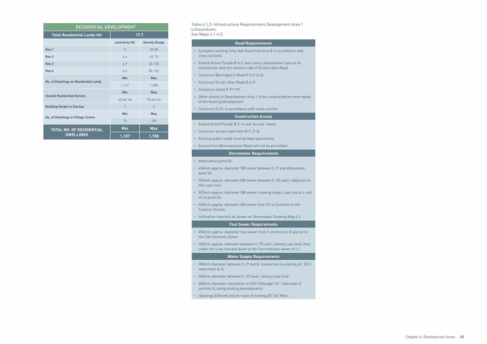
RESIDENTIAL DEVELOPMENT
Total Residential Lands HA 17.7
Land Area HA Density Range
Res 1 0 35-50
Res 2 6.4 45-70
Res 3 6.9 65-100
Res 4 4.4 85-125
No. of Dwellings on Residential LandsMin Max
1,112 1,688
Overall Residential DensityMin Max
63 per ha 95 per ha
Building Height in Storeys 2 5
No. of Dwellings in Village CentreMin Max
75 100
TOTAL NO. OF RESIDENTIAL DWELLINGS
Min Max
1,187 1,788
Table 6.1.2: Infrastructure Requirements Development Area 1 Lehaunstown. See Maps 4.1-4.5.
Road Requirements
• Complete existing Tully Vale Road from A to B in accordance with cross sections.
• Extend Grand Parade B to C and close Lehaunstown Lane at its intersection with the western side of Druid’s Glen Road.
• Construct Barrington’s Road P to C to D.
• Construct Druid’s Glen Road Q to P.
• Construct street P-P1-P2.
• Other streets in Development Area 1 to be constructed to meet needs of the housing development.
• Construct D-D1 in accordance with cross section.
Construction Access
• Extend Grand Parade B-C to suit ‘Access’ needs.
• Construct access road from N11, P-Q.
• Existing public roads must be kept operational.
• Access from Brennanstown Road will not be permitted.
Stormwater Requirements
• Attenuation pond 2A.
• 450mm approx. diameter SW sewer between C, P and attenuation pond 2A.
• 525mm approx. diameter SW sewer between C, P2 and L (adjacent to the Luas line).
• 525mm approx. diameter SW sewer crossing under Luas line at L and on to pond 2A.
• 450mm approx. diameter SW sewer from D1 to D and on to the Ticknick Stream.
• Infiltration trenches as shown on Stormwater Drawing Map 4.2.
Foul Sewer Requirements
• 450mm approx. diameter foul sewer from C environs to D and on to the Carrickmines Sewer.
• 450mm approx. diameter between C, P2 and L (along Luas line), then under the Luas line and down to the Carrickmines sewer at L1.
Water Supply Requirements
• 300mm diameter between C, P and Q. Connection to existing 24” DCC watermain at Q.
• 400mm diameter between C, P2 and L (along Luas line).
• 400mm diameter connection to DCC Stillorgan 24” main east of junction A, along existing developments.
• Upsizing (600mm) and re-route of existing 20” AC Main.
Chapter 6: Development Areas66
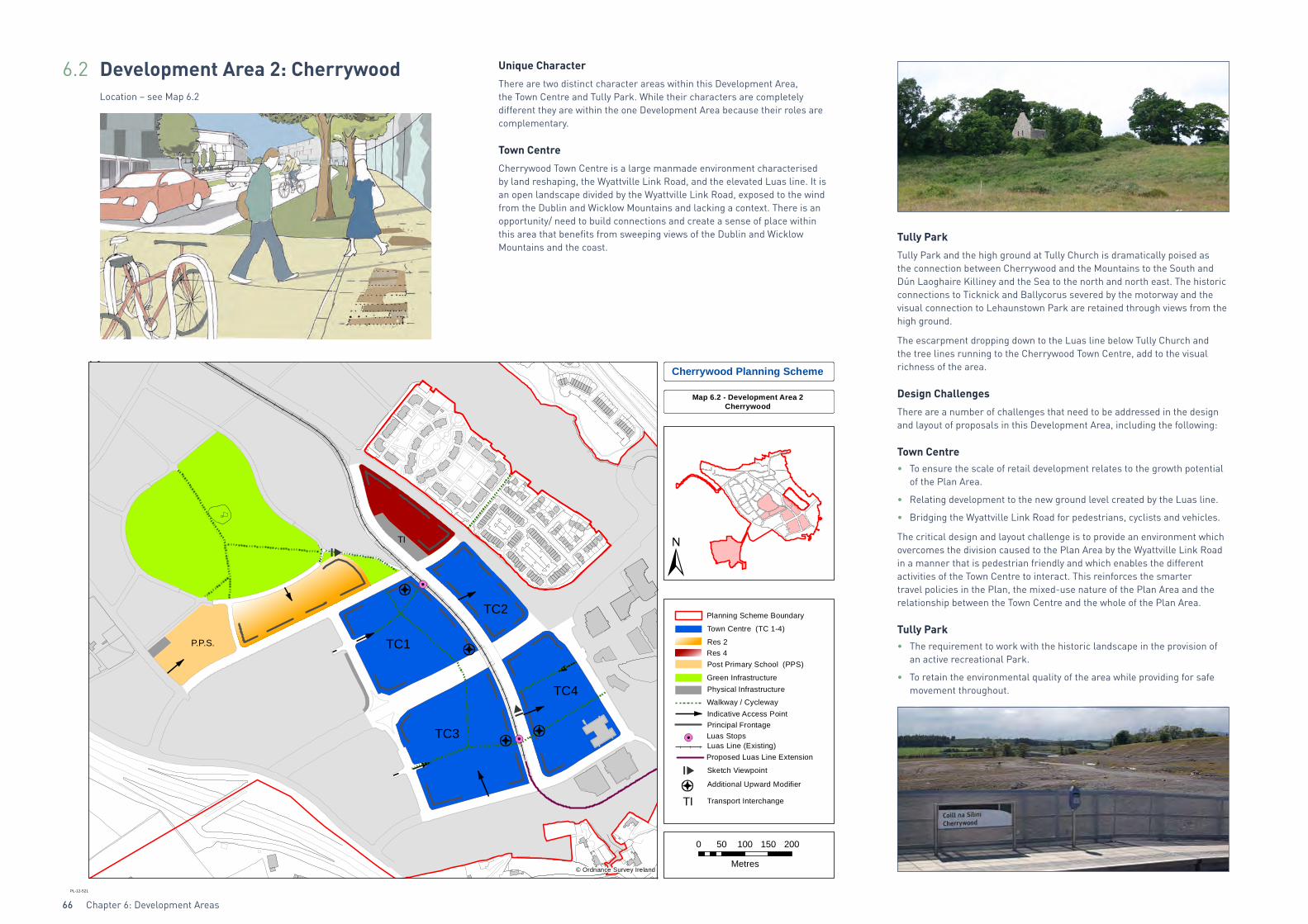
6.2 Development Area 2: CherrywoodLocation – see Map 6.2
Unique Character
There are two distinct character areas within this Development Area, the Town Centre and Tully Park. While their characters are completely different they are within the one Development Area because their roles are complementary.
Town Centre
Cherrywood Town Centre is a large manmade environment characterised by land reshaping, the Wyattville Link Road, and the elevated Luas line. It is an open landscape divided by the Wyattville Link Road, exposed to the wind from the Dublin and Wicklow Mountains and lacking a context. There is an opportunity/ need to build connections and create a sense of place within this area that benefits from sweeping views of the Dublin and Wicklow Mountains and the coast.
Tully Park
Tully Park and the high ground at Tully Church is dramatically poised as the connection between Cherrywood and the Mountains to the South and Dún Laoghaire Killiney and the Sea to the north and north east. The historic connections to Ticknick and Ballycorus severed by the motorway and the visual connection to Lehaunstown Park are retained through views from the high ground.
The escarpment dropping down to the Luas line below Tully Church and the tree lines running to the Cherrywood Town Centre, add to the visual richness of the area.
Design Challenges
There are a number of challenges that need to be addressed in the design and layout of proposals in this Development Area, including the following:
Town Centre• To ensure the scale of retail development relates to the growth potential
of the Plan Area.
• Relating development to the new ground level created by the Luas line.
• Bridging the Wyattville Link Road for pedestrians, cyclists and vehicles.
The critical design and layout challenge is to provide an environment which overcomes the division caused to the Plan Area by the Wyattville Link Road in a manner that is pedestrian friendly and which enables the different activities of the Town Centre to interact. This reinforces the smarter travel policies in the Plan, the mixed-use nature of the Plan Area and the relationship between the Town Centre and the whole of the Plan Area.
Tully Park• The requirement to work with the historic landscape in the provision of
an active recreational Park.
• To retain the environmental quality of the area while providing for safe movement throughout.
P.P.S.
Cherrywood Planning Scheme
Map 6.2 - Development Area 2Cherrywood
TC1
TC3
TC4
TC2
TI
Planning Scheme Boundary
Res 4
Walkway / Cycleway
Green Infrastructure
Indicative Access PointPrincipal Frontage
Town Centre (TC 1-4)
Post Primary School (PPS)
Sketch Viewpoint
Additional Upward Modifier
Transport InterchangeTI
Luas Stops
Proposed Luas Line ExtensionLuas Line (Existing)
Physical Infrastructure
Metres
0 50 100 150 200
PL-12-521
© Ordnance Survey Ireland
Res 2
Chapter 6: Development Areas 67
Future Form
Cherrywood Town Centre will accommodate the greatest concentration of development within the Plan Area. The Town Centre area is a mixed-use area, which will provide for a range of uses including: residential, office, retail, leisure, cafés and restaurants, ensuring that there is activity throughout the day and into the evening. The mix of interdependent land uses will contribute to the sense of place and identity.
The challenge with the Town Centre and the benefit of having it straddle the Wyattville Link Road is that there is an opportunity for it to create its own character, building on its wider setting. The Town Centre will bridge the divide created by the Wyattville Link Road, will create a Centre where all the different land uses are catered for and the needs of the residents and employees are met. It is the centre of economic, social and retailing activity within the Plan Area. It’s design and layout must embrace these functions by developing spaces of a quality that attracts people to them and through them to allow a sustainable level of footfall to be achieved that will enhance the viability of the area and contribute to a feeling of security.
This could be approached in a number of ways including:
• Designing the Town Centre link so that it will encourage and channel movement across the Wyattville Link Road.
• Designing the layout of the Town Centre so that ease of pedestrian movement to the Town Centre link is a primary design consideration. This could be achieved in a number of ways including:
> Stepping the buildings up from the perimeter of the Town Centre plots to the level of the Luas line and the pedestrian crossing of the Wyattville Link Road, so that across the Town Centre the buildings immediately adjoining the Town Centre link and Luas line are at grade;
Or
> Building the Town Centre on a podium that rises to the level of the Luas line. The treatment of plot edges will require considered design solutions.
For this elevated environment to be successful it will be perceived by the pedestrian as a real and natural place. As such the interface between the elevated Town Centre link and the adjoining ground should be designed to protect from the visual and auditory effects of traffic on the Wyattville Link Road.
Figure 6.1: Illustrative Sketch of Town Centre
N
The transport interchange for Bus and Luas is adjacent to the Town Centre. A plaza area to focus pedestrian and cycle access to the Town Centre from the west provides the main access to the central amenity area of Tully Park.
Tully Park fulfils a myriad of functions aside from the area being for recreational activities and being of historical significance:
• It provides pedestrian and cycle linkages between the Village Centres, the Town Centre and employment areas.
• It provides the recreational space for the primary and post primary schools adjoining the park.
• It provides views across the Plan Area and visually links the Plan Area to its hinterland.
Urban Form Development Framework
Achieving a successful urban form in the Cherrywood town centre is critical. The town centre crosses different landownerships and incorporates a variety of opportunities and constraints, including the crossing of the Wyattville Link Road. To ensure a comprehensive approach to the layout and urban form of the Cherrywood town centre, it is a pre-requisite to the approval of any planning applications for the town centre that, following consultation with the relevant landowners, an Urban Form Development Framework be prepared by the Development Agency in accordance with the Cherrywood SDZ Planning Scheme.
The purpose of the Urban Form Development Framework is to provide clarity and to assist the assessment of whether planning applications are consistent with the objectives of the Planning Scheme. Any development permitted in the town centre shall be in accordance with the Urban Form Development Framework.
The preparation of the Framework shall take cognisance of the design approach set out in the submissions received by An Bord Pleanála on the 27th day of February 2014 from BMA Planning and MÓLA Architecture on behalf of Cherrywood Properties, and from McCutcheon Halley Walsh and Scott Tallon Walker Architects on behalf of Dún Laoghaire Rathdown Properties Limited.
The level of detail provided by the Framework shall be at least that provided in the submission to An Bord Pleanála by Scott Tallon Walker Architects on behalf of Dún Laoghaire-Rathdown Properties Limited, on the 27th day of February 2014, which related to quadrant TC3.
The Framework shall address the area identified as ‘town centre’ (TC 1-4) on Map 6.2 ‘Development Area 2 Cherrywood’ and shall, at a minimum, include the following:
(a) Identification of: - the principal focus and civic core of the town centre, - the principal retail focus for quadrant TC1, and - the relationship between quadrant TC1 and Grand Parade, and their respective urban identities,
(b) a block layout for the town centre, illustrating urban blocks and urban grain,
(c) height, scale and massing, and building typologies,
(d) finsihed floor levels for buildings, including identification of entrance level(s), and finished levels for roads and footways, and in particular, the horizontal and vertical connections between Grand Parade and the surrounding streets/buildings,
(e) the location, design and treatment of squares, civic spaces, pocket parks, and the public realm generally,
(f) provision for facilities including a community facility, places of worship, a library, and a primary care unit, in accordance with Objective DA11,
(g) the treatment of the Grand Parade generally, including the proposed approach to the crossing of the Wyattville Link Road, demonstrating how an attractive and welcoming urban environment can be maintained, having regard to its important transport function as set out in the Planning Scheme,
(h) provision for a separate pedestrian/cycle bridge across the Wyattville Link Road, connecting quadrants TC1 and TC3, as shown in Map 6.2 ‘Development Area 2 Cherrywood’, and provision for the sequencing of this development.
(i) identification of vehicular and pedestrain routes within the town centre, and associated finished levels and access points, including car park access points, including section drawings and
(j) identification of the car parking spaces to be provided, the location access to and usage of car parks, including shared use car parks, and any on-street parking.
The framework shall not materially alter the Planning Scheme.
In the event of disagreement between the parties on any matters within the Framework, the matter in question shall be referred to An Bord Pleanála for determination.
Specific Objectives:
DA 10 The design and layout of the Town Centre shall address the following issues:
• In relation to ground levels, the change in levels between the surrounding road network and the Town Centre Link shall be designed in a manner that is attractive to the pedestrian;
• In relation to building heights, where a building addresses two streets, building height will be measured from the higher street.

Chapter 6: Development Areas68
• In relation to the Grand Parade, it is proposed as a low speed 30km/h street facilitating movement across the Wyattville Link Road for pedestrians, cyclists, Luas and motorised traffic. It will mitigate the severance caused by the Wyattville Link Road and encourage interaction between both sides of the Town Centre. In traffic terms it will provide vehicular access to development blocks TC2 and TC4 and reduce at-grade crossing movements of the Wyattville Link Road. Mitigation of the severence outlined, together with these access issues must be addressed.
• In relation to the relationship with the Wyattville Link Road, lands that encroach/abut/ or in any way have a relationship with the Wyattville Link Road, shall show the relationship between all building edges and the Road. The design of all elements shall be such that pedestrian movement is positively discouraged across the Link Road at-grade. This detail is necessary to support the creation of an attractive and sustainable environment in the Town Centre.
DA 11 The Town Centre link should form an important public space of a civic character, with trees and soft landscaping elements for shelter and visual amenity. The design of the Town Centre link shall incorporate features to protect pedestrian and cycle movement. These features will provide a safe environment for all users of the Town Centre Link and the Wyattville Link Road.
DA 12 Retail Impact Assessments shall accompany retail applications within the Town Centre.
DA 13 To design civic spaces to assist movement through the Town Centre, in particular marking where pedestrian routes converge or cross.
DA 14 That Tully Park is developed in accordance with the objectives set down in Chapter 5 Green Infrastructure and Chapter 3 Cultural and Built Heritage.
DA 15 To provide a Transport Interchange (T.I) in accordance with Chapter 4 and Map 6.2.
DA 16 To provide a Community Facility in the Town Centre in accordance with Section 2.3.4.
DA 17 To provide a Library Facility in the Town Centre in accordance with Section 2.3.4.
DA 18 To provide a Primary Care Unit in the Town Centre in accordance with Section 2.3.6.
RESIDENTIAL DEVELOPMENT
Total Residential Lands HA 4
Land Area Density Range
Res 1 0 35-50
Res 2 2.5 45-70
Res 3 0 65-100
Res 4 1.5 85-125
No. of Dwellings on Residential Lands
Min Max
240 363
Overall Residential DensityMin Max
60 per Ha 91 per Ha
Residential Units Town CentreMin Max
1,000 1,250
Building Height in Storeys 2 5
TOTAL NO. OF RESIDENTIAL DWELLINGSMin Max
1,240 1,613
EDUCATION
Educational Use Lands HA 1.8
Quantum and Type of Schools 0 Primary 1 Post Primary
Site 1 Area HA - 1.8
TRANSPORT INTERCHANGE (T.1)Site Area HA 0.3
Table 6.2.1: Development Type and Quantum for Development Area 2 Cherrywood
DEVELOPMENT AREA 2 CHERRYWOOD LAND USE AREAS
LAND USE AREA IN HECTARES
Mixed Use TC 16.1
Residential 4
Education 1.8
Transport Interchange 0.3
Green Infrastructure 21.7
DEVELOPMENT AREA 2 CHERRYWOOD
Gross Area HA Net Developable HA
77.9 21.9
CHERRYWOOD TOWN CENTRETotal Town Centre Lands HA 16.1
RETAIL SQ.MMin Max
Net / Gross Net / Gross
Convenience Retail 2,000 / 3,030 4,000/6,060
Comparison Retail 16,160/24,485 17,600/26,667
Retail Services 4,540/6,879 5,400/8,182
Total Retail QuantumMin Net / Gross Max Net /Gross
22,700/34,34 27,000/40,909
RESIDENTIAL Town Centre
Residential Dwelling UnitsMin Max
1,000 1,250
Gross Residential Floor Area Sq.m 120,000 150,000
NON RESIDENTIAL USES SQ.M
High Intensity EmploymentMin Max
82,800 109,000
Non Retail UsesMin Max
47,500 60,000
Community FacilitiesMin Max
2,200 3,000
TOTAL NON RESIDENTIAL FLOOR AREA 132,500 172,000
TOTAL QUANTUM FLOOR AREA Town Centre SQ.M
Min Max
286,894 362,909
Plot RatioMin Max
1:1.8 1: 2.3
Site CoverageMin Max
50% 80%
Building Height in StoreysMin Max
2 5
Upward Modifier 3 Storeys

Chapter 6: Development Areas 69
The Town Centre is further split into 4 areas to ensure a sustainable allocation of uses throughout and to allow for a critical mass of retail, non retail and community uses, a honey pot of employment to complement the existing employment in Bride’s Glen and a dispersal of residential to instil life through the Town Centre.
There is an allowance of 10% transfer of uses between the 4 areas in the Town Centre to give flexibility whilst maintaining the overall figures in Tables 6.2.1 and Tables 6.2.2. The optimum split of development quantum between the 4 areas within the Town Centre is detailed in the following table. (This 10% transfer is between each area is subject to agreement between Town Centre landowners).
Table 6.2.2: Breakdown of Development Quantum for Sites TC1, TC2, TC3 and TC4 Cherrywood Town Centre
TC1 SITE AREA SQM 43,000Use Min Area Sq.m No. Units Max Area Sq.m No. Units
Retail Gross 26,750 32,000
High Intensity Employment 8,000 10,000
Residential 24,000 200 32,400 270
Non Retail 17,000 21,000
Community 1,100 1,500
Total 76,850 96,900
Plot Ratio 1.8 2.3
TC2 SITE AREA SQM 21,000Use Min Area Sq.m No. Units Max Area Sq.m No. Units
Retail Gross 2,150 2,800
High Intensity Employment 0 0
Residential 28,200 235 36,000 300
Non Retail 7,000 9,000
Community 0 0
Total 37,350 47,800
Plot Ratio 1.8 2.3
TC3 SITE AREA SQM 53,880Use Min Area Sq.m No. Units Max Area Sq.m No. Units
Retail Gross 3,000 3,100
High Intensity Employment 54,800 74,300
Residential 27,000 225 33,600 280
Non Retail 8,000 10,000
Community 1,100 1,500
Total 93,900 122,500
Plot Ratio 1.7 2.3
TC4 SITE AREA SQ.M 43,000Use Min Area Sq.m No. Units Max Area Sq.m No. Units
Retail Gross 2,494 3,009
High Intensity Employment 12,753 17,453
High Intensity Employment Constructed as of February 2012
7,247 7,247
Residential 40,800 340 48,000 400
Non Retail 15,500 20,000
Community 0 0
Total 78,794 95,709
Plot Ratio 1.8 2.2
TOTAL QUANTUM Town Centre SQ.M Min 286,894 Max 362,909
Min MaxSite Coverage Town Centre 50 % 80%
Building Height in Storeys Town Centre 2 5
Table 6.2.3: Infrastructure Requirements Development Area 2 Cherrywood. See Maps 4.1-4.5.
Road Requirements
• Reconstruct existing roundabout at A to signalised 4 arm junction.
• Complete existing Tully Vale Road (Grand Parade) A to B in accordance with cross sections.
• Construct Street A1 to F1.
• Construct at-grade junction (left in/left out) on Wyattville Road.
• Construct road J to WLR.
• Set up Traffic Management Plan to facilitate construction of bridge over Wyattville Link Road.
• Construct Overbridge on WLR and street A2-A3.
• Complete existing road A3 to H to WLR in accordance with cross section.
• Reconstruct existing road A3 to I to A in accordance with cross section.
• Construct street A2-B.
• Construct streets linking to overbridges on WLR and complete the core street network.
• Construct remainder of street network specified for Development Area 2 i.e. all other streets designed to suit development of buildings and the urban landscape.
Construction Access
• From Wyattville Link Road via junction A or left in/out junction.
• Traffic Management proposal to be prepared and approved to keep traffic operational in a safe manner on the Wyattville Link Road during construction of the Cherrywood Town Centre.
Stormwater Requirements
• Attenuation ponds at outfall 5A.
• 450mm approx. diameter SW sewer from J environs to outfall 5A and 300mm diameter SW outlet to Cherrywood Road SW sewer.
• Attenuation Pond at Outfall 2B.
• 450mm approx diameter SW sewer from A2 environs to pond 2B.
Foul Sewer Requirements
• 450mm approx. diameter from K environs and under Luas connecting into the Carrickmines Sewer near pond 2B.
• 450mm approx diameter sewer from the environs of J and H along the Wyatville Road upsizing to 525mm approx. and on to the Carrickmines Sewer.
Water Supply Requirements
• Connection to DCC Stillorgan 24” Main.
• 400mm approx. diameter from 24” main to A.
• Upsizing (600mm) and re-route of existing 20” AC Main.
• 500 to 300mm diameter loop around Cherrywood Town Centre, from upsized 600mm diameter main.

Chapter 6: Development Areas70
6.3 Development Area 3: PriorslandLocation – see Map 6.3
Unique Character
Priorsland is characterised by the flat low-lying flood plain of the Carrickmines Stream, the tree belt of Turkey Oaks, Priorsland House, the Carrickmines Station and the archaeology of the Watermill and the Portal Tomb which can be viewed from the area.
Homes that can be accessed from Brennanstown Road can be viewed at the far side of the Luas.
The landscape suggests a neighbourhood that develops and is animated by the potential of the stream and the tree belt, with development providing shelter from the adjoining motorway.
Design Challenges
There are a number of challenges that need to be addressed in the design and layout of proposals in this Development Area:
• Designing the development that abuts the M50 in a manner which improves the noise environment within the Plan Area to protect the residential amenity of the individual homes. (See Chapter 2 Proposed Development in Cherrywood)
• Incorporating the Flood Containment Zone into the public realm (see Map 4.3).
• Linking the school site to the Village Centre.
• Protecting the residential amenity of homes outside the Plan Area by means of landscaping and design considerations.
• Protect the character of the protected structures by according with the requirements set out in Chapter 3 Cultural and Built Heritage.
• Access to the area.
• Ensure the scale of development supports the economic viability of the Village.
P.P.S.
P.S.
P.S.
Cherrywood Planning Scheme
Map 6.3 - Development Area 3Priorsland
HIE6
TI
Planning Scheme Boundary
Res 3Res 2
Luas Line (Existing)
Primary School (PS)Green Infrastructure
Protected Structures
Luas Stops
Village Centre
Walkway / CyclewayIndicative Access PointPrincipal Frontage
High Intensity Employment (HIE)
Transport InterchangeTI
Sketch Viewpoint
Physical Infrastructure
0 50 100 150 20025
Metres
PL-12-522
© Ordnance Survey Ireland
Chapter 6: Development Areas 71
Future Form
Priorsland may be the second of the three Villages to be developed. The Village Centre will be centrally located within this Development Area, fronting onto a landscaped linear space which incorporates a floodplain containment zone and a tree line of existing Turkey Oaks.
The Village Centre is located equidistance from 2 Luas stops, Carrickmines and Brennanstown, and is across from a primary school and a park therefore enhancing its pivotal location within this Development Area.
A Park and Ride facility, most likely in the form of a multi-storey car park, will be located adjacent to the Carrickmines Luas Stop. This Park and Ride facility will be accessed from the Carrickmines Interchange and will ensure that this valuable infrastructure resource is not only accessible to the residents of Cherrywood, but also to residents living in the wider area.
The entrance into Priorsland from Barrington’s Road is landmarked by a triangular site accommodating High Intensity Employment development in the form of a building of up to 5 storeys in height.
Specific Objectives:
DA 19 Pedestrian and vehicular connections are to be provided across the flood containment zone by way of bridges.
DA 20 Development adjoining the M50 to provide sound mitigation for the remainder of the Development Area.
DA 21 There shall be a high quality of landscaping and visual amenity at the interface with Cherrywood when viewed from the M50.
DA 22 Lands adjacent to Carrickmines Luas stop to provide a transport interchange, and a park and ride facility with connections to the national road network. A local convenience retail outlet (of up to 200m2 gross floor area) and a tea room/cáfe use are permissible in principle on the lands adjacent to the Carrickmines Luas stop.
DA 23 Access to Brennanstown Luas stop to be achieved through design of the residential plot.
DA 24 To provide appropriate access to Druid’s Glen from the open space.
DA 25 To develop Priorsland House and Carrickmines Station in accordance with the details set down in Chapter 3 Cultural and Built Heritage.
DA 26 Access to Carrickmines Interchange will be limited to: Priorsland House, Carrickmines Station including lands adjoining these structures identified in Map 3.3 and the transport facilities adjoining the Carrickmines Luas stop.
DA 27 A community facility in accordance with Section 2.3.4 will be provided in the Village Centre.
Table 6.3.1: Development Type and Quantum for Development Area 3 Priorsland
DEVELOPMENT AREA 3 PRIORSLAND LAND USE AREAS
LAND USE AREA IN HECTARES
Mixed Use Village Centre 0.9
High Intensity Employment 0.4
Residential 9.2
Education 0.8
Transport Interchange 0.3
Green Infrastructure 1.2
DEVELOPMENT AREA 3 PRIORSLAND
Gross Area HA Net Developable HA 20.3 11.3
PRIORSLAND VILLAGE CENTRE
Total Village Centre Lands HA 0.9
RETAIL SQ.MMin Max
Net / Gross Net / Gross1 no. Supermarket 550 / 834 900 / 1,365Local Retail 150 / 228 300 / 455Retail Services 150 / 228 300 / 455
Total Retail Quantum Village CentreMin Net / Gross Max Net / Gross
850 / 1,290 1,500 / 2,275
RESIDENTIAL
Residential Dwelling UnitsMin Max75 100
Gross Residential Floor Area Sq.mMin Max
9,000 12,000
NON RESIDENTIAL USES SQ.M
Non Retail UsesMin Max700 1,000
High Intensity EmploymentMin Max700 1,000
Community FacilitiesMin Max250 500
Total Non Residential Floor AreaMin Max
1,650 2,500
TOTAL FLOORSPACE QUANTUM PRIORSLAND VILLAGE CENTRE
SQ.M
Min Max
11,940 16,775
Plot RatioMin Max
1: 1.3 1: 2
Site CoverageMin Max40% 60%
Building Height in StoreysMin Max
3 4
HIGH INTENSITY EMPLOYMENT
Site HIE 6 High Intensity Employment Lands HA 0.4
Proposed Quantum Sq.mMin Max
6,000 8,000
Plot RatioMin Max
1: 1.5 1: 2
Site CoverageMin Max40% 60%
Building Height in StoreysMin Max
3 5
RESIDENTIAL DEVELOPMENTTotal Residential Lands HA 9.2
Land Area HA Density RangeRes 1 0 35 - 50Res 2 4.5 45 - 70Res 3 4.7 65 - 100Res 4 0 85 - 125
No. of Dwellings on Residential LandsMin Max508 785
Overall Residential DensityMin Max
55 per ha 85 per ha Building Height in Storeys 2 5
No. of Dwellings in Village CentreMin Max75 100
TOTAL NO. OF RESIDENTIAL DWELLINGS
Min Max583 885
EDUCATION Educational Use Lands HA 0.8
Quantum and Type of Schools 1 Primary 0 Post Primary
Site 1 Area HA 0.8 -
TRANSPORT INTERCHANGE (T.I) Site Area HA 0.27
Table 6.3.2: Infrastructure Requirements Development Area 3 Priorsland. See Maps 4.1-4.5.
Road Requirements• Construct M – D.
• Roads D-C-P-Q, A-B and B-C as specified for Development Area 1.Construction Access
• Through single controlled access at Junction D on Barrington’s Road.Stormwater Requirements
• Flood containment zone.
• Diversion of Ticknick Stream.
• Flood flow bypass culvert parallel to Carrickmines River.
• Detention basins and swales as shown on Map 4.2.Foul Sewer Requirements
• 450mm approx. diameter sewer from E and D connecting into the Carrickmines Sewer.
Water Supply Requirements• Upsizing (600mm) and re-route of existing 20” AC main.
• 300mm branch main from the upsized 600mm diameter main to existing 300mm diameter at I.
• Connection to DCC Stillorgan 24” main at Q.
• 400mm diameter from 24” main to A, A’, B, L, P2, C, D and at 300mm. via M and S to connect to existing 200mm watermain in Glenamuck Road.
• 400mm diameter Luas crossing at C.
• Abandon section of existing 33” Main and reroute through E to tie back into existing main near attenuation pond 1.
Chapter 6: Development Areas72
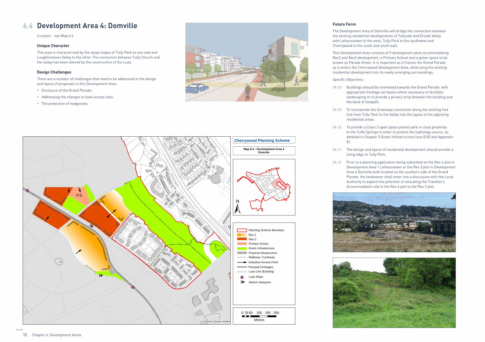
6.4 Development Area 4: DomvilleLocation - see Map 6.4
Unique Character
This area is characterised by the steep slopes of Tully Park to one side and Loughlinstown Valley to the other. The connection between Tully Church and the valley has been altered by the construction of the Luas.
Design Challenges
There are a number of challenges that need to be addressed in the design and layout of proposals in this Development Area:
• Enclosure of the Grand Parade.
• Addressing the changes in level across sites.
• The protection of hedgerows.
Future Form
The Development Area of Domville will bridge the connection between the existing residential developments of Tullyvale and Druids Valley with Lehaunstown to the west, Tully Park to the southwest and Cherrywood to the south and south east.
This Development Area consists of 5 development plots accommodating Res2 and Res3 development, a Primary School and a green space to be known as Parade Green. It is important as it frames the Grand Parade as it enters the Cherrywood Development Area, while tying the existing residential development into its newly emerging surroundings.
Specific Objectives:
DA 28 Buildings should be orientated towards the Grand Parade, with appropriate frontage set backs where necessary to facilitate landscaping or to provide a privacy strip between the building and the back of footpath.
DA 29 To incorporate the Greenway connection along the existing tree line from Tully Park to the Valley into the layout of the adjoining residential areas.
DA 30 To provide a Class 2 open space pocket park in close proximity to the Tuffa Springs in order to protect the hydrology source, as detailed in Chapter 5 Green Infrastructure (see GI30 and Appendix E).
DA 31 The design and layout of residential development should provide a living edge to Tully Park.
DA 32 Prior to a planning application being submitted on the Res 4 plot in Development Area 1 Lehaunstown or the Res 3 plot in Development Area 4 Domville both located on the southern side of the Grand Parade, the landowner shall enter into a discussion with the Local Authority to explore the potential of relocating the Traveller’s Accommodation site in the Res 4 plot to the Res 3 plot.
P.P.S.
P.S.
P.S.
Cherrywood Planning Scheme
Map 6.4 - Development Area 4Domvile
0 50 100 150 20025
Metres
PL-12-523
© Ordnance Survey Ireland
Planning Scheme Boundary
Luas Line (Existing)
Luas Stops
Walkway / CyclewayPhysical InfrastructureGreen Infrastructure
Indicative Access Point
Principal Frontages
Sketch Viewpoint
Res 3Res 2
Primary School
Chapter 6: Development Areas 73
Table 6.4.1: Development Type and Quantum for Development Area 4 Domville
DEVELOPMENT AREA 4 DOMVILLE LAND USE AREAS
LAND USE AREA IN HECTARES
Residential 12
Education 0.85
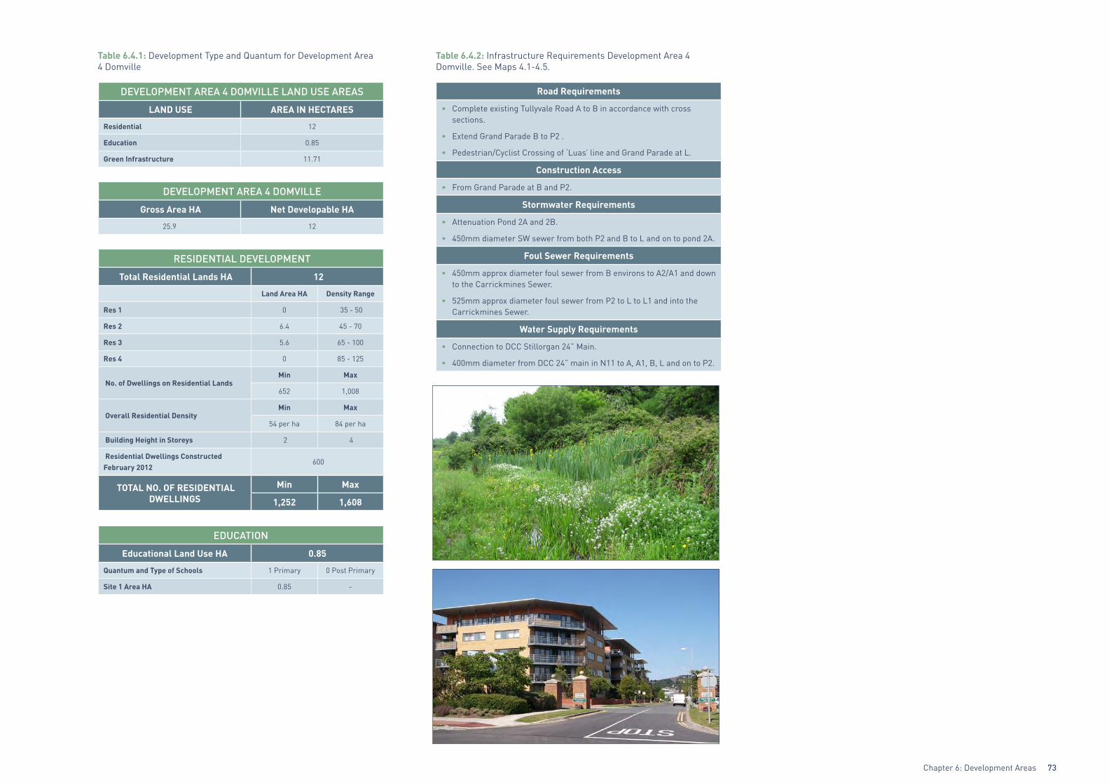
Green Infrastructure 11.71
DEVELOPMENT AREA 4 DOMVILLE
Gross Area HA Net Developable HA
25.9 12
RESIDENTIAL DEVELOPMENT
Total Residential Lands HA 12
Land Area HA Density Range
Res 1 0 35 - 50
Res 2 6.4 45 - 70
Res 3 5.6 65 - 100
Res 4 0 85 - 125
No. of Dwellings on Residential LandsMin Max
652 1,008
Overall Residential DensityMin Max
54 per ha 84 per ha
Building Height in Storeys 2 4
Residential Dwellings Constructed February 2012
600
TOTAL NO. OF RESIDENTIAL DWELLINGS
Min Max
1,252 1,608
EDUCATION
Educational Land Use HA 0.85
Quantum and Type of Schools 1 Primary 0 Post Primary
Site 1 Area HA 0.85 -
Table 6.4.2: Infrastructure Requirements Development Area 4 Domville. See Maps 4.1-4.5.
Road Requirements
• Complete existing Tullyvale Road A to B in accordance with cross sections.
• Extend Grand Parade B to P2 .
• Pedestrian/Cyclist Crossing of ‘Luas’ line and Grand Parade at L.
Construction Access
• From Grand Parade at B and P2.
Stormwater Requirements
• Attenuation Pond 2A and 2B.
• 450mm diameter SW sewer from both P2 and B to L and on to pond 2A.
Foul Sewer Requirements
• 450mm approx diameter foul sewer from B environs to A2/A1 and down to the Carrickmines Sewer.
• 525mm approx diameter foul sewer from P2 to L to L1 and into the Carrickmines Sewer.
Water Supply Requirements
• Connection to DCC Stillorgan 24” Main.
• 400mm diameter from DCC 24” main in N11 to A, A1, B, L and on to P2.
Chapter 6: Development Areas74
6.5 Development Area 5: Druid’s GlenLocation – see Map 6.5
Unique Character
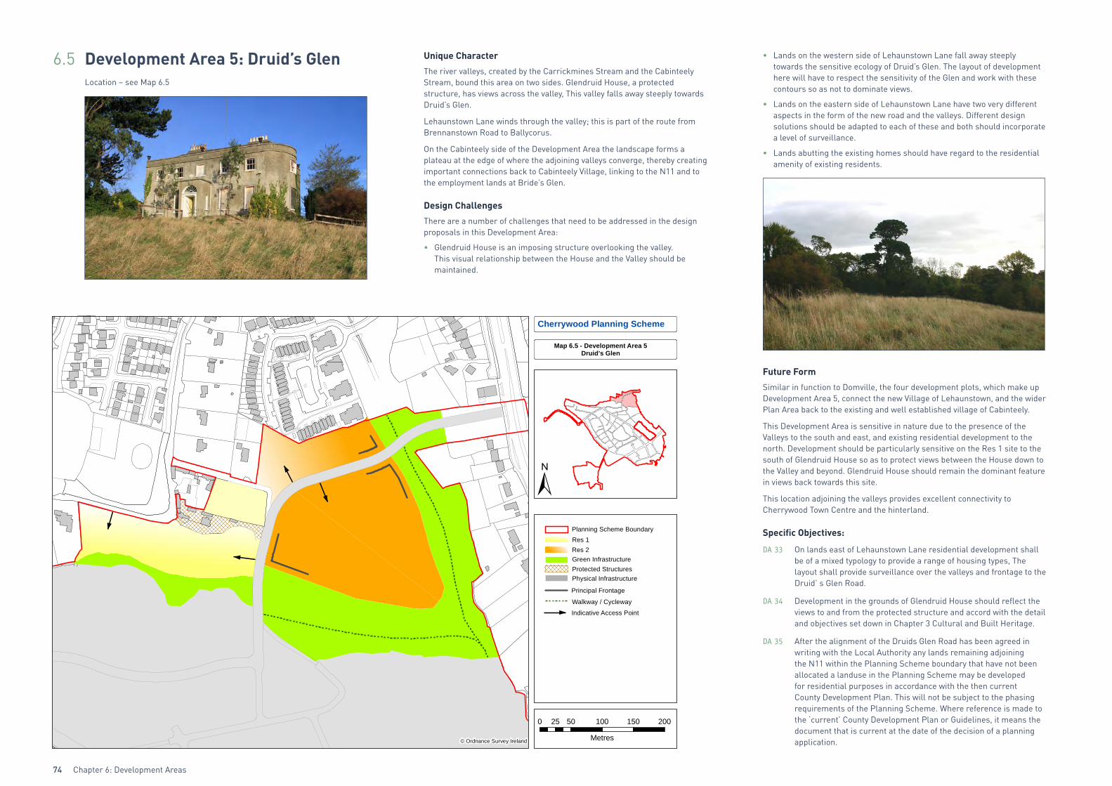
The river valleys, created by the Carrickmines Stream and the Cabinteely Stream, bound this area on two sides. Glendruid House, a protected structure, has views across the valley, This valley falls away steeply towards Druid’s Glen.
Lehaunstown Lane winds through the valley; this is part of the route from Brennanstown Road to Ballycorus.
On the Cabinteely side of the Development Area the landscape forms a plateau at the edge of where the adjoining valleys converge, thereby creating important connections back to Cabinteely Village, linking to the N11 and to the employment lands at Bride’s Glen.
Design Challenges
There are a number of challenges that need to be addressed in the design proposals in this Development Area:
• Glendruid House is an imposing structure overlooking the valley. This visual relationship between the House and the Valley should be maintained.
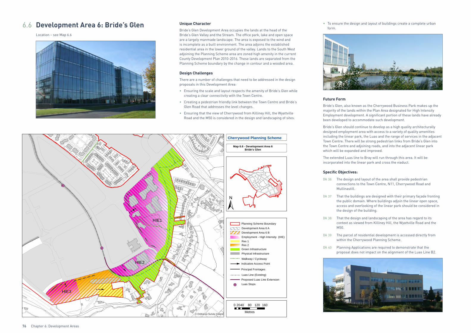
• Lands on the western side of Lehaunstown Lane fall away steeply towards the sensitive ecology of Druid’s Glen. The layout of development here will have to respect the sensitivity of the Glen and work with these contours so as not to dominate views.
• Lands on the eastern side of Lehaunstown Lane have two very different aspects in the form of the new road and the valleys. Different design solutions should be adapted to each of these and both should incorporate a level of surveillance.
• Lands abutting the existing homes should have regard to the residential amenity of existing residents.
Future Form
Similar in function to Domville, the four development plots, which make up Development Area 5, connect the new Village of Lehaunstown, and the wider Plan Area back to the existing and well established village of Cabinteely.
This Development Area is sensitive in nature due to the presence of the Valleys to the south and east, and existing residential development to the north. Development should be particularly sensitive on the Res 1 site to the south of Glendruid House so as to protect views between the House down to the Valley and beyond. Glendruid House should remain the dominant feature in views back towards this site.
This location adjoining the valleys provides excellent connectivity to Cherrywood Town Centre and the hinterland.
Specific Objectives:
DA 33 On lands east of Lehaunstown Lane residential development shall be of a mixed typology to provide a range of housing types, The layout shall provide surveillance over the valleys and frontage to the Druid’ s Glen Road.
DA 34 Development in the grounds of Glendruid House should reflect the views to and from the protected structure and accord with the detail and objectives set down in Chapter 3 Cultural and Built Heritage.
DA 35 After the alignment of the Druids Glen Road has been agreed in writing with the Local Authority any lands remaining adjoining the N11 within the Planning Scheme boundary that have not been allocated a landuse in the Planning Scheme may be developed for residential purposes in accordance with the then current County Development Plan. This will not be subject to the phasing requirements of the Planning Scheme. Where reference is made to the ‘current’ County Development Plan or Guidelines, it means the document that is current at the date of the decision of a planning application.
Cherrywood Planning Scheme
Map 6.5 - Development Area 5Druid's Glen
Planning Scheme Boundary
Walkway / Cycleway
Principal Frontage
Res 2Res 1
Green Infrastructure
Physical InfrastructureProtected Structures
Indicative Access Point
0 50 100 150 20025
Metres
PL-12-524
© Ordnance Survey Ireland

Chapter 6: Development Areas 75
Table 6.5.1: Development Type and Quantum for Development Area 5 Druid’s Glen
DEVELOPMENT AREA 5 DRUID’S GLEN LAND USE AREAS
LAND USE AREA IN HECTARES
Residential HA 8.5
Green Infrastructure 6.2
DEVELOPMENT AREA 5 DRUID’S GLEN
Gross Area HA Net Developable HA
15.6 8.5
RESIDENTIAL DEVELOPMENT
Total Residential Lands HA 8.5
Land Area HA Density Range
Res 1 2.6 35 - 50
Res 2 5.9 45 - 70
Res 3 0 65 - 100
Res 4 0 85 - 125
No. of Dwellings on Residential LandsMin Max
357 543
Overall Residential DensityMin Max
42 per ha 64 per ha
Building Height in Storeys 2 4
TOTAL NO. OF RESIDENTIAL DWELLINGS
Min Max
357 543
Table 6.5.2: Infrastructure Requirements Development Area 5 Druid’s Glen. See Maps 4.1-4.5.
Road Requirements
• Construct Road P3-Q and close Lehaunstown Lane at its intersection with the western side of Druids Glen Road. If a secondary access is required on to Brennanstown Road to serve a limited number of units this will be contingent on traffic calming.
Construction Access
• From N11, via Route P3-Q.
Stormwater Requirements
• Attenuation pond 2A.
• 300mm diameter approx. SW pipe from P3 environs to pond 2A.
Water Supply Requirements
• Initially, Area 5 can be served from Q to P3 (200mm-300mm diameter approx). Watermains from C2 to P to P to P3 to be installed when roads are constructed.
• Connection to 26” DCC watermain at Q.
Foul Sewer Requirements
• Local foul network to connect to Carrickmines or Foxrock trunk sewers.
Chapter 6: Development Areas76
6.6 Development Area 6: Bride’s GlenLocation – see Map 6.6
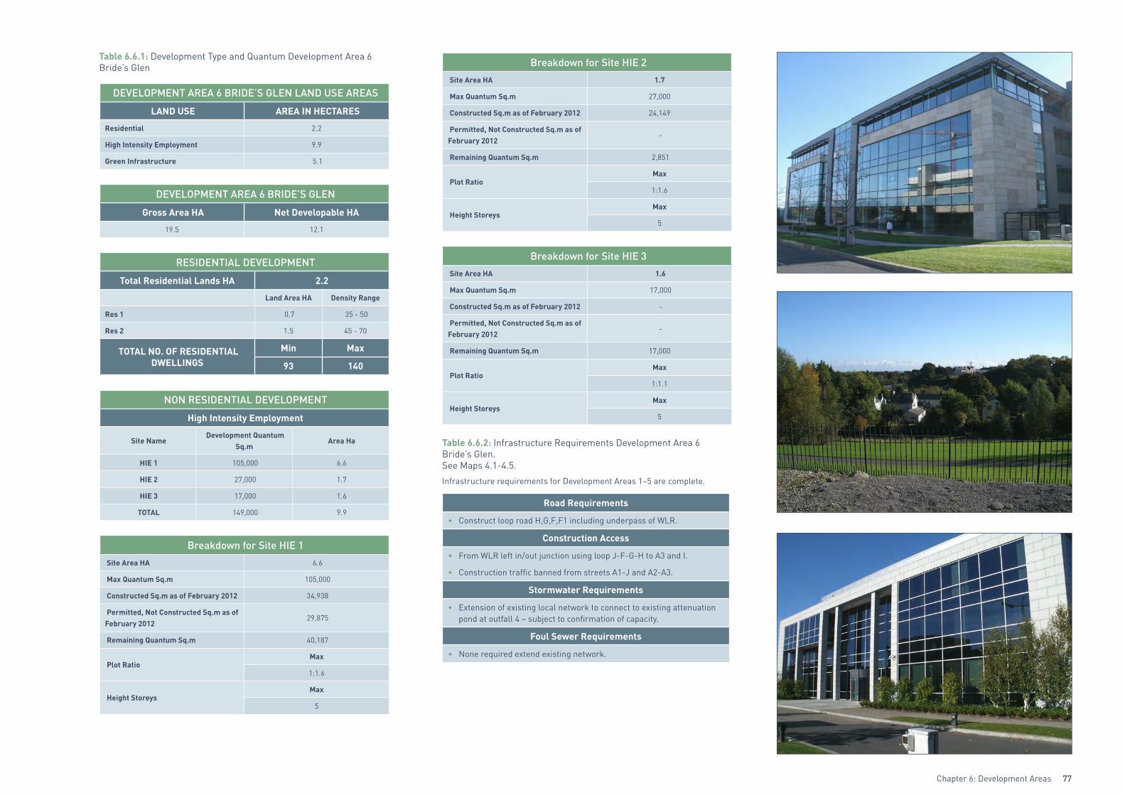
Unique Character
Bride’s Glen Development Area occupies the lands at the head of the Bride’s Glen Valley and the Stream. The office park, lake and open space are a largely manmade landscape. The area is exposed to the wind and is incomplete as a built environment. The area adjoins the established residential area in the lower ground of the valley. Lands to the South West adjoining the Planning Scheme area are zoned high amenity in the current County Development Plan 2010-2016. These lands are separated from the Planning Scheme boundary by the change in contour and a wooded area.
Design Challenges
There are a number of challenges that need to be addressed in the design proposals in this Development Area:
• Ensuring the scale and layout respects the amenity of Bride’s Glen while creating a clear connectivity with the Town Centre.
• Creating a pedestrian friendly link between the Town Centre and Bride’s Glen Road that addresses the level changes.
• Ensuring that the view of Cherrywood from Killiney Hill, the Wyattville Road and the M50 is considered in the design and landscaping of sites.
• To ensure the design and layout of buildings create a complete urban form.
Future Form
Bride’s Glen, also known as the Cherrywood Business Park makes up the majority of the lands within the Plan Area designated for High Intensity Employment development. A significant portion of these lands have already been developed to accommodate such development.
Bride’s Glen should continue to develop as a high quality architecturally designed employment area with access to a variety of quality amenities including the linear park, the Luas and the range of services in the adjacent Town Centre. There will be strong pedestrian links from Bride’s Glen into the Town Centre and adjoining roads, and into the adjacent linear park which will be expanded and improved.
The extended Luas line to Bray will run through this area. It will be incorporated into the linear park and cross the viaduct.
Specific Objectives:
DA 36 The design and layout of the area shall provide pedestrian connections to the Town Centre, N11, Cherrywood Road and Mullinastill.
DA 37 That the buildings are designed with their primary façade fronting the public domain. Where buildings adjoin the linear open space, access and overlooking of the linear park should be considered in the design of the building.
DA 38 That the design and landscaping of the area has regard to its context as viewed from Killiney Hill, the Wyattville Road and the M50.
DA 39 The parcel of residential development is accessed directly from within the Cherrywood Planning Scheme.
DA 40 Planning Applications are required to demonstrate that the proposal does not impact on the alignment of the Luas Line B2.
!H
!H
Cherrywood Planning Scheme
Map 6.6 - Development Area 6Bride's Glen
HIE1
HIE2
HIE3
±Planning Scheme Boundary
0 40 80 120 16020
Metres
PL-14-121
© Ordnance Survey Ireland
!H Luas Stops
Walkway / Cycleway
Principal Frontages
Proposed Luas Line Extension
Employment - High Intensity (HIE)
Luas Line (Existing)
Green InfrastructurePhysical Infrastructure
Res 1
Indicative Access Point
Res 2
Development Area 6 ADevelopment Area 6 B
Chapter 6: Development Areas 77
Table 6.6.1: Development Type and Quantum Development Area 6 Bride’s Glen
DEVELOPMENT AREA 6 BRIDE’S GLEN LAND USE AREAS
LAND USE AREA IN HECTARES
Residential 2.2
High Intensity Employment 9.9
Green Infrastructure 5.1
DEVELOPMENT AREA 6 BRIDE’S GLEN
Gross Area HA Net Developable HA
19.5 12.1
RESIDENTIAL DEVELOPMENT
Total Residential Lands HA 2.2
Land Area HA Density Range
Res 1 0.7 35 - 50
Res 2 1.5 45 - 70
TOTAL NO. OF RESIDENTIAL DWELLINGS
Min Max
93 140
NON RESIDENTIAL DEVELOPMENT
High Intensity Employment
Site Name Development Quantum
Sq.m Area Ha
HIE 1 105,000 6.6
HIE 2 27,000 1.7
HIE 3 17,000 1.6
TOTAL 149,000 9.9
Breakdown for Site HIE 1 Site Area HA 6.6
Max Quantum Sq.m 105,000
Constructed Sq.m as of February 2012 34,938
Permitted, Not Constructed Sq.m as of February 2012
29,875
Remaining Quantum Sq.m 40,187
Plot RatioMax
1:1.6
Height StoreysMax
5
Breakdown for Site HIE 2 Site Area HA 1.7
Max Quantum Sq.m 27,000
Constructed Sq.m as of February 2012 24,149
Permitted, Not Constructed Sq.m as of February 2012
-
Remaining Quantum Sq.m 2,851
Plot RatioMax
1:1.6
Height StoreysMax
5
Breakdown for Site HIE 3 Site Area HA 1.6
Max Quantum Sq.m 17,000
Constructed Sq.m as of February 2012 -
Permitted, Not Constructed Sq.m as of February 2012
-
Remaining Quantum Sq.m 17,000
Plot RatioMax
1:1.1
Height StoreysMax
5
Table 6.6.2: Infrastructure Requirements Development Area 6 Bride’s Glen. See Maps 4.1-4.5.
Infrastructure requirements for Development Areas 1–5 are complete.
Road Requirements
• Construct loop road H,G,F,F1 including underpass of WLR.
Construction Access
• From WLR left in/out junction using loop J-F-G-H to A3 and I.
• Construction traffic banned from streets A1-J and A2-A3.
Stormwater Requirements
• Extension of existing local network to connect to existing attenuation pond at outfall 4 – subject to confirmation of capacity.
Foul Sewer Requirements
• None required extend existing network.
Chapter 6: Development Areas78
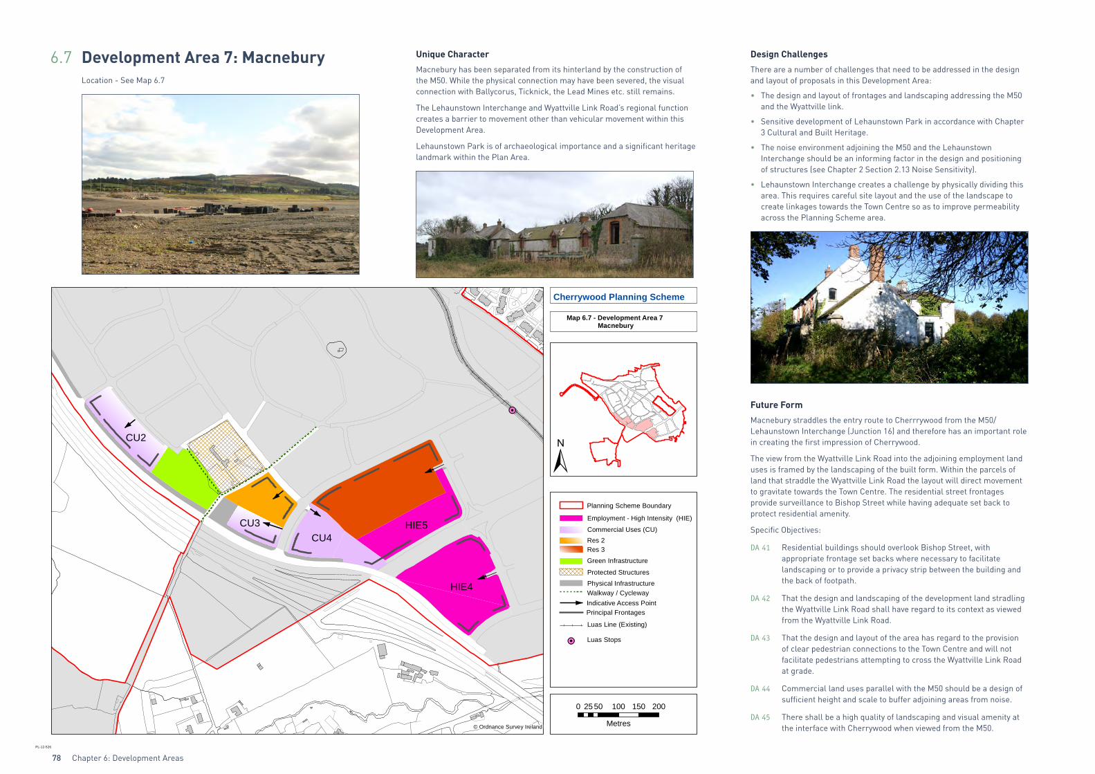
6.7 Development Area 7: MacneburyLocation - See Map 6.7
Unique Character
Macnebury has been separated from its hinterland by the construction of the M50. While the physical connection may have been severed, the visual connection with Ballycorus, Ticknick, the Lead Mines etc. still remains.
The Lehaunstown Interchange and Wyattville Link Road’s regional function creates a barrier to movement other than vehicular movement within this Development Area.
Lehaunstown Park is of archaeological importance and a significant heritage landmark within the Plan Area.
Design Challenges
There are a number of challenges that need to be addressed in the design and layout of proposals in this Development Area:
• The design and layout of frontages and landscaping addressing the M50 and the Wyattville link.
• Sensitive development of Lehaunstown Park in accordance with Chapter 3 Cultural and Built Heritage.
• The noise environment adjoining the M50 and the Lehaunstown Interchange should be an informing factor in the design and positioning of structures (see Chapter 2 Section 2.13 Noise Sensitivity).
• Lehaunstown Interchange creates a challenge by physically dividing this area. This requires careful site layout and the use of the landscape to create linkages towards the Town Centre so as to improve permeability across the Planning Scheme area.
Future Form
Macnebury straddles the entry route to Cherrrywood from the M50/Lehaunstown Interchange (Junction 16) and therefore has an important role in creating the first impression of Cherrywood.
The view from the Wyattville Link Road into the adjoining employment land uses is framed by the landscaping of the built form. Within the parcels of land that straddle the Wyattville Link Road the layout will direct movement to gravitate towards the Town Centre. The residential street frontages provide surveillance to Bishop Street while having adequate set back to protect residential amenity.
Specific Objectives:
DA 41 Residential buildings should overlook Bishop Street, with appropriate frontage set backs where necessary to facilitate landscaping or to provide a privacy strip between the building and the back of footpath.
DA 42 That the design and landscaping of the development land stradling the Wyattville Link Road shall have regard to its context as viewed from the Wyattville Link Road.
DA 43 That the design and layout of the area has regard to the provision of clear pedestrian connections to the Town Centre and will not facilitate pedestrians attempting to cross the Wyattville Link Road at grade.
DA 44 Commercial land uses parallel with the M50 should be a design of sufficient height and scale to buffer adjoining areas from noise.
DA 45 There shall be a high quality of landscaping and visual amenity at the interface with Cherrywood when viewed from the M50.
P.P.S.
P.S.
P.S. Cherrywood Planning Scheme
Map 6.7 - Development Area 7 Macnebury
HIE4
HIE5CU4
CU2
CU3
Planning Scheme Boundary
Luas Stops
Walkway / Cycleway
Principal Frontages
Res 3Res 2Commercial Uses (CU)
Employment - High Intensity (HIE)
Luas Line (Existing)
Green Infrastructure
Physical InfrastructureProtected Structures
Indicative Access Point
0 50 100 150 20025
Metres
PL-12-526
© Ordnance Survey Ireland

Chapter 6: Development Areas 79
DA 46 To maintain the pedestrian access over the M50 to open space lands at Ticknick.
DA 47 The proposed tunnel on Beckett Road, under the Wyattville Link Road, shall be developed in accordance with the clarification submitted to an Bord Pleanála by the Development Agency on the 15th day of January 2014. See appendix H
Table 6.7.1: Development Type and Quantum Development Area 7 Macnebury
DEVELOPMENT AREA 7 MACNEBURY LAND USE AREAS
LAND USE AREA IN HECTARES
High Intensity Employment 5.76
Commercial Uses 4.1
Residential 5.3
Green Infrastructure HA 1.4
DEVELOPMENT AREA 7 MACNEBURY
Gross Area HA Net Developable HA
24.6 15.16
NON RESIDENTIAL DEVELOPMENT
HIGH INTENSITY EMPLOYMENT
High Intensity Employment Lands HA 5.76
Max Quantum Sq.m 81,000
Breakdown for Site HIE 4
Area HA 3.8
Max Quantum Sq.m 57,000
Plot RatioMax
1:1.5
Building Height in StoreysMax
5
Breakdown for Site HIE 5
Area HA 1.96
Max Quantum Sq.m 24,000
Plot Ratio 1:1.2
Building Height in StoreysMax
4
COMMERCIAL USES
Commercial Uses Lands HA 4.1
Min Quantum Sq.m 41,000
Site CU 2
Area HA 1.6
Min Quantum Sq.m 16,000
Min Plot RatioMin
1:1
Building Height in StoreysMin Max
2 4
Site CU 3
Area HA 0.7
Min Quantum Sq.m 7,000
Min Plot RatioMin
1:1
Building Height in StoreysMin Max
2 3
Site CU 4
Area HA 1.8
Min Quantum Sq.m 18,000
Min Plot RatioMin
1:1
Building Height in StoreysMin Max
2 4
RESIDENTIAL DEVELOPMENT
Total Residential Lands HA 5.3
Land Area HA Density Range
Res 1 0 35 - 50
Res 2 1.2 45 - 70
Res 3 4.1 65 - 100
Res 4 0 85 - 125
No. of Dwellings on Residential LandsMin Max
321 494
Overall Residential DensityMin Max
61 per ha 93 per ha
Building Height in StoreysMin Max
2 5
TOTAL NO. OF RESIDENTIAL DWELLINGS
Min Max
321 494
Table 6.7.2: Infrastructure Requirements Development Area 7 Macnebury. See Maps 4.1-4.5.
Infrastructure requirements of Development Areas 1-5 are complete.
Road Requirements
• Loop road H,G,F,F1 including underpass of WLR.
• Beckett Road E-F.
• Construct street network F1-K1.
Construction Access
• Construction traffic banned from streets A1-J and A2-A3.
• From WLR left in/out junction via loop J-F-G-H to E2 and K1.
Stormwater Requirements
• Attenuation pond 5A.
• 525mm approx. diameter SW sewer from J environ to pond 5A.
• Detention basins and infiltration trenches as shown on Stormwater drawing.
• 525mm diameter approx. SW sewer from F1 environs to F and from K environs to detention basin.
Foul Sewer Requirements
• 450mm approx. diameter sewer from F1 to WLR Road, along it and crossing the Luas to connect into the Carrickmines Sewer.
• 300mm approx. diameter sewer from K to F1.
• 450mm approx. diameter from J and H to A and on to Carrickmines Sewer.
Water Supply Requirements
• Upsizing (600mm) and re-route of existing 20” AC Main.
• 500 to 400mm diameter from H to J’ to F from above upsized main.
Chapter 6: Development Areas80
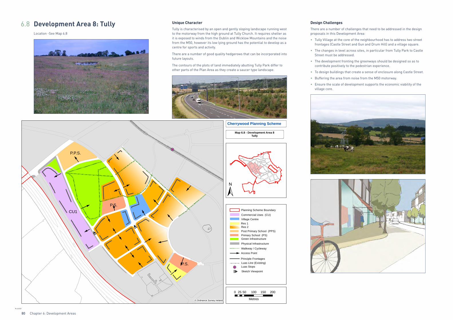
6.8 Development Area 8: TullyLocation -See Map 6.8
Unique Character
Tully is characterised by an open and gently sloping landscape running west to the motorway from the high ground at Tully Church. It requires shelter as it is exposed to winds from the Dublin and Wicklow Mountains and the noise from the M50, however its low lying ground has the potential to develop as a centre for sports and activity.
There are a number of good quality hedgerows that can be incorporated into future layouts.
The contours of the plots of land immediately abutting Tully Park differ to other parts of the Plan Area as they create a saucer type landscape.
Design Challenges
There are a number of challenges that need to be addressed in the design proposals in this Development Area:
• Tully Village at the core of the neighbourhood has to address two street frontages (Castle Street and Gun and Drum Hill) and a village square.
• The changes in level across sites, in particular from Tully Park to Castle Street must be addressed.
• The development fronting the greenways should be designed so as to contribute positively to the pedestrian experience.
• To design buildings that create a sense of enclosure along Castle Street.
• Buffering the area from noise from the M50 motorway.
• Ensure the scale of development supports the economic viability of the village core.
P.P.S.
P.P.S. P.S.
P.S.
P.S.
Cherrywood Planning Scheme
Map 6.8 - Development Area 8Tully
CU1 Planning Scheme Boundary
Luas Stops
Walkway / Cycleway
Post Primary School (PPS)Primary School (PS)
Principle Frontages
Village Centre
Res 2Res 1
Commercial Uses (CU)
Luas Line (Existing)
Green Infrastructure
Physical Infrastructure
Access Point
Sketch Viewpoint
0 50 100 150 20025
Metres
PL-12-527
© Ordnance Survey Ireland
Chapter 6: Development Areas 81
Future Form
Tully Village will be the third and last Village Centre to be developed within the Plan Area. It will be the largest of the three Village Centres due to its central location and the level of residential development directly surrounding it. This Development Area will also accommodate the widest range of uses of all the Development Areas, excluding the Town Centre.
This Development Area is focused around a Village Centre and large area of Class 1 Open Space (Beckett Park). In addition there will be 2 primary schools and 1 post primary school. A linear plot, which will accommodate a range of Commercial Uses, is located on lands adjacent to the M50 and accessed from Mercer’s Road. A site on the northern portion of this Commercial Uses strip, adjacent to the green area and the post primary school, has been earmarked for the development of a commercial leisure facility.
Tully Village is bisected by Castle Street running from north to south. Castle Street will provide a safe and calm environment for the movement of pedestrians and cyclists due to the presence of a bus gate. The bus-gate will facilitate a quality bus service through the central Plan Area and deflect through traffic from the Village and adjacent residential areas towards the primary transport routes which have been designed for the purpose of moving traffic around the Plan Area towards the N11, M50 and Town Centre. The presence of a bus gate on Castle Street will contribute to the creation of a pleasant living environment in the central residential quarter of Cherrywood.
Specific Objectives:
DA 48 The village will be focused on the village square so as to draw together greenways with the village school, the local park and the local shops.
DA 49 The design and building heights within the village shall limit the impact of over shadowing on the village square.
DA 50 Residential development shall be of sufficient height to provide passive surveillance over Beckett Park and the greenways so as to enhance the pedestrian experience.
DA 51 Development fronting Tully Park should be less structured and create a softer frontage with Tully Park.
DA 52 Buildings should be orientated towards Castle Street, with appropriate frontage and set backs where necessary to facilitate landscaping and/or to provide a privacy strip between the building and the back of footpath.
DA 53 Beckett Park should have good linkages to the local primary and post primary schools.
DA 54 In accordance with Chapter 5 Green Infrastructure GI29 pocket parks will be provided along Lehaunstown Lane to provide play opportunities for the adjoining residents.
DA 55 A Community Facility will be provided in the Village Centre in accordance with Section 2.3.4.
DA 56 There shall be a high quality of landscaping and visual amenity at the interface with Cherrywood when viewed from the M50.
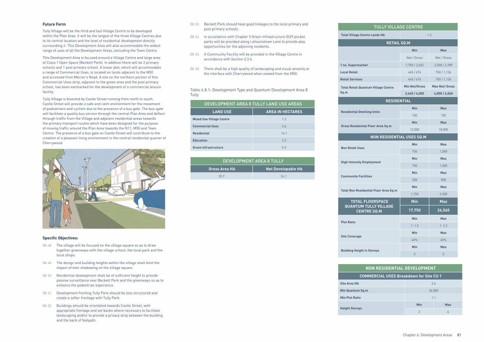
Table 6.8.1: Development Type and Quantum Development Area 8 Tully
DEVELOPMENT AREA 8 TULLY LAND USE AREAS
LAND USE AREA IN HECTARES
Mixed Use Village Centre 1.2
Commercial Uses 3.6
Residential 16.1
Education 3.2
Green Infrastructure 5.5
DEVELOPMENT AREA 8 TULLY
Gross Area HA Net Developable HA
35.9 24.1
TULLY VILLAGE CENTRE
Total Village Centre Lands HA 1.2
RETAIL SQ.M
Min Max
Net / Gross Net / Gross
1 no. Supermarket 1,750 / 2,652 2,500 / 3,789
Local Retail 445 / 674 750 / 1,136
Retail Services 445 / 674 750 / 1,136
Total Retail Quantum Village Centre Sq.m
Min Net/Gross Max Net/ Gross
2,640 / 4,000 4,000 / 6,060
RESIDENTIAL
Residential Dwelling UnitsMin Max
100 150
Gross Residential Floor Area Sq.mMin Max
12,000 18,000
NON RESIDENTIAL USES SQ.M
Non Retail UsesMin Max
750 1,000
High Intensity EmploymentMin Max
750 1,000
Community FacilitiesMin Max
250 500
Total Non Residential Floor Area Sq.mMin Max
1,750 2,500
TOTAL FLOORSPACE QUANTUM TULLY VILLAGE
CENTRE SQ.M
Min Max
17,750 26,560
Plot RatioMin Max
1: 1.5 1: 2.2
Site CoverageMin Max
40% 60%
Building Height in StoreysMin Max
3 5
NON RESIDENTIAL DEVELOPMENT
COMMERCIAL USES Breakdown for Site CU 1
Site Area HA 3.6
Min Quantum Sq.m 36,000
Min Plot Ratio 1:1
Height StoreysMin Max
2 4

Chapter 6: Development Areas82
RESIDENTIAL DEVELOPMENT
Total Residential Lands HA 16.1
Land Area HA Density Range
Res 1 0.6 35 - 50
Res 2 15.5 45 - 70
Res 3 0 65 - 100
Res 4 0 85 - 125
No. of Dwellings on Residential LandsMin Max
719 1,115
Overall Residential DensityMin Max
45 per ha 69 per ha
Building Height in StoreysMin Max
2 4
No. of Dwellings in Tully Village CentreMin Max
100 150
TOTAL NO. OF RESIDENTIAL DWELLINGS
Min Max
819 1,265
EDUCATION
Lands for Educational Use HA 3.2
Quantum and Type of Schools 2 Primary 1 Post Primary
Site 1 Area HA - 1.6
Site 2 Area HA 0.8 -
Site 3 Area HA 0.8 -
Table 6.8.2: Infrastructure Requirements Development Area 8 Tully.
See Maps 4.1-4.5.
Infrastructure requirements for Development Areas 1-5 are complete.
Road Requirements
• Loop road H,G,F,F1 including underpass of WLR.
• Beckett Road E-F.
• Construct Barringtons’s Road D-E.
• Construct street K1-D1.
• Construct internal street network within Development Area 8 to suit housing development.
Construction Access
• From WLR left in/out junction via loop J-F-G-H to E2 and K1 From Tully Vale Road (Grand Parade) at P2 from Barringtons’s Road at D.
• Construction traffic banned from streets A1-J, A2-A3, P-P1-P2 and P2-C.
Stormwater Requirements
• 525mm approx. diameter SW sewer from K1/K4 to Detention Basin at E2.
• Detention basins as shown on the stormwater drawing – also detention basins in Zone 3.
• Diversion of Ticknick stream.
• 525mm diameter SW sewer from D1 to D and to detention basins.
• 400mm diameter SW sewer from K environs to detention basins.
Foul Sewer Requirements
• 450mm approx. diameter to sewer from K5 to D and on to the Carrickmines sewer.
• 450mm approx. diameter sewer from E3 to E and on to the Carrickmines sewer.
Water Supply Requirements
• Abandon section of existing 33” main.
• Re-route 33” main.
• Upsizing (600mm) and re-route of existing 20” AC Main.
• 500 to 400mm diameter trunk from upsized main to H, F1, F, E, D, C.