environmental permitting for operations and maintenance ... · 1/8/2018 · california water code...
TRANSCRIPT

Environmental Permitting for Operations
and Maintenance
Final Environmental Impact Report
State of California Natural Resources Agency
Department of Water Resources
Prepared by: California Department of Water Resources
Division of Flood Management Flood Maintenance Office
Contact: Scott Kranhold
Senior Environmental Scientist (Supervisor) 3310 El Camino Avenue Room 140
Sacramento, CA 95821
January 2018

Environmental Permitting for Operations and Maintenance Project i 130028.07 Final Environmental Impact Report January 2018
TABLE OF CONTENTS Environmental Permitting for Operations and Maintenance Project
Page
Chapter 1, Introduction ...................................................................................................... 1-1 1.1 Introduction ........................................................................................................ 1-1 1.2 Summary of Proposed Project and Project Objectives ...................................... 1-1 1.3 Organization of the Final EIR ............................................................................. 1-3 1.4 Public Participation and Environmental Review Process ................................... 1-3 1.5 CEQA Certification and Project Approval .......................................................... 1-4
Chapter 2, Text Changes to the Draft EIR and Recirculated Draft EIR .......................... 2-1 2.1 Introduction ........................................................................................................ 2-1 2.2 Staff Initiated Changes to the Draft EIR ............................................................. 2-1 2.3 Staff Initiated Changes to the RDEIR ................................................................ 2-5 2.4 Summary of Staff Initiated Changes .................................................................. 2-5 2.5 Changes to the Draft EIR in Response to Comments ........................................ 2-6
Chapter 3, Comments and Responses ............................................................................. 3-1 3.1 Introduction ........................................................................................................ 3-1
Appendices A. Distribution List for Draft EIR and RDEIR ................................................................A-1
List of Figures Figure 2-4 Maintenance Area Location .......................................................................... 3-92
List of Tables Table 2-3 Acreage of Areas Maintained by DWR Maintenance Yards ........................... 2-3 Table 3.3-1 Habitat Acreage in the Project Area ............................................................... 2-3 Table 3.3-13 Riparian Habitat, Potential Wetlands and Other Waters of the United
States and State, and Oak Woodland in the Project Area .............................. 2-4 Table 3.2-4 Air District Thresholds of Significance for Maintenance Activities ................... 2-9 Table 3.2-6 Criteria Pollutant Emissions from Maintenance Activities ............................... 2-9 Table 3.3-2a Species Presence Timing by Life Stage in Region 1 (RM 0-60) with Work
Window (July 1 through October 30) ............................................................ 2-12 Table 3.3-2b Species Presence Timing by Life Stage in Region 2 (RM >60) with Work
Window (June 1 through September 30) ...................................................... 2-13 Table 3.3-2a Species Presence Timing by Life Stage in Region 1 (RM 0-60) with Work
Window (July 1 through October 30) ............................................................ 3-37

Table of Contents
Page
Environmental Permitting for Operations and Maintenance Project ii 130028.07 Final Environmental Impact Report January 2018
Table 3.3-2b Species Presence Timing by Life Stage in Region 2 (RM >60) with Work Window (June 1 through September 30) ...................................................... 3-38
Table 3.3-9 Required Buffer Distances for Bats and Nesting Birds and Bats .................. 3-63 Table 3.2-4 Air District Thresholds of Significance for Maintenance Activities ................. 3-85 Table 3.2-6 Criteria Pollutant Emissions from Maintenance Activities ............................. 3-86

Environmental Permitting for Operations and Maintenance Project 1-1 130028.07 Final Environmental Impact Report January 2018
CHAPTER 1 Introduction
1.1 Introduction The Department of Water Resources (DWR) circulated the Environmental Permitting for Operations and Maintenance Project (proposed project) Draft Environmental Impact Report (EIR) for public and agency comment from January 18, 2017 through March 3, 2017. During the comment period, DWR held a public hearing in Sacramento on February 22, 2017. At the end of the circulation period for the Draft EIR, a total of 10 written comment letters and e-mails were received. There were no comments made at the public hearing. Subsequently, DWR revised Section 3.4 – Cultural Resources of the Draft EIR and circulated just this section as a Recirculated Draft EIR (RDEIR) for public review. The revised Section 3.4 of the Draft EIR was circulated for public review and comment for a period of 45 days, starting on September 19, 2017 and ending on November 3, 2017.
This document is the Final EIR for the proposed project and it contains written responses to all comments received by DWR from agencies and the public on the Draft EIR and the RDEIR section. Individual responses were prepared to all comments received. The responses to comments clarify and amplify text in the Draft EIR and RDEIR and do not change the findings or conclusions of either document.
This Final EIR also includes a list of commenters, comment letters received, and corrections to the Draft EIR made in response to staff review and in response to comments. This Final EIR has been prepared in accordance with the California Environmental Quality Act (CEQA) and together with the Draft EIR and RDEIR (and appendices) constitutes the EIR for the proposed project.
1.2 Summary of Proposed Project and Project Objectives
DWR conducts operations and maintenance (O&M) of certain facilities of the federal flood control projects within the Central Valley of California. Continuous maintenance and proper operation of flood control facilities are critical for obtaining the benefits (e.g., flood protection) of federal flood control projects and maintaining eligibility for federal disaster relief programs. The lives and property of millions of Californians rely on these projects for protection against devastating flooding.
Federal law requires that all federal flood control facilities are operated and maintained in accordance with the O&M manuals prepared by the U.S. Army Corps of Engineers (USACE).

1. Introduction
Environmental Permitting for Operations and Maintenance Project 1-2 130028.07 Final Environmental Impact Report January 2018
The O&M manuals incorporate the federal flood control regulations codified at 33 Code of Federal Regulations (CFR) Section 208.10. The State of California has provided assurances to the federal government through the Central Valley Flood Protection Board (CVFPB, formerly the Reclamation Board). California Water Code (Code) Sections 8361 and 12878 et seq., assigns the O&M responsibilities of certain units of the federal flood control project that are not the responsibility of local agencies to DWR. Specifically, DWR’s Flood Maintenance Office (FMO) conducts ongoing maintenance activities on levees, within channels, and on appurtenant structures that are part of the Sacramento River Flood Control Project (SRFCP) and the Middle Creek Project in Lake County, components of the State Plan of Flood Control (SPFC). Maintenance is conducted in accordance with standards and requirements of federal and State laws and regulations as well as applicable USACE O&M manuals and design profiles. The goal of the maintenance is to meet the requirements of State and federal law, regulations, and to continue the useful life of the SRFCP and Middle Creek Project facilities and provide for public safety and proper functioning of flood control facilities in accordance with their original design.
Within DWR, two maintenance yards, the Sutter and Sacramento Maintenance Yards, are responsible for the State’s maintenance. More specifically, maintenance activities include but are not limited to: (1) levee maintenance to ensure serviceability in times of floods (e.g., rodent abatement and damage repair, vegetation management, erosion repair, toe drain and pressure relief well repair, levee crown and access road maintenance, unauthorized encroachment removal, stability berm reconstruction, and fencing/levee protection); (2) channel maintenance (e.g., sediment removal, debris/obstruction and wild growth removal, vegetation management, and channel and bank scour repair); (3) flood control structure maintenance and repair (e.g., pumping plants, weirs and outfall gates, and bridge maintenance and repair; and pipe/culvert repair, replacement, and abandonment); and (4) data collection. The proposed project would allow the continuation of these maintenance activities within the regulatory limitations imposed by the required permits.
The overall objective of the proposed project is to conduct maintenance activities in accordance with federal requirements, established in the O&M manuals, that are consistent with and incorporates standards established by federal regulations to provide for the public safety and proper functioning of the SRFCP and Middle Creek Project flood control facilities. Specifically, to enable DWR to conduct land and facilities management in ways that ensure the following is maintained:
• Channel design flow capacity, levee integrity, and proper functioning of flood management structures.
• Visibility and accessibility of facilities for inspections, maintenance, and flood-fighting operations.
• Consistency with federal flood control requirements (O&M manuals, including 33 CFR section 208.10), the Governor’s California Water Action Plan, and DWR plans and policies, including but not limited to the Central Valley Flood Protection Plan (CVFPP), DWR’s Environmental Stewardship and Sustainability Policies, and DWR Climate Action Plan, etc.

1. Introduction
Environmental Permitting for Operations and Maintenance Project 1-3 130028.07 Final Environmental Impact Report January 2018
1.3 Organization of the Final EIR The Final EIR is organized as follows:
Chapter 1 – Introduction: This chapter summarizes the proposed project, describes the content and format of the Final EIR, summarizes the public participation and review process, and describes the CEQA certification and project approval process.
Chapter 2 – Text Changes to the Draft EIR: This chapter summarizes revisions to the Draft EIR and RDEIR as a result of staff initiated changes and text changes in response to comments. The revisions contain clarification, amplification, and corrections that have been identified since publication of the Draft EIR and RDEIR. The text revisions do not change the findings or conclusions presented in the Draft EIR and RDEIR.
Chapter 3 – Responses to Comments: This chapter includes a list of the comment letters received followed by the comment letters and responses to the comments contained in each letter. The responses to comments are numbered consistent with the comment number in each letter. For example, the response to the first comment in Comment Letter 1 is Response to Comment 1-1.
1.4 Public Participation and Environmental Review Process
DWR notified all responsible and trustee agencies and interested groups, organizations, and individuals that the Draft EIR on the proposed project was available for review. The following list of actions took place during the preparation, distribution, and review of the Draft EIR:
• A Notice of Preparation (NOP) and Notice of Completion (NOC) were filed with the State Clearinghouse (State Clearinghouse Number (SCH #) 2015052035) on May 11, 2015 for public review ending on June 9, 2015.
• The NOP and information on the one scoping meeting were provided to: (1) State, local and federal agencies; (2) 11 local libraries; (3) 11 county clerk offices; (4) 8 newspapers; and (5) other interested parties. The NOP was also made available on DWR’s website. See Appendix A for a list of libraries, county clerks’ offices, and newspapers.
• One scoping meeting was held on May 19, 2015 at the DWR Division of Flood Management, 3310 El Camino Avenue, Sacramento, CA 95821 from 2:00 to 4:00 pm.
• The NOC and copies of the Draft EIR were filed with the State Clearinghouse on January 18, 2017 with public review ending on March 3, 2017.
• Notices of Availability (NOA) and information on a public hearing were provided to: (1) State, local and federal agencies; (2) 11 local libraries; (3) 11 county clerk offices; (4) 8 newspapers; and (5) other interested parties. The NOA and the Draft EIR were also made available on DWR’s website. See Appendix A for a list of libraries, county clerks’ offices, and newspapers.

1. Introduction
Environmental Permitting for Operations and Maintenance Project 1-4 130028.07 Final Environmental Impact Report January 2018
• A public hearing to receive comments on the Draft EIR was held in Sacramento on February 22, 2017 from 2:00 to 4:00 p.m. at DWR Division of Flood Management, 3310 El Camino Avenue, Sacramento, CA 95821.
• Copies of the DEIR, including appendices, were available for public review at DWR’s Division of Flood Management, Flood Maintenance Office during normal business hours located at 3310 El Camino Avenue, Room 100, Sacramento, CA 95821.
• A Notice of Recirculation (NOR) for the revised Section 3.4 – Cultural Resources of the DEIR was provided to: (1) State, local and federal agencies; (2) 11 local libraries; (3) 11 county clerk offices; (4) 8 newspapers; and (5) other interested parties. The NOR and revised Section 3.4 – Cultural Resources of the RDEIR were also made available on DWR’s website. See Appendix A for a list of libraries, county clerks’ offices, and newspapers.
• The NOR and copies of the revised Section 3.4 – Cultural Resources of the RDEIR were filed with the State Clearinghouse on September 19, 2017 with public review ending on November 3, 2017.
• Copies of the revised Section 3.4 – Cultural Resources of the RDEIR were available for public review at DWR’s Division of Flood Management, Flood Maintenance Office during normal business hours located at 3310 El Camino Avenue, Room 100, Sacramento, CA 95821.
1.5 CEQA Certification and Project Approval Before DWR makes a decision with regard to the proposed project, CEQA Guidelines Section 15090(a) requires that DWR first certify that the EIR has been completed in compliance with CEQA, that DWR has reviewed and considered the information in the EIR, and that the EIR reflects the independent judgment and analysis of DWR.
In the event DWR approves the proposed project, CEQA requires that it file a Notice of Determination (NOD) and adopt appropriate findings as set forth in CEQA Guidelines Section 15091. Under CEQA Guidelines Section 15092, a lead agency may only approve or carry out a project subject to an EIR if it determines that: (1) that project will not have a significant effect, or (2) that the agency has eliminated or substantially lessened all significant effects on the environment where feasible and any remaining significant effects on the environment that are found to be unavoidable are acceptable due to overriding considerations.

Environmental Permitting for Operations and Maintenance Project 2-1 130028.07 Final Environmental Impact Report January 2018
CHAPTER 2 Text Changes to the Draft EIR and Recirculated Draft EIR
2.1 Introduction This chapter presents minor corrections and revisions made to the Draft EIR initiated by DWR based on their on-going review and in response to comments received. New text is indicated in a double underline and text to be deleted is reflected by a strike through. The changes identified below are clarifications or amplification of the information and analysis contained in the Draft EIR. The changes are organized by the order in which they appear in the Draft EIR. None of the changes identified below results in a significant impact that was not already identified in the Draft EIR, with the exception of certain impacts to tribal cultural resources, which prompted recirculation of the cultural resources analysis (Section 3.4) of the Draft EIR. Furthermore, none of the impacts identified in the Draft EIR were found to be substantially more severe as the result of the following changes, with the exception of certain impacts to tribal cultural resources. An RDEIR was prepared and circulated by DWR, which addressed comments received on the cultural resources section of the Draft EIR and during consultation of DWR with the United Auburn Indian Communities. Text changes in responses to comments received on the Draft EIR and RDEIR are presented in Section 2.4 below.
2.2 Staff Initiated Changes to the Draft EIR In reviewing the project area footprint after publication of the Draft EIR, DWR became aware of two areas of discrepancy in how the project area was drawn. These include the following.
1. Over-representation of DWR’s channel maintenance area occurred in locations where DWR does not maintain the adjacent levee. Based on the California Levee Database (CLD) used to create the State Plan of Flood Control- Map Book of Operations and Maintenance Manual Units (DWR, 2012) the channel maintenance area in the data used for the Draft EIR included the area from one levee centerline to the other. This over-represents the channel maintenance area because it includes the water-side levee slope (in channels where there is a levee). These data were revised such that in areas where DWR maintains both channel and levees, the channel area was clipped to the edge of the water-side levee buffer. However, in areas where DWR maintains the channel but not the adjacent levees, the channel maintenance area was not clipped, and therefore included the waterside levee up to the levee centerline.
2. In the data used for the Draft EIR, the water-side levee buffer extends into the channel maintenance area (i.e., extends beyond the levee toe), and this narrow strip just beyond the toe of the levee was previously included in the levee maintenance area. While it is true that

2. Text Changes to the Draft EIR and Recirculated Draft EIR
Environmental Permitting for Operations and Maintenance Project 2-2 130028.07 Final Environmental Impact Report January 2018
levee toe roads are present in this area and that levee maintenance activities are performed there, the channel area is defined as extending from one levee toe to the other. It is therefore more appropriate for the waterside levee buffer to be included in the channel maintenance area, while acknowledging that levee maintenance activities such as road grading and minor repairs would occur on toe roads in this area. The data were revised accordingly.
In summary, based on the two discrepancies discussed above, the total channel maintenance area is smaller than described in the Draft EIR (by 3,337 acres), and the total levee maintenance area is smaller than described in the Draft EIR (by 461 acres) and the project area is therefore smaller than presented in the Draft EIR.
Two additional changes were made to the project area. Portions of six channel areas maintained by the Sacramento Maintenance Yard were reclassified as “actively maintained.” These areas were previously classified as “channel areas of maintenance responsibility.” This change does not affect the total channel maintenance area or the total project area, it just more accurately identifies the channel areas that are actively maintained by the Sacramento Maintenance Yard. This change affected portions of the following channels: Linda Creek; Pleasant Grove Creek Canal; Dry Creek; Sacramento Bypass; Fremont Weir; and, Yolo Bypass. Lastly, the channel area at Lake of the Woods was originally shown to extend beyond the land side of the adjacent levee.
The following modifications to the project area have been made for the Final EIR:
• Define the channel maintenance area as the area between the levee toes. This eliminates a large area formerly mapped as “channel” that extended from the levee toe to the centerline of the levee (on levees not maintained by DWR, as described above under number 1). For channel maintenance areas where levee anatomy data were not available (in Lake and portions of Butte County) or not applicable (Sutter Bypass collecting canals), the channel areas remain unchanged.
• Water-side levee toe buffer (typically 10-20 feet wide from the toe of the levee) now classified as channel maintenance area (in areas where DWR maintains the channel), while acknowledging that some levee maintenance activities would be performed in this area due to the presence of levee toe roads. For levee maintenance areas where DWR does not maintain the adjacent channel, the levee maintenance area includes the water-side levee toe buffer (typically 10-20 feet wide from the toe of the levee). This is consistent with how these levee maintenance areas were presented in the Draft EIR
• Removed portion of channel maintenance area at Lake of the Woods which erroneously showed up on the landside of the adjacent levee.
• Reclassify portions of six channels as “actively maintained.” These areas were previously included in the “channel area within the remainder of the area of maintenance responsibility.”
Based on the reduction of the overall project area, three acreage tables have been updated for the final EIR. The updated Tables 2-3, 3.3-1, and 3.3-13 are presented below.

2. Text Changes to the Draft EIR and Recirculated Draft EIR
Environmental Permitting for Operations and Maintenance Project 2-3 130028.07 Final Environmental Impact Report January 2018
TABLE 2-3 ACREAGE OF AREAS MAINTAINED BY DWR MAINTENANCE YARDS
Maintenance Area Category
Area Maintained by Sutter Maintenance
Yard (acres)
Area Maintained by Sacramento Maintenance
Yard (acres)
Total (acres)
Levee* 2,598 1,324 3,923
Actively Maintained Channel Area 16,543 3,467 20,010
Channel Area within Remainder of Area of Maintenance Responsibility
57,103 89,707 146,810
Total 76,245 94,497 170,742
NOTE: *For facilities where DWR maintains both the levee and the channel, the water-side levee buffer is included in the channel maintenance
area. However, DWR may conduct levee maintenance activities within this area, such as maintenance of the levee toe road.
TABLE 3.3-1 HABITAT ACREAGE IN THE PROJECT AREA
Habitat Type Levee Channel - Actively
Maintained Channel - Areas of
Responsibility Total
Valley foothill riparian 193 7,278 17,581 25,052
Mixed riparian scrub 21 705 3,701 4,426
Riverine 17 816 27,990 28,823
Saline emergent wetland 0 0 6,506 6,507
Freshwater emergent wetland 10 446 5,771 6,227
Seasonal wetland 73 3,852 3,418 7,343
Vernal pool complex 0 19 51 70
Annual grassland 1,683 6,224 17,142 25,048
Oak woodland 0 3 10 13
Agricultural land 1,640 409 62,895 64,944
Cropland and pasture 214 77 33,113 33,403
Orchard and vineyard 132 3 10,810 10,945
Rice 51 12 14,785 14,847
Other agricultural land1 1,243 318 4,187 5,748
Barren 21 184 820 1,026
Urban 265 75 925 1,265
Total 3,923 20,010 146,810 170,742
NOTE: 1. Other agricultural land includes fallow fields, idle agricultural land, agricultural roads, ornamental trees, and other agricultural lands
that do not correspond to any other agricultural land types. SOURCES: CDFW and GIC at CSU Chico, 2011, 2013; DWR, 2010; DWR, 2001; USGS, 2010; ESRI, 2015; ESA, 2015

2. Text Changes to the Draft EIR and Recirculated Draft EIR
Environmental Permitting for Operations and Maintenance Project 2-4 130028.07 Final Environmental Impact Report January 2018
TABLE 3.3-13 RIPARIAN HABITAT, POTENTIAL WETLANDS AND OTHER WATERS OF THE UNITED STATES
AND STATE, AND OAK WOODLAND IN THE PROJECT AREA
Habitat Type Levee (acres)
Channel - Actively
Maintained (acres)
Channel - Other Areas of
Responsibility (acres)
Total (acres)
Riparian Habitata Valley Foothill Riparian Forest 193 7,278 17,581 25,052
Mixed Riparian Scrub 21 705 3,701 4,426
Total 214 7,982 21,282 29,478
Wetlands and Waters of the United States and Stateb Freshwater Emergent Wetland 10 446 5,771 6,227
Seasonal Wetland 73 3,852 3,418 7,343
Vernal Pool Complexc 0 19 51 70
Saline Emergent Wetland 0 0 6,506 6,507
Rice 51 12 14,785 14,847
Riverine (Other Waters) 17 816 27,990 28,823
Total 150 5,145 58,521 63,816
Oak Woodland 0 3 10 13
NOTES: a. Some areas of valley foothill riparian and mixed riparian scrub may be considered wetlands subject to regulation by the USACE and
Central Valley RWQCB. b. These natural communities potentially include jurisdictional wetlands and waters of the United States and State, but no jurisdictional
wetland delineation was conducted c. Vernal pool complexes include upland grassland matrix. SOURCES: GIC at CSU Chico, n.d.; CDFW and GIC at CSU Chico, 2013; DWR, 2001, 2010; USGS 2010; ESRI, 2015
Finally, references to the overall project area have been updated to174,541 170,742 acres on Draft EIR pages 3.3-123 and 3.3-141. The following text references to habitat acreages have also been updated:
Draft EIR page 3.3-66, first paragraph:
“The project area covers 4,384 3,923 acres of levees and 19,718 20,010 acres of channels maintenance areas that are actively maintained, and an additional 150,439 146,810 acres of channel maintenance areas where DWR has maintenance responsibility."
Draft EIR page 3.3-89, first paragraph:
“Western Yellow-billed Cuckoo. A total of 154 120 acres of levee maintenance areas is within proposed critical habitat of the western yellow-billed cuckoo. Moreover, 1,200 1,203 acres of actively maintained channel maintenance areas and14,692 14,670 acres of channel areas that are DWR’s maintenance responsibility, but are not actively maintained, are within proposed critical habitat.”
In the above text, the acreage of actively maintained channel maintenance area is greater in the Final EIR than the Draft EIR by 3 acres because the area previously attributed to the levee toe

2. Text Changes to the Draft EIR and Recirculated Draft EIR
Environmental Permitting for Operations and Maintenance Project 2-5 130028.07 Final Environmental Impact Report January 2018
buffer is now classified as “channel.” Therefore, this is not a new project area, it has just been reclassified from “levee” to “channel.”
Draft EIR page 3.3-139, third paragraph:
“The project area includes approximately 25,577 25,052 acres of valley foothill riparian and 13 acres of oak woodland habitat (7,508 7,278 acres and 3 acres actively maintained, respectively). These habitats contain trees that may be afforded protection under city and county ordinances. In addition, trees protected under local ordinances may be located in the 1,539 1,265 urban acres in the project area.”
2.3 Staff Initiated Changes to the RDEIR For greater consistency and clarification, the following edits were made to the RDEIR. Potential impacts to cultural resources and the significance of these potential impacts remain unchanged.
RDEIR page 3.4-35, Table 3.4-3, second row:
“3.4-2: Conducting maintenance activities could result in damage or destruction of known or previously unidentified archaeological resources and/or eligible TCRs.”
RDEIR page 3.4-35, Table 3.4-3, seventh row:
“3.4-7: Conducting maintenance activities could contribute to cumulative damage or destruction of archaeological resources and/or eligible TCRs.”
RDEIR page 3.4-59, first paragraph:
“Impact 3.4-7: Conducting maintenance activities could contribute to potentially significant cumulative damage or destruction of archaeological resources and/or eligible tribal cultural resources. (Less than Cumulatively Considerable for Archaeological Resources; Potentially Cumulatively Considerable for TCRs)”
RDEIR page 3.4-60, bottom of the page:
“Mitigation Measures
Implementation of the following mitigation measures would further reduce the contribution associated with conducting maintenance activities to this less-than-significant cumulative impact to a less-than-considerable level.
Measure 3.4-9 (All): Implement Mitigation Measures 3.24-2(b) and 3.4-4”
2.4 Summary of Staff Initiated Changes The changes discussed above universally result in a reduction of the total project area, corresponding with reductions in project area occupied by riparian, wetland, grassland, oak woodland, agriculture, and urban habitat types. Estimated annual maximum project impacts by habitat type (Draft EIR tables 3.3-3, 3.3-4, and 3.3-14) have not changed since these estimates are based on records and knowledge of past maintenance activities. Therefore, the annual impacts to each habitat type continue to make up a small portion of the habitat area present in the Project

2. Text Changes to the Draft EIR and Recirculated Draft EIR
Environmental Permitting for Operations and Maintenance Project 2-6 130028.07 Final Environmental Impact Report January 2018
area. The potential impacts to special-status species and movement corridors and nursery sites have not changed as a result of the project area updates. Based on the reduction in overall project area combined with the small (unchanged) acreage of estimated annual maximum habitat impacts, potential impacts to biological resources and the significance of these potential impacts remain unchanged.
Editorial changes were made to the RDEIR for consistency and clarification. Potential impacts to cultural resources and the significance of these potential impacts remain unchanged.
2.5 Changes to the Draft EIR in Response to Comments
The following provides those text changes that were made in response to comments on the Draft EIR and the RDEIR in order of appearance in the EIR. The following text changes also appear in the responses to comments provided in Chapter 3 of this Final EIR.
Chapter 2: Project Description Draft EIR page 2-1, second paragraph:
“Fencing/levee protection”
Draft EIR page 2-1, third paragraph:
“Compliance with Fish and Game Code Section 1600 et seq. results in DWR and the California Department of Fish and Wildlife (CDFW) entering into a Lake and Streambed Alteration Agreement (LSAA). DWR’s current LSAA expired on January 6, 2016. Since entering into the most recent LSAA, CDFW became aware of additional information about special-status species that may be present in areas covered by a new LSAA.”
Draft EIR page 2-14, paragraph added:
“The project area includes all areas of DWR’s maintenance responsibility on the SRFCP and Middle Creek Project levees, channels, and flood control structures, as listed above in Tables 2-1 and 2-2. The geographic extent of the project area was defined using geographic information systems (GIS) as follows:
1. Levee anatomies were obtained from the SPFC Delta Anatomy Mapping Project. This dataset defined the location and extent of levee crown, levee landside, and levee waterside areas. Levee waterside extends from the hinge point to the levee’s waterside toe, or to the waterside edge, or 50 feet from the crown, whichever comes first. Levee landside extends from the crown hinge point to the levee toe. A 15-foot buffer was added to the levee landside. A 15-foot buffer was added to the levee waterside then trimmed to the water’s edge, if the water’s edge was closer than 15 feet. Areas within the SRFCP that were not included in the original SPFC dataset were digitized using contour data to define the levee crown and levee waterside and landside, as well as a 15-foot buffer. Geographic Information Center (California State University, Chico) developed the levee anatomy data, commissioned by DWR to conduct vegetation management planning and analysis.
2. Channel areas were defined based on the channel maintenance polygon data from the California Levee Database (CLD) used to create the State Plan of Flood Control-Map Book of Operation and

2. Text Changes to the Draft EIR and Recirculated Draft EIR
Environmental Permitting for Operations and Maintenance Project 2-7 130028.07 Final Environmental Impact Report January 2018
Maintenance Manual Units (DWR, 2012b). A distinction was made between “actively maintained” channels and channel “areas of responsibility.” Channel areas of responsibility include areas that are not regularly maintained, generally because they do not create water conveyance or other flood control issues such as agricultural and developed lands. Actively maintained channels are defined as those channel areas that DWR maintenance yards regularly maintain. Actively maintained areas were identified by meeting with maintenance yard staff and mapping the areas that are routinely maintained or where the maintenance yard staff would be likely to conduct work throughout the SRFCP (DWR, 2016a). It should be noted that all levees for which DWR has maintenance responsibility are actively maintained.”
Draft EIR, bottom of page 2-14 and top of page 2-15:
“The project area includes the features listed in Tables 2-1 and 2-2 as well as those work areas that may result in landside disturbance. These work areas may extend 200 feet landward from the top of bank or, if a levee is present, from the landside toe of the levee. Most staging, borrow and spoil areas, and access routes used during maintenance activities are within this landside levee buffer work area. Existing and previously disturbed staging areas, roads, and spoil/borrow areas are used to the maximum extent feasible. If previously undisturbed areas are required for landside staging or spoil/borrow areas, appropriate best management practices and applicable mitigation measures are followed.
For the purpose of analysis in this EIR, actively maintained areas are identified within the overall area of maintenance responsibility. Actively maintained areas are defined as those areas that DWR maintenance yards regularly maintain, as described in this project description, and include the levees and flood control structures, as well as the channel maintenance areas listed in Tables 2-1 and 2-2, unless otherwise indicated. Locations within the area of maintenance responsibility that are not within the actively maintained areas are only very occasionally subject to maintenance by DWR in response to specific flood hazards. These areas include, for example, rice fields within the Sutter and Yolo Bypasses and the open water channel areas of the Sacramento and Feather Rivers. Levee maintenance areas are included in DWR’s levee anatomy geographical information system (GIS) database, which includes the levee crown, landside and waterside levee slopes, and 20-foot-wide landside and waterside buffers beyond the toes of the levee. Actively maintained channel areas and the associated area of maintenance responsibility are also specifically identified in the GIS database. Flood control structures are typically included within the channel and levee maintenance areas. Table 2-3 provides the acreages maintained by DWR’s maintenance yards within each of the maintenance area categories.”
Draft EIR page 2-21 delete the heading and first paragraph (in addition, Sections 2.5.3 – 2.5.5 are renumbered to 2.5.2 – 2.5.4, respectively):
2.5.2 Levee Maintenance Levees are inspected by both USACE and DWR, and the resulting inspection reports document conditions that may pose a risk of flooding to property. Rodent damage, vegetation, erosion, levee-crown and access road degradation, and pipe penetrations are factors that contribute to structural deficiencies. Levees are also inspected and maintained to provide visibility and access for those inspections, for maintenance, and for flood-fighting activities. Maintenance activities associated with levees are discussed below and in the following pages. Descriptions for maintenance, repair, replacement, and abandonment of pipes/culverts that are within levees are presented in Section 2.5.3 of this chapter.

2. Text Changes to the Draft EIR and Recirculated Draft EIR
Environmental Permitting for Operations and Maintenance Project 2-8 130028.07 Final Environmental Impact Report January 2018
Draft EIR page 2-32, the heading and text under “Fencing/Levee Protection”:
“Fencing/Levee Protection
Maintenance Activities Levee crown roads and toe roads have restricted access so that unauthorized vehicles cannot access the roads for safety reasons. Metal gates secured with locks are installed on the roads at access points, and in limited areas there are metal fences or barbed-wire fences to prevent pedestrian or bicycle access. These Gates and fences periodically require maintenance or replacement, and new gates or fences are sometimes installed. In addition, road signs, mile markers, or other DWR signage may be installed, maintained, or replaced along levees.
Gate, fence, and sign installation or replacement would typically involve excavating a small hole in the levee with a hydraulic auger, backhoe, or hand tools; installing and positioning; and filling the hole with concrete or compacted soil. Equipment required for this work could include the hydraulic auger or backhoe mentioned above as well as hand tools, a truck, a small cement mixer, and a compactor. Maintenance work could include welding and repainting of gates and painting.
Frequency Gate, fence, and sign installation and maintenance would occur as needed.
Timing These activities could occur year-round.
Acreage of Work The annual acreage of work for gate, fence, and sign installation is less than 0.01 acre for each maintenance yard. The footprint of work would be small and negligible compared to other activities.”
Draft EIR page 2-36 paragraph 3, second sentence:
“The annual acreage of work for sediment removal from collecting canals is up to 133123 acres which can be broken down into subcategories for sediment removal (up to 76 acres) and spoils placement (up to 47 acres).”
Draft EIR second-to-last bullet at the bottom of page 2-47:
“Repair and replace fencing/gates/railing.”
Draft EIR page 2-56, Table 2-5, 6th row under the State Permits/Approvals section:
“Permitted activities on facilities that would impact the bed, channel, or bank of any stream channel or river”

2. Text Changes to the Draft EIR and Recirculated Draft EIR
Environmental Permitting for Operations and Maintenance Project 2-9 130028.07 Final Environmental Impact Report January 2018
Chapter 3. Environmental Setting, Impacts, and Mitigation Measures Section 3.2: Air Quality Draft EIR page 3.2-10:
TABLE 3.2-4 AIR DISTRICT THRESHOLDS OF SIGNIFICANCE FOR MAINTENANCE ACTIVITIES1
Air District Counties ROG NOx PM10 PM2.5
Butte County AQMD Butte 137 ppd 137 ppd 80 ppd --
Colusa County APCD Colusa -- -- -- --
Feather River AQMD2 Yuba, Sutter 4.5 tpy2 4.5 tpy2 80 ppd
Glenn County APCD Glenn -- -- -- --
Sacramento Metropolitan AQMD Sacramento -- 85 ppd 80 ppd 82 ppd
Tehama County APCD Tehama 137 ppd 137 ppd 137 ppd --
Placer County APCD Placer 82 ppd 82 ppd 82 ppd --
Yolo-Solano AQMD3 Yolo, Solano (part) 54 ppd3 54 ppd3 80 ppd --
Lake County AQMD4 Lake 54 ppd4 54 ppd4 82 ppd4 (exhaust)
54 ppd4 (exhaust)
NOTES: 1. ppd = Pounds per Day; tpy = Tons per Year 2. Feather River AQMD threshold for construction related NOx emissions is calculated at 25 ppd multiplied by the length in project days
not to exceed the 4.5 tons/year threshold. Since all levee maintenance activities would occur continuously over many years, the FRAQMD’s maximum allowed ROG and NOx threshold of 4.5 tpy is used to determine significance.
3. Yolo-Solano AQMD has established thresholds of 10 tons per year for ROG and NOx, which would equate to approximately 54 pounds per day.
4. Lake County AQMD does not have established CEQA thresholds of significance, but does recommend applying the Bay Area Air Quality Management District thresholds.
SOURCE: Butte County AQMD, 2014; Feather River AQMD, 2010; Lake County AQMD, 2015; Placer County APCD, 2012; Sacramento Metropolitan AQMD, 2009; Tehama County APCD, 2015; Yolo-Solano AQMD, 2007; Yolo-Solano AQMD, 2015.
Draft EIR page 3.2-13:
TABLE 3.2-6 CRITERIA POLLUTANT EMISSIONS FROM MAINTENANCE ACTIVITIES1, 2
Activity ROG
(ppd/tpy) NOx
(ppd/tpy) PM10
(ppd/tpy) PM2.5
(ppd/tpy)
Levee Maintenance – Erosion Repair1 0.3/<0.1 5.04.2/<0.1 10.0/<0.1 1.2/<0.1
Channel Maintenance – Large Sediment Removal1 2.3/<0.1 50.845.0/0.5 76.8/0.8 13.1/0.1
Structure Maintenance – Culvert Repair/Replacement1 0.3/<0.1 5.34.4/0.1 11.8/0.2 1.4/<0.1
Deferred maintenance activities First 2 years – Culvert Repair/Replacement2
0.3/<0.1 5.64.5/0.1 12.6/0.1 1.5/<0.1
Data Collection – Geotechnical Boring1 0.3/<0.1 5.54.5/<0.1 6.9/<0.1 0.9/<0.1
NOTES: ppd = Pounds per Day; tpy = Tons per Year 1. Levee, Channel, and Structure Maintenance as well as Data Collection activities were modeled with CalEEMod version 2016.3.1 and
incorporating information provided by DWR. Model output data is included in Appendix C. A few key assumptions include: • Levee Maintenance – Erosion Repair: Take up to 2 weeks to complete, 0.5 acre disturbed, 8-hour day work shifts, potential
equipment including excavators (1), graders (1), dump trucks (2), and water trucks (1).

2. Text Changes to the Draft EIR and Recirculated Draft EIR
Environmental Permitting for Operations and Maintenance Project 2-10 130028.07 Final Environmental Impact Report January 2018
TABLE 3.2-6 CRITERIA POLLUTANT EMISSIONS FROM MAINTENANCE ACTIVITIES1, 2
Activity ROG
(ppd/tpy) NOx
(ppd/tpy) PM10
(ppd/tpy) PM2.5
(ppd/tpy)
• Channel Maintenance – Large Sediment Removal: Take up to 1 month to complete, 20 acres potentially disturbed, up to 50,000 cubic yards sediment removed, 10-hour day work shifts, equipment including bulldozers (2), roller/compactors (1), graders (2), loaders (2), small scrapers (2), excavators (2), dump trucks (4), water trucks (2).
• Structure Maintenance – Culvert Repair/Replacement: Take up to 10 weeks to complete, 0.5 acre disturbed, 8-hour day work shifts, equipment including excavators (1), graders (1), cranes (1, used occasionally), dump trucks (2), and water trucks (1).
• Data Collection – Geotechnical Boring: Take up to 2 days to complete, 8-hour day work shifts, equipment including rotary drill rigs (1) and shallow draft barge (1) for in-water borings.
• All off-road equipment is assumed to be equipped with Tier 3 engines and oxidation catalysts that would reduce NOx by 20%. 2. Structural maintenance activities that would occur the first 2years were modeled based on the following assumptions. Modeling
Output data is included in Appendix C. • Activities would take up to one month to complete, 0.5 acre disturbed, 8-hour day work shifts, equipment including excavators
(1), graders (1), cranes (1, used occasionally), dump trucks (2), and water trucks (1). • All off-road equipment is assumed to be equipped with Tier 3 engines and oxidation catalysts that would reduce NOx.
SOURCE: CARB, 2008; DWR, 2016
Section 3.3: Biological Resources Draft EIR page 3.3-6, paragraph 2:
“Riverine habitats in the project area provide vital fish spawning, rearing, and migratory habitat for a diverse assemblage of native and nonnative fish species (Moyle, 2002). Fish species can be separated into anadromous (i.e., species that spawn in riverine habitats after migrating as adults from marine habitat) and resident species (i.e., species that live in riverine or Delta habitats year-round). Native anadromous species that occur or have the potential to occur in project area rivers and streams include Chinook salmon (Oncorhynchus tshawytscha), steelhead (O. mykiss), green and white sturgeon (Acipenser medirostris and A. transmontanus), and Pacific lamprey (Lampetra tridentata). Included among these anadromous fishes are multiple species of concern, including spring-run Chinook salmon (ESA Threatened), winter-run Chinook salmon (ESA Endangered), fall/late-fall Chinook salmon (Federal species of concern), Southern Distinct Population Segment (DPS) green sturgeon (ESA Threatened), Central Valley steelhead (ESA Threatened), and Pacific lamprey (California species of concern). Native resident species that occur or could occur in these rivers or in the Delta include delta smelt (Hypomesus transpacificus), longfin smelt (Spirinchus thaleichthys), Clear Lake hitch (Lavinia exilicauda chi), Sacramento pikeminnow (Ptychocheilus grandis), Sacramento splittail (Pogonichthys macrolepidotus), Sacramento sucker (Catostomus occidentalis), hardhead (Mylopharodon conocephalus), Sacramento roach (Lavinia symmetricus), and rainbow trout (O. mykiss). Included among these resident fishes are multiple species of concern, including delta smelt (ESA Threatened), longfin smelt (CESA Threatened), Clear Lake hitch (California species of concern), and Sacramento splittail (California species of concern). Nonnative anadromous species found in project area waterways include striped bass (Morone saxatilis) and American shad (Alosa sapidissima). Nonnative resident species found in these waterways include smallmouth bass (Micropterus dolomieu), channel catfish (Ictalurus punctatus), white catfish (Ameiurus catus), brown bullhead (I. nebulosus), and golden shiner (Notemigonus crysaleucas) (Moyle, 2002).”
Draft EIR page 3.3-6 paragraph 3, last sentence:
“As discussed above, anadromous fishes, including spring-run Chinook salmon, winter-run Chinook salmon, Southern Distinct Population Segment (DPS) green sturgeon, and Central Valley steelhead, fall-

2. Text Changes to the Draft EIR and Recirculated Draft EIR
Environmental Permitting for Operations and Maintenance Project 2-11 130028.07 Final Environmental Impact Report January 2018
/late fall–run Chinook salmon, and Pacific lamprey, also are present during their upstream migration as adults and downstream migration as juveniles (Moyle, 2002).”
Draft EIR page 3.3-8, after paragraph 1:
“Historically, during the winter and spring, the rivers were not contained by their channels, and spread out over large areas, especially in the Sacramento Valley (Kelley, 1989), to provide extensive floodplain habitat for juvenile salmon (Williams, 2006). Seasonal shallow-water habitat areas provide refuge from unfavorable hydraulic conditions and predation, as well as foraging habitat for out-migrating juvenile salmonids (Williams, 2010). Multiple studies have shown that the productive environments of seasonal floodplains enhance growth rates of juvenile Chinook salmon (Sommer et al., 2001, 2005; Jeffres et al., 2008).”
Draft EIR page 3.3-15, directly following the “Fish” heading:
“Several special-status fish species occur in the project area. Tables 3.3-2a and 3.3-2b show the timing of the presence of life stages of special-status fish species within the project area in Regions 1 (RM 0-60) and 2 (RM >60). Different in-water work-windows were delineated for each Region to provide protection for the different fish species and life stages present in each Region (see Mitigation Measure 3.3-3c for details). It is important to note that each species is not present across the entire project area or in each Region, with some life stages and species only present in small portions of the project area. Also, some life stages that occur outside of the project area are excluded from the table, including spring-run and winter-run spawning that occurs further upstream in the Sacramento River mainstem or tributaries, and delta smelt and longfin smelt juveniles which rear in the more saline waters of the bays downstream of the action area.
Tables 3.3-2a and 3.3-2b shows that there is great overlap in the presence of life stages of special-status fish species in each Region, making the identification of an in-water work window for maintenance activities difficult (see Mitigation Measure 3.3-3c). In-fact, no time period would eliminate all life stages from potential exposure to maintenance activities. However, Tables 3.3-2a and 3.3-2b show that the in-water work window of July 1 through October 30 in Region 1 and June 1 through September 30 in Region 2, effectively reduces exposure of the most vulnerable life stages to maintenance activities, and only exposes a few juvenile and adult life stages that generally are present almost (or entirely) year-round to maintenance activities.
The in-water work window for Region 1 was defined as July 1 through October 30. A July start date effectively avoids the spawning and incubation period (spring and early summer) for delta smelt and longfin smelt, two listed Delta species (see Table 3.3-2a for life stage timing). In addition, winter-run juveniles have been observed upstream of the Delta in the Sacramento River at Red Bluff Diversion Dam in significant numbers during October, justifying an October 1 end date to the in-water work window.
The in-water work window for Region 2 was defined as June 1 through September 30. A June 1 start date completely avoids the juvenile life stage for spring-run and winter-run Chinook salmon, and avoids the primary emigration period of juvenile fall/late-fall Chinook salmon and steelhead. In addition, the October 30 end date limits the exposure to juvenile winter-run Chinook salmon. A significant number of juvenile winter-run have been observed approaching the Delta during the month of November at the Knights Landing screw trap in recent years.

2. Text Changes to the Draft EIR and Recirculated Draft EIR
Environmental Permitting for Operations and Maintenance Project 2-12 130028.07 Final Environmental Impact Report January 2018
TABLE 3.3-2A SPECIES PRESENCE TIMING BY LIFE STAGE IN REGION 1 (RM 0-60) WITH WORK WINDOW
(JULY 1 THROUGH OCTOBER 30)
NOTE: * Yellow band reflects the in-water work window of July 1 through October 30.
Species or Run Life StageJuvenileAdult MigrationJuvenileAdult MigrationJuvenileAdult MigrationJuvenileAdult MigrationJuvenileAdult MigrationSpawningIncubationAdult MigrationSpawningIncubationAdult MigrationSpawningIncubationJuvenile/AdultsSpawningIncubationJuvenile/AdultsAdult MigrationJuvenileAdult Migration
Pacific Lamprey
Longfin smelt
Hardhead
Sacramento splittail
Green Sturgeon
Spring Chinook
Winter Chinook
Fall/Late-Fall Chinook
Steelhead
Delta smelt
Jul Aug Sep Oct Nov DecJan Feb Mar Apr May Jun

2. Text Changes to the Draft EIR and Recirculated Draft EIR
Environmental Permitting for Operations and Maintenance Project 2-13 130028.07 Final Environmental Impact Report January 2018
TABLE 3.3-2B SPECIES PRESENCE TIMING BY LIFE STAGE IN REGION 2 (RM >60) WITH WORK WINDOW
(JUNE 1 THROUGH SEPTEMBER 30)
NOTE: * Yellow band reflects the in-water work window of June 1 through September 30.”
Draft EIR page 3.3-15, following the “North American Green Sturgeon” header:
“Adult Southern DPS green sturgeon enter San Francisco Bay in late winter through early spring and spawn from April through early July, with peaks of activity influenced by factors including water flow and temperature (Heublein et al., 2009; Poytress et al., 2011).”
Draft EIR page 3.3-18, last paragraph:
“Here, the greater availability of drift invertebrates contributes to higher juvenile growth rates than are found in adjacent river channels (Sommer et al., 2001). Juveniles can become stranded when water levels recede, however, stranding losses of Chinook and other native species are usually modest (Sommer et al., 2005; Jeffres et al., 2008). Managed floodplains in the Central Valley are exceptionally well-drained because of grading for agriculture, which likely helps promote successful emigration of young salmon (Sommer et al., 2001). In the tidally influenced lower Sacramento River, juveniles forage in shallow areas with protective cover, such as intertidal and subtidal mudflats, marshes, channels, and sloughs (McDonald,
Species or Run Life StageJuvenileAdult MigrationJuvenileAdult MigrationSpawningIncubationJuvenileAdult MigrationSpawningIncubationJuvenileAdult MigrationJuvenileAdult MigrationSpawningIncubationJuvenile/AdultsAdult MigrationSpawningIncubationJuvenile/AdultsSpawningIncubationJuvenileAdult Migration
Clear Lake hitch
Hardhead
Pacific Lamprey
Spring Chinook
Winter Chinook
Fall/Late-Fall Chinook
Steelhead
Green Sturgeon
Jul Aug Sep Oct Nov DecJan Feb Mar Apr May Jun

2. Text Changes to the Draft EIR and Recirculated Draft EIR
Environmental Permitting for Operations and Maintenance Project 2-14 130028.07 Final Environmental Impact Report January 2018
1960; Healey, 1980), and are less abundant where shorelines incorporate revetment (McLain and Castillo, 2009).”
Draft EIR page 3.3-19, after the first paragraph under “Central Valley Spring-Run Chinook Salmon”:
“Spring-run fry emerge from the gravel from November to March (Moyle, 2002). Juveniles may reside in freshwater for 12 to 16 months, but some migrate to the ocean as young-of-the- year in the winter or spring months within eight months of hatching (CALFED, 2000). Studies of Butte Creek (Ward et al., 2003) found the majority of spring-run migrants to be fry moving downstream primarily during December, January, and February, and that these movements appeared to be influenced by flow. Small numbers of spring-run juveniles remained in Butte Creek to rear and migrate as yearlings later in the spring. Juvenile emigration patterns in Mill and Deer creeks are very similar to patterns observed in Butte Creek, with the exception that Mill and Deer creek juveniles typically exhibit a later young-of-the-year migration and an earlier yearling migration (Lindley et al., 2004).”
Draft EIR page 3.3-20, last paragraph under “Sacramento River Winter-Run Chinook Salmon”:
“Other threats to the ESU include entrainment of fish in water diversions, predation by native and nonnative fish species (particularly at artificial structures), passage barriers or delays of adults at Sutter and Yolo Bypasses, heavy metal contamination and toxicants, ocean harvest, water exports in the Delta (especially during consecutive dry years), altered river flows, and high summer water temperatures (NMFS, 2011, 2014).”
Draft EIR page 3.3-21, section added before “Invertebrates”:
“Pacific Lamprey Pacific Lamprey are a relatively large anadromous and parasitic fish reaching over 800 cm in length (Goodman and Reid, 2012). Adult Pacific Lamprey enter freshwater and reside there anywhere from a few months to a few years prior to spawning, though spawning generally occurs in the spring following migration into freshwater, spawning in low gradient stream reaches, in gravel, often at the tailouts of pools and riffles (Goodman and Reid, 2012). Pacific Lamprey were historically widespread along the west coast of the United States and as they overlap with several Endangered Species Act (ESA) - listed salmonids they may be vulnerable to many of the same threats (Goodman and Reid, 2012). In particular, they appear to be declining in numbers due to: reduced quantity and quality of spawning and rearing habitats, passage issues associated hydropower and irrigation diversion such as obstruction, entrainment and mortality, a propensity for high predation risks, and a vulnerability to contaminants due to their life history (Goodman and Reid, 2012).”
Draft EIR page 3.3-53, section moved from “Local” to after “Critical Habitat” (page 3.3-49):
“Habitat Conservation Plans and Natural Community Conservation Plans There are several Regional Habitat Conservation Plans/Natural Community Conservation Plans in development in the Sacramento Valley Region and surrounding foothills, and the project area intersects the coverage areas for all of these. The plans in development include the Butte Regional Conservation Plan, Yuba Sutter Resource Conservation Plan, Yolo Natural Heritage Program, Placer County Conservation Plan, and Feather River Regional Permitting Program Habitat Conservation Plan. As these plans have not

2. Text Changes to the Draft EIR and Recirculated Draft EIR
Environmental Permitting for Operations and Maintenance Project 2-15 130028.07 Final Environmental Impact Report January 2018
yet been formally adopted, they are not discussed further in this section. However, one habitat conservation plan that intersects the project area has been formally adopted: the Natomas Basin Habitat Conservation Plan (NBHCP). The NBHCP is discussed further below.
Natomas Basin Habitat Conservation Plan The NBHCP was adopted in 2003 and covers approximately 53,341 acres within the Natomas Basin (Basin). The purpose of the NBHCP is to promote biological conservation of 22 species (with a focus on habitat for the giant garter snake and Swainson’s hawk), along with economic development and continuation of agriculture within the Basin. The NBHCP established a multi-species conservation program to mitigate the expected loss of habitat values and incidental take of State and federally protected species that would result from urban development, operation of irrigation and drainage systems, and rice farming.
Through the NBHCP, habitat conservation takes place in a system of biological reserves that are set up in three general regions of the Basin. The biological reserves are established progressively as the Natomas Basin Conservancy (Conservancy, the non-profit organization established to be the NBHCP plan operator) receives mitigation fees from NBHCP participants to purchase land within the three regional conservation areas and then restore and maintain the habitat for covered species. NBHCP participants include the City of Sacramento, Sutter County, Reclamation District 1000, Natomas Central Mutual Water Company, and the Natomas Basin Conservancy.”
Draft EIR page 3.3-51, section added after paragraph 2:
“Natural Community Conservation Plans “Natural Community Conservation Plans (NCCPs) are discussed above with Habitat Conservation Plans (HCP) since in many cases these conservation planning efforts are combined into one document. NCCPs in the project area that are currently under development include: Butte Regional Conservation Plan, Yuba Sutter Resource Conservation Plan, Yolo Natural Heritage Program, and the Placer County Conservation Plan. As these plans have not yet been formally adopted, they are not discussed further in this section.”
Draft EIR page 3.3-55, last paragraph:
“The maximum annual average area of work and potential habitat areas affected by type were estimated where possible based on experience of DWR staff and these estimates are presented in (Tables 3.3-3 and 3.3-4). The estimates were made using data from the CDFW Routine Maintenance Agreement (RMA) Verification Request Forms (VRF’s), RMA annual reports, the Flood Maintenance Office maintenance tracking tool, and experience of DWR staff.”
Draft EIR page 3.3-57, Table 3.3-3, row 7, column 1:
“Fencing/Levee Protection”
Draft EIR page 3.3-61, Table 3.3-4, row 7, column 1:
“Fencing/Levee Protection”
Draft EIR page 3.3-62, Table 3.3-4, row 3, last column:
“Removed vegetation will be piled up to dry, includes spoils area.No habitat impact”

2. Text Changes to the Draft EIR and Recirculated Draft EIR
Environmental Permitting for Operations and Maintenance Project 2-16 130028.07 Final Environmental Impact Report January 2018
Draft EIR page 3.3-67, footnote added to paragraph 3:
“Over time, drainage channels and canals get clogged with floating and submerged aquatic vegetation consisting mainly of nonnative invasive species such as water hyacinth, water primrose, Brazilian waterweed, parrot’s feather, and coontail.8
8 Coontail (Ceratophyllum demersum) is considered native to California (Jepson Flora Project, 2015), unlike the other aquatic plants listed in this section.”
Draft EIR page 3.3-69, Table 3.3-6, row 7, column 1:
“Fencing/Levee Protection”
Draft EIR page 3.3-91, “Measure 3.3-1c”:
“Measure 3.3-1c (All): To minimize the potential for invasive plants to be introduced or spread during maintenance activities, a qualified biologist will work with maintenance yard staff as needed to develop an invasive species management plan that will include invasive plant prevention Best Management Practices (BMPs), based on Preventing the Spread of Invasive Plants: Best Management Practices for Land Managers (Cal-IPC, 2012). The plan would include BMPs to prevent the downstream spread of aquatic invasive plant propagules during physical removal of aquatic vegetation from channels.”
Draft EIR page 3.3-92, “Measure 3.3-1h”:
“Measure 3.3-1h (CM, FC): DWR will dewater maintenance areas potentially providing aquatic habitat for giant garter snakes to the extent feasible. Any dewatered aquatic habitat will be kept dry for at least 15 consecutive days before conducting maintenance activities. If 15 consecutive days is not feasible then DWR will consult with both the USFWS and CDFW to apply appropriate measures. If dewatering cannot remove all water, potential giant garter snake prey (i.e., fish and tadpoles) will be removed so that giant garter snakes and other wildlife are not attracted to the maintenance area.” DWR will coordinate with CDFW and the federal resource agencies and obtain the necessary permits/authorizations to conduct fish rescues (see Mitigation Measure 3.3-3e).
Draft EIR page 3.3-93, “Measure 3.3-1l”:
“Measure 3.3-1l (LM, CM, FC): For work areas with a discrete footprint smaller than 0.25 acreWhere site conditions allow, DWR will install giant garter snake exclusion fencing entirely around planned maintenance areas as a way to divert moving snakes away from the active construction zone during periods when giant garter snakes are active as described for Measure 3.3-1k. Exclusionary fencing will be constructed 5 days prior to beginning maintenance activities, and constructed consistent with USFWS and CDFW guidance. Full exclusionary fencing will be inspected and maintained daily by DWR staff and a qualified biologist while maintenance activities are being conducted to verify the condition and function of the fence and to verify that giant garter snakes do not get trapped in the excluded area.”
Draft EIR page 3.3-96, “Measure 3.3-1aa”:
“Measure 3.3-1aa (LM, CM, FC): If suitable elderberry shrubs cannot be avoided during maintenance activities, trimming will be conducted according to the USFWS Framework for Assessing the Impacts to the Valley Elderberry Longhorn Beetle (USFWS, 2017) or current USFWS guidelines to the extent feasible). and will be trimmedIf additional trimming or removal is needed during maintenance, a qualified biologist will survey these shrubs for the presence of

2. Text Changes to the Draft EIR and Recirculated Draft EIR
Environmental Permitting for Operations and Maintenance Project 2-17 130028.07 Final Environmental Impact Report January 2018
VELB according to USFWS guidanceprotocols (USFWS, 2017, or current guidance document1999b).”
Draft EIR page 3.3-97, “Measure 3.3-1ee”:
“Measure 3.3-1ee (LM, CM, FC): Wherever feasible, DWR will conduct maintenance activities that could potentially affect special-status nesting birds, common nesting birds, and bats at those times of the year when adverse effects on these species would be avoided. If maintenance activities are completed outside of the nesting seasons specified in Table 3.3-8 (active season for bats), no additional mitigation is required to mitigate for adverse effects on nesting birds or bats.”
Draft EIR page 3.3-97, “Measure 3.3-1ff”:
“Measure 3.3-1ff (LM, CM, FC): If maintenance activities that could affect suitable habitat for nesting birds and occupied bat roosts cannot be conducted outside of the nesting seasons listed in Table 3.3-8, DWR will complete pre-activity surveys for nesting birds (including raptor and passerine nest surveys and heron and egret rookeries) and bats. Surveys will be conducted by a qualified biologist. Surveys will be conducted within suitable nesting or roost habitat that could be affected by maintenance activities (e.g., staging areas, spoils areas, access routes) and will include a 500-foot buffer area (or larger area if required by established survey protocol) surrounding these areas. Where appropriate, pre-activity surveys will follow established survey protocols or guidelines.”
Draft EIR page 3.3-98 “Measure 3.3-1gg”:
“Measure 3.3-1gg (LM, CM, FC): If bats or nesting birds or bats have been identified by a qualified biologist in or adjacent to a maintenance area, DWR will establish an avoidance buffer as indicated in Table 3.3-9 for maintenance activities that would potentially affect the bats or nesting birds or bats (see Table 3.3-6). Alternatively, a qualified biologist may determine that a buffer is not required to avoid adverse effects on bats or nesting birds and bats, based on the specific maintenance activities to be conducted and species present.”
Draft EIR page 3.3-98, Table 3.3-9:
“TABLE 3.3-9 REQUIRED BUFFER DISTANCES FOR BATS AND NESTING BIRDS AND BATS”
Draft EIR page 3.3-99, paragraph 1:
“Maintenance activities that may impact special-status bats or nesting birds or bats occurring within the avoidance buffer indicated in Table 3.3-9 will be monitored by a qualified biologist either continuously or periodically during work, as determined by the qualified biologist.”
Draft EIR page 3.3-103, Table 3.3-11, row 7, column 1:
“Fencing/Levee Protection”
Draft EIR page 3.3-107, first paragraph under “Levee Maintenance”:
“Levee crown and access road maintenance, and fencing/levee protection will occur within existing roads.”

2. Text Changes to the Draft EIR and Recirculated Draft EIR
Environmental Permitting for Operations and Maintenance Project 2-18 130028.07 Final Environmental Impact Report January 2018
Draft EIR page 3.3-111 add to the discussion under Impact 3.3-3:
“Temperature and flow have been shown to be relevant parameters with respect to spawning, survival and growth of North American green sturgeon (NMFS, 2015). Summer water temperatures in the upper Sacramento River have typically been below water temperatures that inhibit the growth or survival of larval or juvenile green sturgeon (NMFS, 2015). However, in years of drought, such as during 2014 and 2015, water temperatures can approach stressful levels for young sturgeon and may be of greater concern in the future with expected climate change (NMFS, 2015).”
Draft EIR page 3.3-113, Table 3.3-12, row 7, column 1:
“Fencing/Levee Protection”
Draft EIR page 3.3-117, last paragraph:
“Maintenance activities would occur within much of the Sacramento River, its tributaries, and associated waterways in Central Valley that may exhibit water temperatures close to the upper bounds of many native fish species even without anthropogenic habitat impacts (Moyle, 2002). Temperature and flow have also been shown to be relevant parameters with respect to spawning, survival and growth of North American green sturgeon (NMFS, 2015). Summer water temperatures in the upper Sacramento River have typically been below water temperatures that inhibit the growth or survival of larval or juvenile green sturgeon (NMFS, 2015). However, in years of drought, such as during 2014 and 2015, water temperatures can approach stressful levels for young sturgeon and may be of greater concern in the future with expected climate change (NMFS, 2015).”
Draft EIR page 3.3-122, “Measure 3.3-3c”:
“Measure 3.3-3c (LM, CM, FC): Whenever possible, in water work will be conducted between July 1 and November 30September 30 to minimize adverse impacts on fish and their habitat, at locations where there is habitat potentially supporting special-status fish. Work during this period will avoid the seasons in which special-status migratory fish (e.g., salmonids, green sturgeon, Clear Lake hitch) are more likely to be found in the project area. Work on dry land may occur before or after this period. Additionally, work may occur outside this period when channels remain dry.”
Draft EIR page 3.3-122, “Measure 3.3-3d”:
“Measure 3.3-3d (LM, CM, FC): DWR will reduce the impacts to shaded riverine aquatic habitat by implementing the following measures:
• An inventory of SRA habitat will be conducted before construction activities begin. Any shaded riverine aquatic habitat that is removed will be replaced, with replacement to occur on site when feasible, or placed off-site in-coordination with Central Valley habitat restoration efforts. DWR will attempt to use large woody material that was removed from the channel for maintenance purposes in Central Valley habitat restoration efforts, if placement of the material would be beneficial to salmonids and would not constitute a navigation hazard. This includes IWM and other instream structures, overhead shade, and shallow-water habitat. DWR will work with the appropriate regulatory agency (CDFW, USFWS and/or NMFS) to develop success criteria and the timing and duration of monitoring.”

2. Text Changes to the Draft EIR and Recirculated Draft EIR
Environmental Permitting for Operations and Maintenance Project 2-19 130028.07 Final Environmental Impact Report January 2018
Draft EIR page 3.3-122, “Measure 3.3-3e”:
“Measure 3.3-3e (FC, DC): Before conducting maintenance that requires dewatering the channel and potentially stranding special-status fishes, a specific fish rescue plan will be developed and CDFW and/or NMFS will be consulted prior to the start of the project. The fish rescue plan will be submitted to CDFW and NMFS for review prior to implementation. The plan will reference and implement adapted fish relocation measures defined in current technical guidance documents and/or established in previous agency-reviewed DWR fish rescue plans. The general procedure will include establishing a “cofferdam” (cofferdam may be composed of stop blocks, portable cofferdam, etc.), the lowering of water within the coffer dammed area, catching fish within the area by seining or dip netting, and relocating them outside of the dammed area within the same waterbody. The intakes of water pumps needed for the activity will be screened to NMFS salmonid-screening specifications to prevent entraining fish in the pump. Whenever possible, low-flow pumps with appropriately screened intakes will be used during dewatering. Fish entrapped within the cofferdam will be rescued before the cofferdam is completely drained. DWR will invite NMFS and CDFW biologists to be on-site for the fish rescue effort. As safety allows, qualified biologists will capture and relocate fish as specified in the fish rescue plan.”
Section 3.4: Cultural Resources Text has been revised to replace all instances of the term “prehistoric” with the term “precontact”.
RDEIR page 3.4-3, first paragraph:
“Consultations with tribes affiliated with the EPOM project area have indicated that resources with tribal values are known to be present in the project area, including: Native American archaeological sites, cemeteries and burial sites, shrines, sanctified cemeteries, puberty sites, veneration sites, dedication sites, termination sites, birth sites, medicinal sites, prayer sites, gathering areas, and fishing sites, as well as plants, animals, soils and water resources that tribes have indicated are vital to their well-being.”
RDEIR page 3.4-6, paragraphs 1 and 2:
“Colusa, Yolo, and Solano Counties. Portions of the Middle Creek Project in Lake County were occupied by the Pomo at Middle Creek. The Nisenan inhabited Yuba and Sutter counties north to Honcut Creek, south to the town of Verona, and into parts of Sacramento, Placer and El Dorado counties. The Nisenan Miwok occupied eastern Yolo County and all of Sacramento County until a point where the Sacramento River meets the Delta in Sacramento County. The Miwok were near the towns of Freeport and Clarksburg in Yolo and Sacramento counties and throughout the southernmost portions of the project area, including Solano and San Joaquin counties. The Nisenan occupied eastern Yolo County and all of Sacramento County until a point where the Sacramento River meets the Delta in Sacramento County. The Miwok were near the towns of Freeport and Clarksburg in Yolo and Sacramento counties and throughout the southernmost portions of the project area. The Pomo occupied the area of the Middle Creek Flood Control Project.
Major villages were located along the headwaters, bends, forks, and confluences of rivers. Many of these places had names that are still significant to, and known by tribes. Water—whether springs, creeks, rivers, lakes, bays, or the ocean—is one of the most important resources necessary for human use and settlement, by providing sustenance and corridors for travel and trade, and establishing traditional boundaries. For these reasons, areas near water often have archaeological sites as well as ceremonial places and cemeteries important to Native American traditions.

2. Text Changes to the Draft EIR and Recirculated Draft EIR
Environmental Permitting for Operations and Maintenance Project 2-20 130028.07 Final Environmental Impact Report January 2018
Today, there are 109 federally recognized tribes in California and approximately 40 groups seeking to gain recognition. While the devastation brought about by the introduction of disease and displacement following European contact was overwhelming, Native American individuals and communities continue to protect their cultural heritage and identity, including sites and places of importance to them, and maintaining their languages and traditions.”
RDEIR page 3.4-6, second paragraph under “Historical Setting”:
“Native American communities, many of which were dependent upon the mission system, did not fare so well continued to be negatively impacted by the expansion of Euroamerican settlers into their traditional territories.”
RDEIR page 3.4-7, paragraph 1:
“In some cases, the levees were built around tribal mounds and those mounds remain inside the levee structures. Portions of some sacred and religious places within levees and other historical features have been removed and replaced with sterile soil. However, even though the burials and cultural items may have been removed in some instances, the physical places remain and native soils may still be present.”
RDEIR page 3.4-20, end of paragraph 2:
“DWR met with the Yocha Dehe on December 1, 2016 and May 10, 2017, and consultation with the Yocha Dehe is ongoing.”
RDEIR page 3.4-20, paragraph 3:
“Since this meeting, UAIC has provided DWR with its Geographic Area of Traditional and Cultural Affiliation, various plans and protocols that the tribe also shared with DWR for the Central Valley Flood Protection Plan, and a site map of known cultural resources in the project area. After recirculation of this chapter, DWR consulted with UAIC on November 9, 15, and 21, 2017.”
RDEIR page 3.4-22, paragraph 3:
“Native American burials include: intact skeletal remains; burial soils; cremations; disarticulated remains mixed into the levee matrix from borrow areas containing Native American burials; mass graves resulting from the California Indian Wars, the Gold Rush, or similar events; Native American warfare sites; dedicated communal cemeteries; family cemeteries; household cemeteries; and individual cemeteries.”
RDEIR page 3.4-34, heading and the paragraph following:
Impact Mechanisms “Impacts to cultural resources are considered significant if they result in a substantial adverse change to the character defining features that make a resource significant. For archaeological resources, impacts include the destruction or demolition of the scientific and or traditional values that make prehistoricprecontact and historic period archaeological sites significant. These impacts could occur as a result of earth moving maintenance activities, such as bulldozing, vegetation removal, construction staging or excavation which can disturb or destroy subsurface archaeological deposits. Additionally, surficial evidence of archaeological

2. Text Changes to the Draft EIR and Recirculated Draft EIR
Environmental Permitting for Operations and Maintenance Project 2-21 130028.07 Final Environmental Impact Report January 2018
resources may be damaged as a result of vegetation burning, or dragging and leveling activities. For historic built resources, significant impacts would include alteration of the character defining features of the building or structure, including design, unique engineering characteristics, or replacement of materials (e.g., concrete, metal, stone, etc.) that are inconsistent with the historic character of a resource. Resources of concern to tribes can be impacted by earth moving maintenance activities, such as bulldozing, construction staging or excavation. Resources of concerns to tribes can also be impacted indirectly by alteration of the character defining features of the resource.”
RDEIR page 3.4-48, under “Mitigation Measures”:
“Implementation of the following mitigation measures, in conjunction with DWR staff review of available sensitivity analysis as appropriate for the project, would address impacts to cultural resources through the identification and treatment of archaeological and cultural resources discovered during the course of pre-maintenance cultural resource studies. However, even with these measures, some impacts to cultural resources could remain potentially significant and unavoidable.
Measure 3.4-2(a) (All):
Upon written request, which may be a standing request, the tribes culturally affiliated with the affected area(s) will promptly be provided with the annual list of proposed maintenance activities. Any updates will also be promptly provided. Affiliated tribes will be given two weeks30 (14 calendar days) to notify or provide information to DWR regarding the potential presence of cultural resources in the immediate vicinity of the locations of anticipated maintenance activities.
When specific locations for maintenance activities are identified, DWR will consider the maintenance activity’s potential to significantly impact archaeological or TCRs by evaluating the nature of the activity (activities described in Table 3.4-5 that indicate a potential for impact) and the potential presence of cultural resources, using the following existing information: sensitivity analyses, information provided by affiliated tribes in response to the annual list for maintenance activities (including information from tribal databases that tribes wish to submit), results of previously conducted surveys and investigations, and records from the California Historical Resources Information System and sacred lands file searches, and In evaluating the potential for impacts to TCRs, DWR will consider the findings of the Archaeological Sensitivity Analysis completed by DWR (both the existing confidential levee sensitivity analysis completed in 2016, as well as any future sensitivity analysis completed for other EPOM areas). Tribal consultation has indicated that tribes are concerned about eroded cultural material that could be identified in the project areas and are specifically concerned about how that material is removed and where it is ultimately deposited. The tribes are also concerned about the introduction of sterile soils, which might not support native plant communities that are important to the tribe. If this evaluation indicates that a maintenance activity has the potential to significantly impact archeological or TCRs, then DWR will complete a pre-maintenance cultural resources investigation that includes, at a minimum, the following measures.”
• Conduct Records Search. On an annual basis DWR will determine whether updated record searches are necessary. If needed, aAn updated records search will be conducted at the appropriate Information Center of the California Historical Resources Information System and/or Tribal Register, when needed, or when previous records searches exceed more than 5 years of age. When updated records searches are conducted, a sacred lands file check will also be requested from the Native American Heritage Commission.
• Contact Tribes. Letters and emails will be sent and phone calls made to Native American tribes who have traditionally used the project area via a sacred lands file check and contact list request from the Native American Heritage Commission. Letters will inform the tribes of
2. Text Changes to the Draft EIR and Recirculated Draft EIR
Environmental Permitting for Operations and Maintenance Project 2-22 130028.07 Final Environmental Impact Report January 2018
DWR’s consultation policy and ask the tribes for information regarding archaeological and other cultural resources in the project area. On an annual basis, DWR will prepare a list of maintenance activities proposed for the upcoming year. DWR will use this list to consult with will then initiate coordination with interested Native American tribes to identify and mitigate impacts to potentially significant resources of concern to tribes. following DWR’s and the State of California’s Natural Resources Agency Tribal Engagement Policy. Information on locations of sensitive resources obtained from the tribes (if provided) will be kept confidential and used to inform the impact and mitigation analysis. As part of this process, research will need to be conducted to determine the locations of any previous Native American reburials that occurred following other projects in the EPOM project area. This information will be sought from affiliated tribes, the NAHC, and county records.
• Conduct Pedestrian Survey. If the maintenance activity footprint has not been previously subjected to a pedestrian survey for cultural resources and the footprint is considered potentially sensitive for cultural resources, a survey will be conducted by DWR cultural resources staff or a qualified archaeologist meeting the Secretary of the Interior’s standards for archaeology, documenting any archaeological or other cultural resources present on DPR forms and evaluating resources within and adjacent to the maintenance activity footprint for listing in the California or National Registers. In some circumstances, the involvement of tribal monitors will be appropriate. DWR will consult with tribes regarding tribal participation in pedestrian surveys based on potential for discovery of resources of concern to tribes and the type of activity planned and the potential for those activities to impact resources of concern to tribes.
• Conduct Subsurface Testing and Monitoring. In the event that tribal outreach, archival review, or survey efforts identify the activity area as sensitive for archaeological resources or TCRs, subsurface presence/absence evaluation (preferably using noninvasive methods or testing), site boundary definition evaluation or testing, and/or archaeological monitoring will be implemented as appropriate and in coordination with affiliated Native American tribes. Subsurface testing, if performed, will generally be confined to within the depth and footprint of the proposed project disturbance.
DWR may provide an opportunity to include qualified tribal monitors during the implementation of certain maintenance activities. The decision to do so will be based on the nature of the maintenance activity and the cultural sensitivity of the specific location. For example, the inclusion of a qualified tribal monitor would be considered for certain invasive construction or excavation activities identified on Table 3.4-5 that are adjacent to known Native American cultural sites or where there is a high probability of buried deposits based on the project’s geomorphological studies. Tribal monitors will be required to submit reports., and the Field observations results will be recorded by DWR in a confidential manner and DWR will coordinate with tribes on developing best practices for protecting confidential information in DWR’s database. maintained by DWR will use this information to determine the need for additional surveys and investigations related to future maintenance activities in the area.
• Prepare Cultural Resources Inventory Report. A cultural resources inventory report will be prepared documenting the results of records search, field survey, and Native American consultation efforts. If prepared by a consultant, a draft will include eligibility recommendations using all four criteria of PRC 5024.1 for any resources within the project area and will be given to DWR cultural resources staff and tribes for review prior to finalizing. Additional investigations may include supplemental documentation of resources important to Native Americans. For example, a separate Cultural Resources Inventory Report may be prepared for resources of concern to tribes by an ethnographer, as appropriate. The final inventory report will be sent to DWR cultural resources staff and the appropriate Information Center of the California Historical Resources Information System.

2. Text Changes to the Draft EIR and Recirculated Draft EIR
Environmental Permitting for Operations and Maintenance Project 2-23 130028.07 Final Environmental Impact Report January 2018
If cultural resources are identified within the activity area, DWR will issue a written eligibility determination and assess the significance of any potential impacts to the resource(s) in coordination with affiliated tribes.
Additional cultural resources investigations may include further analysis, avoidance, preservation, testing and evaluation of archaeological or other cultural resources.
Documentation for tribal resources may need to be separated from other cultural resources due to the confidentiality of certain tribal resource information.
• Provide Awareness and Sensitivity Training. DWR will provide in-person preconstruction cultural resources awareness and sensitivity training to maintenance yard staff regarding proper procedures and steps to follow in the event that archaeological or other cultural materials, including human remains, are encountered during maintenance work and/or construction. The training materials will be developed by a DWR archaeologist meeting the Secretary of the Interior’s Professional Qualification Standards for archaeology in coordination with affiliated tribes, and may be updated to reflect concerns for specific projects and locations. The requirement for maintaining the confidentiality of resources of tribal concern will be included in the training. Participants will sign a form acknowledging that they have received the training and agree to keep resource locations confidential and to stop work within 100 feet of any unanticipated discovery. Topics to be addressed in training sessions will include, but are not limited to: the purpose for monitoring (if being conducted); regulations protecting cultural resources, including TCRs; basic identification of archaeological resources and potential TCRs; proper discovery protocols; and appropriate behavior and conduct in cultural areas.
Only personnel who have received cultural resource awareness and sensitivity training will be allowed to enter areas potentially containing TCRs or prehistoricprecontact archaeological resources. Training will include a presentation developed in coordination with affiliated tribal representatives. Topics may include the potential presence and type of Native American and non-Native American resources that might be found during operations associated with the individual flood control projects, and necessary reporting protocols. Written materials, developed with input from affiliated tribes, will be provided to personnel as appropriate.
• Determine Areas with Previous Inventories. If areas of maintenance activity have been previously been subjected to adequate inventoriesd for cultural resources and no indication of cultural resources is present, this information shall be included in DWR’s annual report of maintenance activities. No additional cultural resources work will be required under CEQA prior to future maintenance activities covered under EPOM, provided there have been no major changes to conditions within the maintenance activity area since the cultural resources studies were conducted (e.g., major land alterations due to erosion, construction, or removal of built environment features may trigger additional review) and unevaluated sites have been evaluated in coordination with affiliated tribes. If archaeological resources or TCRs are identified during archival review, survey, or consultation, these resources will be visited in the field and their documentation updated pursuant to the protocols above to reflect the current status of physical integrity prior to future maintenance activities.
RDEIR page 3.4-50, under “Measure 3.4-2(b)”:
• “Determine if Avoidance or Preservation in Place is Feasible. Consistent with State CEQA Guidelines Section 15126.4(b)(3), avoidance or preservation in place is the preferred method to mitigate impacts and will be applied where feasible. Avoidance or preservation in place may be accomplished through creating exclusion zones, developing procedures and guidelines for maintenance activities in archaeologically sensitive areas, planning construction to avoid the resource; or capping and covering the resource. Some forms of archaeological treatment

2. Text Changes to the Draft EIR and Recirculated Draft EIR
Environmental Permitting for Operations and Maintenance Project 2-24 130028.07 Final Environmental Impact Report January 2018
may not be appropriate for tribally significant resources and may require other treatment to be determined through tribal consultation.
If avoidance or preservation in place of a unique archaeological resource potentially significant archaeological or other cultural resource is not feasible, DWR will prepare and implement an Archaeological Research Design and Treatment Plan (ARDTP). The ARDTP will be prepared by a Secretary of the Interior–qualified archaeologist and in consultation with affiliated tribes, and will identify any sanctified cemeteries, ceremonial sites or other places where data recovery may not be appropriate. How the proposed data recovery program would preserve the significant information the archaeological resource will be developed in consultation with affiliated tribes.
Additional investigations may include supplemental documentation of resources important to Native Americans. For example, a separate Cultural Resources Inventory Report may be prepared for resources of concern to tribes by an ethnographer, as appropriate.
• Provide Treatment for Significant Archaeological or Other Cultural Resources of Unique Archaeological Resources. DWR will follow the applicable requirements of PRC Section 21083.2. Treatment for most resources would consist of, but would not be not limited to, sample excavation, artifact collection, site documentation, repatriation and final disposition, and historical research, with the aim to target the recovery of important scientific data contained in the portion(s) of the significant resource to be impacted by maintenance activities. The ARDTP will include provisions for analysis of data in a regional context, reporting of results within a timely manner and subject to review and comments by Native American tribes and DWR before being finalized, curation of historic artifacts and data at a curation facility that meets state standards, and dissemination of final confidential reports to the appropriate Native American tribes, the appropriate Information Center of the California Historical Resources Information System, and DWR. Curation of Native American artifacts will be a topic of consultation with affiliated tribes and Most Likely Descendants (MLDs) per PRC 5097, as appropriate.
• If avoidance or preservation in place is not feasible and the resource is both a unique significant archaeological resource and is important to tribal cultural values, DWR will consult with interested tribes to determine appropriate mitigation alternatives that will mitigate the archaeological value and the tribal cultural value of the site, as appropriate. Some forms of archaeological treatment may not be appropriate for tribally significant resources and may require other treatment to be determined through tribal consultation. Additional investigations may include supplemental documentation of resources important to Native Americans. For example, separate Cultural Resources documentation may be prepared by an ethnographer, as appropriate, to mitigate the impacts to resources of concern to tribes.”
RDEIR page 3.4-51, under “Measure 3.4-2(c)”:
• “Halt Work. All work will halt within a 100-foot radius of the discovery. DWR will have a qualified professional archaeologist meeting the Secretary of the Interior’s Professional Qualification Standards for archaeology, in consultation with affiliated, tribes, and, where applicable, a tribal monitor or representative, assess the significance of the find. The archaeologist will have the authority to modify the no-work radius as appropriate, using professional judgment in consultation with any tribal monitor or representative. It is recognized that consultation with Native American tribes and individuals may enable better recognition of tribal cultural values at archaeological sites beyond their informational potential and DWR will consult with tribes if resources potentially of concern to tribes are observed during project implementation. Work will not continue within the no-work radius until the archaeologist conducts sufficient research, evidence and data collection to establish that the resource is either: (1) not cultural in origin; or (2) not potentially eligible for listing on the California or National Registers.

2. Text Changes to the Draft EIR and Recirculated Draft EIR
Environmental Permitting for Operations and Maintenance Project 2-25 130028.07 Final Environmental Impact Report January 2018
• Discovery of Human Remains. If potential human remains are encountered, all work will halt within 100 feet of the find and the DWR cultural resources staff will be contacted by onsite construction crews. The DWR cultural resources staff will contact the appropriate County coroner in accordance with PRC Section 5097.98 and California Health and Safety Code Section 7050.5. If the coroner determines the remains are Native American, the coroner will contact the NAHC. As provided in PRC Section 5097.98, the NAHC will identify the person or persons believed most likely to be descended from the deceased Native American. The designated Most Likely Descendant (MLD) then has 48 hours from the time access to the property is granted to make recommendations to DWR concerning treatment of the remains (AB 2641). If there is a likelihood of multiple human remains, consultation may be extended. The MLD most likely descendent will make recommendations for means of treating, with appropriate dignity, the human remains and any associated grave goods as provided in PRC Section 5097.98. If DWR does not agree with the recommendations of the MLD, the Native American Heritage Commission can mediate (PRC Section 5097.94). If no agreement is reached, DWR will, per state law, rebury the remains where they will not be further disturbed (PRC Section 5097.98). The site will be recorded with the Native American Heritage Commission or the appropriate Information Center; using an open space or conservation zoning designation or easement; or recording a document with the county in which the site is located (AB 2641). However, mitigation may still be needed if impacts occur to those burials and DWR will consult with the MLD to identify appropriate mitigation.
• Provide Treatment of Potentially Eligible Resources. If a potentially eligible resource is encountered, then the archaeologist and DWR as lead agency in consultation with affiliated tribes will arrange for either: (1) avoidance of the resource, if possible; or (2) test excavations to evaluate eligibility, and if eligible, attempt to resolve adverse effects with affiliated Native American tribes to determine appropriate mitigation. The assessment of eligibility will be formally documented in writing and submitted to the SHPO as verification that the provisions in CEQA for managing unanticipated discoveries and PRC 5024 have been met. Pursuant to PRC 5024.5 (b), the SHPO and DWR will determine if the proposed action will adversely affect the historical resource and if so will adopt prudent and feasible measures that will eliminate or mitigate the adverse effects in consultation with the affiliated tribes. If avoidance or preservation in place of a significant archaeological resource is not feasible, DWR will prepare and implement an ARDTP as described in Mitigation Measure 3.4-2(b).
• Compile and Maintain a List of All Discoveries. DWR will compile and maintain a list of all discoveries and will share information with affiliated tribes through a process developed during implementation.”
RDEIR page 3.4-59, discussion after under “Measure 3.4-7 (All)”:
“With the implementation of Mitigation Measures 3.4-2(a) through (c), DWR would reduce EPOM’s contribution to cumulative impacts on archaeological resources to a less than considerable level. However, with respect to TCRs, generally for the reasons described in connection with Impact 3.4-2, in some circumstances and for some activities, EPOM’s contribution to the cumulative impact would potentially be considerable and the resulting impact potentially significant and unavoidable. Mitigation Measures 3.4-2(a) through (c) address EPOM’s contribution to potentially significant cumulative damage or destruction of archaeological and tribal cultural resources. Additionally, the 2017 Central Valley Flood Protection Plan Update includes mitigation that addresses the cumulative impacts of DWR's Central Valley Flood Protection Program, and projects undertaken by other agencies will be subject to the consultation requirements of AB 52, which will serve to address broader cumulative impacts.”

2. Text Changes to the Draft EIR and Recirculated Draft EIR
Environmental Permitting for Operations and Maintenance Project 2-26 130028.07 Final Environmental Impact Report January 2018
Chapter 7: References The following changes were made to the references for Chapter 2: Project Description:
DWR (California Department of Water Resources). 2012a. Central Valley Flood Protection Plan. Sacramento, California.
DWR (California Department of Water Resources). 2012b. State Plan of Flood Control- Map Book of Operation and Maintenance Manual Units.
DWR (California Department of Water Resources). 2016a. DWR areas of maintenance responsibility and actively maintained areas. Delivered via e-mail from Pat Gilbert, DWR, on March 13, 2016 and revised by ESA for DWR on May 9, 2016.
DWR (California Department of Water Resources). 2016ba. Draft Central Valley Flood System Conservation Strategy. Sacramento, California. Draft prepared July 2016.
DWR (California Department of Water Resources). 2016db. Collecting Canal Maintenance, Initial Study/Mitigated Negative Declaration. Prepared for the California Department of Water Resources by Environmental Science Associates (ESA) and H.T. Harvey & Associates. October 2016. State Clearinghouse #2016072028.
The following changes were made to the references for Section 3.3: Biological Resources:
CALFEFD (CALFED Bay-Delta Program). 2000. Ecosystem Restoration Program Plan Volume I: Ecological Attributes of the San Francisco Bay-Delta Watershed: Final Programmatic EIS/EIR Technical Appendix. CALFED Bay-Delta Program.
Goodman, D.H. and S.B. Reid. 2012. Pacific Lamprey (Entosphenus tridentatus) Assessment and Template for Conservation Measures in California. U.S. Fish and Wildlife Service. Arcata, California.
Heublein, J. C., J. T. Kelly, C. E. Crocker, A. P. Klimley and S. T. Lindley. 2009. Migration of green sturgeon, Acipenser medirostris, in the Sacramento River. Environmental Biology of Fishes 84:245-258.
Jepson Flora Project. 2015. Jepson Flora Project (eds.) Jepson eFlora, Ceratophyllum demersum. http://ucjeps.berkeley.edu/eflora/eflora_display.php?tid=18711.
Kelley, R. 1989. Battling the inland sea. University of California Press. Berkeley, California.
Lindley, S.T., R. Schick, B. P. May, J. J. Anderson, S. Greene, C. Hanson, A. Low, D. McEwan, R. B. MacFarlane, C. Swanson, and J. G. Williams. 2004. Population Structure of Threatened and Endangered Chinook Salmon ESUs in California’s Central Valley Basin. NOAA Technical Memorandum NOAA-TM-NMFS-SWFSC-360. April 2004.
Merz, J. E., S. Hamilton, P. S. Bergman and B. Cavallo. 2011. Spatial perspective for delta smelt: a summary of contemporary survey data. California Fish and Game 97:164-189.
Merz, J. E., P. S. Bergman, J. F. Melgo, and S. Hamilton. 2013. Longfin smelt: spatial dynamics and ontogeny in the San Francisco Estuary, California. California Fish and Game 99:122-148.
NMFS (National Marine Fisheries Service). 2015. Southern distinct population segment of the North American green sturgeon (Acipenser medirostris) 5-year review: summary and evaluation. National Marine Fisheries Service, Long Beach, CA.
Poytress W.R., J.J. Gruber, and J.P. Van Eenennaam. 2010. 2009 Upper Sacramento River Green Sturgeon Spawning Habitat and Larval Migration Surveys. Annual Report of U.S. Fish and Wildlife Service to U.S. Bureau of Reclamation, Red Bluff, CA.

2. Text Changes to the Draft EIR and Recirculated Draft EIR
Environmental Permitting for Operations and Maintenance Project 2-27 130028.07 Final Environmental Impact Report January 2018
Poytress, W. R., J. J. Gruber and J. P. Van Eenennaam. 2011. 2010 Upper Sacramento River green sturgeon spawning habitat and larval migration surveys. Annual Report of U.S. Fish and Wildlife Service to U.S. Bureau of Reclamation, Red Bluff, CA.
Sommer, T. R., W. C. Harrell, and M. Nobriga. 2005. Habitat use and stranding risk of juvenile Chinook salmon on a seasonal floodplain. North American Journal of Fisheries Management 25:1493-1504.
USFWS (U.S. Fish and Wildlife Service). 2017. Framework for Assessing the Impacts to the Valley Elderberry Longhorn Beetle (Desmocerus californicus dimorphus). U.S. Fish and Wildlife Service; Sacramento, California. 28 pp.
USFWS (U.S. Fish and Wildlife Service). 1999b. Conservation Guidelines for the Valley Elderberry Longhorn Beetle. July 9, 1999. Sacramento Fish and Wildlife Office. Sacramento, California.
Ward, P., T. McReynolds, and C. Garman. 2003. Butte and Big Chico Creeks Spring-Run Chinook Salmon, Oncoryhnchus Tshawytscha, Life History Investigations 2001-2002. Prepared for CDFW.
Williams, J. G. 2010. Life history conceptual model for Chinook salmon and steelhead. DRERIP Delta Conceptual Model. Sacramento (CA): Delta Regional Ecosystem Restoration Implementation Plan. Available: http://www.dfg.ca.gov/ERP/drerip_conceptual_models.asp.

Environmental Permitting for Operations and Maintenance Project 3-1 130028.07 Final Environmental Impact Report January 2018
CHAPTER 3 Comments and Responses
3.1 Introduction This section contains the comment letters that were received on the Draft EIR and the RDEIR Section 3.4 – Cultural Resources. Following each comment letter is a response by DWR intended to supplement, clarify, or amend information provided in the Draft EIR/RDEIR or refer the reader to the appropriate place in the document where the requested information can be found. Comments that are not directly related to environmental issues may be discussed or noted for the record. Where text changes are warranted based on comments on the Draft EIR/RDEIR, those changes are included following the response to comment (text inserts are shown with double underline and deletions by strikeout). The reader is also referred to Chapter 2, Text Changes, where all the text changes can be found in sequence.
Occasionally, a response to a comment provides a cross-reference to another response to comment. This occurs when the same, or very similar, comment was made or question asked, and an appropriate response was included elsewhere.

Letter 1
1-1

Letter 1
1-1 cont.

Letter 1
1-1 cont.

Letter 1
1-1 cont.
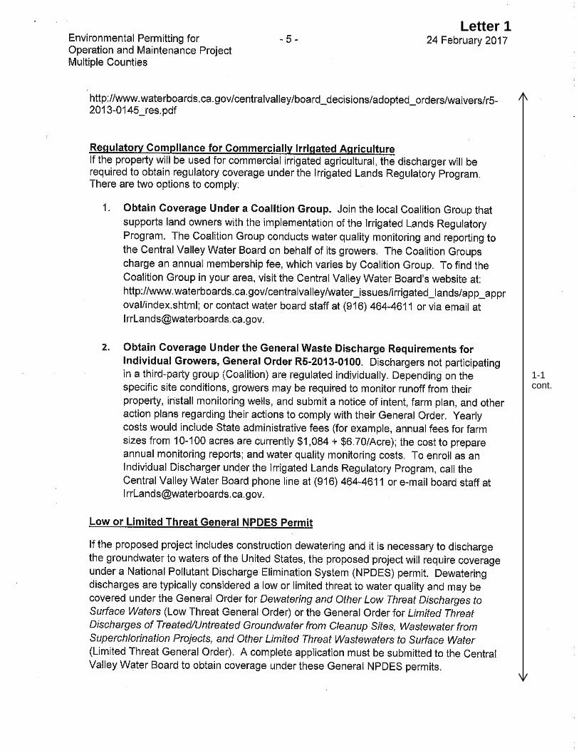
Letter 1
1-1 cont.

Letter 1
1-1 cont.
3. Comments and Responses
Environmental Permitting for Operations and Maintenance Project 3-9 130028.07 Final Environmental Impact Report January 2018
Letter 1 Response
Central Valley Regional Water Quality Control Board February 24, 2017
1-1 The comment letter describes the Central Valley Regional Water Quality Control Board’s (Central Valley Water Board) regulatory responsibility to protect water quality and groundwater, including permitting authority. As presented in table 2-5 on pages 2-56 and 2-57 in the Draft EIR, anticipated regulatory approvals include those from the Central Valley Water Board described in the comment. Mitigation Measure 3.3-5e on page 3.3-136 of the Draft EIR would obligate DWR to obtain permits and comply with permit conditions of Section 404 and Section 401 of the Clean Water Act and the Porter-Cologne Water Quality Control Act to prevent water quality degradation. Further, as described on pages 3.5-25 to 3.5-29 of the Draft EIR, the proposed project would include activities that could affect water quality, but implementation of Mitigation Measure 3.5-1 would include best management practices (BMPs) to prevent degradation of water quality from work sites.

Letter 2
2-1

Letter 2
2-1 cont.
2-2
2-3

Letter 2
2-3 cont.
2-4

Letter 2
2-4 cont.
2-5
2-6

Letter 2
2-6 cont.
2-7
2-8

Letter 2
2-8 cont.
2-9
2-10
2-11
2-12

Letter 2
2-13
2-14
2-15
2-16

Letter 2
2-16 cont.
2-17

Letter 2
2-17 cont.
2-18
2-19
2-20

Letter 2
2-21

Letter 2

Letter 2
2-23
2-24
2-25
2-26
2-27
2-28
2-29
2-30
2-22
2-21
Letter 2
2-31
2-32
2-33
2-34
2-35
2-36
2-37
2-38
2-39
2-40
2-41
2-42
2-43
2-44
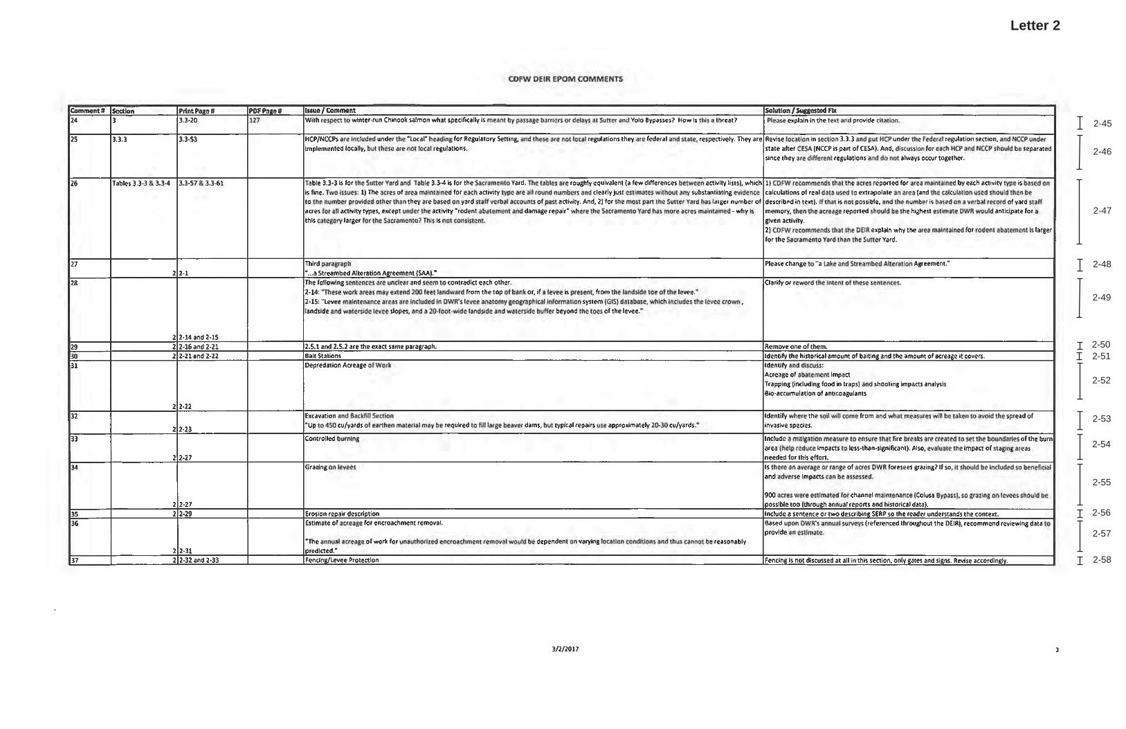
Letter 2
2-45
2-46
2-47
2-48
2-49
2-502-51
2-52
2-53
2-54
2-55
2-56
2-57
2-58

Letter 2
2-59
2-60
2-61
2-62
2-632-64
2-65
2-66
2-67
2-68
2-692-70
2-71
2-72
2-73
2-74

Letter 2
2-75
2-76
2-77
2-78
2-79
2-80
2-81
2-82
2-83
2-84
2-85

3. Comments and Responses
Environmental Permitting for Operations and Maintenance Project 3-29 130028.07 Final Environmental Impact Report January 2018
Letter 2 Response
California Department of Fish and Wildlife March 2, 2017
2-1 DWR thanks CDFW North Central Region for their comments as a trustee and responsible agency pursuant to CEQA.
2-2 Text designated as Comment 2-2 is a project description summary.
2-3 DWR intends to apply for and obtain new Lake or Streambed Alteration Agreement (LSAA)(s) and Incidental Take Permit (ITP)(s) for the project, as needed.
2-4 The project’s Standards of Significance for Biological Resources require a consideration of potential conflicts with the “provisions of an adopted HCP, NCCP, or other approved local, regional, or State habitat conservation plan.” As stated in Section 3.3.4 (starting on page 3.3-137) the only adopted HCP or NCCP in the project area is the Natomas Basin HCP and potential conflicts with this adopted HCP are discussed. The other conservation planning documents identified in the comment have not been adopted, and are still being developed, or are in draft format. DWR is interested in being a plan participant for HCPs/NCCPs where there is sufficient geographic overlap of the project area within the HCP/NCCP plan area and where the covered activities and covered species of the HCP/NCCP match the needs of the project.
The project was designed to be consistent with the 2017 update to the CVFPP Public Draft, as stated in in Draft EIR Sections ES-2 (page ES-2) and 2.4 (page 2-15). This includes the CVFPP Conservation Strategy, adopted by the Central Valley Flood Protection Board in August 2017.
2-5 The extent to which project maintenance activities would affect wildlife movement corridors is discussed in Draft EIR Section 3.3.4 (pages 3.3-123 through 3.3-126) and mitigation measures are provided to reduce this impact to less than significant. Protection measures include: avoidance of riparian forest and riparian scrub whenever possible; cutting swaths of vegetation through large channels so that flood conveyance standards can be met while minimizing riparian impacts; and, maintaining vegetation buffers between the low-flow channel and managed riparian habitat. These measures are adequate to protect wildlife movement corridors within the project area.
DWR coordinates with CDFW for the properties where flood maintenance is conducted, and it is incumbent upon CDFW managers to notify DWR of CDFW policies on land owned or managed by CDFW. In addition, CDFW Regions 1, 2, and 3 will be notified separately (at CDFW’s request) of DWR’s project maintenance activities that may affect resources protected by the California Fish and Game Code Section 1602 within that region’s regulatory authority. Under the LSAAs CDFW Regions 1, 2, and 3 will have information on location, extent, and schedule of planned maintenance activities in their

3. Comments and Responses
Environmental Permitting for Operations and Maintenance Project 3-30 130028.07 Final Environmental Impact Report January 2018
regions, updated annually, and can pass along this information as needed within the agency. Finally, the project does not propose any changes to DWR’s outdoor recreation policies or access for outdoor recreation.
With the exception of wildlife corridors discussed above, wildlife habitat on adjacent properties would not be affected by the project.
2-6 The Draft EIR, in Section 3.3.4 (pages 3.3-54 through 3.3-56), describes the types of impacts that would result from maintenance activities, these include: temporary, long-term, and permanent impacts. The EIR states: “Maintenance activities most often have a temporary effect on biological resources. Given that flood maintenance activities have typically occurred in the project area since at least the 1950s, habitats within the project area have been subject to a periodic disturbance regime due to maintenance activities for decades. This means that changes in habitat conditions occur at regular intervals in any given location, but at other locations, vegetation continues to develop. Therefore, when considering the entire biological landscape of the project area, the environment is in a state of dynamic equilibrium when undergoing regular maintenance.” (page 3.3-54).
This discussion also provides examples of temporary, long-term and permanent impacts to biological resources. “Areas where no maintenance has occurred for many years, but where DWR expects to conduct maintenance activities regularly in the future would be subject to permanent habitat modification during the first year and then be subject to temporary effects in subsequent years. Examples of this are sediment removal from collecting canals where no sediment has been removed in recent years, or channel vegetation management in channels with dense vegetation where no management has ocurred for many years” (page 3.3-55). Information regarding extent of areas where the above statement is true is not available. Therefore, it is not possible to know how many acres of riparian habitat will be permanently impacted at the start of the project, and temporarily impacted in future years.
Text on Draft EIR page 3.3-55 has been revised to include specific information on data used to estimate the maximum annual average area of work as follows: “The maximum annual average area of work and potential habitat areas affected by type were estimated where possible based on experience of DWR staff and these estimates are presented in (Tables 3.3-3 and 3.3-4). The estimates were made using data from the CDFW Routine Maintenance Agreement (RMA) Verification Request Forms (VRF’s), RMA annual reports, the Flood Maintenance Office maintenance tracking tool, and experience of DWR staff.
2-7 Mitigation measures in the Draft EIR are designed to allow flexibility for maintenance activities with regard to schedule and footprint while providing adequate protection measures for sensitive biological resources. In cases where avoidance and minimization measures are not feasible due to schedule or site constraints, other subsequent measures

3. Comments and Responses
Environmental Permitting for Operations and Maintenance Project 3-31 130028.07 Final Environmental Impact Report January 2018
are proposed. For example, when avoidance of suitable giant garter snake aquatic habitat is not feasible (3.3-1e), work would be conducted during the inactive period (3.3-1g) and work areas would be dewatered (3.3-1j). If work in suitable giant garter snake aquatic habitat must be conducted during the active period, a monitor would be present (3.3-1j), DWR would operate equipment differently (3.3-1i), and temporarily affected habitat would be restored (3.3-1p). If, in addition to these measures, there is potential for incidental take, DWR would obtain incidental take authorization from USFWS and CDFW. Avoidance and minimization will not be feasible in all circumstances, as discussed in the Draft EIR impacts discussion (Section 3.3.4), but it is important to include these measures for circumstances where there are opportunities to completely avoid resource impacts.
The proposed measures are consistently enforceable and would be tracked and reported through the Mitigation Monitoring and Report Program (MMRP).
2-8 The comment states that “the Draft EIR lists a number of mitigation measures for biological resources that rely on future approvals or agreements” Measures including 3.3-1f, 3.3-1h, 3.3-1m, 3.3-1u, 3.3-1v, 3.3-1jj, 3.3-1kk, and 3.3-2b state that DWR would coordinate with CDFW (and when appropriate USFWS and NMFS) during maintenance activities to achieve avoidance and minimization of special-status species and their habitats. In many circumstances coordination with agency staff is called for when a certain threshold is met such as when complete avoidance is infeasible (3.3-1h; 3.3-1gg; 3.3-1jj) or when individuals would be relocated from the work area (3.3-1u; 3.3-1x). Because the project activities would occur within a large maintenance area and over a long timeframe, the mitigation measures were written to accommodate the range of potential impacts while providing adequate protection to special-status species and other sensitive biological resources such that project impacts are reduced to less than significant (also see responses to Comments 9-12 and 9-20).
A streambed alteration agreement with the CDFW as well as an incidental take permit for potential take of state listed species will be applied for. The project meets the conditions for those permits, as summarized in Comment 2-3. Other state and federal permits and approvals will also be sought for the project. These permits and authorizations are likely to include avoidance, minimization, and protection measures for sensitive biological resources. The measures would be proposed by DWR in the permit applications but may be revised by the agency in the final permit.
The benefits of project maintenance activities are discussed in Section 3.3.4. Many of the benefits provided in the comment may be implemented as part of the mitigation effort for the project.
2-9 Mitigation monitoring and reporting will be included in the MMRP for the EIR. The Draft EIR states that DWR will obtain permits for impacts to wetlands, riparian habitat,

3. Comments and Responses
Environmental Permitting for Operations and Maintenance Project 3-32 130028.07 Final Environmental Impact Report January 2018
or state- or federally listed species and that DWR will work with the appropriate regulatory agency to develop mitigation under those permits (see response to Comment 2-8). The permit requirements will likely include performance standards and monitoring requirements that DWR is committing to.
2-10 The statement that burrowing owl populations are threatened by loss of mammalian commensals is supported by research, as referenced on Draft EIR page 3.3-28. The primary threats to giant garter snake populations are discussed on Draft EIR page 3.3-26 and supported by research. The loss of mammalian commensals is not listed as a primary threat to giant garter snake. However, project impacts to giant garter snake are discussed in detail in Draft EIR Section 3.3.4 with respect to individual maintenance activities impacts and cumulative impacts. Draft EIR page 3.3-77 states “rodent abatement and damage repair could indirectly affect both giant garter snakes and burrowing owls. Indirect effects could occur because rodent abatement and damage repair activities would decrease the number of small-mammal burrows potentially available to both species. The loss of small-mammal burrows across a portion of the levees included in the project area would temporarily reduce the availability of habitat for burrowing owl nesting and giant garter snake brumation.”
The cumulative impacts discussion concludes that the proposed avoidance, minimization, and compensation measures for loss of special-status species habitat, along with project-related improvements to giant garter snake aquatic habitat would result in less than significant cumulative impacts to giant garter snake. Likewise impacts to burrowing owl are identified as less than significant after mitigation.
2-11 The “Recommended Timing and Methodology for Swainson’s Hawk Nesting Surveys in California’s Central Valley (Swainson’s Hawk Technical Advisory Committee [SHTAC], 2000)” is included in mitigation Measure 3.3-1ff as shown on page 3.3-98 of the Draft EIR. Mitigation Measures 3.3-1ee through 3.3-1ii (page 3.3-97 through 3.3-99) would reduce project impacts to Swainson’s hawk to less than significant as described under Impact 3.3-1. No additional measures are necessary.
2-12 All fish species have similar detail in the life history section description. See response to Comment 2-24 for additional detail on fish species’ life stages and how they coincide with mitigation measures.
2-13 As is stated on page 1-1 (second paragraph), the EIR addresses maintenance activities conducted by the Flood Maintenance Office: “Specifically, DWR’s Flood Maintenance Office (FMO) conducts ongoing maintenance activities on levees, within channels, and on appurtenant structures that are part of the Sacramento River Flood Control Project (SRFCP) and Middle Creek Project in Lake County, both components of the State Plan of Flood Control (SPFC).” The same paragraph also states that these maintenance activities are conducted “in accordance with standards and requirements of federal and State laws

3. Comments and Responses
Environmental Permitting for Operations and Maintenance Project 3-33 130028.07 Final Environmental Impact Report January 2018
and regulations as well as applicable USACE O&M manuals and design profiles.” Moreover, the EIR states on page 1-1 (third paragraph, 1st sentence): “DWR is preparing this Environmental Impact Report (EIR) to evaluate impacts of implementing maintenance activities associated with maintaining the proper function of the SRFCP and Middle Creek Project flood protection facilities in accordance with their original design …”
Although FMO conducts maintenance of the four weirs listed in the comment, the only structure that is operated is the Sacramento Weir. It is operated based on the US Army Corps of Engineers’ (USACE’s) Operations and Maintenance (O&M) manual requirements, and that activity is therefore not covered in this EIR. The other three weirs are passive structures that pass flows depending on water levels in the river.
2-14 See response to Comment 2-13. This EIR is evaluating the impact of maintenance and repair of flood management facilities only, not the impact due to the operation of those facilities. Therefore, this EIR would not be incorporating measures to mitigate for effects caused by the operation of facilities, such as the construction of fishways.
2-15 The Draft EIR methodology for estimating the annual acreage of grouting by the Maintenance Yards is clearly described in footnote b of Table 3.3-4 (page 3.3-64). The estimated annual acreage of impacts is given for each activity by habitat type in Draft EIR tables 3.3-3 and 3.3-4. These are used as a basis for identifying potential impacts of the project on all special-status species that could be present in those habitat types. Grouting is conducted on levees and corresponds with grassland habitat. In addition, analysis of potential project impacts to giant garter snake included data from focused surveys and mapping of giant garter snake habitat on DWR levees (DWR 2014) as discussed on Draft EIR pages 3.3-73 through 3.3-75, along with input from the Maintenance Yard staff.
All wildlife habitats within the project area are three dimensional (e.g., riparian habitat varies in height and density, aquatic habitat in channels varies in depth) but are quantified in two dimensions using an area estimate (acres). This provides a consistent way to analyze project impacts and to implement avoidance and minimization measures to the greatest extent feasible.
2-16 As stated in Draft EIR Sections 2.5.2 (page 2-21) and 3.3.4 (page 3.3-97) DWR utilizes the best available information along with pesticide label instructions, and laws, requirements, and guidelines of the California Department of Pesticide Regulation to plan rodent abatement. Best available information includes current research, maintenance yard staff experience, and recommendations from a licensed pest control advisor (PCA). The licensed PCA consults the California Department of Pesticide Regulation’s PRESCRIBE database prior to making Pest Control Recommendations.

3. Comments and Responses
Environmental Permitting for Operations and Maintenance Project 3-34 130028.07 Final Environmental Impact Report January 2018
In effect an Integrated Pest Management Plan would accomplish the same results as DWR’s current approach (described in Draft EIR Section 2.5.2 page 2-21) which includes following all laws, instructions, and expert recommendations.
It is not possible at this time to estimate the total area treated with rodenticide. Written records of rodenticide quantities are not available, nor is the spatial extent of past applications. DWR utilizes information from inspections to determine the annual needs for rodent abatement, as discussed in Draft EIR Section 2.5.2 (page 2-21).
2-17 Draft EIR Section 4.2.1 (page 4-6 through 4-7) lists 17 levee and channel maintenance, water storage, and flood system improvement projects that were included in the cumulative impacts analysis. Many of these projects cover large areas and many activities. They are projects for which there is “sufficiently detailed information about the project to allow meaningful analysis without undue speculation” and that are “actively under development” meaning that the projects are “reasonably foreseeable” (Draft EIR page 4-6). These projects overlap with the proposed project in regional geography, as well as many project activities, and potential impacts to biological resources. The 2017 CVFPP update is included in the cumulative analysis for the proposed project and captures operations and maintenance for the entire State Plan of Flood Control at a program level.
As stated in Impact 3.3-8 (Draft EIR page 3.3-141) “Although the magnitude of adverse effects to special-status wildlife varies both by species and by specific proposed maintenance activities (see Table 3.3-6), the potential aggregated effect in the proposed project area to the cumulative impact would be considerable.” Because “no assurances exist that similar flood projects or other construction projects would not potentially affect special-status species and sensitive natural communities” even though “those projects would require consultation with CDFW, the USFWS, and NMFS to determine appropriate methods for minimizing impacts” (Draft EIR page 3.3-140). Therefore, while it is not possible to present the exact special-status species and habitat impacts of all other related and reasonably foreseeable projects (that would require speculation), the Draft EIR analysis and discussion has clearly stated that since the other analyzed projects are similar in scope and nature and can be expected to have similar impacts to biological resources with no assurance of avoidance, minimization, and/compensation for those impacts, the cumulative impact to special-status species and sensitive natural communities is significant (Draft EIR page 3.3-141).
The conclusion that the proposed project’s contribution to cumulative impacts on special-status species and sensitive habitats is less than considerable with mitigation is supported by the project impact conclusions. As stated on Draft EIR pages 3.3-101 (impacts to special-status wildlife); 3.3-111 (impacts to special-status plants); 3.3-122 (impacts to special-status fish); 3.3-126 (impacts to migratory corridors for wildlife); and, 3.3-136 (impacts to riparian habitat, wetlands and waters, and oak woodlands), project-related

3. Comments and Responses
Environmental Permitting for Operations and Maintenance Project 3-35 130028.07 Final Environmental Impact Report January 2018
impacts to terrestrial and aquatic biological resources would be less than significant with mitigation. With implementation of appropriate protection measures for special-status species and sensitive habitats, the cumulative impact is less than considerable because project-related impacts would be avoided, minimized, and/compensated, as stated on Draft EIR page 3.3-141. As described in response to Comment 2-7, mitigation measures in the Draft EIR are designed to allow flexibility for maintenance activities with regard to schedule and footprint while providing adequate protection measures for sensitive biological resources. In cases where avoidance and minimization measures are not feasible due to schedule or site constraints, other subsequent measures are proposed. Further, if, in addition to these measures, there is potential for incidental take, DWR would obtain incidental take authorization from USFWS and CDFW. The mitigation measures proposed to mitigate the proposed project’s contribution to cumulative impacts to less than considerable are consistently enforceable and would be tracked and reported through the MMRP.
Please refer to response to Comment 2-7 regarding enforcement of project mitigation measures.
2-18 Responses to Comments 2-22 through 2-85 from the Excel file provided with Letter 2 are listed below.
2-19 The preparation of this EIR did not include biological resources surveys and instead relied on existing DWR data and information. Because no biological surveys were conducted, no special-status species were observed and no CNDDB forms were prepared and submitted. However, DWR prepared a record of know occurrences observed in the project area, observed by DWR environmental staff (DWR, 2015). Many of these occurrences have been reported to the CNDDB.
2-20 DWR will pay the environmental filing fee.
2-21 CDFW will receive responses to all comments on the Draft EIR at least 10 days prior to certification of the Final EIR by the lead agency.
2-22 Regardless of the current status of the gates, their maintenance is part of the EPOM project.
2-23 We added the following language for Impact 3.3-3 (Draft EIR page 3.3-111) that addresses water temperature concerns for green sturgeon: Temperature and flow have been shown to be relevant parameters with respect to spawning, survival and growth of North American green sturgeon (NMFS 2015). Summer water temperatures in the upper Sacramento River have typically been below water temperatures that inhibit the growth or survival of larval or juvenile green sturgeon (NMFS 2015). However, in years of drought, such as during 2014 and 2015, water temperatures can approach stressful levels

3. Comments and Responses
Environmental Permitting for Operations and Maintenance Project 3-36 130028.07 Final Environmental Impact Report January 2018
for young sturgeon and may be of greater concern in the future with expected climate change (NMFS 2015).
2-24 The work windows have now been revised, with 2 different windows in two different regions:
The following text and Tables 3.3-2a and 3.3-2b were inserted on page 3.3-15 under “Fish”:
Several special-status fish species occur in the project area. Tables 3.3-2a and 3.3-2b show the timing of the presence of life stages of special-status fish species within the project area in Regions 1 (RM 0-60) and 2 (RM >60). Different in-water work-windows were delineated for each Region to provide protection for the different fish species and life stages present in each Region (see Mitigation Measure 3.3-3c for details). It is important to note that each species is not present across the entire project area or in each Region, with some life stages and species only present in small portions of the project area. Also, some life stages that occur outside of the project area are excluded from the table, including spring-run and winter-run spawning that occurs further upstream in the Sacramento River mainstem or tributaries, and delta smelt and longfin smelt juveniles which rear in the more saline waters of the bays downstream of the action area.
Tables 3.3-2a and 3.3-2b shows that there is great overlap in the presence of life stages of special-status fish species in each Region, making the identification of an in-water work window for maintenance activities difficult (see Mitigation Measure 3.3-3c). In-fact, no time period would eliminate all life stages from potential exposure to maintenance activities. However, Tables 3.3-2a and 3.3-2b show that the in-water work window of July 1 through October 30 in Region 1 and June 1 through September 30 in Region 2, effectively reduces exposure of the most vulnerable life stages to maintenance activities, and only exposes a few juvenile and adult life stages that generally are present almost (or entirely) year-round to maintenance activities.
The in-water work window for Region 1 was defined as July 1 through October 30. A July start date effectively avoids the spawning and incubation period (spring and early summer) for delta smelt and longfin smelt, two listed Delta species (see Table 3.3-2a for life stage timing). In addition, winter-run juveniles have been observed upstream of the Delta in the Sacramento River at Red Bluff Diversion Dam in significant numbers during October, justifying an October 1 end date to the in-water work window.
The in-water work window for Region 2 was defined as June 1 through September 30. A June 1 start date completely avoids the juvenile life stage for spring-run and winter-run Chinook salmon, and avoids the primary emigration

3. Comments and Responses
Environmental Permitting for Operations and Maintenance Project 3-37 130028.07 Final Environmental Impact Report January 2018
period of juvenile fall/late-fall Chinook salmon and steelhead. In addition, the October 30 end date limits the exposure to juvenile winter-run Chinook salmon. A significant number of juvenile winter-run have been observed approaching the Delta during the month of November at the Knights Landing screw trap in recent years.
TABLE 3.3-2A SPECIES PRESENCE TIMING BY LIFE STAGE IN REGION 1 (RM 0-60) WITH WORK WINDOW
(JULY 1 THROUGH OCTOBER 30)
NOTE: * Yellow band reflects the in-water work window of July 1 through October 30.
Species or Run Life StageJuvenileAdult MigrationJuvenileAdult MigrationJuvenileAdult MigrationJuvenileAdult MigrationJuvenileAdult MigrationSpawningIncubationAdult MigrationSpawningIncubationAdult MigrationSpawningIncubationJuvenile/AdultsSpawningIncubationJuvenile/AdultsAdult MigrationJuvenileAdult Migration
Pacific Lamprey
Longfin smelt
Hardhead
Sacramento splittail
Green Sturgeon
Spring Chinook
Winter Chinook
Fall/Late-Fall Chinook
Steelhead
Delta smelt
Jul Aug Sep Oct Nov DecJan Feb Mar Apr May Jun

3. Comments and Responses
Environmental Permitting for Operations and Maintenance Project 3-38 130028.07 Final Environmental Impact Report January 2018
TABLE 3.3-2B SPECIES PRESENCE TIMING BY LIFE STAGE IN REGION 2 (RM >60) WITH WORK WINDOW
(JUNE 1 THROUGH SEPTEMBER 30)
NOTE: * Yellow band reflects the in-water work window of June 1 through September 30.
2-25 In water maintenance activities at weirs would only occur during the in water work window of June 1 through October 1 when the presence of the most vulnerable life stages of listed fish species is unlikely to occur. In addition, mitigation Measure 3.3-1d (page 3.3-91) is already listed for mitigation for Flood control structure maintenance and repair (including weir maintenance) on page 3.3-123. This measure requires that “A qualified biologist will be available on an on-call basis during all project-related activities. If needed, a qualified biologist will be maintained on-site during maintenance activities to ensure the protection of special-status species as required.”
2-26 Although maintenance of the weir is within the purview of the EPOM project, the weir configuration and operations is not. The in-water work windows completely avoids the upstream migration period (March through May) of spring-run adults. In addition, all maintenance activities in tributaries with spring-run present occur downstream of spring-run holding and spawning locations that occur in the upper watershed.
Species or Run Life StageJuvenileAdult MigrationJuvenileAdult MigrationSpawningIncubationJuvenileAdult MigrationSpawningIncubationJuvenileAdult MigrationJuvenileAdult MigrationSpawningIncubationJuvenile/AdultsAdult MigrationSpawningIncubationJuvenile/AdultsSpawningIncubationJuvenileAdult Migration
Clear Lake hitch
Hardhead
Pacific Lamprey
Spring Chinook
Winter Chinook
Fall/Late-Fall Chinook
Steelhead
Green Sturgeon
Jul Aug Sep Oct Nov DecJan Feb Mar Apr May Jun

3. Comments and Responses
Environmental Permitting for Operations and Maintenance Project 3-39 130028.07 Final Environmental Impact Report January 2018
2-27 The in water work windows have been changed (see response to Comment 2-24).
2-28 The in-water work windows were changed to July 1 through October 30 in Region 1 (RM 0-60) and June 1 through September 30 in Region 2 (RM >60) to avoid impacts to early winter-run emigrants. In addition, all in water work is expected to occur during daylight hours, further limiting the impact to migrating juvenile salmonids.
2-29 See response to Comment 2-28.
2-30 See response to Comment 2-28.
2-31 The EIR evaluates the impact on listed fish species of weir maintenance and repair only, not the impact due to the operation of the weir itself.
2-32 Mitigation Measure 3.3-3d on page 3.3-122 already addresses the concern for removal of woody material. However, an option is added to coordinate woody material replacement with restoration efforts. Therefore, Measure 3.3-3d was modified as follows: "Any shaded riverine aquatic habitat that is removed will be replaced, with replacement to occur on site when feasible, or placed off-site in-coordination with Central Valley habitat restoration efforts. DWR will attempt to use large woody material that was removed from the channel for maintenance purposes in Central Valley habitat restoration efforts, if placement of the material would be beneficial to salmonids and would not constitute a navigation hazard. This includes IWM and other instream structures, overhead shade, and shallow-water habitat.”
2-33 The last sentence of the third full paragraph on page 3.3-6 of the Draft EIR was rewritten as follows:
As discussed above, anadromous fishes, including spring-run Chinook salmon, winter-run Chinook salmon, Southern Distinct Population Segment (DPS) green sturgeon, and Central Valley steelhead, fall-/late fall–run Chinook salmon, and Pacific lamprey, also are present during their upstream migration as adults and downstream migration as juveniles (Moyle, 2002).
2-34 Seasonal wetlands can provide rearing habitat for native fish species. The following language was therefore added (Draft EIR page 3.3-8): Historically, during the winter and spring, the rivers were not contained by their channels, and spread out over large areas, especially in the Sacramento Valley (Kelley, 1989), to provide extensive floodplain habitat for juvenile salmon (Williams, 2006). Seasonal shallow-water habitat areas provide refuge from unfavorable hydraulic conditions and predation, as well as foraging habitat for out-migrating juvenile salmonids (Williams, 2010). Multiple studies have shown that the productive environments of seasonal floodplains enhance growth rates of juvenile Chinook salmon (Sommer et al., 2001, 2005; Jeffres et al., 2008).

3. Comments and Responses
Environmental Permitting for Operations and Maintenance Project 3-40 130028.07 Final Environmental Impact Report January 2018
2-35 We agree that stranding may occur on floodplains and have added the following language to this paragraph (Draft EIR page 3.3-18): “Juveniles can become stranded when water levels recede, however, stranding losses of Chinook and other native species are usually modest (Sommer et al., 2005; Jeffres et al., 2008). Managed floodplains in the Central Valley are exceptionally well-drained because of grading for agriculture, which likely helps promote successful emigration of young salmon (Sommer et al., 2001).”
2-36 The unique behavior of spring-run juveniles was incorporated with the following text (Draft EIR page 3.3-19): “Spring-run fry emerge from the gravel from November to March (Moyle, 2002). Juveniles may reside in freshwater for 12 to 16 months, but some migrate to the ocean as young-of-the- year in the winter or spring months within eight months of hatching (CALFED, 2000). Studies of Butte Creek (Ward et al., 2003) found the majority of spring-run migrants to be fry moving downstream primarily during December, January, and February, and that these movements appeared to be influenced by flow. Small numbers of spring-run juveniles remained in Butte Creek to rear and migrate as yearlings later in the spring. Juvenile emigration patterns in Mill and Deer creeks are very similar to patterns observed in Butte Creek, with the exception that Mill and Deer creek juveniles typically exhibit a later young-of-the-year migration and an earlier yearling migration (Lindley et al., 2004).”
2-37 The section of the EIR the commenter is referring to (3.3-54 to 3.3-90) presents the impacts of maintenance activities on wildlife species, not fish species. Pages 3.3-114 to 3.3-130 address the impacts of maintenance activities on fish species. Also, mitigation Measure 3.3-3e on page 3.3-122 addresses screening of pumps: “The intakes of water pumps needed for the activity will be screened to NMFS salmonid-screening specifications to prevent entraining fish in the pump. Whenever possible, low-flow pumps with appropriately screened intakes will be used during dewatering.”
2-38 We added reference to Mitigation Measure 3.3-3e (page 3.3-122) which details a fish rescue plan. The language on page 3.3-92 will be revised as follows:
Measure 3.3-1h (CM, FC): DWR will dewater maintenance areas potentially providing aquatic habitat for giant garter snakes to the extent feasible. Any dewatered aquatic habitat will be kept dry for at least 15 consecutive days before conducting maintenance activities. If 15 consecutive days is not feasible then DWR will consult with both the USFWS and CDFW to apply appropriate measures. If dewatering cannot remove all water, potential giant garter snake prey (i.e., fish and tadpoles) will be removed so that giant garter snakes and other wildlife are not attracted to the maintenance area. DWR will coordinate with CDFW and the federal resource agencies and obtain the necessary permits/authorizations to conduct fish rescues (see Mitigation Measure 3.3-3e).
See response to Comment 2-40 with revised rescue plan language.

3. Comments and Responses
Environmental Permitting for Operations and Maintenance Project 3-41 130028.07 Final Environmental Impact Report January 2018
2-39 The measure states that a mitigation plan will be developed to comply with permit conditions. The following text was added to Measure 3.3-3d (page 3.3-122):
DWR will work with the appropriate regulatory agency (CDFW, USFWS and/or NMFS) to develop success criteria and the timing and duration of monitoring.
2-40 DWR will work with CDFW and NMFS to obtain their review and input. DWR is not required to provide funding to CDFW for this work. Measure 3.3-3e (page 3.3-122) was revised as follows:
Measure 3.3-3e (FC, DC): Before conducting maintenance that requires dewatering the channel and potentially stranding special-status fishes, a specific fish rescue plan will be developed and CDFW and/or NMFS will be consulted prior to the start of the project. The fish rescue plan will be submitted to CDFW and NMFS for review prior to implementation. The plan will reference and implement adapted fish relocation measures defined in current technical guidance documents and/or established in previous agency-reviewed DWR fish rescue plans. The general procedure will include establishing a “cofferdam” (cofferdam may be composed of stop blocks, portable cofferdam, etc.), the lowering of water within the coffer dammed area, catching fish within the area by seining or dip netting, and relocating them outside of the dammed area within the same waterbody. The intakes of water pumps needed for the activity will be screened to NMFS salmonid-screening specifications to prevent entraining fish in the pump. Whenever possible, low-flow pumps with appropriately screened intakes will be used during dewatering. Fish entrapped within the cofferdam will be rescued before the cofferdam is completely drained. DWR will invite NMFS and CDFW biologists to be on-site for the fish rescue effort. As safety allows, qualified biologists will capture and relocate fish as specified in the fish rescue plan.
2-41 While the in-water work window is much more restrictive (July 1 through October 1) in order to limit the impact to listed fish species, the work window for erosion control is wider due to the limited impact of erosion repair activities on fish species. Erosion repair occurs on the levee slope to prevent further erosion, causing little impact to fish species possibly present in the adjacent waterway.
2-42 Delta smelt was added to the list of fish species potentially affected by maintenance activities.
The third sentence of the second paragraph on page 3.3-6 was rewritten as:
Native resident species that occur or could occur in these rivers and streams include Sacramento pikeminnow (Ptychocheilus grandis), delta smelt (Hypomesus transpacificus), Sacramento splittail (Pogonichthys macrolepidotus), Sacramento sucker (Catostomus occidentalis), hardhead

3. Comments and Responses
Environmental Permitting for Operations and Maintenance Project 3-42 130028.07 Final Environmental Impact Report January 2018
(Mylopharodon conocephalus), Sacramento roach (Lavinia symmetricus), and rainbow trout (O. mykiss).
2-43 The following text was added to the first paragraph under North American Green Sturgeon on page 3.3-15:
Adult Southern DPS green sturgeon enter San Francisco Bay in late winter through early spring and spawn from April through early July, with peaks of activity influenced by factors including water flow and temperature (Heublein et al., 2009; Poytress et al., 2011).
Measures to avoid take of spawning eggs and adults were not included because all maintenance activities in the Sacramento River mainstem occur well downstream of green sturgeon spawning habitat. Spawning habitat for green sturgeon extends downstream to RKM 333 (Poytress et al., 2013) while the most upstream maintenance activity occurs at Phelan Island at RKM 309.
2-44 We agree that it is helpful to more clearly describe what listed species and life stages are present in the action area that may be impacted by the maintenance activities. See our response to Comment 2-24 for new tables and language added describing life stage timing and new work windows.
2-45 Improvements to adult passage both at Sutter and Yolo Bypasses are recovery actions for Central Valley salmonids identified in the NMFS recovery plan that is already cited (NMFS, 2014) on page 3.3-20, second paragraph.
2-46 Edits incorporated as recommended. The discussion of Habitat Conservation Plans and Natural Community Conservation Plans was moved to the end of the discussion on Federal Endangered Species Act.
The following text was added under “State” and “California Endangered Species Act” in Section 3.3.3 (pages 3.3-50 and 3.3-51):
Natural Community Conservation Plans Natural Community Conservation Plans (NCCPs) are discussed above with Habitat Conservation Plans (HCP) since in many cases these conservation planning efforts are combined into one document. NCCPs in the project area that are currently under development include: Butte Regional Conservation Plan, Yuba Sutter Resource Conservation Plan, Yolo Natural Heritage Program, and the Placer County Conservation Plan. As these plans have not yet been formally adopted, they are not discussed further in this section.
2-47 DWR used the best available data to estimate the acres of habitat potentially affected by maintenance activities. In many cases, the best available data was a verbal report from

3. Comments and Responses
Environmental Permitting for Operations and Maintenance Project 3-43 130028.07 Final Environmental Impact Report January 2018
maintenance yard staff, as noted in the comments/assumptions column. However, additional detail on data sources has been added to the Final EIR. Please see response to Comment 2-6. The acreages in Tables 3.3-3 and 3.3-4 (pages 3.3-57 through 3.3-64) are the "estimated maximum habitat areas potentially affected by maintenance activities" as indicated in the title of the table.
Regarding grouting acreage, according to the document entitled "Estimate of Surface Area of Rodent Burrow Grouting of Levees Maintained by Dept. of Water Resources" (DWR, 2016), The Sutter Yard evaluates 411.75 acres of levee for grouting each year and the Sacramento Maintenance Yard evaluates 785.75 acres of levee for grouting each year. Each yard grouts an average of 2 burrows per acre per year. Because the levee area evaluated for grouting is greater for the Sacramento Maintenance yard, consequently the area grouted is larger as well.
2-48 The end of the second sentence of the third paragraph on page 2-1 of the Draft EIR was changed as follows:
… entering into a Lake and Streambed Alteration Agreement (LSAA).
2-49 The description of the project area in Section 2.3 (page 2-5) has been replaced with the project area description from Section 3.3.2 (page 3.3-1) as follows:
The project area includes all areas of DWR’s maintenance responsibility on the SRFCP and Middle Creek Project levees, channels, and flood control structures, as listed above in Tables 2-1 and 2-2. The geographic extent of the project area was defined using geographic information systems (GIS) as follows:
1. Levee anatomies were obtained from the SPFC Delta Anatomy Mapping Project. This dataset defined the location and extent of levee crown, levee landside, and levee waterside areas. Levee waterside extends from the hinge point to the levee’s waterside toe, or to the waterside edge, or 50 feet from the crown, whichever comes first. Levee landside extends from the crown hinge point to the levee toe. A 15-foot buffer was added to the levee landside. A 15-foot buffer was added to the levee waterside then trimmed to the water’s edge, if the water’s edge was closer than 15 feet. Areas within the SRFCP that were not included in the original SPFC dataset were digitized using contour data to define the levee crown and levee waterside and landside, as well as a 15-foot buffer. Geographic Information Center (California State University, Chico) developed the levee anatomy data, commissioned by DWR to conduct vegetation management planning and analysis.
2. Channel areas were defined based on the channel maintenance polygon data from the California Levee Database (CLD) used to create the State Plan of Flood Control- Map Book of Operation and Maintenance Manual Units (DWR, 2012b). Channel areas extend from levee toe to levee toe. A distinction was made between “actively maintained” channels and channel

3. Comments and Responses
Environmental Permitting for Operations and Maintenance Project 3-44 130028.07 Final Environmental Impact Report January 2018
“areas of responsibility.” Channel areas of responsibility include areas that are not regularly maintained, generally because they do not create water conveyance or other flood control issues such as agricultural and developed lands. Actively maintained channels are defined as those channel areas that DWR maintenance yards regularly maintain. Actively maintained areas were identified by meeting with maintenance yard staff and mapping the areas that are routinely maintained or where the maintenance yard staff would be likely to conduct work throughout the SRFCP (DWR, 2016a). It should be noted that all levees for which DWR has maintenance responsibility are actively maintained.
The project area includes the features listed in Tables 2-1 and 2-2 as well as those work areas that may result in landside disturbance. These work areas may extend 200 feed landward from the top of bank or, if a levee is present, from the landside toe of the levee. Most staging, borrow and spoil areas, and access routes used during maintenance activities are within this landside levee buffer. Existing and previously disturbed staging areas, roads, and spoil/borrow areas are used to the maximum extent feasible. If previously undisturbed areas are required for landside staging or spoil/borrow areas, appropriate best management practices and applicable mitigation measures are followed.
For the purpose of analysis in this EIR, actively maintained areas are identified within the overall area of maintenance responsibility. Actively maintained areas are defined as those areas that DWR maintenance yards regularly maintain, as described in this project description, and include the levees and flood control structures, as well as the channel maintenance areas listed in Tables 2-1 and 2-2, unless otherwise indicated. Locations within the area of maintenance responsibility that are not within the actively maintained areas are only very occasionally subject to maintenance by DWR in response to specific flood hazards. These areas include, for example, rice fields within the Sutter and Yolo Bypasses and the open water channel areas of the Sacramento and Feather Rivers. Levee maintenance areas are included in DWR’s levee anatomy geographical information system (GIS) database, which includes the levee crown, landside and waterside levee slopes, and 20-foot-wide landside and waterside buffers beyond the toes of the levee. Actively maintained channel areas and the associated area of maintenance responsibility are also specifically identified in the GIS database. Flood control structures are typically included within the channel and levee maintenance areas. Table 2-3 provides the acreages maintained by DWR’s maintenance yards within each of the maintenance area categories.
Please also see “Staff Initiated Changes” for discussion of revisions to project area habitat acreages for the Final EIR.
2-50 The repeated paragraph has been removed and the section numbering was updated.

3. Comments and Responses
Environmental Permitting for Operations and Maintenance Project 3-45 130028.07 Final Environmental Impact Report January 2018
2-51 Please see the response to Comment 2-16.
2-52 Consistent with the text on Draft EIR Section 2 page 2-22, there is no impact area associated with depredation. Depredation methods, including shooting and trapping, are discussed on Draft EIR page 2-22. The impacts of rodent abatement and depredation are discussed in Draft EIR Section 3.3 page 3.3-73, including the effects of secondary poisoning.
2-53 Soil for backfill for large beaver dams originates from spoil sites within the project area.
Best management practices to avoid the spread of invasive species are described in the invasive species management plan (Measure 3.3-1c).
2-54 The project description (Draft EIR Chapter 2, Project Description, page 2-27) states that fire breaks would be placed at levee toes and along levee toe roads where practicable. In addition, because controlled burns are conducted with the authorization and support of local fire districts and air quality management districts, and according to all laws and local ordinances within the appropriate season and only in rural areas (Draft EIR Chapter 2, Project Description, page 2-27), additional safeguards are in place to prevent the fire from spreading to adjacent areas.
DWR uses existing staging areas for controlled burning as well as other maintenance activities, as discussed in Section 2.3 page 2-14.
2-55 The Sacramento and Sutter maintenance yards have not used grazing as a vegetation management tool in the past but may propose to use it in the future. Any potential acreage to be grazed is not known yet.
The effects of grazing on biological resources are discussed in Section 3.3.4 on pages 3.3-79, 3.3-89, 3.3-102, and 3.3-137.
2-56 The Small Erosion Repair Program (SERP) is a separate program. Erosion repair proposed as part of the project is described in Draft EIR Section 2.5.2 (page 2-28 through 2-29).
2-57 The occurrence of encroachments is entirely dependent on forces outside of DWR's control, and there is no way to accurately estimate encroachment occurrence in the future. The average number of encroachments over the past 25 years is 1/year for the Sacramento Maintenance Yard, as stated in Tables 3.3-3 and 3.3-4 (pages 3.3-57 through 3.3-64).
2-58 The following text was added to Draft EIR Section 2, pages 2-32 and 2-33:
Levee crown roads and toe roads have restricted access so that unauthorized vehicles cannot access the roads for safety reasons. Metal gates secured with

3. Comments and Responses
Environmental Permitting for Operations and Maintenance Project 3-46 130028.07 Final Environmental Impact Report January 2018
locks are installed on the roads at access points, and in limited areas there are metal fences or barbed-wire fences to prevent pedestrian or bicycle access. These Gates and fences periodically require maintenance or replacement, and new gates or fences are sometimes installed. In addition, road signs, mile markers, or other DWR signage may be installed, maintained, or replaced along levees.
Gate, fence, and sign installation or replacement would typically involve excavating a small hole in the levee with a hydraulic auger, backhoe, or hand tools; installing and positioning; and filling the hole with concrete or compacted soil. Equipment required for this work could include the hydraulic auger or backhoe mentioned above as well as hand tools, a truck, a small cement mixer, and a compactor. Maintenance work could include welding and repainting of gates and painting.
Frequency Gate, fence, and sign installation and maintenance would occur as needed.
Timing These activities could occur year-round.
Acreage of Work The annual acreage of work for gate, fence, and sign installation is less than 0.01 acre for each maintenance yard. The footprint of work would be small and negligible compared to other activities.”
2-59 Total for annual acreage of work for sediment removal from Collecting Canals was updated to 123 acres on Draft EIR page 2-36.
2-60 Acreage of herbicide use cannot be reasonably predicted, and quantities have therefore not been included. Previous permit authorizations do not provide sufficient information to allow estimates of future herbicide application acreage.
2-61 According to Measure 3.3-1l (Draft EIR page 3.3-93) and as amended (see response to Comment 2-78) work areas would be fenced with giant garter snake exclusion fencing whenever necessary and feasible. This includes piles for burning.
2-62 Edits incorporated as recommended. Table 2-5 (page 2-56) now reads “Permitted activities on facilities that would impact the bed, channel, or bank of any stream channel or river (Fish and Game Code Section1602).”
2-63 The direct and indirect impacts to giant garter snake as a result of project maintenance activities are discussed in Section 3.3.4 (page 3.3-54), and include all proposed maintenance activities. The language from the setting section referenced in the comment
3. Comments and Responses
Environmental Permitting for Operations and Maintenance Project 3-47 130028.07 Final Environmental Impact Report January 2018
identifies the main threats to giant garter snake throughout its range and across large areas of suitable habitat.
2-64 Please see Response to Comment 2-46.
2-65 The referenced sentence is immediately followed by examples of this type of impact (Draft EIR page 3.3-55) which include sediment removal from collecting canals where no sediment has been removed in recent years or vegetation management in channels with dense vegetation where no management has occurred for many years. Other types of impacts include temporary and permanent which are described in detail in Section 3.3.4 "Methods of Analysis."
2-66 Direct and indirect effects of maintenance activities are analyzed for each species as shown in Table 3.3-6 (page 3.3-69 through 3.3-71) and discussed in the text in Section 3.3.4 (page 3.3-54). For example, page 3.3-73 "Rodent abatement and damage repair may result in direct mortality of giant garter snakes." However, impact significance was not analyzed for each activity individually, but rather as groups of similar activities that have similar effects on biological resources, as stated in the referenced text.
In addition, beneficial effects are discussed for those special-status species and their habitats that would benefit from certain maintenance activities.
2-67 DWR used documentation from past work (e.g., reports to the Central Valley Flood Protection Board) and experience of maintenance yard staff to estimate the acreage of maintenance activities where feasible. There are no sources of information that would enable DWR to provide meaningful estimates of future encroachment removal or herbicide application acreages. Please also see response to Comment 2-60.
2-68 Please see response to Comment 2-57.
2-69 Grazing is discussed in Draft EIR Sections 2.5.2 and 2.5.3, on pages 2-27 through 2-28 and 2-43 through 2-44 respectively. In addition, the Acreage of Work for grazing in channels (page 2-44) is given as 900 acres for the Sutter Maintenance Yard. This matches the channel grazing acreage value in Table 3.3-3.
2-70 Table 3.3-4 (page 3.3-61 through 3.3-64): Debris/Obstruction Removal is given as 0.5 acre annually. Mechanical removal of aquatic vegetation is 5 acres for the Sacramento Maintenance Yard, as described on Draft EIR page 2-40. Table 3.3-4 has been updated to reflect the 5 acres of mechanical removal of aquatic vegetation conducted by the Sacramento Maintenance Yard.
2-71 A footnote to Draft EIR page 3.3-67 has been added that reads: “Coontail (Ceratophyllum demersum) is considered native to California (Jepson Flora Project, 2015), unlike the other aquatic plants listed in this section.”

3. Comments and Responses
Environmental Permitting for Operations and Maintenance Project 3-48 130028.07 Final Environmental Impact Report January 2018
2-72 Draft EIR Section 3.3-4 concludes that “The use of pesticides for the purpose of rodent abatement to protect levees would therefore not result in a significant impact caused by raptor poisoning” (Draft EIR page 3.3-73). Therefore, no mitigation is proposed and there is no unmitigated direct or indirect effect to raptors or other species. As discussed in Draft EIR Section 2.5.2 (page 2-22) and response to Comment 2-16, DWR utilizes the best information available, along with the results of levee inspections to plan and implement rodent abatement activities. Activities that involve rodenticides are carried out according to all applicable laws and regulations, and pesticide labels, which are designed to protect people, wildlife, and water quality.
2-73 Avoidance and minimizations measures for giant garter snake are Measures 3.3-1e through 3.3-1t in Draft EIR Section 3.3-4 (page 3.3-92 through 3.3-94). Burrowing owl avoidance and minimization measures are Measures 3.3-1ee through 3.3-1jj (Draft EIR Section 3.3-4; page 3.3-97 through 3.3-100). Any loss of habitat for giant garter snake that cannot be avoided would be addressed in the Biological Assessment prepared for Federal Endangered Species Act (FESA) incidental take authorization, per Measure 3.3-1t, and would not occur until authorization is provided by USFWS. Measure 3.3-1jj requires DWR to prepare an exclusion and relocation plan and coordinate with CDFW when active burrowing owl burrows cannot be avoided.
2-74 Trimming guidelines have been incorporated into Draft EIR Measure 3.3-1aa (page 3.3-96) as follows:
Measure 3.3-1aa (LM, CM, FC): If suitable elderberry shrubs cannot be avoided during maintenance activities, and will be trimmed or removed any trimming of the shrub that may be required will be conducted according to the USFWS Framework for Assessing the Impacts to the Valley Elderberry Longhorn Beetle (USFWS 2017) or current USFWS guidelines to the extent feasible(USFWS, 1999b). If additional trimming or removal is needed during maintenance, a qualified biologist will survey these shrubs for the presence of VELB according to USFWS protocols guidance (USFWS, 2017, or current guidance document1999b).
(USFWS) U.S. Fish and Wildlife Service). 2017. Framework for Assessing the Impacts to the Valley Elderberry Longhorn Beetle (Desmocerus californicus dimorphus). U.S. Fish and Wildlife Service; Sacramento, California. 28 pp.
2-75 Herbicide application on levees is fairly predictable from year to year because all levee areas are subject to vegetation management every year. Aquatic and woody vegetation management are less predictable because they tend to be associated with conditions specific to each year. For example, years with large flood events may require more sediment removal or debris/obstruction removal. Woody vegetation management may be needed for equipment access, or may need to be removed to get to the underlying

3. Comments and Responses
Environmental Permitting for Operations and Maintenance Project 3-49 130028.07 Final Environmental Impact Report January 2018
sediment or debris. After flood events, aquatic vegetation may be less prevalent in some areas where it gets flushed out, while it may collect in other areas.
2-76 Preventing the spread of invasive species when transporting and placing spoils will be included in invasive plan prevention BMPs.
2-77 Draft EIR measures that address work within 200 feet of aquatic habitat potentially suitable for giant garter snake include: 3.3-1e, 3.3-1g, 3.3-1h, 3.3-1i, 3.3-1j, 3.3-1p, and 3.3-1t. These measures will be implemented as written and enforced through the MMRP.
2-78 Mitigation Measure 3.3-1l (page 3.3-93) has been revised to read:
Measure 3.3-1l (LM, CM, FC): For work areas with a discrete footprint smaller than 0.25 acreWhere site conditions allow, DWR will install giant garter snake exclusion fencing entirely around planned maintenance areas as a way to divert moving snakes away from the active construction zone during periods when giant garter snakes are active as described for Measure 3.3-1k. Exclusionary fencing will be constructed 5 days prior to beginning maintenance activities, and constructed consistent with USFWS and CDFW guidance. Full exclusionary fencing will be inspected and maintained daily by DWR staff and a qualified biologist while maintenance activities are being conducted to verify the condition and function of the fence and to verify that giant garter snakes do not get trapped in the excluded area.
2-79 Draft EIR Measures 3.3-1r and 3.3-1s are consistent with the Colleting Canals IS/MND Measures BIO-19 and BIO-21.
2-80 The effects of fumigation on giant garter snake are discussed on Draft EIR page 3.3-73 as follows "Rodent abatement and damage repair may result in direct mortality of giant garter snakes. When occupying small-mammal burrows on levees, giant garter snakes could be entombed in burrows when fumigants are placed inside burrows and sealed with earth, when small-mammal burrows are filled with grout, or when small-mammal burrow complexes on levees are excavated and backfilled."
2-81 The beneficial effects of herbicide application to special-status species habitat are discussed on Draft EIR page 3.3-67.
Potential adverse impacts to aquatic organisms as a result of herbicide application would be avoided through the use of aquatic approved herbicides, applied according to herbicide label instructions by a qualified applicator, and under direction from a licensed PCA, as described for this maintenance activity on Draft EIR page 2-39.
The impacts of rodenticide use in rodent abatement activities are discussed on Draft EIR pages 3.3-73 and 3.3-75.

3. Comments and Responses
Environmental Permitting for Operations and Maintenance Project 3-50 130028.07 Final Environmental Impact Report January 2018
2-82 Coordination with CDFW on all applicable special-status species is identified in Draft EIR Measures 3.3-1f, 3.3-1u, 3.3-1x, 3.3-1jj, 3.3-2b, and 3.3-3e for situations in which special-status species cannot be avoided and may require relocation. In some cases, such as burrowing owl (3.3-1jj) relocation may involve many steps and it would be useful to have a plan prepared. In other cases such as valley elderberry longhorn beetle, agency guidelines provide the methods to follow for trimming or relocation of elderberry shrubs. Therefore, while a relocation plan may be necessary for some species, it may not be appropriate or useful for others.
2-83 Please see response to Comment 2-5.
2-84 The comment is noted and will be considered by DWR.
2-85 Please see response to Comment 2-5.

Letter 3
3-1
3-2

Letter 3
3-2 cont.
3-3
3-4

Letter 3
3-4 cont.
3-5
3-6
3-7
3-8

Letter 3
3-8 cont.
3-9
3-10
3-11
3-12

Letter 3
3-12 cont.
3-13
3-14

Letter 3
3-15
3-16
3-17
3-18
3-19

Letter 3

Letter 3
Letter 3

3. Comments and Responses
Environmental Permitting for Operations and Maintenance Project 3-61 130028.07 Final Environmental Impact Report January 2018
Letter 3 Response
California Department of Fish and Wildlife March 3, 2017
3-1 DWR thanks CDFW Region 1 for their comments as a trustee and responsible agency pursuant to CEQA.
3-2 DWR intends to apply for and obtain new LSAA(s) and ITP(s), where appropriate for the project.
3-3 DWR has coordinated with CDFW Region 1 staff and will be submitting separate LSAA notifications for Elder and Deer Creeks, and additional permit applications (e.g., CESA ITP, etc.) when applicable.
3-4 Flood control maintenance activities in Deer Creek will occur in the valley section of Deer Creek, and will avoid the sensitive spawning and holding habitat for spring-run Chinook salmon that occurs in the canyon reaches upstream. DWR has been coordinating with Region 1 and there will be no sediment removal activities within Deer Creek. In addition, the in-water work window (July 1 through October 1) avoids the most sensitive spawning period for Pacific Lamprey that occurs from March through June (Goodman and Reid 2012).
3-5 See response to Comment 3-4.
3-6 See response to Comment 3-4.
3-7 See response to Comment 3-3.
3-8 See response to Comment 3-3. DWR is participating in meetings of the Deer Creek Watershed Conservancy (DCWC) Lower Deer Creek Flood and Ecosystem Improvement Project and will continue to coordinate with CDFW Region 1 staff regarding permitting needs for maintenance activities.
3-9 We added Pacific lamprey to the special-status fish species discussed as potentially affected by maintenance activities. We also added the following paragraph detailing the species (after paragraph 4 on page 3.3-21):
Pacific Lamprey Pacific lamprey (Entosphenus tridentatus) are a relatively large anadromous and parasitic fish reaching over 800 cm in length (Goodman and Reid 2012). Adult Pacific Lamprey enter freshwater and reside there anywhere from a few months to a few years prior to spawning, though spawning generally occurs in the spring following migration into freshwater, spawning in low gradient stream reaches, in gravel, often at the tailouts of pools and riffles (Goodman and Reid 2012).

3. Comments and Responses
Environmental Permitting for Operations and Maintenance Project 3-62 130028.07 Final Environmental Impact Report January 2018
Pacific Lamprey were historically widespread along the west coast of the United States and as they overlap with several Endangered Species Act (ESA) - listed salmonids they may be vulnerable to many of the same threats (Goodman and Reid, 2012). In particular, they appear to be declining in numbers due to: reduced quantity and quality of spawning and rearing habitats, passage issues associated hydropower and irrigation diversion such as obstruction, entrainment and mortality, a propensity for high predation risks, and a vulnerability to contaminants due to their life history (Goodman and Reid, 2012).
The most vulnerable life stages of adult immigration and spawning are avoided with the current in-water work windows of July 1 through October 1 (see response to Comment 2-44). No sediment removal or dewatering will occur within Deer Creek. Therefore, no additional protections are needed for Pacific lamprey beyond the mitigation measures already described.
3-10 The footnote for Table 3.3-8 (page 3.3-97) clearly states that the “nesting” column includes the nesting season for birds and the active season for bats. In addition, Measures 3.3-1ee and 3.3-1ff, and 3.3-1gg have added clarifying text to show that “nesting” does not apply to bats, only to birds. See revised text below.
Measure 3.3-1ee (LM, CM, FC): Wherever feasible, DWR will conduct maintenance activities that could potentially affect special-status nesting birds, common nesting birds, and bats at those times of the year when adverse effects on these species would be avoided. If maintenance activities are completed outside of the nesting seasons specified in Table 3.3-8 (active season for bats), no additional mitigation is required to mitigate for adverse effects on nesting birds or bats.
Measure 3.3-1ff (LM, CM, FC): If maintenance activities that could affect suitable habitat for nesting birds and occupied bat roosts cannot be conducted outside of the nesting seasons listed in Table 3.3-8, DWR will complete pre-activity surveys for nesting birds (including raptor and passerine nest surveys and heron and egret rookeries) and bats. Surveys will be conducted by a qualified biologist. Surveys will be conducted within suitable nesting or roost habitat that could be affected by maintenance activities (e.g., staging areas, spoils areas, access routes) and will include a 500-foot buffer area (or larger area if required by established survey protocol) surrounding these areas. Where appropriate, pre-activity surveys will follow established survey protocols or guidelines. These protocols include:
• Bald Eagle Nesting Territory Survey Form and Instructions (CDFG, 2010b)
• Staff Guidance Regarding Avoidance of Impacts to Tricolored Blackbird Breeding Colonies on Agricultural Fields in 2015 (CDFW, 2015b)

3. Comments and Responses
Environmental Permitting for Operations and Maintenance Project 3-63 130028.07 Final Environmental Impact Report January 2018
• Recommended Timing and Methodology for Swainson’s Hawk Nesting Surveys in California’s Central Valley (Swainson’s Hawk Technical Advisory Committee [SHTAC], 2000)
• A Natural History Summary and Survey Protocol for the Western Yellow-billed Cuckoo Population (Halterman et al., 2015)
• Staff Report on Burrowing Owl Mitigation (CDFG, 2012)
• Least Bell’s Vireo Survey Guidelines (USFWS, 2001b)
If no established survey protocol exists, the qualified biologist will complete surveys within 1 week of the start of the activity, or within 2 weeks of restart of the activity after the activity has lapsed. If no nesting birds and/or roosting bats are detected during pre-activity surveys, no additional mitigation measures are required.
Measure 3.3-1gg (LM, CM, FC): If bats or nesting birds or bats have been identified by a qualified biologist in or adjacent to a maintenance area, DWR will establish an avoidance buffer as indicated in Table 3.3-9 for maintenance activities that would potentially affect the bats or nesting birds or bats (see Table 3.3-6). Alternatively, a qualified biologist may determine that a buffer is not required to avoid adverse effects on bats or nesting birds or bats, based on the specific maintenance activities to be conducted and species present.
TABLE 3.3-9 REQUIRED BUFFER DISTANCES FOR BATS AND NESTING BIRDS AND BATS
Resource Buffer Distance
White-tailed kite 0.5 mile
Bald eagle 0.5 mile
Northern harrier 300 feet
Swainson’s hawk 0.25 mile (urban); 0.5 mile (rural or during use of heavy equipment)
California black rail 700 feet
Western yellow-billed cuckoo 500 feet
Loggerhead shrike 100 feet
Least Bell’s vireo 500 feet
Bank swallow 300 feet
Yellow-breasted chat 100 feet
Modesto song sparrow 100 feet
Tricolored blackbird 300 feet
Common nesting birds 100 feet (passerines); 300 feet (raptors); 200 feet (heron or egret rookeries)
Western red bat maternity roost 250 feet
California mastiff bat maternity roosts 250 feet

3. Comments and Responses
Environmental Permitting for Operations and Maintenance Project 3-64 130028.07 Final Environmental Impact Report January 2018
If required, buffers will be marked in the field by a qualified biologist using temporary fencing, high-visibility flagging, or other means that are equally effective in clearly delineating the buffers. Maintenance activities will not occur within the buffer. If maintenance activities must occur in buffers, a buffer of reduced width will be established in consultation with USFWS and/or CDFW, depending on the listing status of the species by a qualified biologist, marked, and avoided during maintenance activities in that location. Maintenance activities that may impact special-status bats or nesting birds or bats occurring within the avoidance buffer indicated in Table 3.3-9 will be monitored by a qualified biologist either continuously or periodically during work, as determined by the qualified biologist. The qualified biologist will be empowered to stop maintenance activities that, in the biologist’s opinion, threaten to cause unanticipated and/or unpermitted adverse effects on special-status wildlife (e.g., nest abandonment). If maintenance activities are stopped, the qualified biologist will consult with CDFW (and USFWS if appropriate) to determine appropriate measures that DWR will implement to avoid adverse effects. Buffers will be maintained until there is no longer a threat of disturbance to the sensitive biological resource (e.g., young have fledged, individuals have moved out of the area), as determined by a qualified biologist.
3-11 The comment is noted and will be considered by DWR.
3-12 The project does not affect known bat roosts. If bat roosts would be affected in future Mitigation Measures 3.3-1ff, 3.3-1gg, and 3.3-1hh would be implemented to reduce impacts to less than significant.
3-13 DWR maintains the Deer Creek channel but not the Deer Creek levees or any areas outside of the Deer Creek levees where vernal pools may be present. DWR’s maintenance activities in Deer Creek are limited to the areas between the waterside levee toes. Vernal pool habitat locations within the project area are described on page 3.3-8 and do not include the Deer Creek area. Therefore, Hoover’s spurge (Euphorbia hooveri) has low potential to occur within the project area and is unlikely to be affected by project maintenance activities.
3-14 DWR maintains the Deer Creek channel but not the Deer Creek levees or any areas outside of the Deer Creek levees where grassland or woodland habitats on adobe clay soils may be present. DWR’s maintenance activities in Deer Creek are limited to the areas between the waterside levee toes and are unlikely to affect habitat suitable for adobe lily (Fritillaria pluriflora) in the Deer Creek area.
3-15 DWR is in ongoing discussion with CDFW Region 1 regarding the best permitting approach for Elder Creek.

3. Comments and Responses
Environmental Permitting for Operations and Maintenance Project 3-65 130028.07 Final Environmental Impact Report January 2018
3-16 Mitigation Measure 3.3-3c (page 3.3-122) will be revised as follows:
Measure 3.3-3c (LM, CM, FC): Whenever possible, in water work will be conducted as depicted in Tables 3.3-2a and 3.3-2b at locations where there is habitat potentially supporting special-status fish, except in Deer Creek where the work window will be between July 15 and November September 30, to minimize adverse impacts on fish and their habitat at locations where there is habitat potentially supporting special-status fish. Work during this period will avoid the seasons in which special-status migratory fish (e.g., salmonids, green sturgeon, Clear Lake hitch) are more likely to be found in the project area. Work on dry land may occur before or after this period. Additionally, work may occur outside this period when channels remain dry.
3-17 See response to Comment 2-44.
3-18 See response to Comments 3-9 and 2-44.
3-19 See response to Comments 2-37 and 2-40.

Letter 4
4-1

Letter 4
4-1 cont.
4-2
4-3
4-4
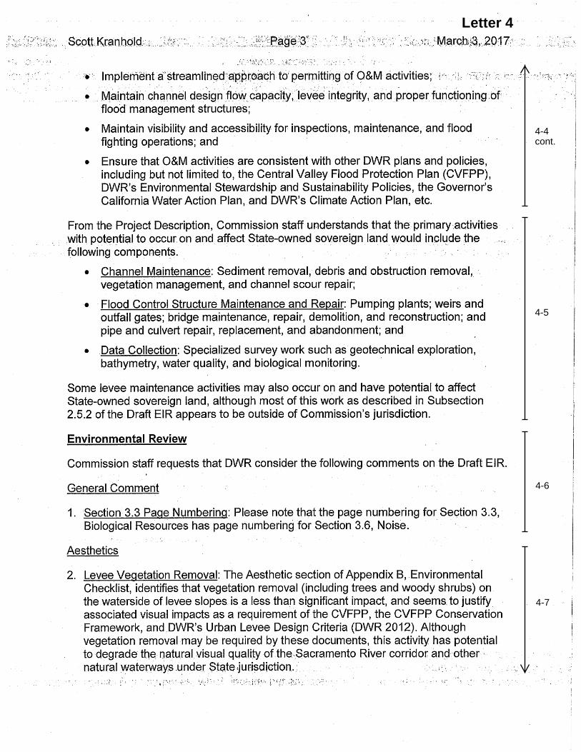
Letter 4
4-4 cont.
4-5
4-6
4-7

Letter 4
4-7 cont.
4-8
4-9
4-10
4-11

Letter 4
4-11 cont.
4-12
4-13

Letter 4
4-13 cont.
4-14
4-15

Letter 4
4-15 cont.
4-16
4-17

3. Comments and Responses
Environmental Permitting for Operations and Maintenance Project 3-75 130028.07 Final Environmental Impact Report January 2018
Letter 4 Response
California State Lands Commission March 3, 2017
4-1 The comment describes CSLC’s responsibilities, jurisdiction, and an explanation of Public Trust lands. As noted in Table 2-5 on page 2-56 of the Draft EIR, it is expected that a general permit will be obtained for permitted activities on facilities subject to CSLC jurisdiction. The text in Table 2-5 has been changed to reflect that a lease with the CSLC would also be required for the proposed project.
4-2 The proposed project would not preclude the use of State sovereign lands within CSLC’s jurisdiction and would maintain channels and waterways to function for flood flow in the future. DWR would obtain a general permit and lease from the CSLC upon approval of the proposed project.
4-3 The proposed project involves ongoing maintenance activities, including channel maintenance, which are designed to minimize flood risk by maintaining the structural integrity and extending the useful life of the flood protection system. The proposed project would not permanently obstruct navigation or the exercise of incidences of navigation. Most of the maintenance work and data collection activities would be done in the dry portions of the channels, thereby avoiding the obstruction of navigation. As noted in Response to Comment 4-1, DWR would obtain a general permit and lease for permitted activities on facilities subject to CSLC jurisdiction.
4-4 The comment is a summary of the proposed project objectives and does not address the environmental analysis in the Draft EIR.
4-5 The comment describes proposed project activities that are likely to occur on and affect State-owned sovereign land within the CSLC’s jurisdiction. See responses to Comments 4-1 and 4-2.
4-6 The comment addresses page numbering and does not address the environmental analysis in the Draft EIR. Page numbering in the Section 3.3, Biological Resources are correct.
4-7 As described on page 2-26 of the Draft EIR, levee vegetation removal would occur according to DWR’s levee vegetation management strategy using the levee tree assessment to make decisions on removal of trees and shrubs. As shown on Figure 2-7 of the Draft EIR, only certain sections of waterside slope of levees would have vegetation management (i.e., 20 feet from the crown). Levee vegetation management would primarily consist of limbing up and trimming of branches with some tree removal. Tree removal would occur less frequently and only for those trees that redirect or obstruct flows and/or have the potential to result in levee integrity issues (e.g., erosion, scouring, etc.). Unlike the proposed project maintenance activities, the West Sacrament Area Flood Control Agency Southport Sacramento River Early Implementation Project is a large

3. Comments and Responses
Environmental Permitting for Operations and Maintenance Project 3-76 130028.07 Final Environmental Impact Report January 2018
construction project that requires the removal of substantial amounts of trees and shrubs for the construction of slurry walls, setback levees, seepage berms and other structures. Further, the proposed levee vegetation management would occur on an annual basis and would be done gradually such that views of the levees from within the waterways would not result in a perceptible change in vegetation to users within channels and waterways, as described on pages B-3 to B-5 in Appendix B of the Draft EIR.
4-8 There are no regulations in particular that exempt the State from local regulations. However, there is a common law concept called sovereign immunity for every State in the U.S. This common law is employed differently by each of the states, and in California has been made through case law. "When [the state] engages in such sovereign activities as the construction and maintenance of its buildings, ... it is not subject to local regulations unless the Constitution says it is or the Legislature has consented to such regulation." (Hall v. City of Taft, 47 Cal. 2d 177, at p. 183 [302 P.2d 574]; also see City of Orange v. Valenti, 37 Cal. App. 3d 240 [112 Cal. Rptr. 379]). Nevertheless, the environmental analysis in the Draft EIR considers the local regulations and analyzes impacts relative to thresholds of significance (see Section 3.2 Air Quality in the Draft EIR) of each of the local air districts.
4-9 While the section did not list every kind of structural maintenance in the section, the modeling of emissions included a list of equipment, time, and area of disturbance, including from the activity of bridge repair, demolition, and reconstruction. Therefore, the analysis in the Draft EIR included emissions data for all structural maintenance activities provided in Table 2-2-4 on pages 2-19 and 2-20 of the Draft EIR.
4-10 Mitigation Measure 3.3-1c (page 3.3-91) is provided to minimize the potential introduction or spread of invasive plants during maintenance activities. It includes the preparation of an invasive species management plan which would be based on accepted best management practices for preventing the spread of invasive plants. A sentence was added to Measure 3.3-1c to clarify this. Measure 3.3-1c now reads:
Measure 3.3-1c (All): To minimize the potential for invasive plants to be introduced or spread during maintenance activities, a qualified biologist will work with maintenance yard staff as needed to develop an invasive species management plan that will include invasive plant prevention Best Management Practices (BMPs), based on Preventing the Spread of Invasive Plants: Best Management Practices for Land Managers (Cal-IPC, 2012). The plan would include BMPs to prevent the downstream spread of aquatic invasive plant propagules during physical removal of aquatic vegetation from channels.
This addition, alongside the other BMPs in the invasive species management plan, aims to prevent the spread of invasive plants during maintenance activities. The potential for maintenance activities to favor non-native species may vary by activity, location, spatial scale, year, and a number of other ecological factors. The reasonable approach is to

3. Comments and Responses
Environmental Permitting for Operations and Maintenance Project 3-77 130028.07 Final Environmental Impact Report January 2018
develop BMPs to prevent spread during maintenance activities, as discussed above and proposed in mitigation Measure 3.3-1c. In addition, while invasive plants are generally considered to have a negative effect on native species and their habitats, some invasive plants support habitat for native species such as Himalayan blackberry which provides habitat for tricolored blackbird and giant garter snake as discussed in Section 3.3.4.
4-11 Consultation with state and federal agencies would be carried out on a case by case basis depending on the circumstances of the maintenance activities being carried out and the species being protected. The level of consultation with state and federal agencies is not always equal, it must be appropriate for the species being protected.
Both CDFW and USFWS would be consulted on giant garter snake capture and relocation (mitigation Measure 3.3-1f) as well as other measures pertaining to giant garter snake and special-status nesting birds (mitigation Measures 3.3-1gg and 3.3-1hh). USFWS would be consulted if maintenance activities could result in take of valley elderberry longhorn beetle (mitigation Measure 3.3-1bb), and similarly for federally-listed vernal pool crustaceans (mitigation Measure 3.3-1cc). Take authorization for listed fish under FESA and CESA would be requested from the appropriate agencies (mitigation Measure 3.3-3d), including USFWS, NMFS, and CDFW.
DWR will use any applicable programmatic consultation agreements.
4-12 Project maintenance activities may result in take of state and federally listed species as stated under Impact 3.3-1 (Draft EIR Section 3.3 page 3.3-66). The following mitigation measures state that DWR would obtain take authorization from CDFW and/or USFWS as appropriate for potential take of listed species: 3.3-1t; 3.3-1bb; 3.3-1cc; 3.3-1dd; 3.3-1hh; 3.3-3d; and 3.3-3e. No additional environmental review pursuant to CEQA or the National Environmental Policy Act is necessary.
4-13 DWR responds to sea level rise and other consequences of climate change through implementation of the California Climate Adaptation Strategy. This is reflected in the 2017 CVFPP, and other DWR flood management planning documents. Sea level rise only very gradually affects DWR’s flood maintenance as described in the EIR, and has no practical direct impact on day-to-day operations of the FMO maintenance yards. Therefore, analysis of sea level rise impacts was not merited in the EIR. Please also see response to Comment 4-2.
4-14 The analysis provided on pages 3.4-41 through 3.4-45 in the Draft EIR explain that impacts to submerged cultural resources, including from bridge demolition and reconstruction, could result in a potentially significant impact on unidentified submerged cultural resources. Further, the Draft EIR on page 3.4-45 implements Mitigation Measures 3.4-1(a) and 3.4-3(b) to reduce potential impacts to less than significant levels through identification, consultation, avoidance, and data recovery of submerged cultural resources.

3. Comments and Responses
Environmental Permitting for Operations and Maintenance Project 3-78 130028.07 Final Environmental Impact Report January 2018
4-15 The baseline setting and regulatory setting Information on mercury and methylmercury conditions in waterways in the watersheds encompassing the project area were provided on pages 3.5-17 to 3.5-18 and 3.5-19 and 3.5-20 to 3.5-21, respectively. Furthermore, impacts related to water quality from implementation of maintenance activities in and adjacent to waterways by the proposed project, including mercury/methylmercury, were analyzed on pages 3.5-25 through 3.5-30 and includes mitigation measures to prevent the degradation of water quality from maintenance activities.
4-16 DWR does not expect maintenance activities under the EPOM project to result in longstanding changes to existing public access. There may, however, be changes to current public access on a temporary basis that are necessitated by the O&M activity. Given the wide variety of O&M activities covered by EPOM and the vast geographic scope of the project, it is not feasible to identify changes in public access at this point. Instead, when activities and locations are identified through project implementation, DWR will consider whether the activity will require restrictions on existing public access, recognizing the importance of public safety and public access.
4-17 DWR will post copies of those CEQA documents listed in the comment to the following website when they become available: http://water.ca.gov/floodmgmt/fmo/msb/env-permit.cfm.
February 16, 2017
Sent Via Email Only Mr. Scott Kranhold, Senior Environmental Scientist (Supervisor) Maintenance Environmental Support Branch Division of Flood Management, Flood Maintenance Office Department of Water Resources 3310 El Camino Avenue, Room 140 Sacramento, CA 95821 Environmental Permitting for Operation and Maintenance Draft Environmental Impact Report (SMAQMD # SAC201701703) Dear Mr. Kranhold: The Sacramento Metropolitan Air Quality Management District (SMAQMD) is obligated by State law1 to represent the citizens of Sacramento in influencing the decisions of other public and private agencies whose actions may have an adverse impact on air quality. It is in this spirit, SMAQMD staff provides the following comments on the Environmental Permitting for Operation and Maintenance project Draft Environmental Impact Report (DEIR).
1. The SMAQMD Board of Directors adopted thresholds of significance for particulate matter emissions (PM10 and PM2.5) in May 2015. The thresholds should be included in Table 3.2-4 and used to compare to project emissions in Sacramento County. The thresholds can be obtained on the SMAQMD’s website: http://www.airquality.org/LandUseTransportation/Documents/CH2ThresholdsTable5-2015.pdf
2. Due to its non-attainment status for ozone and particulate matter ambient air quality standards, SMAQMD requests all projects in Sacramento County implement the attached basic construction emission control practices regardless of the significance determination.
3. Generally, SMAQMD recommends selecting Sacramento County as the location of the project in the CalEEMod analysis, rather than using the air basin as the location, which was selected for this project analysis.
4. The CalEEMod analysis assumes the use of oxidation catalysts and tier 3 off-road equipment.
1 California Health and Safety Code §40961
Letter 5
5-1
5-2
5-3
5-4
5-5

a. Oxidation catalysts are not feasible or practical at this time and should not be
assumed in the CalEEMod analysis. This will impact the NOx emissions levels. b. Please include a discussion of how the use of tier 3 off-road equipment will be
implemented. 5. On page 3.2-9, there is a reference to 1,000 hours/year as the low use vehicle threshold
for the California Air Resources Board’s Off-Road Regulation. Please confirm the hours/year requirement.
6. All projects are subject to SMAQMD rules in effect at the time of construction. A complete listing of current rules is available at www.airquality.org or by calling 916-874-4800. Specific rules that may relate to construction activities are attached.
Please contact me at 916-874-4881 or [email protected] if you have any questions regarding these comments. Sincerely, /sent electronically/ Karen Huss Associate Air Quality Planner/Analyst Attachments Cc: Paul Philley, SMAQMD Sondra Spaethe, Feather River AQMD Matt Jones, Yolo Solano AQMD Yu-shuo Chang, Placer County APCD
Letter 5
5-5 cont.
5-6
5-7

BASIC CONSTRUCTION EMISSION CONTROL PRACTICES The following practices are considered feasible for controlling fugitive dust from a construction site. Control of fugitive dust is required by District Rule 403 and enforced by District staff.
Water all exposed surfaces two times daily. Exposed surfaces include, but are not limited to soil piles, graded areas, unpaved parking areas, staging areas, and access roads.
Cover or maintain at least two feet of free board space on haul trucks transporting soil, sand, or other loose material on the site. Any haul trucks that would be traveling along freeways or major roadways should be covered.
Use wet power vacuum street sweepers to remove any visible trackout mud or dirt onto adjacent public roads at least once a day. Use of dry power sweeping is prohibited.
Limit vehicle speeds on unpaved roads to 15 miles per hour (mph).
All roadways, driveways, sidewalks, parking lots to be paved should be completed as soon as possible. In addition, building pads should be laid as soon as possible after grading unless seeding or soil binders are used.
The following practices describe exhaust emission control from diesel powered fleets working at a construction site. California regulations limit idling from both on-road and off-road diesel powered equipment. The California Air Resources Board enforces the idling limitations.
Minimize idling time either by shutting equipment off when not in use or reducing the time of idling to 5 minutes [required by California Code of Regulations, Title 13, sections 2449(d)(3) and 2485]. Provide clear signage that posts this requirement for workers at the entrances to the site.
Although not required by local or state regulation, many construction companies have equipment inspection and maintenance programs to ensure work and fuel efficiencies.
Maintain all construction equipment in proper working condition according to manufacturer’s specifications. The equipment must be checked by a certified mechanic and determine to be running in proper condition before it is operated.
Lead agencies may add these emission control practices as Conditions of Approval (COA) or include in a Mitigation Monitoring and Reporting Program (MMRP).
Letter 5
5-8

SMAQMD Rules & Regulations Statement (revised 1/2017) The following statement is recommended as standard condition of approval or construction document language for all development projects within the Sacramento Metropolitan Air Quality Management District (SMAQMD): All projects are subject to SMAQMD rules in effect at the time of construction. A complete listing of current rules is available at www.airquality.org or by calling 916.874.4800. Specific rules that may relate to construction activities or building design may include, but are not limited to: Rule 201: General Permit Requirements. Any project that includes the use of equipment capable of releasing emissions to the atmosphere may require permit(s) from SMAQMD prior to equipment operation. The applicant, developer, or operator of a project that includes an emergency generator, boiler, or heater should contact the SMAQMD early to determine if a permit is required, and to begin the permit application process. Other general types of uses that require a permit include, but are not limited to, dry cleaners, gasoline stations, spray booths, and operations that generate airborne particulate emissions. Portable construction equipment (e.g. generators, compressors, pile drivers, lighting equipment, etc.) with an internal combustion engine over 50 horsepower is required to have a SMAQMD permit or a California Air Resources Board portable equipment registration (PERP) (see Other Regulations below). Rule 402: Nuisance. The developer or contractor is required to prevent dust or any emissions from onsite activities from causing injury, nuisance, or annoyance to the public. Rule 403: Fugitive Dust. The developer or contractor is required to control dust emissions from earth moving activities, storage or any other construction activity to prevent airborne dust from leaving the project site. Rule 414: Water Heaters, Boilers and Process Heaters Rated Less Than 1,000,000 BTU PER Hour. The developer or contractor is required to install water heaters (including residence water heaters), boilers or process heaters that comply with the emission limits specified in the rule. Rule 417: Wood Burning Appliances. This rule prohibits the installation of any new, permanently installed, indoor or outdoor, uncontrolled fireplaces in new or existing developments. Rule 442: Architectural Coatings. The developer or contractor is required to use coatings that comply with the volatile organic compound content limits specified in the rule.
Letter 5
5-8 cont.

Rule 453: Cutback and Emulsified Asphalt Paving Materials. This rule prohibits the use of certain types of cut back or emulsified asphalt for paving, road construction or road maintenance activities. Rule 460: Adhesives and Sealants. The developer or contractor is required to use adhesives and sealants that comply with the volatile organic compound content limits specified in the rule. Rule 902: Asbestos. The developer or contractor is required to notify SMAQMD of any regulated renovation or demolition activity. Rule 902 contains specific requirements for surveying, notification, removal, and disposal of asbestos containing material.
Other Regulations (California Code of Regulations (CCR))
17 CCR, Division 3, Chapter 1, Subchapter 7.5, §§93105 Naturally Occurring Asbestos: The developer or contractor is required to notify SMAQMD of earth moving projects, greater than 1 acre in size in areas “Moderately Likely to Contain Asbestos” within eastern Sacramento County. The developer or contractor is required to comply with specific requirements for surveying, notification, and handling soil that contains naturally occurring asbestos.
13 CCR, Division 3, Chapter 9, Article 5, Portable Equipment Registration Program: The developer or contractor is required to comply with all registration and operational requirements of the portable equipment registration program such as recordkeeping and notification.
13 CCR, Division 3, Chapter 9, Article 4.8, §2449(d)(2) and 13 CCR, Division 3, Chapter 10, Article 1, §2485 regarding Anti-Idling: Minimize idling time either by shutting equipment off when not in use or reducing the time of idling to 5 minutes. These apply to diesel powered off-road equipment and on-road vehicles, respectively.
Letter 5
5-8 cont.

3. Comments and Responses
Environmental Permitting for Operations and Maintenance Project 3-85 130028.07 Final Environmental Impact Report January 2018
Letter 5 Response
Sacramento Air Quality Management District February 16, 2017
5-1 The comment states the obligation and duty of the SMAQMD to represent the citizens of Sacramento and does not address the environmental analysis in the Draft EIR.
5-2 The following text changes have been made to reflect the SMAQMD PM2.5 and PM10 standards in Table 3.2-4 of the Draft EIR as noted in the comment:
TABLE 3.2-4 AIR DISTRICT THRESHOLDS OF SIGNIFICANCE FOR MAINTENANCE ACTIVITIES1
Air District Counties ROG NOx PM10 PM2.5
Butte County AQMD Butte 137 ppd 137 ppd 80 ppd --
Colusa County APCD Colusa -- -- -- --
Feather River AQMD2 Yuba, Sutter 4.5 tpy2 4.5 tpy2 80 ppd
Glenn County APCD Glenn -- -- -- --
Sacramento Metropolitan AQMD
Sacramento -- 85 ppd 80 ppd 82 ppd
Tehama County APCD Tehama 137 ppd 137 ppd 137 ppd --
Placer County APCD Placer 82 ppd 82 ppd 82 ppd --
Yolo-Solano AQMD3 Yolo, Solano (part) 54 ppd3 54 ppd3 80 ppd --
Lake County AQMD4 Lake 54 ppd4 54 ppd4 82 ppd4 (exhaust)
54 ppd4 (exhaust)
NOTES: 1. ppd = Pounds per Day; tpy = Tons per Year 2. Feather River AQMD threshold for construction related NOx emissions is calculated at 25 ppd multiplied by
the length in project days not to exceed the 4.5 tons/year threshold. Since all levee maintenance activities would occur continuously over many years, the FRAQMD’s maximum allowed ROG and NOx threshold of 4.5 tpy is used to determine significance.
3. Yolo-Solano AQMD has established thresholds of 10 tons per year for ROG and NOx, which would equate to approximately 54 pounds per day.
4. Lake County AQMD does not have established CEQA thresholds of significance, but does recommend applying the Bay Area Air Quality Management District thresholds.
SOURCE: Butte County AQMD, 2014; Feather River AQMD, 2010; Lake County AQMD, 2015; Placer County APCD, 2012; Sacramento Metropolitan AQMD, 2009; Tehama County APCD, 2015; Yolo-Solano AQMD, 2007; Yolo-Solano AQMD, 2015.
5-3 In May 2012, DWR adopted the DWR Climate Action Plan-Phase I: Greenhouse Gas Emissions Reduction Plan (GGERP), which details DWR’s efforts to reduce its greenhouse gas (GHG) emissions, consistent with Executive Order S-3-05 and the Global Warming Solutions Act of 2006 (Assembly Bill [AB] 32). DWR also adopted the Initial Study/Negative Declaration prepared for the GGERP in accordance with the CEQA Guidelines review and public process. The GGERP and the Initial Study/Negative Declaration were incorporated by reference in the Draft EIR, Appendix B, Environmental Checklist and are available at: http://www.water.ca.gov/climatechange/CAP.cfm. The GGERP provides estimates of historical (back to 1990), current, and future GHG emissions related to operations, construction, maintenance, and business practices (e.g., building-related energy use). The GGERP specifies aggressive 2020 and 2050 emission

3. Comments and Responses
Environmental Permitting for Operations and Maintenance Project 3-86 130028.07 Final Environmental Impact Report January 2018
reduction goals and identifies a list of GHG emissions reduction measures to achieve these goals, including DWR’s contract specifications on contractors’ use of best management practices (BMPs) and vehicle and fleet conversion to higher efficiency engines. The BMPs included as policy within the GGERP applicable to the proposed project are listed in the basic construction emission control practices provided by SMAQMD. The proposed project, therefore, is consistent with DWR’s GGERP and with SMAQMD air quality emissions policies.
5-4 As described on page 2-5 and shown in Figures 2-4 through 2-6b of the Draft EIR, the proposed project is located in many different counties. As stated on page 3.2-1, the proposed project activities are located in the jurisdiction of eight different air quality management districts, including SMAQMD. Therefore, CalEEMod was run for the activities in each separate air quality management district.
5-5 Use of oxidation catalysts was removed from the text in the Draft EIR and the emissions modeling redone to reflect the use of Tier 3 engines. Table 3.2-6 on page 3.2-13 of the Draft EIR has been revised as follows:
TABLE 3.2-6 CRITERIA POLLUTANT EMISSIONS FROM MAINTENANCE ACTIVITIES1, 2
Activity ROG
(ppd/tpy) NOx
(ppd/tpy) PM10
(ppd/tpy) PM2.5
(ppd/tpy)
Levee Maintenance – Erosion Repair1 0.3/<0.1 5.04.2/<0.1 10.0/<0.1 1.2/<0.1
Channel Maintenance – Large Sediment Removal1
2.3/<0.1 50.845.0/0.5 76.8/0.8 13.1/0.1
Structure Maintenance – Culvert Repair/Replacement1
0.3/<0.1 5.34.4/0.1 11.8/0.2 1.4/<0.1
Deferred maintenance activities First 2 years – Culvert Repair/Replacement2
0.3/<0.1 5.64.5/0.1 12.6/0.1 1.5/<0.1
Data Collection – Geotechnical Boring1 0.3/<0.1 5.54.5/<0.1 6.9/<0.1 0.9/<0.1
NOTES: ppd = Pounds per Day; tpy = Tons per Year 1. Levee, Channel, and Structure Maintenance as well as Data Collection activities were modeled with CalEEMod
version 2016.3.1 and incorporating information provided by DWR. Model output data is included in Appendix C. A few key assumptions include: • Levee Maintenance – Erosion Repair: Take up to 2 weeks to complete, 0.5 acre disturbed, 8-hour day work
shifts, potential equipment including excavators (1), graders (1), dump trucks (2), and water trucks (1). • Channel Maintenance – Large Sediment Removal: Take up to 1 month to complete, 20 acres potentially
disturbed, up to 50,000 cubic yards sediment removed, 10-hour day work shifts, equipment including bulldozers (2), roller/compactors (1), graders (2), loaders (2), small scrapers (2), excavators (2), dump trucks (4), water trucks (2).
• Structure Maintenance – Culvert Repair/Replacement: Take up to 10 weeks to complete, 0.5 acre disturbed, 8-hour day work shifts, equipment including excavators (1), graders (1), cranes (1, used occasionally), dump trucks (2), and water trucks (1).
• Data Collection – Geotechnical Boring: Take up to 2 days to complete, 8-hour day work shifts, equipment including rotary drill rigs (1) and shallow draft barge (1) for in-water borings.
• All off-road equipment is assumed to be equipped with Tier 3 engines and oxidation catalysts that would reduce NOx by 20%.
2. Structural maintenance activities that would occur the first 2years were modeled based on the following assumptions. Modeling Output data is included in Appendix C. • Activities would take up to one month to complete, 0.5 acre disturbed, 8-hour day work shifts, equipment
including excavators (1), graders (1), cranes (1, used occasionally), dump trucks (2), and water trucks (1). • All off-road equipment is assumed to be equipped with Tier 3 engines and oxidation catalysts that would
reduce NOx. SOURCE: CARB, 2008; DWR, 2016

3. Comments and Responses
Environmental Permitting for Operations and Maintenance Project 3-87 130028.07 Final Environmental Impact Report January 2018
Through implementation of the GGERP, DWR will be able to maintain Tier 3 requirements for the proposed EPOM activities. Further, as stated on page 3.2-8 of the Draft EIR, DWR is in the process of phasing out all Tier 0 through Tier 3 vehicles to be replaced by cleaner Tier 4 vehicles. Also, see Response to Comment 5-3 regarding DWR’s implementation of BMPs.
5-6 The following text from page 3.2-9 of the Draft EIR has been revised to reflect the correct number of hours for low-use exemption vehicles as reported on the California Air Resources Board’s Website at https://www.arb.ca.gov/msprog/ordiesel/faq/lowusefaq.pdf:
Some heavy equipment vehicles such as dozers are only used during flood response efforts and are considered low-use equipment. These vehicles are compliant if they are run no more than 200 1,000 hours each year.
5-7 Through implementation of permitted activities, DWR will comply with applicable SMAQMD rules.
5-8 The comment is an attachment to the letter that includes SMAQMD’s basic construction emission control practices and SMAQMD Rules & Regulations Statement for development projects in their jurisdiction. See also Response to Comment 5-3 for information on DWR’s BMPs.

STATE OF CALIFORNIA – NATURAL RESOURCES AGENCY EDMUND G. BROWN, JR., Governor
DELTA PROTECTION COMMISSION 2101 Stone Blvd., Suite 210 West Sacramento, CA 95691 (916) 375-4800 / FAX (916) 376-3962www.delta.ca.gov
Skip Thomson, Chair Solano County Board of Supervisors
Oscar Villegas, Vice Chair Yolo County Board of Supervisors
Diane Burgis Contra Costa County Board of Supervisors
Don Nottoli Sacramento County Board of Supervisors
Chuck Winn San Joaquin County Board of Supervisors
Juan Antonio Banales Cities of Contra Costa and Solano Counties
Christopher Cabaldon Cities of Sacramento and Yolo Counties
Susan Lofthus Cities of San Joaquin County
Michael Scriven Central Delta Reclamation Districts
Justin van Loben Sels North Delta Reclamation Districts
Robert Ferguson South Delta Reclamation Districts
Karen Ross CA Department of Food and Agriculture
John Laird CA Natural Resources Agency
Brian Bugsch CA State Lands Commission
Brian Kelly CA State Transportation Agency
Ex Officio Members
Honorable Jim Frazier California State Assembly
Honorable Cathleen Galgiani California State Senate
March 3, 2017
Mr. Scott Kranhold, Senior Environmental Scientist (Supervisor)Maintenance Environmental Support BranchDivision of Flood Management, Flood Maintenance OfficeDepartment of Water Resources3310 El Camino Avenue, Room 140Sacramento, CA 95821
Re: Draft Environmental Impact Report for Environmental Permitting forOperation and Maintenance (SCH #2015052035)
Dear Mr. Kranhold:
Thank you for providing the Delta Protection Commission (Commission) theopportunity to review the Draft Environmental Impact Report (EIR) for theEnvironmental Permitting for Operation and Maintenance Project (Project). TheProject involves maintenance activities associated with Sacramento River FloodControl Project and Middle Creek Project facilities that would require permit orother regulatory approvals or agreements.
The Commission is a state agency charged with ensuring orderly, balancedconservation and development of Delta land resources and improved floodprotection. Proposed local government projects within the Primary Zone of theLegal Delta, which includes portions of Contra Costa, Sacramento, San Joaquin,Solano, and Yolo counties, must be consistent with the Commission’s Land Useand Resource Management Plan (LURMP). Proposed Department of WaterResources actions are not subject to consistency requirements with the LURMPsince the Project is sponsored by a state agency. However, the Commissionreviewed the project for possible impacts on the resources of the Primary Zone.
The Commission is supportive of projects that ensure that Delta flood protectioninfrastructure is well maintained and operating effective and efficiently, whileminimizing potential impacts on wildlife habitat. This project will help reducethe overall cost of environmental compliance and permitting. We appreciateyour efforts to incorporate our comments, dated June 8, 2015, on the Notice ofPreparation. We reiterate our recommendation in that letter to show the legalboundary of the Delta primary and secondary zones in the figures to assistdocument reviewers in assessing potential effects on wildlife habitat.
Thank you for the opportunity to provide input. Please contact Blake Roberts,Senior Environmental Planner, at (916) 375 4237 for any questions regarding thecomments provided.
Letter 6
6-1
6-2

Letter 6
3. Comments and Responses
Environmental Permitting for Operations and Maintenance Project 3-91 130028.07 Final Environmental Impact Report January 2018
Letter 6 Response
Delta Protection Commission March 3, 2017
6-1 The comment is noted that the proposed project is not subject to consistency requirements with the LURMP since it is sponsored by a State agency. See also response to Comment 6-2.
6-2 The comment supports the proposed project and asks that a figure with the legal boundary of the Delta, including primary and secondary zones, be included in the Final EIR to assist reviewers in assessing potential impacts on wildlife habitat. Please see revised Figure 2-4 for the inclusion of the boundary of the legal Delta.

Clear Lake
YoloBypass
Butte Basin
Lake Berryessa
Folosom Lake
Lake Oroville
Camanche Reservoir
Sutter Bypass
LodiLodi
DavisDavis
ChicoChico
AuburnAuburn
WoodlandWoodland
Orovil leOrovil le
PetalumaPetaluma
Yuba CityYuba City
VacavilleVacaville
PittsburgPittsburg
ClearlakeClearlake
Marysvil leMarysvil le
VallejoVallejo
SacramentoSacramento
Figure 2-4Maintenance Area Location
Source: DWR 2015Date: April 21, 2017
0 5 10 15 202.5MilesDivision of Flood
ManagementFlood Maintenance Office
Sutter Yard Area of Responsibility
Sacramento Yard Area of ResponsibilityDWR Maintained Channels
DWR Maintained Levees
Flood Bypasses Delta Primary Zone
Delta Secondary Zone

Sent Via E-Mail
March 3, 2017
Scott Kranhold, Senior Environmental ScientistCalifornia Department of Water ResourcesDivision of Flood Management3310 El Camino Avenue, Room 100Sacramento, CA [email protected]
Subject: Draft Environmental Impact Report for Environmental Permitting for Operation and Maintenance (State Clearinghouse No. 2015052035)
Dear Mr. Kranhold:
The Sacramento Municipal Utility District (SMUD) appreciates the opportunity to provide comments on the Draft Environmental Impact Report (DEIR) for Environmental Permitting Operations and Maintenance (Project). SMUD is the primary energy provider for Sacramento County and the proposed Project area. SMUD’s vision is to empower our customers with solutions and options that increase energy efficiency, protect the environment, reduce global warming, and lower the cost to serve our region. As a Responsible Agency, SMUD aims to ensure that the proposed Project limits the potential for significant environmental effects on SMUD facilities, employees, and customers.
It is our desire that the DEIR for Environmental Permitting Operations and Maintenance will acknowledge any Project impacts related to the following:
Overhead and or underground transmission and distribution line easements. Please view the following links on smud.org for more information regarding transmission encroachment:
o https://www.smud.org/en/business/customer-service/support-and-services/design-construction-services.htm
o https://www.smud.org/en/do-business-with-smud/real-estate-services/transmission-right-of-way.htm
Utility line routingElectrical load needs/requirementsEnergy Efficiency
SMUD would like to be involved with discussing the above areas of interest as well as discussing any other potential issues. We aim to be partners in the efficient and sustainable delivery of the proposed Project. Please ensure that the information included in this response is conveyed to the Project planners and the appropriate Project proponents.
Letter 7
7-1

Environmental leadership is a core value of SMUD and we look forward to collaborating with you on this Project. Again, we appreciate the opportunity to provide input on this DEIR. If you have any questions regarding this letter, please contact Jose Bodipo-Memba at [email protected] or (916)732-6493.
Sincerely,
Angela C. McIntireRegional & Local Government Affairs Sacramento Municipal Utility District6301 S Street, Mail Stop A313Sacramento, CA [email protected]
Cc: Jose Bodipo-Memba, SMUD
Letter 7
7-1 cont.

3. Comments and Responses
Environmental Permitting for Operations and Maintenance Project 3-95 130028.07 Final Environmental Impact Report January 2018
Letter 7 Response
Sacramento Municipal Utility District March 3, 2017
7-1 DWR will contact SMUD staff to discuss these issues and any other potential issues related to the proposed project maintenance activities to prevent disturbance and interruption of SMUD infrastructure and delivery of power.

Letter 8
8-1

Letter 8
8-1 cont.

Letter 8
8-1 cont.

Letter 8
8-1 cont.

Letter 8
8-1 cont.

Letter 8
8-1 cont.

Letter 8
8-1 cont.

Letter 8
8-1 cont.

Letter 8
8-1 cont.

Letter 8
8-1 cont.

Letter 8
8-1 cont.

Letter 8
8-1 cont.
Letter 8
8-1 cont.

Letter 8
8-1 cont.

Letter 8

3. Comments and Responses
Environmental Permitting for Operations and Maintenance Project 3-113 130028.07 Final Environmental Impact Report January 2018
Letter 8 Response
United Auburn Indian Community (UAIC) March 17, 2017
8-1 The comments made in this letter were on Section 3.4 – Cultural Resources of the Draft EIR. Subsequent to these comments, a revised version of this section was published in the RDEIR which addressed the comments. Also see responses to comments to Letter 9 on the RDEIR.

Letter 9
9-1

Letter 9
9-2
9-5
9-1 cont.
9-7
9-3
9-4
9-6

Letter 9
9-10
9-8
9-11
9-7 cont.
9-9
9-12

Letter 9
9-12 cont.
9-13
9-14

Letter 9
9-16
9-15
9-17

Letter 9
9-17 cont.
9-18
9-20
9-19

Letter 9
9-22
9-21
9-24
9-23

Letter 9
9-26
9-27
9-24 cont.
9-25

Letter 9
9-29
9-28

Letter 9
9-31
9-32
9-33
9-29 cont.
9-30

Letter 9
9-34
9-36
9-33 cont.
9-37

Letter 9
9-37 cont.
9-38

Letter 9
9-40
9-41
9-38 cont.
9-39

Letter 9
9-41 cont.

Letter 9
9-41 cont.
9-42

3. Comments and Responses
Environmental Permitting for Operations and Maintenance Project 3-131 130028.07 Final Environmental Impact Report January 2018
Letter 9 Response
United Auburn Indian Community (UAIC) November 3, 2017
9-1 DWR appreciates United Auburn Indian Community's (UAIC) active participation in the CEQA compliance process for the EPOM project. UAIC’s March 17, 2017 comment letter on the Draft EIR was clearly written, and DWR made several changes to the Draft EIR in response to the initial letter. Major areas of revision to the draft cultural resources chapter include that while the draft EIR indicated that, with mitigation, impacts would be reduced to a less than significant level for resources of concern to tribes, the recirculated cultural resources chapter of the Draft EIR, the RDEIR, recognizes the potential for significant impacts to resources of concern to tribes. UAIC had commented that impacts could not, with certainty, be reduced to a less than significant level. After considering UAIC's comments, DWR changed the impact conclusion to potentially significant for resources of concern to tribes. DWR believes that the potentially significant finding is appropriate due to the fact that a limited portion of the EPOM project area (174,541-acre or approximately 272-square-miles) will be subject to any specific maintenance activity. While particularly invasive activities (i.e., ground disturbing activities) could potentially have a significant effect on cultural resources, it is likely that the majority of project activities will not frequently co-occur with resources of concern to tribes.
Another area of revision focused on addressing comments regarding whether project specific studies should be deferred until just prior to when the maintenance work will be conducted. The reason for phasing the work on an annual basis are now better described in the RDEIR, including an explanation regarding how the project activities cannot currently be feasibly defined at a level of detail necessary to support planning for the necessary additional studies. This section also now more fully describes the steps that will be taken on an annual basis to identify maintenance work that will be conducted and cultural resources studies that will be conducted in advance of maintenance activities, as well as providing for future tribal consultation regarding project implementation.
Other significant changes to the chapter were made to clarify how tribes will have an opportunity through continued consultation to identity resources of concern, as well as participate in the implementation of the project. The RDEIR also provides additional clarity regarding tribal involvement in the inventory, evaluation and mitigation of tribal cultural resources, and now includes additional detail about the preparation of separate documentation for resources of concern to tribes, as appropriate. The RDEIR now describes how the annual list of maintenance activities will be used by DWR to consult with tribes. DWR decided to recirculate a revised Section 3.4 – Cultural Resources in the RDEIR and consult with UAIC during the 45-day comment period, recognizing that further edits could be made to the section based on future consultations with UAIC. Before publishing the RDEIR, DWR notified UAIC of its intent to do so and of the plan to consult during the 45-day comment period. A few days after the RDEIR was

3. Comments and Responses
Environmental Permitting for Operations and Maintenance Project 3-132 130028.07 Final Environmental Impact Report January 2018
published, DWR followed up with UAIC to schedule consultation meetings. To date, DWR has participated in three conference calls with the UAIC to discuss the project and the tribe's concerns. DWR revised the RDEIR based on input from the tribe during consultation and from the comment letter on the RDEIR. The EPOM EIR must be certified in order to support work that is in the direct interest of public health and safety, and DWR is required to meet externally-imposed deadlines to complete this important work. DWR appreciates UAIC’s efforts and involvement in this important public safety project. As requested by UAIC, their comments submitted on March 17, 2017 will be included in the administrative record.
9-2 There is a very detailed project description in the EIR outlining all of the activities of the EPOM project. For the most part, the project described in the EIR reflects the continuation of operation and maintenance activities that have been occurring for decades. The EIR addresses a project, not a program. The EIR is a project level EIR, with some aspects of the work being covered in a programmatic manner. The project has no end date and could cover activities extending many years. The CVFPP is a critical planning document that guides California’s participation in managing flood risk along the Sacramento River and San Joaquin River systems. The CVFPP proposes a system-wide investment approach for integrated flood management in areas protected by the facilities of the State Plan of Flood Control (SPFC). Management actions identified in the CVFPP include operations and maintenance of the SPFC. The Flood Maintenance Office within DWR is responsible for ongoing operations and maintenance for certain portions of the Sacramento River Flood Control Project (SRFCP), which is a component of the SPFC. The EIR supports DWR’s routine O&M work on the SRFCP. Other facilities that comprise the SPFC are maintained by various local maintaining agencies. EPOM is intended to implement, in part, the CVFPP. The CVFPP EIR also has informed the development of the EPOM EIR. DWR does not have regulatory authority over other maintaining agencies such as reclamation districts, who plan for their own activities. DWR is, however, responsible for making some grants of state funds to some of these entities. The Central Valley Flood Protection Board, which adopted the CVFPP, also has limited regulatory authority over these entities, and their activities are guided by local flood plans as well as USACE O&M manuals.
9-3 The last sentence of paragraph 1, on RDEIR page 3.4-3, has been edited to reflect this comment.
Consultations with tribes affiliated with the EPOM project area have indicated that resources with tribal values are known to be present in the project area, including: Native American archaeological sites, cemeteries and burial sites, shrines, sanctified cemeteries, puberty sites, veneration sites, dedication sites, termination sites, birth sites, medicinal sites, prayer sites, gathering areas, and fishing sites, as well as plants, animals, soils and water resources that tribes have indicated are vital to their well-being.
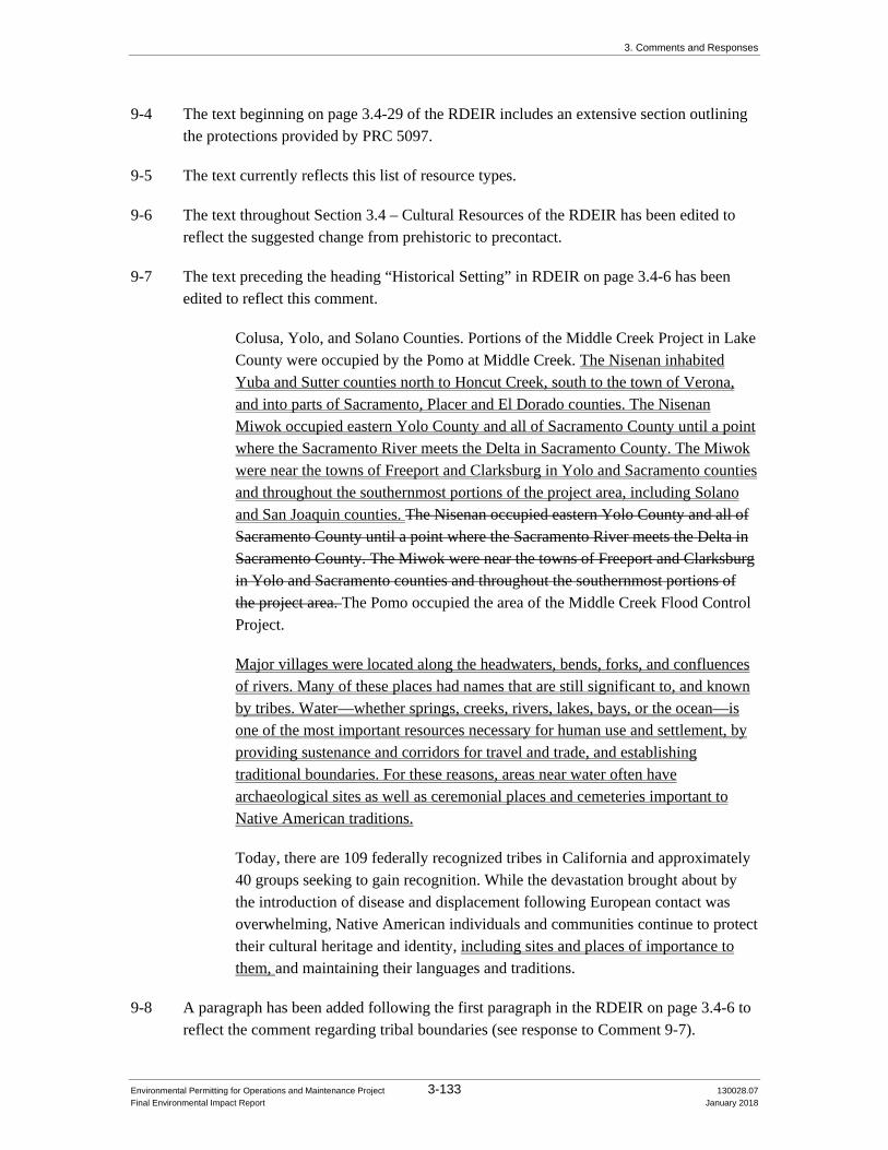
3. Comments and Responses
Environmental Permitting for Operations and Maintenance Project 3-133 130028.07 Final Environmental Impact Report January 2018
9-4 The text beginning on page 3.4-29 of the RDEIR includes an extensive section outlining the protections provided by PRC 5097.
9-5 The text currently reflects this list of resource types.
9-6 The text throughout Section 3.4 – Cultural Resources of the RDEIR has been edited to reflect the suggested change from prehistoric to precontact.
9-7 The text preceding the heading “Historical Setting” in RDEIR on page 3.4-6 has been edited to reflect this comment.
Colusa, Yolo, and Solano Counties. Portions of the Middle Creek Project in Lake County were occupied by the Pomo at Middle Creek. The Nisenan inhabited Yuba and Sutter counties north to Honcut Creek, south to the town of Verona, and into parts of Sacramento, Placer and El Dorado counties. The Nisenan Miwok occupied eastern Yolo County and all of Sacramento County until a point where the Sacramento River meets the Delta in Sacramento County. The Miwok were near the towns of Freeport and Clarksburg in Yolo and Sacramento counties and throughout the southernmost portions of the project area, including Solano and San Joaquin counties. The Nisenan occupied eastern Yolo County and all of Sacramento County until a point where the Sacramento River meets the Delta in Sacramento County. The Miwok were near the towns of Freeport and Clarksburg in Yolo and Sacramento counties and throughout the southernmost portions of the project area. The Pomo occupied the area of the Middle Creek Flood Control Project.
Major villages were located along the headwaters, bends, forks, and confluences of rivers. Many of these places had names that are still significant to, and known by tribes. Water—whether springs, creeks, rivers, lakes, bays, or the ocean—is one of the most important resources necessary for human use and settlement, by providing sustenance and corridors for travel and trade, and establishing traditional boundaries. For these reasons, areas near water often have archaeological sites as well as ceremonial places and cemeteries important to Native American traditions.
Today, there are 109 federally recognized tribes in California and approximately 40 groups seeking to gain recognition. While the devastation brought about by the introduction of disease and displacement following European contact was overwhelming, Native American individuals and communities continue to protect their cultural heritage and identity, including sites and places of importance to them, and maintaining their languages and traditions.
9-8 A paragraph has been added following the first paragraph in the RDEIR on page 3.4-6 to reflect the comment regarding tribal boundaries (see response to Comment 9-7).

3. Comments and Responses
Environmental Permitting for Operations and Maintenance Project 3-134 130028.07 Final Environmental Impact Report January 2018
Regarding the Tribal Territories Map, while DWR recognizes that the UAIC community has developed their own tribal boundaries map, EPOM includes the ancestral territory of numerous tribal entities. Many of these tribal entities have also created their own tribal boundaries, which sometimes overlap the boundaries of other tribes. For this reason, the EIR includes a graphic showing tribal territories based on published literature, therefore, DWR will be using the tribal boundary map that was provided in the RDEIR. During project implementation, DWR will use this tribal boundary map and boundary maps submitted by UAIC and other affiliated tribes.
9-9 The text on page 3.4-6, paragraph 2 of the RDEIR, has been edited to reflect this comment.
Today, there are 109 federally recognized tribes in California and approximately 40 groups seeking to gain recognition. While the devastation brought about by the introduction of disease and displacement following European contact was overwhelming, Native American individuals and communities continue to protect their cultural heritage and identity, including sites and places of importance to them, and maintaining their languages and traditions.
9-10 The last sentence of paragraph 4 on page 3.4-6 of the RDEIR has been edited to reflect this comment.
Native American communities, many of which were dependent upon the mission system, did not fare so well continued to be negatively impacted by the expansion of Euroamerican settlers into their traditional territories.
9-11 A sentence has been added to paragraph 1 on page 3.4-7 of the RDEIR, to reflect this comment.
Portions of some sacred and religious places within levees and other historical features have been removed and replaced with sterile soil. However, even though the burials and cultural items may have been removed in some instances, the physical places remain and native soils may still be present.
9-12 The project area for EPOM encompasses approximately 175,000 acres and covers operations and maintenance activities that will occur for many years. Some of these activities have limited or no potential to impact cultural resources, while other activities could potentially cause impacts. Please see page 2-15 of the Draft EIR, Table 2-3 Acreage of Areas Maintained by DWR Maintenance Yards. This table provides insight into how much area the DWR actively maintains in comparison to the remainder of the project area. DWR maintained levees: 4,384 acres; actively maintained channel areas: 17,882 acres; remainder of channel area of maintenance responsibility: 152,275 acres for a total project area of 174,541 acres. With a high uncertainty of activities within 152,275
3. Comments and Responses
Environmental Permitting for Operations and Maintenance Project 3-135 130028.07 Final Environmental Impact Report January 2018
acres along with 17,882 acres of maintained channel with various activities, record searches and surveys are not being conducted for the EPOM project EIR.
Alternatively, implementation of the mitigation measures in the EPOM EIR will result in the identification on an annual basis of project activities at specific locations that need additional record searches, surveys, and tribal consultation. Prior to project implementation, DWR will develop an annual maintenance list for project implementation that will be preceded by a program of detailed inventories and comprehensive field surveys and other measures as outlined in Mitigation Measure 3.4-2(a) (RDEIR page 3.4-48). Pilot studies are not necessary because comprehensive inventories will be conducted prior to project implementation for all activities with the potential to impact cultural resources. This would include work in Maintenance Areas 4, 9, and 16. As part of this process, DWR will consult with tribes to obtain information about resources that have been identified, such as the information provided by UAIC in their sensitivity map and will consider tribal monitoring as part of their program for implementation. This process will provide for more meaningful consultations with the tribes and other interested parties on the potential impacts to cultural and tribal resources of specific project activities.
9-13 Mitigation banking for biological resources is a very well developed process consisting of numerous existing and fully operational mitigation banks. The use of mitigation banking for biological resource impacts is also fully supported by regulatory agencies. There is no similar program for cultural resources and developing an alternative process for EPOM is beyond the scope of this project. Furthermore, the majority of the actions covered by EPOM are not on DWR land and are permitted through maintenance easements making the long term management of sites challenging. Because this project includes a large geographic area and involves multiple Native American tribes, DWR believes it is more appropriate to develop creative mitigation when the resource and affiliated tribes are identified, so that the affiliated tribes can communicate their preferences to DWR.
9-14 Very early in the process of developing the Draft EIR, DWR thought that this area might need some expedited maintenance and requested that inventories be conducted of the historic period features to determine if they were significant. DWR realized that maintenance to remove sediment from the Sutter Bypass Collecting Canals (Canals) would need to occur before the EPOM EIR would be finalized; therefore, DWR elected to permit the maintenance of the Canals separately. A CEQA document (IS/MD) was prepared and approved in October 2016 for maintenance of all 60 miles of the Canals. Prior to approval, DWR submitted letters to tribes affiliated with the areas of the plan to conduct CEQA analysis on maintenance for this area. UAIC was provided pre-CEQA information, and a final email notification was sent to UAIC on July 21, 2016 informing them that the CEQA IS/MND was available for public comment. The CEQA document was written to address the need for tribal engagement as indicated in Measure (CUL-2): “When specific locations maintenance activities are identified, DWR will complete a

3. Comments and Responses
Environmental Permitting for Operations and Maintenance Project 3-136 130028.07 Final Environmental Impact Report January 2018
cultural resources investigation that includes, at a minimum: …Letters about the Project will be sent to Native American Tribes who have traditionally used the Project area. Letters will inform the Tribes of DWR’s policy of consultation and ask for the Tribes to help with the identification of archaeological resources in the Project area…”
The planned work to remove sediment has been delayed; however, the bridge replacement and repair work has moved forward. In line with CEQA Measure CUL-2, UAIC and other tribes were notified of the bridge replacement and repair maintenance project that was analyzed in the CEQA document. Tribes were invited to meet in the field through the NHPA Section 106 consultation process. UAIC attended a field visit with DWR and USACE staff on October 24, 2017.
Any future maintenance (e.g., sediment removal, vegetation management, etc.) actions in this area that are covered by the Canal’s CEQA document will also be covered by EPOM’s EIR and thus will comply with EPOM’s EIR, permits, and other authorizations, including implementing the mitigation measures in the RDEIR, including consultation with tribes that are affiliated with this area. Beyond this compliance, any future maintenance that requires federal permits will also require consultation with SHPO and the tribes through the NHPA Section 106 process.
SBFCA is not involved with required maintenance of the Canals.
9-15 The reasons for deferring the inventory, evaluation, and mitigation are described in response to Comments 9-12 and 9-20. As EPOM actions are planned, updated records searches, field surveys and Native American consultation will be conducted and information from tribes regarding resources of concern will be requested. At that time, the UAIC will be asked to share its sensitivity map and list of resources that are not recorded in the CHRIS. Project implementation will be preceded by a program of detailed inventories and comprehensive field surveys and other measures as outlined in Mitigation Measure 3.4-2(b) (RDEIR page 3.4-50). Regarding whether project implementation will be modified based on cultural resource findings, avoidance and preservation in place will be the first choice. However, the EPOM project is required to keep the flood control system operational, therefore it may not be possible to avoid all resources if they are present in areas where maintenance must be conducted to protect life and property.
9-16 The reasons for deferring the inventory, evaluation, and mitigation are described in responses to Comments 9-12 and 9-20. The tables of known resources provided in the Draft EIR were based on information from the 2015 records search and are provided to demonstrate the types of resources that are known to be present in the EPOM project area. DWR recognizes that the majority of these recorded resources are unevaluated. Updated records searches will be conducted in advance of project implementation and any newly recorded sites will be added to the list of known resources, including sites included in the 2015 record search and resources identified through tribal consultation.

3. Comments and Responses
Environmental Permitting for Operations and Maintenance Project 3-137 130028.07 Final Environmental Impact Report January 2018
Unsurveyed areas will be subjected to inventories as deemed necessary based on the sensitivity of the work areas and the EPOM activities that will be conducted. If any potentially significant resources are determined to be within an EPOM project area and they cannot be avoided, they will be subjected to evaluative procedures. The timing for the work and the reasons why it will be phased are described in response to Comment 9-20.
9-17 DWR is aware of and recognizes the importance of resources that have been identified and impacted along the Feather River for the SBFCA’s FRWLP project. Detailed discussions of the resources found during this project are not included in the EIR because the majority of the reports for these studies are still in progress. If EPOM projects must be conducted in areas that overlap the FRWLP, updated records searches will include these reports. Tribal consultation will also be conducted prior to implementation, including a search of the NAHC's sacred lands files to identify sanctified cemeteries and ceremonial sites. For a summary of the relationship of EPOM to maintenance activities undertaken by other entities, please refer to the response to Comment 9-2.
9-18 Reports without confidential information were provided to UAIC. This study was specifically intended to address and evaluate the historic period significance of the built environment resources.
9-19 This is an unnamed site on the Feather River that was tested and found eligible for the NRHP in 1992 for a USACE project based on the presence of human remains and a date of 4,000-5,000 years old.
9-20 As EPOM actions are planned and Native Americans are consulted prior to implementation of maintenance activities, information regarding resources of concern will be requested. The reasons for deferring the inventory, evaluation, and mitigation are described in response to Comment 9-12. This project will include the documentation for individual sites and districts as well as cultural landscapes, as appropriate. In terms of the legal basis for deferring the refinement of mitigation measures in a project EIR to the implementation phase, the Court in Sacramento Old City Association v. City Council of Sacramento (3d Dist. 1991) 229 Cal.App.3d 1011, 1028-9, established the applicable legal standard, quoting and applying the following paragraph from the 1991 version of Mike Remy’s CEQA treatise:
Sundstrom “need not be understood to prevent project approval in situations in which the formulation of precise means of mitigating impacts is truly infeasible or impractical at the time of project approval. In such cases, the approving agency should commit itself to eventually working out such measures as can be feasibly devised, but should treat the impacts in question as being significant at the time of project approval. Alternatively, for kinds of impacts for which mitigation is known to be feasible, but where practical considerations prohibit devising such measures early in the planning process (e.g., at the general plan amendment or rezone stage), the agency can commit itself to eventually

3. Comments and Responses
Environmental Permitting for Operations and Maintenance Project 3-138 130028.07 Final Environmental Impact Report January 2018
devising measures that will satisfy specific performance criteria articulated at the time of project approval. Where future action to carry a project forward is contingent on devising means to satisfy such criteria, the agency should be able to rely on its commitment as evidence that significant impacts will in fact be mitigated.” DWR appreciates the information that has been provided by UAIC regarding locations with the “potential for identification” of tribal resources, but notes that the information is at a general level, as compared to high resolution data that could identify the location of particular resources.
9-21 There are many federally recognized tribes within the EPOM project area, making executing NAGPRA plans of action infeasible. Additionally, there is minimal federal land within the EPOM project area, making the potential for finding Native American human remains on federal land unlikely. For this reason, DWR will not be executing NAGPRA plans of action. In terms of Section 106 compliance, there is the possibility that some work could require a Section 404 permit pursuant to the Clean Water Act from the USACE and in those instances DWR will perform the steps needed to comply with Section 106 of the National Historic Preservation Act. Section 110 of the National Historic Preservation Act does not apply to the EPOM project.
9-22 DWR does not own the majority of the land where EPOM activities will be conducted and operates the EPOM project under maintenance easements with private land owners and other entities. For this reason, and because PRC 5024 is largely focused on state-owned structures, it is unlikely that DWR will be conducting PRC 5024 inventories or consultations.
9-23 DWR recognizes that archaeological resources and resources of tribal significance do not have the same significance criteria, and therefore need to be assessed for integrity by evaluating different character-defining features. This section if the RDEIR outlines that for a property to be considered an historical resource for the purposes of CEQA, it must meet one of the four significance criteria and also retain sufficient integrity to convey that significance. This is true for all property types including resources of importance to tribes.
9-24 Impacts 3.4-4 and 3.4-9 are for non-Native American human remains. Impacts to Native American resources including human remains are addressed in the analysis of Impacts 3.4-2 and 3.4-7, and are coded PSU (potentially significant and unavoidable). As described above, given the nature of the resource, advance identification may not always be feasible and “discovery upon impact” may be unavoidable in some circumstances. The EIR provides specific mitigation for such “unanticipated” discoveries and recognizes that, given these limitations, potentially significant impacts may result.
9-25 EPOM is not for emergency work, although future emergency work will look to the EPOM EIR for applicable mitigation measures.

3. Comments and Responses
Environmental Permitting for Operations and Maintenance Project 3-139 130028.07 Final Environmental Impact Report January 2018
9-26 The seepage berm construction is no longer part of the project. O&M documents were considered and incorporated as DWR determined appropriate for the EPOM project. DWR believes that it is not likely that aquatic vegetation removal and burning, the application of herbicide, and the installation or repair of gates or signs on levees will potentially impact tribal resources. DWR will prepare an annual list that will identify those actions that could potentially impact tribal resources. DWR will consult with tribes to identify any and all types of resources of concern to the tribes that could be impacted by any and all actions of the project.
9-27 This statement is meant to underscore the limited percentage of the EPOM project area (174,541-acre—approximately 272-square-miles) that might be subject to any specific maintenance activity. For example, annual vegetation management activities are estimated to cover somewhat more than 1,000 acres (still less than 1 percent of the project area). This statement is not intended to diminish the potential for impacts, as made clear in the paragraph that follows, beginning with “On the other hand, DWR is informed that the experience of other flood management system maintaining agencies in the Central Valley has involved more extensive contact with tribal resources.” The timing of the work and the reasons why it will be phased are described under Comment 9-20. The text in the first bullet under mitigation Measure 3.4-2(b) has been revised to clarify that preservation in place will be DWR's first choice for mitigation where feasible.
• Determine if Avoidance or Preservation in Place is Feasible. Consistent with State CEQA Guidelines Section 15126.4(b)(3), avoidance or preservation in place is the preferred method to mitigate impacts and will be applied where feasible. Avoidance or preservation in place may be accomplished through creating exclusion zones, developing procedures and guidelines for maintenance activities in archaeologically sensitive areas, planning construction to avoid the resource; or capping and covering the resource. Some forms of archaeological treatment may not be appropriate for tribally significant resources and may require other treatment to be determined through tribal consultation.
9-28 DWR recognizes that determining tribal resource significance may be sometimes complicated so in light of that fact, DWR is simply stating that it may elect to treat a resource as significant even in cases where it believes data are lacking to support such a finding.
9-29 The following text was added to page 3.4-48 of the RDEIR, in the third paragraph of Measure 3.4-2(a) to address this concern about eroded cultural material and the introduction of sterile soil. “Tribal consultation has indicated that tribes are concerned about eroded cultural material that could be identified in the project areas and are specifically concerned about how that material is removed and where it is ultimately deposited. The tribes are also concerned about the introduction of sterile soils, which might not support native plant communities that are important to the tribe.” As EPOM

3. Comments and Responses
Environmental Permitting for Operations and Maintenance Project 3-140 130028.07 Final Environmental Impact Report January 2018
actions are planned and tribes are consulted on an annual basis prior to implementation, information regarding resources of concern will be requested. DWR notes the tribe’s preference to bifurcate archaeological resources from resources of tribal concern. DWR did not reformat or reorganize the chapter to bifurcate the resources, but instead DWR made clarifying changes to existing text that reflects different aspects of these two resources and treatment. DWR also understands that the same measures are not necessarily applicable for archaeological resources and tribal resources as outlined in response to Comment 9-23. DWR will be conducting inventories of areas of concern and sensitivity identified by tribes and through records searches and other research.
The last bullet on page 3.4-48 of the RDEIR was edited to reflect that DWR will provide the annual list of proposed maintenance activities and their locations so that tribes may check tribal sensitivity databases and existing field conditions 30 calendar days prior to the implementation of project activities.
• Contact Tribes. Letters and emails will be sent and phone calls made to Native American tribes who have traditionally used the project area via a sacred lands file check and contact list request from the Native American Heritage Commission. Letters will inform the tribes of DWR’s consultation policy and ask the tribes for information regarding archaeological and other cultural resources in the project area. On an annual basis, DWR will prepare a list of maintenance activities proposed for the upcoming year. DWR will use this list to consult with will then initiate coordination with interested Native American tribes to identify and mitigate impacts to potentially significant resources of concern to tribes. following DWR’s and the State of California’s Natural Resources Agency Tribal Engagement Policy. Information on locations of sensitive resources obtained from the tribes (if provided) will be kept confidential and used to inform the impact and mitigation analysis. As part of this process, research will need to be conducted to determine the locations of any previous Native American reburials that occurred following other projects in the EPOM project area. This information will be sought from affiliated tribes, the NAHC, and county records.
9-30 The third paragraph of Measure 3.4-2(a) on page 3.4-48 of the RDEIR was edited to clarify that DWR has no plans to conduct any formal sensitivity analyses and will determine project area sensitivity and the potential for resources in accordance with mitigation Measure 3.4-2(a).
When specific locations for maintenance activities are identified, DWR will consider the maintenance activity’s potential to significantly impact archaeological or TCRs by evaluating the nature of the activity (activities described in Table 3.4-5 that indicate a potential for impact) and the potential presence of cultural resources, using the following existing information: sensitivity analyses, information provided by affiliated tribes in response to the annual list for maintenance activities (including

3. Comments and Responses
Environmental Permitting for Operations and Maintenance Project 3-141 130028.07 Final Environmental Impact Report January 2018
information from tribal databases that tribes wish to submit), results of previously conducted surveys and investigations, and records from the California Historical Resources Information System and sacred lands file searches, and In evaluating the potential for impacts to TCRs, DWR will consider the findings of the Archaeological Sensitivity Analysis completed by DWR (both the existing confidential levee sensitivity analysis completed in 2016, as well as any future sensitivity analysis completed for other EPOM areas). Tribal consultation has indicated that tribes are concerned about eroded cultural material that could be identified in the project areas and are specifically concerned about how that material is removed and where it is ultimately deposited. The tribes are also concerned about the introduction of sterile soils, which might not support native plant communities that are important to the tribe. If this evaluation indicates that a maintenance activity has the potential to significantly impact archaeological or TCRs, then DWR will complete a pre-maintenance cultural resources investigation that includes, at a minimum, the following measures.
9-31 The first bullet of Measure 3.4-2(a) on page 3.4-48 of the RDEIR has been edited to reflect that DWR will determine whether updated record searches are necessary on an annual basis.
• Conduct Records Search. On an annual basis DWR will determine whether updated record searches are necessary. If needed, aAn updated records search will be conducted at the appropriate Information Center of the California Historical Resources Information System and/or Tribal Register, when needed, or when previous records searches exceed more than 5 years of age. When updated records searches are conducted, a sacred lands file check will also be requested from the Native American Heritage Commission.
9-32 DWR recognizes that tribal representatives must be involved in the identification, evaluation and mitigation of resources of importance to tribes. Given the nature of the project (variety of activities, longevity, geographic scope, many different tribes affiliated with the project area), it is appropriate to develop parameters for including tribes during pedestrian surveys during project implementation. The text of the RDEIR reflects that DWR will consult with the tribes to discuss opportunities to be involved in project implementation including inviting tribal representatives to participate in pedestrian surveys.
9-33 DWR is committed to implementing the least damaging methods for site identification, however due to the expanse of the EPOM project area, it might not always be possible to implement non-invasive resource identification methods. Additionally, the non-invasive methods suggested by UAIC are not sufficiently definitive and would still often need to be followed up with more definitive and invasive resource identification methods. If boundary definition or evaluative measures need to be conducted on a resource of concern to the tribe, DWR will consult with tribes in the determination of what work is

3. Comments and Responses
Environmental Permitting for Operations and Maintenance Project 3-142 130028.07 Final Environmental Impact Report January 2018
needed. Regarding tribal monitoring and the involvement of tribal representatives in surveys and other identification, evaluation and mitigation measures, the EIR provides the following: “DWR may provide an opportunity to include qualified tribal monitors during the implementation of certain maintenance activities. The decision to do so will be based on the nature of the maintenance activity and the cultural sensitivity of the specific location. For example, the inclusion of a qualified tribal monitor would be considered for certain invasive construction or excavation activities identified on Table 3.4-5 that are adjacent to known Native American cultural sites or where there is a high probability of buried deposits based on the project's geomorphological studies.” Given the broad range of activities included in this project, the longevity of the project, and the different tribes that may be interested in monitoring, DWR will address more specific tribal monitoring protocols during project implementation. DWR understands the importance of protecting confidential information about the nature and location of tribal cultural resources. DWR will coordinate with tribes on identifying confidential information and developing best practices for protecting confidential information in DWR’s database.
9-34 DWR recognizes that documentation for tribal resources may need to be separate from a cultural resources inventory report and may also need to be confidential. The language of Measure 3.4-2(a) (RDEIR page 3.4-49, third bulleted item) has been clarified.
• Prepare Cultural Resources Inventory Report. A cultural resources inventory report will be prepared documenting the results of records search, field survey, and Native American consultation efforts. If prepared by a consultant, a draft will include eligibility recommendations using all four criteria of PRC 5024.1 for any resources within the project area and will be given to DWR cultural resources staff and tribes for review prior to finalizing. Additional investigations may include supplemental documentation of resources important to Native Americans. For example, a separate Cultural Resources Inventory Report may be prepared for resources of concern to tribes by an ethnographer, as appropriate. The final inventory report will be sent to DWR cultural resources staff and the appropriate Information Center of the California Historical Resources Information System.
If cultural resources are identified within the activity area, DWR will issue a written eligibility determination and assess the significance of any potential impacts to the resource(s) in coordination with affiliated tribes.
Additional cultural resources investigations may include further analysis, avoidance, preservation, testing and evaluation of archaeological or other cultural resources.
Documentation for tribal resources may need to be separated from other cultural resources due to the confidentiality of certain tribal resource information.

3. Comments and Responses
Environmental Permitting for Operations and Maintenance Project 3-143 130028.07 Final Environmental Impact Report January 2018
9-35 The following text was added to Measure 3.4-2(a) (last bullet on page 3.4-49 of the RDEIR), to emphasize this point. “The requirement for maintaining the confidentiality of resources of tribal concern will be included in the training.”
9-36 DWR is aware of the issue presented by previous fieldwork and reporting and will assess the adequacy of previous studies prior to developing plans for additional inventories.
9-37 DWR notes the tribe’s preference to bifurcate archaeological resources from resources of tribal concern. DWR did not reformat or reorganize Section 3.4 – Cultural Resources in the RDEIR to bifurcate the resources; instead, DWR made clarifying changes to existing text that reflects different aspects of these two resources and treatment. The text under Measure 3.4-2(b) (pages 3.4-50 to 3.4-51 of the RDEIR) has been revised to clarify that the mitigation measure will be applied to all historical resources, not just unique archaeological resources. Language will be added to indicate that preservation in place is the preferred measure. Language has been added indicating that tribal resources would likely need their own treatment plan, not an Archaeological Research Design and Treatment Plan (ARDTP), and that mitigation measures for tribal resources will be developed in consultation with tribal representatives. Details of compliance with PRC 5097, including reburial and curation, will be developed when PRC 5097 is triggered and consultation with the Most Likely Descendant (MLD) occurs.
9-38 DWR recognizes that documentation for tribal resources may need to be separate from a cultural resources inventory report and may also need to be confidential. The language in the mitigation measure has been clarified. Since the NOP for EPOM was filed before July 1, 2015, AB 52 is not directly applicable to the EPOM project. The analysis contained in the EIR was informed by consultation with Native American tribes, and the analysis in the EIR applies the key substantive provisions of AB 52. The text defines the process to be followed in the case of an accidental discovery. While every attempt will be made to avoid accidental discoveries, including consulting with tribes and consulting their sensitivity maps and confidential records, it is still possible that discoveries will occur and this mitigation measure address that potentiality. UAIC provided DWR with a high-level sensitivity map that is helpful to illustrate the potential for encountering tribal resources in the general EPOM footprint. But, the map does not identify specific locations, and it is expected that more specific information will be shared with DWR during project implementation, when O&M work locations are identified. A bullet has been added to the end of Measure 3.4-2(c) (page 3.4-52 of the RDEIR) to provide that DWR will compile and maintain a list of all discoveries and will share information with affiliated tribes through a process developed during implementation. The issue of timing of the inventory, evaluation and mitigation was addressed in response to Comments 9-12 and 9-20.

3. Comments and Responses
Environmental Permitting for Operations and Maintenance Project 3-144 130028.07 Final Environmental Impact Report January 2018
Compile and Maintain a List of All Discoveries. DWR will compile and maintain a list of all discoveries and will share information with affiliated tribes through a process developed during implementation.
9-39 This statement is based on the limited percentage of the EPOM project area (174,541-acre—approximately 272-square-miles) that might be subject to any specific maintenance activity. For example, annual vegetation management activities are estimated to cover somewhat more than 1,000 acres (still less than 1 percent of the project area). This statement is not intended to diminish the potential for impacts but instead recognizes that a limited portion of the EPOM project area that might be subject to any specific maintenance activity, particularly invasive or other activities that could potentially have a significant effect and that the limited density of cultural resources in many of those areas, particularly intact resources that may be eligible for listing as also outlined in response to Comment 9-1.
9-40 The mitigation proposed for project specific impacts addresses the contribution of the EPOM project to the cumulative impacts. Additionally, the 2017 CVFPP Update includes mitigation that addresses the cumulative impacts of DWR's Central Valley Flood Protection Program. Further, projects undertaken by other agencies will be subject to the consultation requirements of AB 52, which will serve to address broader cumulative impacts.
9-41 The responses to Comment 9-41 are presented as a numbered list to correspond with the list in the comment.
1. Methods of restoration/stabilization details must wait until resources are identified. Because DWR does not own the majority of the EPOM project area, landowners will also need to be involved in such decisions, in addition to affiliated tribes.
2. Consultation with UAIC will be reflected in a consultation spreadsheet that includes topics identified by UAIC for consultation and DWR’s responses to those topics and UAIC comments. The EIR itself also references the consultation meetings between DWR and UAIC. Any confidential information that the tribes provided to DWR during the public comment period or through consultation and the consultation spreadsheet will be placed into a confidential appendix of the Final EIR.
3. DWR considered UAIC’s O&M template and incorporated provisions that DWR determined appropriate for the EPOM project in the EIR.
4. DWR reviewed these plans, which were most likely submitted during a different consultation. The EPOM project includes a large geographic area and DWR expects to coordinate with several different tribes during implementation. As such, DWR has determined that it is more appropriate to consult with a particular tribe or tribes, as resources are identified, to understand the affiliated tribe(s) treatment and mitigation preferences.

3. Comments and Responses
Environmental Permitting for Operations and Maintenance Project 3-145 130028.07 Final Environmental Impact Report January 2018
5. DWR will consult with tribes regarding tribal monitoring as part of the implementation of the project. DWR understands the value of including tribal monitors for certain activities. As explained earlier, this project involves a broad range of maintenance activities, a large geographic scope, many different tribes affiliated with the project footprint, and the project will continue for many years. Given these characteristics, DWR will address more specific tribal monitoring protocols during project implementation.
6. Reports that do not contain confidential information have been provided to UAIC.
7. DWR is aware of these resources and will be considering them during project implementation as outlined in response to Comment 9-12, when activities are proposed in the area of these resources.
8. When work is proposed in proximity to a tribal resource, it may be necessary to assess the potential visual/setting/noise/vibration impacts to that resource; however, conducting studies such as visual simulations for a 174,541-acre project area where the activities may not be implemented for decades is not warranted.
9. DWR acknowledges that the UAIC have concerns regarding biological and natural resources and, as outlined in response to Comment 9-12, will be consulting with tribes prior to project implementation to identify such resources.
10. See item 8 of this response.
11. See item 8 of this response.
12. The environmentally superior alternative must take into consideration all resources. The EPOM EIR analyzed a suite of activities that are necessary for public safety, but maintaining the levees also protects many biological and natural resources as well as archaeological resources, cemeteries, and other historical resources. Furthermore, the no action alternative could lead to massive flooding which would likely be significantly more impactful to cemeteries than levee maintenance activities.
13. There was an extension to the Streambed Alteration Agreement and work is proceeding under that extension.
14. DWR is aware of the issue of sensitive cultural and tribal resources for activities associated with the import and export of soil and fill material. DWR may import or export soils, borrow material, fill material (e.g., rock) as part some maintenance activities, such as, but not limited to, erosion repairs, channel scour repairs, levee rodent damage repair or stability berm construction. Imported material used for maintenance related activities, can come from commercial suppliers such as rock quarries, or from existing borrow/spoil sites located throughout the project area. There are some instances in which excess soil may need to be removed and hauled off-site. In these circumstances, soils may be placed and stockpiled at existing or new spoil sites, at DWRs maintenance yards, disposed of at an approved disposal facility, or placed on private properties pending approval and agreements between DWR and the property owner. Regarding protocols, DWR engineers, yard staff, and environmental staff determine the details above on a case by case basis depending on operational needs, using established engineering principles, environmental

3. Comments and Responses
Environmental Permitting for Operations and Maintenance Project 3-146 130028.07 Final Environmental Impact Report January 2018
assessments, including cultural and tribal, and maintenance practices during the planning process for maintenance related activities.
15. Reburial plans will also be based on MLD preferences or recommendations consistent with Public Resources Code 5097.98. Land use restrictions may be appropriate and possible for cemeteries and reburial locations; however, the details must wait for the specifics and also address issues with landowners.
16. The use of tribal monitors was addressed in response to Comment 9-32.
9-42 DWR does not think the UAIC’s concerns are trivial and published the RDEIR to address many of the tribe’s concerns. Additionally, DWR has expended a great deal of effort explaining the project to ensure that all parties understand the importance of the EPOM work, its unique nature and expanse, and that it will be on-going for the foreseeable future.

Letter 10
10-1

Letter 10
10-1 cont.

Letter 10
10-1 cont.

Letter 10
10-1 cont.

Letter 10
10-1 cont.

3. Comments and Responses
Environmental Permitting for Operations and Maintenance Project 3-153 130028.07 Final Environmental Impact Report January 2018
Letter 10 Response
California Department of Conservation Division of Oil, Gas, and Geothermal Resources November 3, 2017
10-1 Although the comment does not address the RDEIR Section 3.4 – Cultural Resources, DWR has reviewed the comment letter and will coordinate with the Division of Oil, Gas, and Geothermal Resources in the course of implementing the maintenance activities described in the DEIR should there be any oil or gas facilities in the project area. DWR does not anticipate removing or obstructing access to any oil or gas wells adjacent to flood control facilities or abandoning oil and gas wells in the course of maintenance. However, should the need arise to do so, DWR would contact the Division of Oil, Gas, and Geothermal Resources for coordination and approval.

Appendix A Distribution List for Draft EIR and RDEIR

Appendix A Distribution List for the Draft EIR and RDEIR
Environmental Permitting for Operations and Maintenance Project A-1 130028.07 Final Environmental Impact Report January 2018
DISTRIBUTION LIST FOR DRAFT EIR AND RDEIR
County Clerk Address County Library Address Newspaper Addresses
Butte County Clerk-Recorder's Office 25 County Center Drive, Suite 105 Oroville, CA 95965-3375 (530) 538-7691
Butte County Library – Chico Branch 1108 Sherman Avenue Chico, CA 95926 (530) 891-2726
Chico Enterprise-Record 400 E. Park Ave. Chico, CA 95928 (530) 891-1234
Colusa County Clerk and Recorder 546 Jay Street, Suite 200 Colusa, CA 95932 (530) 458-0500
Colusa County Library 738 Market Street Colusa, CA 95932 (530) 458-7671
Colusa Sun Herald (Appeal Democrat) 1530 Ellis Lake Drive Marysville, CA 95901 (530) 749-4700
Glenn County Division of the Assessor/Clerk-Recorder 516 West Sycamore Street Willows, CA 95988 (530) 934-6412
Willows Public Library 201 North Lassen Street Willows, CA 95988 (530) 934-5156
Chico Enterprise-Record 400 E. Park Ave. Chico, CA 95928 (530) 891-1234
Lake County Clerk's Office 255 North Forbes Street Lakeport, CA 95453 (707) 263-2311
Lakeport Library 1425 North High Street Lakeport, CA 95453 (707) 263-8817
Lake County News P.O. Box 305 Lakeport, CA 95453 (707) 274-9904 The Record Bee 2150 S. Main Lakeport, CA 95453 (707) 263-5636
Placer County Clerk-Recorder 2954 Richardson Drive Auburn, CA 95603 (530) 886-5600
Auburn Library Physical address: 350 Nevada Street Auburn, CA 95603-3789 Mailing address: 145 Fulweiler Avenue, Suite 150 Auburn, CA 95603-3789 (530) 886-4500
Sacramento Bee The Sacramento Bee 2100 Q. St. Sacramento, CA, 95816 (916) 321-100
Sacramento County Clerk/Recorder Physical address: 600 8th Street Sacramento, CA 95814 Mailing address: P.O. Box 839 Sacramento, CA 95812-0839 (916) 874-6334
Sacramento County Library Central Library 828 I Street Sacramento, CA 95202 (916) 264-2700
Sacramento Bee The Sacramento Bee 2100 Q. St. Sacramento, CA, 95816 (916) 321-100
Solano County Clerk 580 Texas Street Fairfield, CA 94533 (707) 784-7485
Fairfield Civic Center Library 1150 Kentucky Street Fairfield, CA 94533 (866) 572-7587
Fairfield Daily Republic Physical address: 1250 Texas St. Fairfield, CA 94533 Mailing address: P.O. Box 47 Fairfield, CA 94533 (707) 425-4646

Appendix A Distribution List for the Draft EIR and RDEIR
Environmental Permitting for Operations and Maintenance Project A-2 130028.07 Final Environmental Impact Report January 2018
DISTRIBUTION LIST FOR DRAFT EIR AND RDEIR
County Clerk Address County Library Address Newspaper Addresses
Sutter County Clerk-Recorder 433 Second Street Yuba City, CA 95991 (530) 822-7120
Sutter County Library Main Branch 750 Forbes Avenue Yuba City, CA 95991 (530) 822-7137
Sacramento Bee The Sacramento Bee 2100 Q. St. Sacramento, CA, 95816 (916) 321-100
Tehama County Clerk/Recorder’s Office Physical address: 633 Washington Street, Room 11 Red Bluff, CA 96080 Mailing address: P.O. Box 250 Red Bluff, CA 96080 (530) 527-3350
Red Bluff Library 645 Madison Street Red Bluff, CA 96080 (530) 527-0604
Redding Record Searchlight 1101 Twin View Boulevard Redding, CA 96003 (530) 243-2424
Yolo County Clerk-Recorder 625 Court Street, Room B01 Woodland, CA 95695 (530) 666-8130
Mary L. Stephens Davis Branch Library 315 E. 14th Street Davis, CA 95616 (530) 757-5593
Daily Democrat 711 Main Street Woodland, CA 95695 (530) 662-5421
Yuba County Clerk 915 8th Street Marysville, CA 95901 (530) 749-7510
Yuba County Library 303 2nd Street Marysville, CA 95901 (530) 749-7380
Colusa Sun Herald (Appeal Democrat) 1530 Ellis Lake Drive Marysville, CA 95901 (530) 749-4700