esri international users conference 2006€¦ · the historic american landscape survey/cultural...
TRANSCRIPT
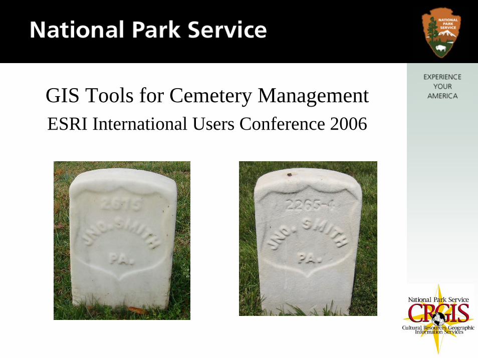
GIS Tools for Cemetery Management ESRI International Users Conference 2006

Too often, because of the historic nature of cemeteries, knowledge of burials and marker conservation is documented in paper forms and the experiences of individual caretakers. Taking these historic texts and maps and combining them with GPS surveys and digital photography into a GIS allows for better management and long term planning.

Why map cemeteries?
Reasons for mapping cemeteries include:
•Cultural resource conservation
•Maintenance of markers and monuments
•Facilities and grounds management
•Records management
•Interment planning
•Locating existing interments

The capability for both staff and visitors to find the location of, and information about, existing burials is probably the most important priority when discussing the development of a GIS application for a cemetery. As with any project assessing the needs of the client during project planning is important.

The Historic American Landscape Survey/Cultural Resources GIS (HALS/CRGIS), in cooperation with the Department of Veterans Affairs National Cemetery Administration, has been developing GIS tools to use in the documentation and management of national cemeteries. Fourteen of these cemeteries are adjacent to, and managed by, NPS units. In the past we have developed locator applications for Poplar Grove National Cemetery, located at the Petersburg National Military Park, and Chalmette National Cemetery, located at the Chalmette National Military Park.
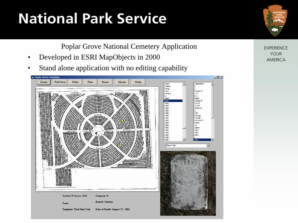
Poplar Grove National Cemetery Application• Developed in ESRI MapObjects in 2000• Stand alone application with no editing capability

Chalmette National Cemetery Application• Developed in ESRI MapObjects in 2001• Stand alone application with no editing capability

In June, 2006 CRGIS delivered a GIS application to the Senior Historian at the Department of Veterans Affairs National Cemetery Administration for the Alexandria National Cemetery located in Alexandria, VA

A gravesite locator application for Alexandria National Cemetery, available on the website of the Department of Veterans Affairs, gives some generalized information about the deceased and the grave location.

We developed an application for the Alexandria National Cemetery in ESRI ArcGIS 9.1 to provide the capability for:
•Editing data
•Adding data
•Flexible queries

Additionally a VBA application was developed to provide a simplified search of the existing interments with the results displayed along with a photograph of the grave marker and the location of the grave highlighted on the map.

Alexandria Cemetery plan 1892
Alexandria Cemetery plan 2004
Paper copies of maps, plans and an aerial photo of the cemetery were collected and scanned. The data included historic and contemporary maps.
It was unknown how many generations from the original these maps were, and thus the inaccuracy from distortion was unknown. The cost of accessing originals should, if possible, be built into the project budget.

Points were located on the scanned maps and those points were GPSed on the ground and post processed. These points were then used to georeference the maps.

A GIS layer containing points representing the individual graves in each row was generated and, using the grave and block numbers as an ‘address’, the map was geocoded
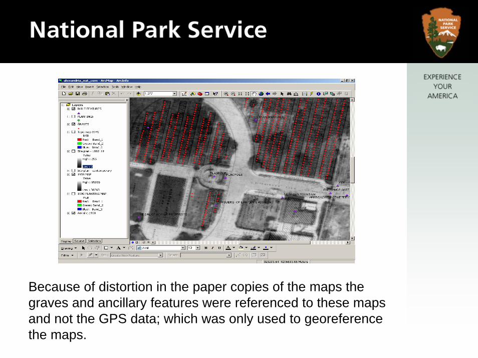
Because of distortion in the paper copies of the maps the graves and ancillary features were referenced to these maps and not the GPS data; which was only used to georeference the maps.

A database of burials was attached to the GIS Layer

Photos of the graves were taken and the file name was added to the database to enable us to reference and display the image. Taking the photos of the markers was one of the most time consuming tasks of the project, issues such as weather and sun angle were the major delays in obtaining the photos.

Additional information was identified by the historian as helpful in the cultural resource management of the cemetery. This included built and landscape features.

Superintendents Lodge Ca.1920
Superintendents Lodge 2005
Ancillary data such as historic and contemporary photos and…

…documents

Were combined into Adobe Acrobat document and hyperlinked to theappropriate point in the GIS.

Cemetery locator applications, especially in ESRI ArcIMSformat, are available. In addition cemetery management tools are available commercially. But these applications do not address historic and cultural resources in addition to the grave markers.

To preserve the unique historic nature of cemeteries we must be willing to address the needs of each individual landscape and adapt the application to meet these needs.