mackay’s crossing - wasteminz.org.nz€™… · uxo survey and investigations sarah halliday ......
TRANSCRIPT
MACKAY’S CROSSING UXO SURVEY AND INVESTIGATIONS
SARAH HALLIDAY AECOM CONTAMINATED LAND ADVISOR TO LHJV FOR TRANSMISSION GULLY
MIKE SKIFFINGTON MIExpE MILSEARCH

• Sarah Halliday (AECOM) & Mike Skiffington (Milsearch)
• UXO Survey and Removal, MacKay’s Crossing,
Paekakariki, March 2015
• Sarah: Context, requirements to do the work etc,
• Mike: Methodology, execution, findings
INTRODUCTION

The Site is at the northern extent of the alignment for the
Transmission Gully alignment, adjacent to the current SH1
– the area as a whole is referred to as MacKay’s Crossing
SETTING
Paekakariki
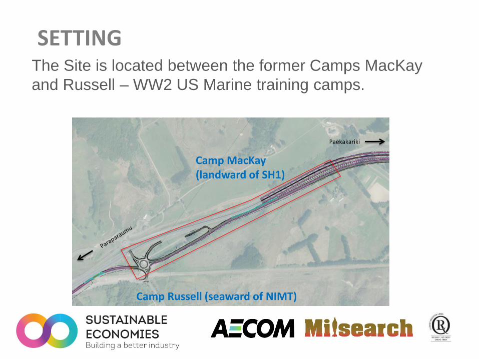
The Site is located between the former Camps MacKay
and Russell – WW2 US Marine training camps.
SETTING
Paekakariki
Camp MacKay (landward of SH1)
Camp Russell (seaward of NIMT)
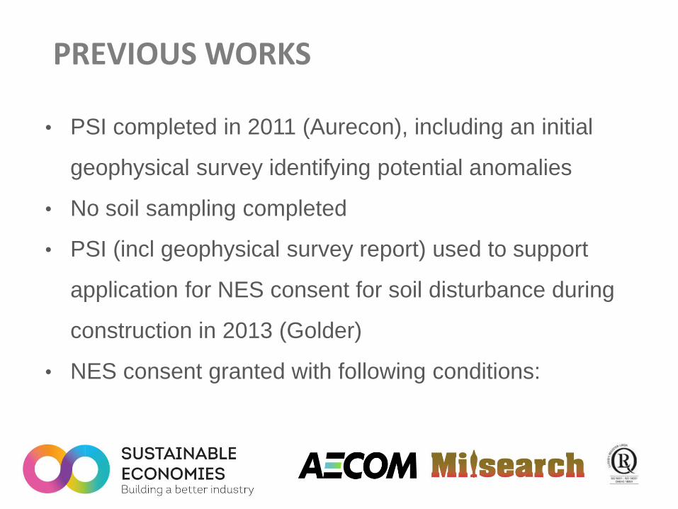
• PSI completed in 2011 (Aurecon), including an initial
geophysical survey identifying potential anomalies
• No soil sampling completed
• PSI (incl geophysical survey report) used to support
application for NES consent for soil disturbance during
construction in 2013 (Golder)
• NES consent granted with following conditions:
PREVIOUS WORKS
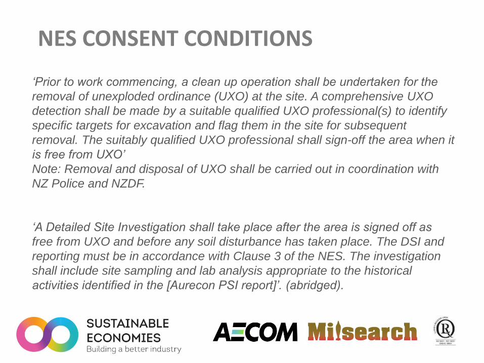
‘Prior to work commencing, a clean up operation shall be undertaken for the
removal of unexploded ordinance (UXO) at the site. A comprehensive UXO
detection shall be made by a suitable qualified UXO professional(s) to identify
specific targets for excavation and flag them in the site for subsequent
removal. The suitably qualified UXO professional shall sign-off the area when it
is free from UXO’
Note: Removal and disposal of UXO shall be carried out in coordination with
NZ Police and NZDF.
‘A Detailed Site Investigation shall take place after the area is signed off as
free from UXO and before any soil disturbance has taken place. The DSI and
reporting must be in accordance with Clause 3 of the NES. The investigation
shall include site sampling and lab analysis appropriate to the historical
activities identified in the [Aurecon PSI report]’. (abridged).
NES CONSENT CONDITIONS
• Approached Milsearch and asked them to review the
consent condition requiring the UXO clearance and
advise if workable – Yes……with limitations.
• Decision to proceed with UXO detection and removal as
specified by consent condition.
• This is where Mike comes in……
ENTER MILSEARCH

SITE
• 5 hectare site
• Adjacent to
SH1
• Divided into 3
areas for
survey and
investigation

AREA 1
• Former State Highway 1
• Tarsealed
• Bounded by
• Swamp
• Current SH 1

AREA 2
• Mown grass with some
sealed area
• Underground Services
• High Pressure Gas line
• Fibre Optic Cable
• Close to Former Camp
MacKay Site

AREA 2
• Substantially disturbed
during 2006 SH 1
construction works
• Used for stockpiling
roading material
• Evidence of re-levelling
on completion of those
works
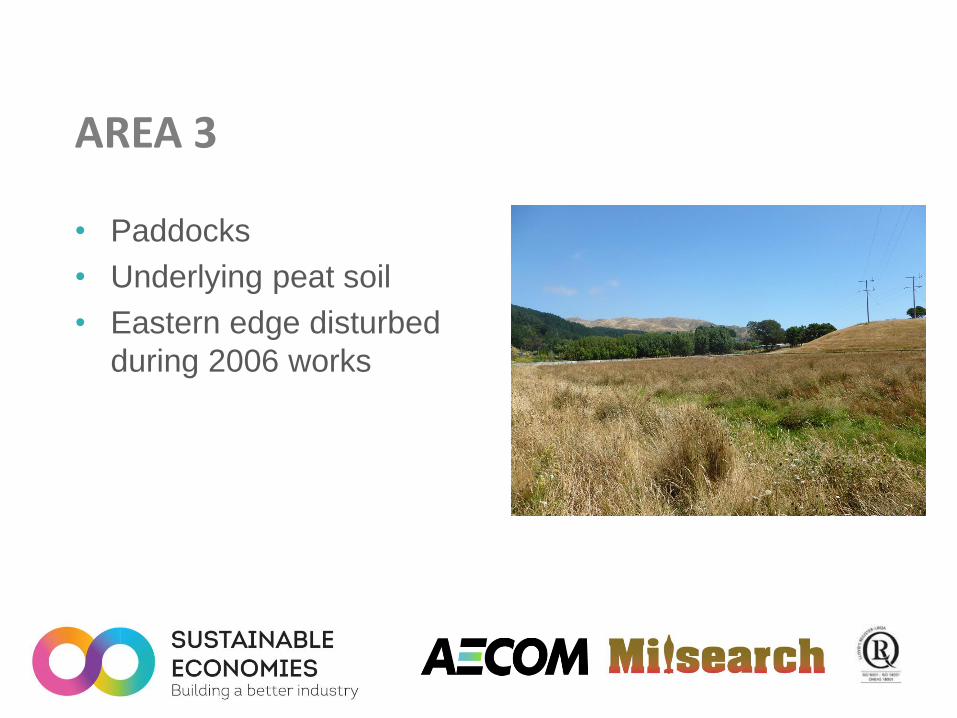
AREA 3
• Paddocks
• Underlying peat soil
• Eastern edge disturbed
during 2006 works
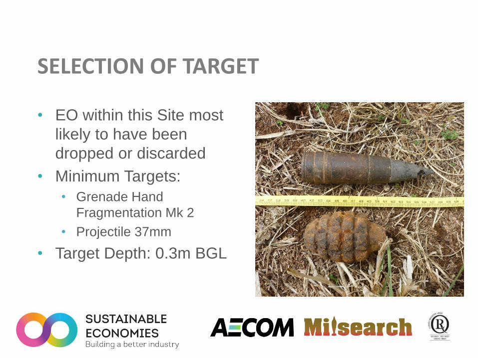
SELECTION OF TARGET
• EO within this Site most
likely to have been
dropped or discarded
• Minimum Targets:
• Grenade Hand
Fragmentation Mk 2
• Projectile 37mm
• Target Depth: 0.3m BGL

SELECTION OF SURVEY TECHNOLOGY

ELECTROMAGNETIC SURVEY
• Areas 1 & 2
• Selected due to;
• Less susceptible to
influence from
services/fences
• Potentially magnetic metal
chip seal
• Geonics EM61 Mk 2 High
Power

MAGNETIC SURVEY
• Area 3
• Underlying peat potentially
conductive reducing
effectiveness of EM
• Geometrics G858
Magentometer
• Dual Sensor

SITE PREPARATION
• Vegetation Slashing
• Tree Removal
• Fence Removal

EQUIPMENT CALIBRATION
• Targets
buried at
0.3m BGL
• Tests equipment
function
• Interpretation
threshold
• GPS offset

INTERPRETATION
• Area 1 – 376 anomalies
• Area 2 – 649 anomalies
• Area 3 – 569 anomalies

INTERPRETATION REPORTS
• Site divided in to
Blocks
• Documentation
• Geophysical
Plots
• Interpretation/
Investigation
Report (Dig-
Sheet)
• GPS file

INVESTIGATION
• Area 1 – 20%
Assessment
• Area 2 – 100%
Remediation & 20%
Assessment
• Area 3 – 20%
Assessment

INVESTIGATION METHOD
• Anomalies relocated with
HPGPS
• Each anomaly
investigated with metal
detector or magnetometer
• Mechanical Plant used for
large and deep anomalies

AREA 1 FINDS
• Primarily related to
road infrastructure
and refuse 31%
12%
7% 7%
6%
3%
34% Wire
Road Infrastructure
Star Picket
Refuse
Bolts
Car Parts
Other Scrap

AREA 3 FINDS
• Mixture of
agricultural and rail
waste
2%
40%
9% 4% 3%
9%
7%
26% Geology
Wire
Rail RelatedScrapHand Tools
Star Pickets
Pipe
Bolts
Other Scrap
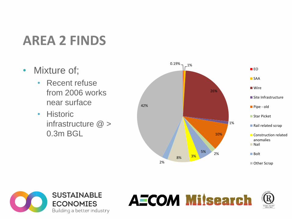
AREA 2 FINDS
• Mixture of;
• Recent refuse
from 2006 works
near surface
• Historic
infrastructure @ >
0.3m BGL
0.19% 1%
26%
1%
10%
2% 5%
3% 8% 2%
42%
EO
SAA
Wire
Site Infrastructure
Pipe - old
Star Picket
Rail related scrap
Construction relatedanomaliesNail
Bolt
Other Scrap
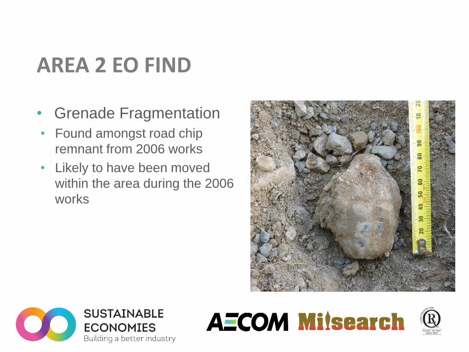
AREA 2 EO FIND
• Grenade Fragmentation
• Found amongst road chip
remnant from 2006 works
• Likely to have been moved
within the area during the 2006
works

AREA 2 EO & SAA FINDS
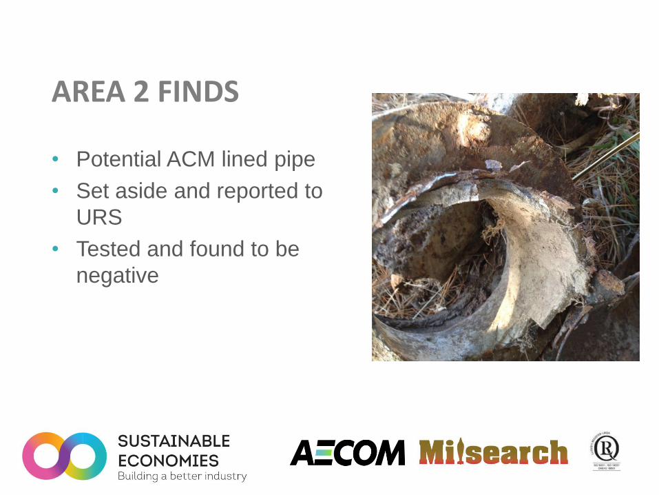
AREA 2 FINDS
• Potential ACM lined pipe
• Set aside and reported to
URS
• Tested and found to be
negative

CONCLUSION • UXO Survey and Investigation Operations require;
• Understanding the site history
• Identifying the target ordnance
• Determining its source/delivery – dropped, buried, fired
• Identifying the site conditions
• Selecting the appropriate technology for the target and the site
• A contaminated site remains contaminated until
assessed or remediated