subject: recommendation report file nos: su/za 14 130863 · subject: recommendation report cim...
TRANSCRIPT

Report to: Development Services Committee Report Date: April 25, 2016
SUBJECT: RECOMMENDATION REPORT
CIM Global Development LP
Draft Plan of Subdivision and Zoning By-law Amendment
applications to allow townhouse development and future
commercial development at 9900 Markham Road, 5899
Major Mackenzie Drive and the abutting property to the east.
File Nos: SU/ZA 14 130863
PREPARED BY: Stacia Muradali, M.C.I.P., R.P.P., Ext. 2008
Senior Planner, East District
REVIEWED BY: Sally Campbell, M.C.I.P., R.P.P., Ext. 2645
Manager, East District
RECOMMENDATION:
1) THAT the staff report titled “RECOMMENDATION REPORT, CIM Global
Development LP, Draft Plan of Subdivision and Zoning By-law Amendment
applications to allow townhouse development and future commercial
development at 9900 Markham Road, 5899 Major Mackenzie Drive and the
abutting property to the east, File Nos: SU/ZA 14 130863”, be received;
2) THAT the record of the Public Meeting held on April 21st, 2015 relating to the
applications for Draft Plan of Subdivision and Zoning By-law Amendment
submitted by CIM Global Development LP for 9900 Markham Road, 5899 Major
Mackenzie Drive and the abutting property to the east, be received;
3) THAT the Zoning By-law Amendment application (ZA 14 130863) submitted by
CIM Global Development LP to amend Zoning By-law 177-96, as amended, be
approved and that the draft By-law attached as Appendix „A‟ be finalized and
enacted without further notice;
4) THAT Draft Plan of Subdivision 19TM- 14014 (SU 14 130863) be approved
subject to the conditions of draft approval set out in Appendix „B‟ of this report;
5) THAT Council grant servicing allocation for 195 townhouse units;
6) THAT the draft plan approval for plan of subdivision 19TM-14014 will lapse
after a period of three (3) years commencing on the date of issuance of draft plan
approval, in the event that a subdivision agreement is not executed within that
period;
7) AND THAT Staff be authorized and directed to do all things necessary to give
effect to this resolution.

Report to: Development Services Committee Report Date: April 25, 2016
Page 2
PURPOSE:
This report recommends approval of the applications for Draft Plan of Subdivision and
Zoning By-law Amendment submitted by CIM Global Development LP to allow
townhouse development and future commercial development at 9900 Markham Road,
5899 Major Mackenzie Drive and the abutting property to the east.
BACKGROUND:
Area context and subject lands
The subject lands are comprised of 9900 Markham Road, 5899 Major Mackenzie Drive
and the abutting property to the east (Part 1, Concession 7, Part Lot 20, RS64R8622) and
are located on the south side of Major Mackenzie Drive East and on the west side of
Markham Road (see Figure 1), adjacent to the existing Tim Hortons/ Wendys restaurants
and Esso Gas Station, which are located at the south-west corner of the intersection (see
Figures 1 and 3). The subject lands are approximately 6.6 hectares (16.3 acres) in area
with an open water channel located along the north-easterly property line which
eventually crosses Markham Road via a culvert and continues on the east side of the road.
There is an existing heritage house, the “William Clarry House” located on the subject
lands. Low density residential homes abut the subject lands to the west and commercial
development is located to the south. A large vacant property located on the east side
Markham Road, formerly owned and operated by Emerson Electric, is proposed for
commercial development and possible future residential development by Villarboit
Development Corporation.
Proposed townhouse and future commercial development
A draft plan of subdivision is proposed to create a 4.12 hectare (10.18 acre) residential
block, a 1.8 hectare (4.4 acre) commercial block and a 0.683 hectare (1.69 acre) open
space block. A common element condominium townhouse development, comprised of
195 freehold townhouses is proposed on the residential block. Site plan approval for the
proposed townhouse development was delegated to Staff on June 23rd
, 2015 by
Development Services Committee. Future commercial development, which will be the
subject of a future site plan application, is contemplated for the proposed commercial
block fronting Markham Road. At this time the Owner has conceptually shown two (2)
commercial buildings which are separated by a private east/west road connection to
Markham Road. A private road, visitors parking and landscape buffer separate the
townhouse development from the future commercial development. The open space block
containing the water channel will be conveyed to the City. Two (2) private open space
amenity areas will be provided as part of the proposed townhouse development. One will
be located at the north-west corner of the subject site and will be approximately 1,030
square metres (11,086 square feet) and the second open space area will be adjacent to the
existing heritage house and will be approximately 490 square metres (5,274 square feet).
Official Plan and Zoning
The majority of the subject lands are designated “Major Commercial” with the remainder
of the lands designated “Urban Residential” and “Hazard Lands” in the City‟s in-force
Official Plan (Revised 1987), as amended. The Wismer Commons Secondary Plan
designates the majority of the subject lands “Major Commercial” with the remainder of

Report to: Development Services Committee Report Date: April 25, 2016
Page 3
the lands designated “Medium Density Residential” and “Hazard Lands/Open Space”.
The City‟s 2014 Official Plan (partially approved by the OMB on October 30th
, 2015)
designates the subject lands “Mixed Use Mid Rise” and “Greenway”.
The proposed development conforms with both the City‟s in-force Official Plan (Revised
1987), as amended, and the City‟s 2014 Official Plan (as partially approved by the OMB
on October 30th
, 2015) both of which provide for a range of commercial uses, as well as
medium density residential uses such as townhouses. The protection and conveyance of
the water channel open space block conforms to both the “Hazard Lands” and
“Greenway” designations.
The subject lands are zoned “Major Commercial (MJC)” with site-specific exceptions
and “Open Space (OS1)” under By-law 177-96. Certain commercial and residential land
uses are permitted by the current zoning, including the proposed land uses.
OPTIONS/ DISCUSSION:
The zoning by-law amendment is appropriate
The purpose of this Zoning By-law amendment (see Appendix „B‟) is as follows:
1. To rezone the area of the subject lands proposed for the townhouse development
to an appropriate residential zone (R2) and to implement site-specific
development standards. A minimum landscape strip width of 3 metres ( 9.8 feet)
and a minimum building setback of 6 metres (19.8 feet) will be implemented to
ensure that there is adequate setback between the existing development to the
west and the proposed townhouses. A minimum 8 metre wide landscape strip is
required at the south property limit, providing a buffer between the proposed
townhouses and the commercial development to the south (see Figure 5).
2. To rezone the portions of the subject lands within the proposed open space block
which are not currently zoned “Open Space One (OS1)”.
3. To establish appropriate setbacks between the future commercial development
and the open space channel block and proposed townhouse development. A
minimum 10 metre (32.9 feet) wide landscape strip will be required on the west
side of the proposed commercial development adjacent to the mutual property line
between the proposed residential and commercial development. The landscape
strip together with the 6 metre (19.8 feet) wide private road and visitor parking
bays will provide sufficient distance between the proposed townhouses and the
future commercial development. The open space channel block includes a
minimum 6 metre (19.8 feet) setback from the top of slope. The zoning by-law
implements a further building setback of 4 metres (13 feet) to ensure that there is
a total minimum setback of 10 metres ( 32.9 feet) between any future buildings
and the top of slope which is in conformity with the City‟s in-force Official Plan
(Revised 1987), as amended, which requires a minimum 10 metre buffer.
Report to: Development Services Committee Report Date: April 25, 2016
Page 4
Outstanding matters respecting the draft plan
There are still some key outstanding matters which remain to be resolved prior to
issuance of draft plan approval or final approval (i.e. registration) of the draft plan:
1. Tree removal
There are trees located primarily at the north-west corner of the subject lands
where a private open space amenity area is proposed and around the existing
heritage house, as well as sporadically across the subject lands. The Owner
proposes to preserve the existing trees located within the private open space
amenity area at the north-west corner of the site; however all of the other trees are
proposed to be removed. Staff has expressed a preference to preserve the trees
around the heritage house, which add to the heritage context and setting of the
house. Staff are reviewing information provided by the applicant regarding
grading and tree preservation and are awaiting additional information including an
appraisal of the value of all trees 40cm in diameter and over, to be provided by the
applicant. This will be used to evaluate the appropriateness of removing the
existing trees especially those located around the heritage house, as well as to
determine the appropriate financial securities for tree preservation and also
compensation for tree replacements if tree removals are contemplated. Staff will
work with the Owner on the design of the open space amenity areas. To ensure
that tree removal, protection and replacement on the site is appropriate conditions
have been included in the draft plan conditions (see Appendix „A‟).
2. Restoration and use of the existing heritage house
The City has requested that the Owner retain and restore the existing heritage
house know as the “William Clarry House”. In 2015 the Owner applied for, and
obtained a Heritage Permit for the repair of the heritage house, including
replacement of roof shingles as well as restoration of exterior windows and doors.
At that time the applicant submitted a Letter of Undertaking outlining their intent
to undertake the repairs. Staff are concerned that since issuance of the Heritage
Permit no work has been done to undertake the repairs outlined in the Heritage
Permit and the heritage house‟s condition has since deteriorated.
The most recent plans provided by the Owner show the heritage house on a raised
area surrounded by a 3 to 1 slope. The plans do not reflect the ultimate lot line for
the heritage property and the proposed use of the heritage house has yet to be
determined by the Owner. Conditions to ensure that the visual appearance and
functional appeal of the heritage house are enhanced, and that that the heritage
house is appropriately sited with proper grading have been included in the draft
plan conditions, including a requirement that repairs to the roof, walls, foundation
and any other elements of the heritage house be undertaken to return the structure
to a sound condition (see Appendix „A‟).
3. Transportation
The Owner has recently submitted an updated Transportation Impact Study to
address City Staff‟s previous comments. It should be noted that the east/west road

Report to: Development Services Committee Report Date: April 25, 2016
Page 5
connection from the Phase 1 land through the Phase 2 land to Markham Road will
be constructed as part of the Phase 1 development. The main transportation
concern respecting the draft plan of subdivision is the requirement for a
southbound dedicated right turn lane on Markham Road into the subject lands to
mitigate any potential queuing issues anticipated on Markham Road, once both
Phases 1 and 2 are fully built out. The Owner is required to provide design
drawings for the southbound right turn lane and revise the draft plan, if necessary,
to provide any additional lands. This could impact the channel and open space
block which will need to be revised to accommodate any additional land
requirement and any adjustments to the water channel prior to final approval of
the draft plan (see Appendix „A‟ and Figures 4 and 5).
Other main transportation requirements which have been identified include the
following;
The Owner is required to coordinate the location of the site access with the
landowner of 9999 Markham Road (on the east side of Markham Road)
respecting the location of the Markham Road site access and revise the
draft plan if required to accommodate the final location of the access road
prior to final approval of the draft plan (see Appendix „A‟); and
The Owner is required to provide a functional design for the Markham
Road intersection which must include design of the future traffic signal
and the aforementioned southbound right turn lane prior to final approval
of the draft plan (see Appendix „A‟);
Toronto and Region Conservation Authority requirements
The Owner has undertaken works approved by the Toronto and Region Conservation
Authority (TRCA) to realign the existing water course and create a naturalized channel
block. This will help to mitigate potential flooding risk on the subject lands and will
result in an overall net ecological gain compared to the existing, degraded channel. The
open space block, which contains the water channel, will be conveyed to the City as part
of the subdivision process. The Owner is proposing an infiltration trench to assist with
stormwater management, however, the TRCA has requested that the length of the
infiltration trench be increased and located in an area of highest potential runoff
generation. Conditions to address outstanding TRCA matters have been included in the
draft plan conditions (see Appendix „A‟).
Region of York requirements
Major Mackenzie Drive East is under the jurisdiction of the Region of York (the
“Region”). The Region has restricted the proposed access on Major Mackenzie Drive to
a right-in/ right-out only, and requires the extension of the existing median on Major
Mackenzie Drive to prevent left turns. The Owner is also required to provide a 10m x
10m daylight triangle at the intersection of Major Mackenzie Drive and the proposed
right-in / right-out access as well as provide a 0.3 metre reserve and widening across the
full frontage of the site where it abuts Major Mackenzie Drive. The widening is required
in order that a minimum of 22.5 metres from the centerline of Major Mackenzie Drive is

Report to: Development Services Committee Report Date: April 25, 2016
Page 6
achieved towards the overall 43 metre wide right-of-way. Requirements of the Region
are included in the draft plan conditions (see Appendix „A‟).
Interface with existing commercial development to the south
There are existing access easements across the subject lands in favour of the property
owner to the south intended to allow access from the commercial development at the
south out to Major Mackenzie Drive and Markham Road respectively. The Owner is
proposing changes to these easements and will be required to provide written
confirmation from the property owner to the south agreeing to removal of the existing
easement through the proposed townhouse development and realignment of the easement
through the future commercial block to Markham Road.
There is currently a landscaped island with walkways and a portion of a driveway that
straddle the property line between the subject lands and the property to the south. The
Owner will be required to ensure that satisfactory arrangements are made to undertake
work within these shared locations and to clearly indicate the timing of such works.
Conditions have been included in the draft conditions to ensure that satisfactory
arrangements are made with the landowner to the south (see Appendix 'A').
Ministry of Transportation (MTO) requirements
Highway 48 north of Major Mackenzie Drive is owned by the Ministry of Transportation.
Therefore, the subject lands are within the MTO permit control area and a permit is
required for construction on the subject lands. Approval from the MTO is required
respecting stormwater runoff, site grading and servicing and traffic impact management
to ensure that any potential impact of the proposed development on the Markham Road/
Major Mackenzie Drive intersection is addressed to the MTO‟s satisfaction. The Owner
is required to satisfy the requirements of the MTO prior to registration of the draft plan
(see Appendix 'A').
Parkland dedication requirements
The Wismer Commons Developers Group Agreement outlines the obligations of
participating land owners with respect to parkland dedication, which is required to be
delivered in accordance with the Wismer Commons Community Design Plan and Open
Space Masterplan. It should be noted that the proposed private open space areas are not
credited for parkland dedication. Staff understand that the Owner has previously fulfilled
these obligations to the Developers Group based on the subject lands being developed for
commercial purposes. The Owner is now required to meet the increase in parkland
dedication generated as a result of the proposed residential townhouse component. Cash
in lieu of parkland is payable to the City based on the current appraised value of the
subject land and a condition of draft plan approval has been included to ensure that this
obligation is met prior to registration.
Developers Group release required
Development of the subject lands cannot proceed without the developer obtaining
clearance from the Wismer Developers Group for their proportionate share for providing
services and parkland in the Wismer Commons community. The Owner must provide a


5899
Major
Mac
kenz
ie Dr
.
Abutt
ing P
ropert
yto
the Ea
st(P
art 1,
Con.7
, Lo
t 20,
RS-64
R862
2)
9900
Mark
ham
Rd.
Major
Mac
kenz
ie Dr
E
Markham Rd
Hammersly Blvd
Darren Hill Trail
Ralph Chalmers Ave Hartmoor St
Macadam Rd
Evershot Cres
Kentland St
Everett St
Wozniak Cres
Sedo
re St
Willow
Lndg
Cornf
lower
St
Martin
au D
rBe
ebe C
res
SUBJ
ECT L
ANDS
³
Q:\G
eoma
tics\N
ew O
perat
ion\20
16 Ag
enda
\SU\SU
_ZA1
4130
863\S
U_ZA
1413
0863
.mxd

"AME
ND 74
-2000
"
"AME
ND 20
10-17
"
"AMEND 2010-55"
"AMEND 2010-153"
"AMEND 2008-155"
"AMEND 2005-376"
AMEND 295-90
AMEND 365-88
"AMEND 2007-168"
"AMEND 2006-296"
"AMEND 2005-5"
"AMEND 2013-127"
"AMEN D 2002-159"
"AMEND 59-2000"
"AMEND 2005-376"
"AMEND 2005-376"
AMEND 2006-209
AMEND 150-97
AMEND 2010-169
"AMEND 2001-93"
"AMEND 2010-143"
"AMEND 2010-143"
"AMEND 2009-211"
"AME
ND 20
10-55
"
"AMEND 2008-218"
"AMEND 2003-201"
"AMEND 2009-211"
AMEND 2004-140
"AMEND 2005-5"
AMEND 2010-122
"AMEND 74-86"
"AME
ND 20
07-15
4"
"AMEND 2009-211"
"AMEND 2010-55"
"AME
ND 20
06-17
3"
"AMEND 2006-296"
"AMEND 2003-207"
"AMEND 2009-141"
"AMEND 2008-155"
"AMEND 2005-5"
"AMEND 169-1999"
"AMEND 2008-155"AMEND 2001-63
AMEND 2005-277
"AMEND 2010-120"
"AMEND 2005-5"
"AMEND 2010-140"
"AME
ND 20
07-16
8"
"AMEND 36-1999"
"AME
ND 20
10-15
3"
"AMEN D 2001-180"
"AMEND 2007-255"
"AME
ND 20
04-19
1"
"AMEND 2005-5"
"AMEND 2011-173"
AMEND 198-91
AMEND 195-89
AMEND 206-78
"AMEND 2007-138"
"AMEND 2006-291"
"AMEND 2007-168"
"AMEND 2003-214"
"AME
ND 20
02-15
9""A
MEND
256-1
999"
"AMEND 2009-141"
"AMEND 2009-211"
"AMEND 2005-5"
"AMEND 184-94"
"AMEND 2004 351"
"AMEND 2003-214"
"AMEND 2003-207"
"AMEND 2006-296"
"AMEND 2003-263"
"AMEND 2003-263"
"AMEND 2008-155"
AMEND 2005-18
AMEND 83-89
AMEND 167-82
"AMEND 285-87"
"AMEND 2005-5"
"AMEND 2004-36"
"AMEND 2003-326"
"AMEND 2010-120"
"AMEND 2006-345"
"AMEN D 2002-159"
"AMEN D 2002-159"
"AME
ND 20
03-20
1"
"AMEND 2008-155"
AMEND 167-91
AMEND 19-89
AMEND 198-78
"AMEND 2010-120"
"AMEND 2010-118"
MJC*187
BY-LAW 177-96
BY-LAW 304-87
BY-LAW 88-76
BY-LAW 177-96
A1
M.I.
MJC*187
R2*182
OS1
R2*185*186
OS2
R2-S*99
RR2
R2*185*186*405
MJC*425(H)
MJC*303
HC2
R2*99
R2*185R2*99
MJC*246
R2-S*185
R2*133*137
AC1(H)R2*355
MJC*221(H)
R2-S*134
OS1
R2*133*207
R2*185*186
R2*393
OS1
OS1
MJC*187*363
OS1*427R2*99
R2-S*134*137
R2*99R2*133*137*205*207
R2-S*134*137*205*207
Castlemore Ave
Markh
am R
d
Major Mackenzie Dr E
Hwy 4
8
Hammersly Blvd
Everett St
Darre
n Hill T
rail
Kentland St
Ralph Chalmers Ave
Hartmoor St
Maca
dam
Rd
Evershot Cres
Ande
rson A
ve
Beebe Cres
³
FIGURE No.2DATE: 08/04/2016
AREA CONTEXT / ZONINGAPPLICANT: CIM GLOBAL DEVELOPMENT LP 9900 MARKHAM ROAD, 5899 MAJOR MACKENZIE DR. EAST AND THE ABUTTING PROPERTY TO THE EASTFILE No. SU_ZA14130863 (SM)
Drawn By: CPW Checked By: SMDEVELOPMENT SERVICES COMMISSION
SUBJECT LANDSQ:\Geomatics\New Operation\2016 Agenda\SU\SU_ZA14130863\SU_ZA14130863.mxd

Castlemore Ave
Markh
am Rd
Major Mackenzie Dr E
Hwy 4
8
Hammersly Blvd
Darre
n Hill T
rail
Everet
t St
Kentl
and St
Ralph
Chalm
ers Av
e
Hartmoor St
Macad
am Rd
Eversh
ot Cre
s
Fred M
cLaren
Blvd
Anders
on Ave
Gracew
ell Rd
Beebe Cres
³
FIGURE No.3DATE: 08/04/2016
AERIAL PHOTO (2015)APPLICANT: CIM GLOBAL DEVELOPMENT LP 9900 MARKHAM ROAD, 5899 MAJOR MACKENZIE DR. EAST AND THE ABUTTING PROPERTY TO THE EASTFILE No. SU_ZA14130863 (SM)
Drawn By: CPW Checked By: SMDEVELOPMENT SERVICES COMMISSION
SUBJECT LANDSQ:\Geomatics\New Operation\2016 Agenda\SU\SU_ZA14130863\SU_ZA14130863.mxd

MAJOR MACKENZIE DRIVE - REGIONAL ROAD No. 25
MACA
DAM
ROA
D
THE
KING'S
HIG
HWAY
No.
48
N10°
17'00
"W45
.821
N72°08'40"E22.627
N71°53'15"E
N10°
13'55
"W
267.9
91
N71°42'15"E 61.499
N72°58'15"E 83.860
N07°
47'20
"W
182.5
40
Block 1Residential4.120 ha
Block 2Commerical1.806 ha
Block 3Open Space0.683 ha
N72°04'50"E 60.823
N10°32'50"W2.050N72°59'20"E 123.803
N10°23'50"W130.213
177.390
6.4 83.176.7 5.8 25.6
41.5
5.82.5
2.5
19.9
6
68
138.4
35
126.6 112.3
175.4
DRAFT PLAN / OPEN SPACE BLOCKTO BE REVISED TO ACCOMMODATE ANYADDITIONAL LANDSREQUIRED FOR SOUTHBOUNDRIGHT TURN LANE AND ANYADJUSTMENTS TO THECHANNEL AREA
³
FIGURE No.4DATE: 08/04/2016
DRAFT PLAN OF SUBDIVISIONAPPLICANT: CIM GLOBAL DEVELOPMENT LP 9900 MARKHAM ROAD, 5899 MAJOR MACKENZIE DR. EAST AND THE ABUTTING PROPERTY TO THE EASTFILE No. SU_ZA14130863 (SM)
Drawn By: CPW Checked By: SMDEVELOPMENT SERVICES COMMISSION
SUBJECT LANDSQ:\Geomatics\New Operation\2016 Agenda\SU\SU_ZA14130863\SU_ZA14130863.mxd

6m S
ETBA
CKFR
OM T
/O S
LOPE
V
20
VV
V
8.00 m10.50 m
8.00 m
STREET E
SERV
ICE
EASE
MENT
LINE
MAJOR MACKENZIE ROAD
MARK
HAM
ROAD
196195194193192191190189188187186
185184183182181178 180179
177176175174173172171
170169168167166165164163162
161160159158157156155154153
152151150149148147146
145
144143142141140139138
137
136135134133132131130129128127126125124123122121
119 120
118117116115114113112111110109108107106105104103
1021011009998979695
9493929190898887
8685848382818079787776757473727170
696867666564636261605958575655
52 53 54
51504948474645444342414039383736
353433323130292827262524232221
19181716151413121110987
654321
14.70 m
7.50 m
22.45 m
6.60 m4.60 m
CON CRE TE PAVER
CONCRETE PAVER
CON CRE TE PAVER
CON CRE TE PAVER
CON CRE TE PAVER
CON
CRE
TE W
ALKW
AY
CON
CRE
TE W
ALKW
AYCO
NCR
ETE
WAL
KWAY
CON
CRE
TE W
ALKW
AY
CON
CRE
TE W
ALKW
AY
CON
CRE
TE W
ALK
WA
Y
CON
CRE
TE W
ALK
WA
Y
CON
CRE
TE W
ALKW
AY
CON
CRE
TE W
ALKW
AYCO
NCR
ETE
WAL
KWAY
SERV
ICE
ENTR
ANCE
V
V
LAN DSC APE BU FFER
LAND
SCAP
E BU
FFER
LAND
SCAP
E BU
FFER
VACA
NT L
AND
FOR
FUTU
RE D
EVEL
OPM
ENT
VV
V
VV
VV
VV
VV
VV
TO WNHOUSENO .28
TO WNHOUSENO .27
TO WNHOUSENO .11
V
TO WNHOUSENO .22
STREET D
STREET D
VV
VV
VV
VV
VV
VV
VV
V
TO WNHOUSENO .15
TO WNHOUSENO .13
VV
VV
V
TO WNHOUSENO .20
TO WNHOUSENO .17
PROP
OSED
TOP
OF S
LOPE
-
7.5m
SETB
ACK
LINE TO WNHOUSE
NO .25
TO WNHOUSENO .23
TO WNHOUSENO .26
TO WNHOUSENO .24
TO WNHOUSENO .21
TO WNHOUSENO .19
TO WNHOUSENO .18
TO WNHOUSENO .16
TO WNHOUSENO .14
TO WNHOUSENO .12
TO WNHOUSENO .10
TO WNHOUSENO .9
TO WNHOUSENO .8
TO WNHOUSENO .7
TO WNHOUSENO .6
TO WNHOUSENO .5
TO WNHOUSENO .4
TO WNHOUSENO .3
TO WNHOUSENO .2
TO WNHOUSENO .1
STRE
ET A
STRE
ET A
STREET C
STREET C
STREET B
STREET B
VACA
NT L
AND
FOR
FUTU
RE D
EVEL
OPM
ENT
VV
VV
VV
VV
V
R=12.0M
R=15.0M
R=9.0MR=12.0M
R=15.0M
R=9.0M
R=12.0M
R=15.0M
R=9.0MR=12.0M
OPEN
SPA
CE
HE RITA GEHO US E
IN V
IN V
FUTUR
E TRCA FLO
ODL INE
2 11 .6 3m
IB2.0m
SI DE W
ALK
2.0m
SI DE W
ALK
CBMH
4 3EX.STM
N6 8 °48' 2 0" E
4 1.67
CBMH0
8
2
COMBO
5780-04
537.06m
GFADRIVETH
RU
5781ft
118SEATS
WH
9
1
1
11
13
4 2
4
B O L L A R D
B O L L A R D
U P / L
U P / L
U P / L
U P / L
U P / L
U P / L
U P / L
U P / L
B O L L A RD
U P / L
U P / H /L
R O A D S I G N
RO
AD
SI
GN
RO
AD
SI
GN
R O A D S I G N
R O A D S I G N
R O A D S I G N
R O A D S I G N
S IG N
S IG N S IG N
S IG N
RO
AD
SI
GN
S IG N
R O A D S I G N
PHASE 1
PHASE 2PHASE 2
FUTURE SIGNALIZED
INTERSECTION
9999 MARKHAM
ROAD
DRAFT PLAN / BLOCK TO BEREVISED TO ACCOMMODATEANY ADDITIONAL LANDSREQUIREDFOR SOUTHBOUNDRIGHT TURN LANEAND ANY ADJUSTMENTS TO THE CHANNELAREA
3m LANDSCAPE STRIPAND 6m BUILDINGSETBACK
8m LANDSCAPE STRIP10m LANDSCAPE STRIPAND SETBACK
PRIVATE OPENSPACE AMENITY
PRIVATE OPENSPACE AMENITY
HERITAGEHOUSE
³
FIGURE No.5DATE: 08/04/2016
SITE PLANAPPLICANT: CIM GLOBAL DEVELOPMENT LP 9900 MARKHAM ROAD, 5899 MAJOR MACKENZIE DR. EAST AND THE ABUTTING PROPERTY TO THE EASTFILE No. SU_ZA14130863 (SM)
Drawn By: CPW Checked By: SMDEVELOPMENT SERVICES COMMISSION
SUBJECT LANDSQ:\Geomatics\New Operation\2016 Agenda\SU\SU_ZA14130863\SU_ZA14130863.mxd
FIGUR
E No.
6DA
TE: 0
8/04/2
016
TYPIC
AL TO
WNHO
USE E
LEVA
TION
APPL
ICAN
T: CI
M GL
OBAL
DEV
ELOP
MENT
LP
990
0 MAR
KHAM
ROA
D, 58
99 M
AJOR
MAC
KENZ
IE DR
. EAS
T
AND
THE A
BUTT
ING
PROP
ERTY
TO TH
E EAS
TFIL
E No.
S
U_ZA
1413
0863
9SM)
Draw
n By:
CPW
Chec
ked B
y: SM
DEVE
LOPM
ENT S
ERVI
CES
COMM
ISSI
ON
FRON
T EL
EVAT
ION
REAR
ELE
VATI
ON
INTE
RIOR
COR
NER
ELEV
ATIO
N
EXTE
RIOR
COR
NER
ELEV
ATIO
N
TOW
NHOU
SE N
O. 6,
15, 2
3
UNIT
B1
UNIT
B1
UNIT
A1UN
IT A1
UNIT
A1UN
IT A1
UNIT
B1
UNIT
B3
UNIT
B3
UNIT
B1
UNIT
A1UN
IT A1
UNIT
A1UN
IT A1
UNIT
B1
UNIT
B1
ASHP
ALT S
HING
LE T
YPRO
OF TR
IM
1ST
FLOO
R
2ND
FLOO
R
3RD
FLOO
R
STUC
CO T
YPPR
ECAS
TAR
CHIT
ECTU
RAL
BANDME
TAL
EAVE
STRO
UGH
TYP
BRIC
K VE
NEER
PREC
AST
ARCH
ITEC
TURA
LBA
ND
STON
E VE
NEER
TYP
U/S
ROOF
ROOF
PEA
K
1ST
FLOO
R
2ND
FLOO
R
3RD
FLOO
R
U/S
ROOF
ROOF
PEA
K
ASHP
ALT S
HING
LE
STUC
COCO
RNIC
E TY
P
DECO
RATI
VEME
TAL R
AILI
NG
PREC
AST
ARCH
ITEC
TURA
LBA
ND
ASHP
ALT
SHIN
GLE
TYP
STUC
CO T
YP
STON
E TY
PST
ONE
VENE
ER TY
P
126
126
126
126
126
126
126
126
126
126
126
126
126
126
126
126
126
126
126
126
126
126
126
126
126
MET
AL R
AILIN
G
DOUB
LE C
ARGA
RAGE
DOO
R TY
PSI
NGLE
CAR
GARA
GE D
OOR
TYP
PRE-
CAST
ARCH
ITEC
TURA
LBA
ND TY
P
STON
EVE
NEER
TYP
MID
POIN
T OF
THE
ROOF
F.F.E
. = 0.
20 m
ABOV
E GR
ADE
FRON
T ELE
VATIO
N
REAR
ELE
VATIO
N
³
Q:\G
eoma
tics\N
ew O
perat
ion\20
16 Ag
enda
\SU\SU
_ZA1
4130
863\S
U_ZA
1413
0863
.mxd

1
APPENDIX „A‟
THE CONDITIONS OF THE COUNCIL OF THE CITY OF MARKHAM
TO BE SATISFIED PRIOR TO RELEASE FOR REGISTRATION OF
PLAN OF SUBDIVISION 19TM-14014
CIM GLOBAL DEVELOPMENT LP
ARE AS FOLLOWS:
1. General
1.1 Approval shall relate to a draft plan of Subdivision prepared by Bousfields Inc,
with a Surveyor‟s Certificate from Schaeffer Dzaldov Bennett Ltd., dated March
9, 2016, and identified as Drawing Number 14150-17dp, and incorporating the
following redline revisions:
Revise the draft plan/ open space block to include additional lands along
Markham Road for the southbound right turn lane and adjustments to the
channel area to the satisfaction of the Director of Engineering and the
Toronto and Region Conservation Authority.
Revise the draft plan if required, to accommodate the final location of the
proposed site access on Markham Road, to the satisfaction of the Director
of Engineering.
Revise the draft plan if required to accommodate any additional lands/
easements required for the Markham Road intersection signalization, to
the satisfaction of the Director of Engineering.
1.2 This draft approval shall apply for a maximum period of three (3) years from date
of issuance by the City, and shall accordingly lapse on XXXX unless extended by
the City upon application by the Owner.
1.3 The Owner shall enter into a subdivision agreement with the City agreeing to
satisfy all conditions of the City and Agencies, financial and otherwise, prior to
final approval.
1.4 The Owner acknowledges and understands that prior to final approval of this draft
plan of subdivision, amendments to the City‟s in-force Official Plan (1987
Revised), as amended, the Wismer Commons Secondary Plan, and Zoning By-
law 177-96, as amended to implement the plan shall have come into effect in
accordance with the provisions of the Planning Act.
1.5 The Owner acknowledges and agrees that the draft plan of subdivision and
associated conditions of draft approval may require revisions, to the satisfaction
of the City, to implement or integrate any recommendations from studies required
as a condition of draft approval, including, but not limited to, Traffic Impact
Study, Internal Functional Traffic Design Study, Stormwater Management Study

2
(Environmental Master Drainage Plan), Internal Servicing Study, Noise Impact
Study, Exhibition Creek Enhancement Design Brief Report, confirmation of
alignment of roads with the locations shown in the draft approved plans, as well
as any comments and conditions received from municipal departments and
external agencies after draft approval is granted. Further, the Owner agrees to
provide additional lands/easements is required, to the satisfaction of the Director
of Engineering, to implement or integrate any recommendations from these
studies.
1.6 The Owner covenants and agrees to enter into a construction agreement and/or
encroachment agreement or any other agreement deemed necessary to permit
construction of services, roads, traffic signals or any other services that are
required to be constructed on Markham Road to the satisfaction of the Director of
Engineering and City Solicitor.
1.7 The Owner acknowledges and agrees to provide the appropriate public art
contribution, to the satisfaction of the Director of Planning and Urban Design.
1.8 Prior to final approval of the draft plan, the Owner acknowledges and agrees to
obtain required approval from TRCA, Region of York and any other applicable
public agencies to the satisfaction of the Director of Engineering.
1.9 The Owner shall covenant and agree in the subdivision agreement to obtain
approval of Site Alteration Plans in accordance with the City‟s Standards prior to
proceeding with any on-site works and more particularly topsoil stripping.
1.10 The Owner covenants and agrees to provide a list of sustainable initiatives which
will be incorporated into the proposed townhouse development (Phase 1), to the
satisfaction of the Director of Planning and Urban Design, prior to site plan
endorsement of the proposed townhouse development (Phase 1) on Block 1 of the
draft plan.
2. Community Design
2.1 The Owner shall implement and incorporate all requirements of the approved
Highway 48, Wismer Commons Community Design Plan into all landscape plans,
architectural control guidelines, engineering plans and any other required design
documents.
2.2 The Owner shall agree to follow and implement the Wismer Commons
Community Architectural Design Guidelines prepared by Watchorn Architect Inc,
dated July 2000 and to retain a design consultant to implement the Architectural
Control Guidelines.

3
2.3 Plans submitted for model home permits for any building within the plan of
subdivision shall bear an approval stamp identifying the architectural company
retained for architectural control and the signature of the control architect. The
approval stamp shall certify that the floor plans, building elevations and site plans
are designed in accordance with the approved architectural control guidelines.
2.4 The Owner shall ensure that the design architect for any buildings within the plan
of subdivision shall not also assume the role of control architect for the plan of
subdivision.
3. Parks and Open Space
3.1 The Owner shall convey land to the City for park purposes in accordance with the
Wismer Commons Community Design Plan or in alternative form as agreed to by
the Director of Planning and Urban Design.
3.2 The Owner shall post approved copies of any Open Space Plans, Conceptual Park
Development Master Plans and Conceptual Facility Fit Plans for the Wismer
Commons Community. Such plans to include, but not be limited to parks, schools,
employment lands and retail/ commercial development, adjacent municipal roads
and Provincial Highway/ Transitway in all sales offices for dwelling units within the
draft plan of subdivision.
4. Landscape Works
4.1 Prior to execution of the subdivision agreement, the Owner shall submit landscape
plans prepared by a qualified person based on the approved Wismer Commons
Open Space Master Plan and Community Design Plan and with the City of
Markham Streetscape Manual, dated June 2009, as amended, into all landscape
works, to the satisfaction of the Director of Planning and Urban Design, which
may include but not be limited to:
a) one street tree per lot or unit;
b) 1.8m high wood corner lot fencing;
c) 1.5m high black vinyl chain link fence on the property line where
residential lots abut open space and valleylands;
d) buffer planting for the open space blocks and single loaded road
allowances abutting Street A;
e) noise attenuation fencing in accordance with an approved noise study;
f) fencing and planting of the walkway blocks; and
4
g) any other landscaping as determined by the Community Design Plan and
the Environmental Master Drainage Plan.
4.2 The Owner shall construct all landscaping in accordance with the approved plans
at no cost to the City.
4.3 The Owner shall provide a specialized depth of topsoil in the entire municipal
boulevard to appropriately plant boulevard trees to the satisfaction of the Director
of Planning and Urban Design.
4.4 The Owner shall not permit their builders to charge home purchasers for the items
listed in Condition 5.1.
4.5 The Owner shall include in all agreements of purchase and sale the following
clause:
“PURCHASERS ARE ADVISED THAT AS A CONDITION OF
APPROVAL OF THE SUBDIVISION WITHIN WHICH THIS
LOT IS LOCATED, THE CITY OF MARKHAM HAS
REQUIRED THE DEVELOPER TO UNDERTAKE AND BEAR
THE COST OF THE FOLLOWING ITEMS:
STREET TREES (TREES PLANTED IN THE CITY BOULEVARD OR IN
ADJACENT PUBLIC LANDS OR PRIVATE LOTS TO MEET 5.1 a) AND
5.1a)
CORNER LOT FENCING
REAR LOT LINE FENCING AT LANES (IF SPECIFICALLY REQUIRED
BY THE CITY)
TREE PLANTING IN REAR YARDS ADJOINING THE LANES (IF
SPECIFICALLY REQUIRED BY THE CITY)
NOISE ATTENUATION FENCING AS IDENTIFIED IN THE NOISE
IMPACT STUDY
FENCING OF SCHOOL, PARK, WALKWAY AND STORMWATER
MANAGEMENT POND BLOCKS
BUFFER PLANTING FOR OPEN SPACE, WALKWAY AND
STORMWATER MANAGEMENT POND BLOCKS AND SINGLE
LOADED STREET ALLOWANCES
SUBDIVISION ENTRY FEATURES AND DECORATIVE FENCING AS
IDENTIFIED ON LANDSCAPE PLANS APPROVED BY THE CITY
THE DEVELOPER HAS BORNE THE COST OF THESE ITEMS AND THE
HOME PURCHASER IS NOT REQUIRED TO REIMBURSE THIS
EXPENSE.”

5
5. Tree Inventory and Tree Preservation Plans
5.1 The Owner shall submit for approval a tree inventory and tree preservation plan to
the satisfaction of the Director of Planning and Urban Design in accordance with
the City of Markham Streetscape Manual dated 2009, as amended from time to
time.
5.2 The Owner shall submit a site grading plan showing the trees to be preserved
based on the approved Tree Preservation Plan prior to the issuance of a Top Soil
Stripping Permit to the satisfaction of the Director of Planning and Urban Design.
5.3 The Owner shall obtain written approval from the Director of Planning and Urban
Design prior to the removal of any trees or destruction or injury to any part of a
tree within the area of the draft plan.
5.4 The Owner shall submit for approval, as part of the tree inventory and tree
preservation plan, in accordance with the City of Markham Streetscape Manual a
tree compensation schedule detailing replacement and enhancement planting or
the replacement value based on the following:
a) Trees between 20cm and 40cm diameter at breast height (DBH) shall be
replaced at a ratio of 2:1
b) All trees over 40cm DBH shall have an individual valuation submitted to
the City by an ISA certified Arborist in accordance with the Council of
Tree and Landscape Appraisers (CTLA) Guide for Plant Appraisal (2000)
c) Where a site does not allow for the 2:1 replacement, the City will negotiate
a credit for tree planting on alternate sites
d) The requirement for the replacement or equivalent economic value
following unauthorized tree removal or damage shall be determined by the
City
e) Compensation and/or replacement of trees to be received shall be provided
in addition to the requirements listed in Condition 5.1a)
6. Financial
6.1 Prior to execution of the subdivision agreement the Owner shall provide a letter of
credit, in an amount to be determined by the Director of Planning and Urban
Design, to ensure compliance with applicable tree preservation, fencing,
streetscape, buffer, landscaping and other landscaping requirements.
7. Noise Impact Study
7.1 Prior to final approval of the draft plan, the Owner shall submit a Noise Impact
Study, prepared by a qualified noise consultant, with recommended mitigation
measures for noise generated by road traffic and by any other identified noise

6
sources, to the satisfaction of the City, in consultation with the Region of York.
The Owner further agrees to make any revisions to the draft plan that may be
required to achieve the recommendations of the Noise Impact Study.
7.2 The Owner shall covenant and agree in the subdivision agreement to implement
noise control measures and warning clauses as recommended by the approved
Noise Impact Study, to the satisfaction of the City (Commissioner of
Development Services), in consultation with the Region of York.
8. Stormwater Management
8.1 Prior to final approval of the draft plan, the Owner shall submit a stormwater
management study, prepared by a qualified engineer, detailing the provision of
water quality and quantity management facilities, hydraulic gradelines, overland
flow routes, and erosion and siltation controls for the draft plan for approval by
the City and the Toronto and Region Conservation Authority. The Owner
acknowledges and agrees that they will be required to construct the proposed
stormwater management facilities and overland routes, provide any easements or
lands for stormwater and overland flow purposes and to revise the draft plan
accordingly, as may ultimately be required.
9. Municipal Services
9.1 Prior to final approval of the draft plan, the Owner shall prepare, to the
satisfaction of the City (Commissioner of Development Services), a Functional
Servicing Report to determine the infrastructure required for all municipal
services internal to the subdivision and potential upgrades to municipal
infrastructure downstream of the subdivision resulted from this development. Any
requirements resulting from this Report shall be incorporated into the draft plan
and provided for in the subdivision agreement. The owner shall covenant and
agree in the subdivision agreement to pay for all external municipal infrastructure
upgrades.
9.2 Prior to final approval of the draft plan, detailed engineering drawings shall be
provided by the Owner which will include, but not be limited to grading control
plans, plan and profile drawings of all underground and aboveground services,
general plans, drainage plans, composite utility plans, stormwater management
detail plans, south bound turn lane and intersection design on Markham Road and
site access, etc. to the satisfaction of the Director of Engineering.
9.3 The Owner shall acknowledge and agree in the subdivision agreement that
building permits will not be issued for lands in any stage of development within
the draft plan of subdivision until the Director of Building Services has been

7
advised by the Fire Chief that there is an adequate water supply for firefighting
operations and acceptable access for firefighting equipment is available.
9.4 The Owner shall acknowledge and agree in the subdivision agreement that,
notwithstanding that the City may approve an interim servicing connection for a
portion of the lands/ development within the draft plan of subdivision, no building
permits will be issued for any development beyond that which can be adequately
serviced by an interim connection, until a further servicing allocation is approved
by Council.
10. Easements
10.1 The Owner shall grant required easements to the appropriate authority for existing
municipal sewers where applicable, public utilities, drainage purposes or turning
circles, upon registration of the plan of subdivision. Any off-site easements and
works necessary to connect watermains, storm and sanitary sewers to outfall
trunks and stormwater management facilities shall be satisfactory to, and
dedicated to, the City.
10.2 Prior to approval of the site plan for Block 2, the Owner covenants and agrees to
grant required easements to the City for the construction of the traffic signal
works at the intersection of Markham Road and the site access to the proposed
development to the satisfaction of the Director of Engineering.
10.3 Prior to approval of the draft plan, the Owner covenants and agrees to grant
required access easements to the City for the maintenance of Exhibition Creek
Block 3 to the satisfaction of the Director of Engineering.
11. Utilities
11.1 The Owner shall covenant and agree in the subdivision agreement that hydro
electric, telephone, gas and television cable services and any other form of
telecommunication services shall be constructed at no cost to the City as
underground facilities within the public road allowances or within other
appropriate easements, as approved on the Composite Utility Plan, to the
satisfaction of the City (Commissioner of Development Services) and authorized
agencies.
11.2 The Owner shall covenant and agree in the subdivision agreement to enter into
any agreement or agreements required by any applicable utility companies,
including PowerStream, Enbridge, telecommunications companies, etc.
11.3 The Owner shall covenant and agree in the subdivision agreement to facilitate the
construction of Canada Post facilities at locations and in manners agreeable to the
City of Markham in consultation with Canada Post and that where such facilities

8
are to be located within public rights-of-way they shall be approved on the
Composite Utility Plan and be in accordance with the Community Design Plan.
11.4 The Owner shall covenant and agree in the subdivision agreement to include in all
offers of purchase and sale a statement that advises prospective purchasers that
mail delivery will be from a designated Community Mailbox. The Owners will
further be responsible for notifying purchasers of the exact Community Mailbox
locations prior to the closing of any home sale.
11.5 The Owner shall covenant and agree in the subdivision agreement to provide a
suitable temporary Community Mailbox location(s) which may be utilized by
Canada Post until the curbs, sidewalks and final grading have been completed at
the permanent Community Mailbox locations. This will enable Canada Post to
provide mail delivery to new residents as soon as homes are occupied.
11.6 Standard Community Mailbox installations are to be done by Canada Post at
locations approved by the municipality and shown on the Composite Utility Plan.
Should the developer propose an enhanced Community Mailbox installation, any
costs over and above the standard installation must be borne by the developer, and
be subject to approval by the City in consultation with Canada Post.
11.7 The Owner covenants and agrees that it will permit any telephone or
telecommunication service provider to locate its plant in a common trench within
the proposed subdivision prior to registration provided the telephone or
telecommunications services provider has executed a Municipal Access
Agreement with the City. The Owner shall ensure that any such service provider
will be permitted to install its plant so as to permit connection to individual
dwelling units within the subdivision as and when each dwelling unit is
constructed.
12. Transportation Impact Study/Internal Functional Traffic Design Study
12.1 Prior to final approval of the draft plan, the Owner shall prepare a Traffic Impact
Study/ Internal Functional Traffic Design Study to the satisfaction of the City and
the Region of York. The Owner shall incorporate the requirements and criteria of
the Traffic Impact Study into the draft approved plan and subdivision agreement.
12.2 The Owner shall covenant and agree in the subdivision agreement to implement
the traffic calming measures identified in the Internal Functional Traffic Study.
The Owner shall further covenant and agree to implement additional traffic
calming measures prior to assumption of the plan of subdivision, if it is
determined by the City that additional traffic calming measures are required.

9
13. Development Charges
13.1 The Owner covenants and agrees to provide written notice of all
development charges related to the subdivision development, including
payments made and any amounts owing, to all first purchasers of lands
within the plan of subdivision at the time the lands are transferred to the
first purchasers.
13.2 The Owner shall pay all fees and development charges as set out in the
subdivision agreement.
14. Environmental Clearance
14.1 The Owner covenants and agrees to retain a “Qualified Person” as defined by the
Environmental Protection Act and its regulations to carry out all necessary
environmental testing, evaluation and remediation in accordance with this
Agreement. The Owner acknowledges that it has retained a “Qualified Person”
for the execution of the Owner‟s obligation hereunder. The Owner agrees that it
shall not substitute the “Qualified Person” without the prior written consent of the
Director of Engineering.
14.2 The Owner covenants and agrees that, prior to execution of this Agreement, an
environmental clearance shall be provided to the City for all lands or interests in
lands to be conveyed to the City to the satisfaction of the Director of Engineering.
The City shall be satisfied that the lands are environmentally suitable for their
proposed use and be certified as such by the “Qualified Person” as defined in
Ontario Regulation 153/04, all of which shall be in accordance with the
Environmental Protection Act and its regulations. The “Qualified Person” shall
file a Record of Site Condition on the Provincial Environmental Site Registry for
all lands to be conveyed.
14.3 The Owner covenants and agrees that if, during construction of the Works,
contaminated soils or materials are discovered, the Owner shall inform the
Director of Engineering immediately, and undertake at its own expense, the
necessary measures to identify and remediate the contaminates soils or
groundwater, all in accordance with the Environmental Protection Act and its
regulations, to the satisfaction of the Director of Engineering and the Ministry of
the Environment. After remediation, the “Qualified Person” shall file an updated
Record of Site Condition on the Provincial Environmental Site Registry, in
accordance with Ontario Regulation 153/04, for all lands to be conveyed to the
City.
14.4 The Owner covenants and agrees to assume full responsibility for the
environmental condition of the Lands and agrees to indemnify and save harmless
the City, its directors, officers, Mayor, Councillors, employees and agents from
10
any and all actions, causes of action, suits, claims, demands, losses, expenses and
damages whatsoever that may arise either directly or indirectly from the approval
and Assumption by the City of the Works, the construction and use of the Works
or anything done or neglected to be done in connection with the use or any
environmental condition on or under the Lands, including any work undertaken
by or on behalf of the City in respect of the Lands and the execution of this
Agreement.
15. Heritage
15.1 Prior to final approval of the draft plan of subdivision or any phase thereof, the
Owner shall carry out a cultural heritage resource assessment for the lands within
the draft plan to ensure the assessment and identification of appropriate treatment
of built heritage and archaeological resources, and further to mitigate any
identified adverse impacts to significant heritage resources to the satisfaction of
the City (Commissioner of Development Services) and the Ministry of Culture.
No demolition, grading, filling or any form of soil disturbances shall take place on
the lands within the draft plan in proximity to the heritage resource prior to the
issuance of a letter from the Ministry of Culture (Heritage Branch) to the City
indicating that all matters relating to heritage resources have been addressed in
accordance with licensing and resource conservation requirements.
15.2 The Owner shall covenant and agree in the subdivision agreement to implement
any measures recommended by the heritage resource assessment, to the
satisfaction of the City and the Ministry of Culture.
15.3 The Owner covenants and agrees to retain the Heritage Building (William Clarry
House), known municipally as 9900 Markham Road on its original site (identified
as building number 145 on the Site Plan- Sheet Number SD1- dated 2016-03-07
prepared by David Johnston Architect).
15.4 The Owner covenants and agrees to protect and conserve the Heritage Building
through the following means:
a) To undertake repairs to the roof, walls, foundation and any other elements
of the vacant Heritage Buildings requiring immediate attention to return
the Heritage Building to a sound condition;
b) To maintain the Heritage Building in good and sound conditions at all
times prior to and during the development of the property;
c) To undertake the following:
secure and protect the buildings from damage through
procedures carried out according to the City of Markham
Guidelines for Boarding Heritage Structures;
erect a “No-trespassing” sign in a visible location on the
property indicating that the Heritage Building is to be

11
preserved onsite and should not be vandalized and/or
scavenged; and
install a 8ft high fence around the perimeter of the house to
protect the dwelling until the completion of construction in
the vicinity or the commencement of long-term occupancy
of the dwelling as confirmed by City (Heritage Section)
staff.
15.5 Prior to final approval of the plan of subdivision or any phase thereof, the
Owner is to implement the following measures to protect the Heritage Building:
a) The Owner is to provide at its expense a legal survey of the Heritage
Building lot to facilitate the registration of the existing heritage
designation and easement agreements on the created lot;
b) The Owner is to provide a Letter of Credit for the Heritage Building to
ensure the preservation of the existing building (total $106,938.00). The
letter of credit shall be retained for use by the City and shall not be
released until the following has been addressed:
construction and grading on the subject lands and adjacent
lots, and roads have been completed to the satisfaction of
the City (Commissioner of Development Services);
the Heritage Building has been restored to sound condition;
the Heritage Building has been connected to municipal
services;
the exterior restoration of the Heritage Building is
complete;
the buildings meet the basic standards of occupancy as
confirmed by the Building Standards Department; and
all other heritage requirements of the Subdivision
Agreement have been completed.
c) The Owner is to enter into a site plan agreement with the City for the
Heritage Building, containing details on the site plan such as driveway,
grading, connections to municipal services, trees to be preserved and
detailed elevations outlining the proposed restoration plan, any additions
and alterations, and any proposed garage. Specific site plan conditions for
the Heritage Building are to be included with the overall site plan
agreement for the entire development.
15.6 The Owner shall covenant and agree in the subdivision agreement to preserve the
Heritage Building through the following means:
a) to provide and implement a traditional restoration plan for the Heritage
Building, prepared by a qualified architect with demonstrated experience
in heritage restoration projects, that would be reviewed and approved by
the City (Heritage Section). The restoration plan is to be included in a site

12
plan agreement for the property;
b) to complete the exterior restoration of the Heritage Building, connection
of all municipal services to the allocated lot (water, gas, hydro, cable,
telephone etc.) and ensure basic standards of occupancy as confirmed by
the Building Standards Department within two (2) years of registration of
the plan of subdivision;
c) to ensure that the architectural design and elevations of dwellings
proposed for adjacent lots is compatible with the restored heritage
dwelling;
d) to ensure that the final proposed grading on the lots adjacent to the
Heritage Building is consistent with the existing historic grading of the
Heritage Building;
e) to ensure that the historic front of the Heritage Building retains a front
yard appearance, the type of fencing should be limited to a low residential
picket fence rather than privacy fencing,
15.7 The Owner shall covenant and agree in the subdivision agreement to prepare and
implement a marketing plan, to the satisfaction of the Commissioner of
Development Services, which details the ways and means by which the Heritage
Building will be marketed to prospective purchasers;
15.8 The Owner shall covenant and agree in the subdivision agreement to provide
notice and commemoration of the Heritage Building through the following means:
a) to provide and install at its cost, an interpretive baked enamel plaque for
the Heritage Building, in a publicly visible location on the property. The
plaque is to be designed according to the specifications of the “Markham
Remembered” program, and outline the history of the house. Details of
the design and location of the plaque are to be submitted for review and
approval of the City (Heritage Section);
b) to include the following notice in each Offer of Purchase and Sale for the
Heritage Building:
“Purchasers are advised that the existing building on this property is
designated pursuant to the Ontario Heritage Act, and is subject to a
heritage easement agreement with the City of Markham. Any proposed
additions or alterations to the exterior of the existing dwelling shall be
subject to review and approval of plans by the City.”
15.9 Prior to final approval of the plan of subdivision or any phase thereof, the
Manager of Heritage Planning shall advise that Conditions 16.1 to 16.8 inclusive,
have been satisfied.
13
16. Well Monitoring Program and Mitigation Plan
16.1 Prior to any site alteration activities, the Owner shall check if there are any active
wells within 500 m of the Zone of Influence (ZOI). If any active wells are found
within the ZOI, the Owner shall prepare and implement a Well Monitoring
Program and Mitigation Plan, in accordance with the City‟s requirements to the
satisfaction of the Director of Engineering.
17. Other City Requirements
17.1 The Owner acknowledges and agrees that firebreak lots within the draft plan shall
be designated in the subdivision agreement, to the satisfaction of the Fire Chief.
The Owner shall provide a letter of credit in an amount to be determined by the
Fire Chief at the subdivision agreement stage to ensure compliance with this
condition.
17.2 The Owner shall acknowledge and agree in the subdivision agreement that
building permits will not be issued for lands in any stage of development within
the draft plan of subdivision until the Director of Building Services has been
advised by the Fire Chief that there is an adequate water supply for firefighting
operations and acceptable access for firefighting equipment is available. The
Owner shall further covenant and agree that fire protection sprinklers (if required)
are installed to the satisfaction of the Fire Chief or his designate.
17.3 The Owner shall acknowledge and agree that the adequacy and reliability of water
supplies for firefighting purposes are subject to review and approval of the Fire
Chief or his designate.
17.4 The Owner shall covenant and agree in the subdivision agreement to include
warning clauses in agreements of purchase and sale for all units with single car
garages advising purchasers of the following:
the City‟s parking by-law requires a minimum of two parking spaces, one in
the driveway and one in the garage;
the City‟s zoning by-law restricts the width of the driveway, this width does
not allow two cars to park side by side; and,
overnight street parking will not be permitted unless an overnight street
parking permit system is implemented by the City
17.5 The Owner shall provide and post display plans in all sales offices which clearly
indicate the location of the following facilities in relation to the lot being
purchased, prior to any Agreements of Purchase and Sale being executed by the
Owner, a builder or their real estate agents:
14
Park, by type, including Park and Open Space Concept Plans and Streetscape
Plans; stormwater management ponds and related facilities; schools by type; place
of worship sites; other institutional site by type; commercial site by type; other
surrounding land uses and facilities as specified by the City; existing or future:
rail facilities, provincial highways, arterial and collector roads, transit routes and
stops; City approved sidewalk, walkway and bike route locations; City approved
postal box and utility furniture locations or possible locations if prior to approval;
City lot grading standards.
All display plans shall be reviewed and approved at the sales office by City staff,
prior to the opening of the sales office.
17.6 The Owner covenants and agrees to purchase from the City two (2) recycling
containers, one (1) green bin and one (1) kitchen collector per residence so that
each purchaser may participate in the City‟s waste diversion program.
Furthermore, the Owner shall ensure that the recycling containers, green bins,
kitchen collectors and educational materials are deposited in each home on or
before the date of closing.
17.7 The Owner covenants and agrees to contact the City at least four (4) weeks prior
to unit occupancy to arrange an appointment time in which the recycling
containers, green bins, kitchen collectors and educational materials are to be
collected by the Owner.
17.8 The Owner covenants and agrees to pay to the City the cost for recycling
containers, green bins and kitchen collectors and to provide said recycling
containers, green bins and kitchen collectors to purchasers at the same cost as paid
to the City.
17.9 The Owner covenants and agrees that during the construction phase of the
development, unobstructed roadway access to a width no less than 6 metres will
be provided for the safe passage of municipal waste and recycling collection
vehicles on the designated collection day. Furthermore, if required, the Owner
shall provide vehicle turning space that meets the City‟s engineering design
standards. The Owner agrees that at times when the above defined access cannot
be provided, the Owner shall be responsible for moving all residential waste,
recyclables and organics from the occupied units to an agreed upon centralized
location at the Owner‟s expense, for collection by the City.
17.10 Prior to final approval of the draft plan, the Owner shall convey Block 38 to the
City, for the purpose of a buffer for the Ministry of Transportation (MTO), free of
all costs and encumbrances, in a manner which is satisfactory to the
Commissioner of Development Services and the Ministry of Transportation
(MTO).
17.11 Prior to final approval of the draft plan, the Owner shall convey Blocks
15
40 and 41 to the City, for the purposes of public walkways, free of all costs and
encumbrances, in a manner which is satisfactory to the Commissioner of
Development Services.
18. Region of York
18.1 The road allowances included within the draft plan of subdivision shall be named
to the satisfaction of the area municipality and York Region.
18.2 Prior to final approval York Region shall confirm that adequate water supply and
sewage servicing capacity are available and have been allocated by the City of
Markham for the development proposed within this draft plan of subdivision or
any phase thereof. Registration of the plan of subdivision shall occur in phases
based on the availability of water supply and sewage servicing allocation.
18.3 The Owner shall agree in the Subdivision Agreement that the Owner shall save
harmless the City of Markham and York Region from any claim or action as a
result of water or sanitary sewer service not being available when anticipated.
18.4 Prior to final approval, the engineering drawings showing the layout of the
watermains and sewers shall be submitted to the Regional Infrastructure Asset
Management Branch for review.
18.5 In the event that there is no means of servicing the proposed development through
the City of Markham‟s water or wastewater system, the Owner shall agree in the
subdivision agreement that any direct connection (temporary or permanent) to a
York Region water or wastewater system requires Regional approval prior to
construction, and engineering drawings showing details of the connection shall be
submitted to the Infrastructure Asset Management Branch for approval.
18.6 For all the subject lands, the Holding (H) provisions of Section 36 of the Ontario
Planning Act shall be used in conjunction with all residential zoning by-law
categories. This will help to ensure that final approval of the subdivision and
development of the subject lands does not occur until such time that the Holding
(H) symbol is removed in accordance with the provisions of the Ontario Planning
Act. The zoning by-law shall specify the terms under which Council may
consider removing the Holding (H) symbol. Such terms shall include a minimum
of the following:
a) the City of Markham approves a transfer of servicing allocation to this
development that is not dependent upon the completion of infrastructure; or,
b) York Region has advised in writing that the required infrastructure to support the
capacity assignment associated with this development will be completed within
a time frame acceptable to the Region (typically 6 to 36 months dependent upon
the complexity of development) to permit plan registration; or,
16
c) the Regional Commissioner of Environmental Services confirms servicing
allocation for this development by a suitable alternative method and the City of
Markham allocated the capacity to this development.
18.7 Prior to final approval, the Owner shall agree that a basic 45 metres Right-of Way
is required for this section of Major Mackenzie Drive. As such, all municipal
setbacks shall be referenced from a point 22.5 metres from the centerline of
construction on major Mackenzie Drive and any additional lands required for turn
lanes at intersections will be conveyed to York Region for public highway
purposes, free of all costs and encumbrances, to the satisfaction of the York
Region Solicitor.
18.8 Prior to final approval, the Owner shall agree to provide direct shared pedestrian
and cycling connections from the proposed development to Major Mackenzie
Drive and other public streets to support active transportation and public transit.
A drawing shall be provided to illustrate the connections.
18.9 Prior to final approval, the Owner shall agree to provide a communication
strategy, as part of the Traffic Impact Study report, to communicate and notify the
Region and the City of Markham to effectively deliver the Information Packages
and pre-loaded Presto Cards to the residents. This strategy shall also include a
physical location for distribution of the Information Packages and pre-loaded
Presto Cards.
18.10 Prior to final approval, the Owner shall submit an updated Transportation Impact
Study and Internal Functional Traffic Design to the satisfaction of the Region.
18.11 Prior to final approval, the Owner shall have prepared, by a qualified professional
transportation consultant, a functional transportation report/ plan outlining the
required Regional road improvements for this subdivision. The report/ plan,
submitted to the Community Planning and Development Services Division for
review and approval, shall explain all transportation issues and shall recommend
mitigative measures for these issues.
18.12 Prior to final approval, the Owner shall provide a written undertaking, to the
satisfaction of the Community Planning and Development Services Division that
the Owner agrees to implement the recommendations of the functional
transportation report/ plan as approved by the Community Planning and
Development Services Division.
18.13 Prior to final approval, the Owner shall submit detailed engineering drawings, to
the Community Planning and Development Services Division for review and
approval, that incorporate the recommendations of the functional transportation
report/ plan as approved by the Community Planning and Development Services
Division. Additionally, the engineering drawings shall include the subdivision
storm drainage system, erosion and siltation control plans, site grading and
17
servicing, plan and profile drawings for the proposed intersections, construction
access and mud mat design, utility and underground servicing location plans,
pavement markings, electrical drawings for intersection signalization and
illumination design, traffic control/ construction staging plans and landscape
plans.
18.14 Prior to final approval, the Owner shall provide drawings for the proposed
servicing of the site to be reviewed by the Engineering Department of the area
municipality. Three (3) sets of engineering drawings (stamped and signed by a
professional engineer), and MOE forms together with any supporting information
shall be submitted to the Community Planning and Development Services
Division, Attention: Mrs. Eva Pulnicki, P. Eng.
18.15 Prior to final approval, the location and design of the construction access for the
subdivision work shall be completed to the satisfaction of the Community
Planning and Development Services Division and illustrated on the Engineering
Drawings.
18.16 Prior to final approval, the Owner shall demonstrate, to the satisfaction of the
Community Planning and Development Services Division, that all existing
driveway(s) along the Regional road frontage of this subdivision shall be removed
as part of the subdivision work, at no cost to York Region.
18.17 Prior to final approval, the Owner shall demonstrate, to the satisfaction of the
Community Planning and Development Division, that elevations along the
streetline shall be 0.3 metres above the centerline elevations of the York Region
roadway, unless otherwise specified by the Community Planning and
Development Services Division.
18.18 The Owner shall agree prior to the development approval of any development
blocks in this plan of subdivision, that direct vehicle access from any development
lots to Major Mackenzie Drive will not be permitted. Access must be obtained
through the internal road network.
18.19 Prior to final approval, the access to Major Mackenzie Drive shall be restricted to
a Right-in/Right-out only, The existing median on Major Mackenzie Drive shall
be extended westerly to a point to be determined by the Region.
18.20 Prior to final approval, the Owner shall submit drawings depicting the following
to the satisfaction of York Region staff:
a) All existing woody vegetation within the York Region road Right-of-Way,
b) Tree protection measures to be implemented on and off the York Region
road Right-of-Way to protect Right-of-Way vegetation to be preserved,
c) Any woody vegetation within the York Region road Right-of-Way that is
proposed to be removed or relocated. However, it is to be noted that tree
removal within York Region road Rights-of-Way shall be avoided to the

18
extent possible/ practical. Financial or other compensation may be sought
based on the value of trees proposed for removal,
d) A planting plan for all new and relocated vegetation to be planted within
the York Region road Right-of-Way, based on the following general
guideline:
Tree planting shall be undertaken in accordance with York Region standards as
articulated in Streetscaping Policy and using species from the York Region Street
Tree Planting List. These documents may be obtained from the Forestry Section.
If any landscaping or features other than tree planting (eg. flower beds, shrubs) are
proposed and included in the subdivision agreement, they will require the
approval of the City and be supported by a Maintenance Agreement between the
City and the Region for City maintenance of these features; any such Maintenance
Agreement should indicate that where the area municipality does not maintain the
feature to York Region‟s satisfaction, the area municipality will be responsible for
the cost of maintenance or removal undertaken by the Region.
18.21 Prior to final approval, the Owner shall agree that the following lands will be
conveyed to York Region for public highway purposes, free of all costs and
encumbrances, to the satisfaction of the York Region Solicitor:
a) A widening across the full frontage of the site where it abuts Major
Mackenzie Drive of sufficient width to provide a minimum of 22.5 metres
from the centerline of construction of Major Macknezie Drive; and
b) A 10m x 10m daylight triangle at the intersection of the proposed access
to Major Mackenzie Drive; and
c) A 0.3metre reserve across the full frontage of the site where it abuts Major
Mackenzie Drive and adjacent to the above road widening.
18.22 Prior to final approval, in order to determine the property dedications (if any)
required to achieve the ultimate Right-of-Way width for Major Mackenzie Drive
abutting the subject site, the applicant shall submit a recent plan of survey for the
property that illustrates the existing centre line of construction of Major
Mackenzie Drive.
18.23 The Owner shall provide a solicitor‟s certificate of title in a form satisfactory to
the Regional Solicitor, at no cost to the Region, with respect to the conveyance of
these lands to York Region. Alternatively, the Owner shall submit documentation
to York Region confirming that the existing streetline represents sufficient Right-
of-Way as required by York Region.
18.24 The Owner shall arrange for the preparation, review and deposit on title of a
reference plan describing the lands to be conveyed to the Region, as described
above, to the satisfaction of the Regional Community Planning and Development
Services Division.

19
18.25 The Region requires the Owner to submit to it, in accordance with the
requirements of the Environmental Protection Act and O.Reg. 153/04 Records of
Site Condition Part XV.1 of the Act (as amended) (“O.Reg. 153/04”), a Phase 1
Environmental Site Assessment (“Phase 1 ESA”) of the Owner‟s lands that are
the subject of the application, including the lands to be conveyed to the Region
(the “Conveyance Lands”). The Phase 1 ESA cannot be more than 2 years old as
of the actual date title to the Conveyance Lands is transferred to the Region. If
the Phase 1 ESA is linked to different phases of development and there will be
multiple conveyances of lands, the Phase 1 ESA prepared in respect of a specific
conveyance and phase of development cannot be more than two years old as of
the actual date of transfer of title to the Region. If a Phase 1 ESA is or would be
more than two years old as of the actual date of transfer of title to the Region, the
Phase 1 ESA will need to be either updated or a new Phase 1 obtained by the
Owner in accordance with the requirements of this section. The Region, at its
discretion, may require further study, investigation, assessment and delineation to
determine whether any remedial or other action is required regardless of the
findings or conclusions of the Phase 1ESA. Any Phase II environmental site
assessment required by or submitted to the Region must be prepared in general
accordance with the requirements of O. Reg. 153/04 (as noted above). Reliance
on the Phase 1 ESA and any subsequent environmental reports or other
documentation prepared in respect of the environmental condition of the lands
must be provided to the Region and : (i) will be addressed to “The Regional
Municipality of York”, (ii) contain wording to the effect that the region is entitled
to rely on such reports or documentation in their entirety; and (iii) the terms and
conditions of the reliance extended (including any wording seeking to limit
liability) must be satisfactory to the Region.
The Owner shall also provide the Region‟s Community Planning and
Development Services Division with a certified written statement from the Owner
or the Owner‟s authorized representative that no contaminant, pollutant, waste of
any nature, hazardous substance, toxic substance, dangerous goods, or other
substance or material defined or regulated under applicable environmental laws is
present at, on, in or under lands to be conveyed to the Region (including soils,
substrata, surface water and groundwater, as applicable); (i) at the time of
conveyance, at a level of concentration that exceeds the Environmental Protection
Act O. Reg. 153/04 (as amended) full depth generic site condition standards
applicable to the intended use of such lands by the Region or any other
remediation standards published or administered by governmental authorities
applicable to the intended land use; and (ii) in such a manner, condition or state,
or is emanating or migrating from such lands in a way, that would contravene
applicable environmental laws.
The preparation and delivery of the Phase 1 ESA, any subsequent environmental
reports, other documentation, reliance and the Owner‟s certified written statement
shall be provided at no cost to the Region.

20
18.26 Prior to final approval, the Owner shall demonstrate to the satisfaction of the
Community Planning and Development Services Division that the proposed
access to Major Mackenzie Drive shall be designed to intersect Major Mackenzie
Drive at a right angle, or on a common tangent.
18.27 Prior to final approval, the Owner shall engage the services of a consultant to
prepare and submit for review and approval, a noise study to the satisfaction of
the Community Planning and Development Services Division recommending
noise attenuation features.
18.28 The Owner shall agree in the subdivision agreement, in wording satisfactory to
the Community Planning and Development Services Division, to implement the
noise attenuation features as recommended by the noise study and to the
satisfaction of the Community Planning and Development Services Division.
18.29 The Owner shall agree in the subdivision agreement, in wording satisfactory to
the Community Planning and Development Services Division, that where berm,
noise wall, window and/or oversized forced air mechanical systems are required,
these features shall be certified by a professional engineer to have been installed
as specified by the approved Noise Study and in conformance with the Ministry
of Environment guidelines and the York Region Noise Policy.
18.30 The following warning clause shall be included in a registered portion of the
subdivision agreement with respect to the lots or blocks affected:
“Purchasers are advised that despite the inclusion of noise attenuation features
within the development area and within the individual building units, noise levels
will continue to increase, occasionally interfering with some activities of the
building‟s occupants.”
18.31 Where noise attenuation features will abut a York Region Right-of-Way, the
Owner shall agree in the subdivision agreement, in wording satisfactory to York
Region‟s Community Planning and Development Services Division, as follows:
a) That no part of any noise attenuation feature shall be constructed on or
within the York Region Right-of-Way;
b) That noise fences adjacent to York Region roads may be constructed on
the private side of the 0.3 metre reserve and may be a maximum 2.5
metres in height, subject to the area municipality‟s concurrence;
c) That maintenance of the noise barriers and fences bordering on York
Region‟s Right-of-Way shall not be the responsibility of York Region; and
d) That any landscaping provided on York Region Right-of-Way by the
Owner or the area municipality for aesthetic purposes must be approved
by the Community Planning and Development Services Division and shall
be maintained by the area municipality with the exception of the usual
grass maintenance.

21
18.32 The Owner shall agree in the subdivision agreement, in wording satisfactory to the
Community Planning and Development Services Division, to be responsible to
decommission any existing wells on the Owner‟s lands in accordance with all
applicable provincial legislation and guidelines to the satisfaction of the area
municipality.
18.33 Prior to final approval, the Owner shall demonstrate, to the satisfaction of the
Community Planning and Development Services Division, that all local
underground services will be installed within the area of the development lands
and not within York Region‟s road allowance. If a buffer or easement is needed
to accommodate the local services adjacent to York Region‟s Right-of-Way, then
the Owner shall provide a satisfactory buffer or easement to the City, at no cost to
the Region.
18.34 The Owner shall agree in the subdivision agreement, in wording satisfactory to the
Community Planning and Development Services Division that the Owner will be
responsible for determining the location of all utility plants within York Region
Right-of-Way and for the cost of relocating, repairing and restoring any
appurtenances damaged during construction of the proposed site works. The
Owner must review, or ensure that any consultants retained by the Owner, review,
at an early stage, the applicable authority‟s minimum vertical clearances for aerial
cable systems and their minimum spacing and cover requirements. The Owner
shall be entirely responsible for making any adjustments or relocations, if
necessary, prior to the commencement of any construction.
18.35 Prior to final approval, the Owner shall satisfy the Regional Municipality of York
Transportation Service Department and the area municipality that the services to
be installed by the Owner within or in conjunction with the Plan will provide a
concrete pedestrian access connection from the internal roadways to the Regional
roadways. The concrete pedestrian access connection shall meet the local
municipality‟s standards for sidewalks and shall be obtained and maintained by
the area municipality.
18.36 The Owner shall agree in the subdivision agreement to convey lands to the
municipality to provide for such pedestrian access connection referred to in
Condition 18.35 above.
18.37 The Owner shall satisfy the Regional Municipality of York Transportation Service
Department that the services to be installed within or in conjunction with the Plan
will provide passenger standing area/shelter identified below and shall be installed
to the satisfaction of the local municipality and York Region Transit. The Region
confirms that all such passenger standing area/ shelter pad shall be owned and
maintained by the Region and that the local municipality shall have no
responsibility for those notwithstanding that they may be included in the
subdivision agreement.

22
Subject to approval by YRT/Viva, passenger standing area and shelter pad shall
be provided at the following location:
ON Street AT Street Location Standard Traffic
Signal
Request
Markham
Road
Internal
roadway
shown
between Major
Mackenzie Dr
& Castlemore
Ave
NW corner YRT-1.02
The passenger standing area/shelter pad shall be provided at no cost to York
Region and shall be provided concurrently with construction of necessary
sidewalks. The Owner may apply for a development charge credit, in accordance
with the York Region – Road Works development charge credit guideline for
passenger standing areas and shelter pads.
Landscaping should not interfere with the bus stop, passenger standing area or
corner sightlines. Bus stop located in front of the employment areas shall be
incorporated into the landscape design.
The bus stop location determined during the design phase is subject to change.
Prior to construction of the passenger standing area/ shelter pad, the Owner shall
confirm with YRT/Viva the final bus stop location/ requirements. The Owner is
to contact YRT/Viva Facilities Supervisor (tel. 905-762-2111) to confirm final
details.
18.38 Prior to final approval, the Owner shall submit drawings showing, as applicable
concrete pedestrian access, passenger standing area and shelter pad to the
satisfaction of York Region.
18.39 The Owner shall agree in the subdivision agreement to advise all potential
purchasers of the existing transit services in this development as identified in
Condition 18.35. This includes current transit routes, bus stops and shelter
locations, This shall be achieved through distribution of information/marketing
materials (YRT/Viva route maps, Future Plan maps & providing YRT/Viva
website contact information) at sales offices and appropriate notification clauses
in purchase agreements. The YRT/Viva route maps and the Future Plans maps
are available from YRT/Viva upon request.
23
18.40 The Owner shall satisfy the Regional Municipality of York Transportation
Services Department that the services to be installed within or in conjunction with
the Plan will include illumination in accordance with the local municipality‟s
design standards along all streets which have transit services, sidewalks,
pedestrian access and bus stop location.
18.41 Prior to final approval, the Owner shall address the following comments related to
the Transportation Impact Study & Internal Functional Traffic Design dated
December 2014 prepared by MMM Group to the satisfaction of the Region:
a) The Transportation Impact Study must include the retail/commercial
component in order to access the full potential impact of the entire
development.
b) The northern access to Major Mackenzie Drive shall be restricted to a
Right-in Right-out only access. The existing median on Major Mackenzie
Drive shall be extended west to restrict the left-turn movements at the
north access.
c) The eastbound right-turn taper at the north access shall be extended west
to accommodate the right-turn movements into the development.
Functional drawings for the north access shall be provided for the
Region‟s review.
The study accesses transportation impact for the 2017 horizon year. This
represents the opening year of the proposed development. According to
the York Region Transportation Impact Study Guideline, small
developments shall be accessed during the opening year or 5 years
(whichever is the maximum). Since a 5 year horizon (horizon year 2019)
is further than the 2017 opening year, this study shall be revised to include
a 5 year horizon.
d) Section 4.1 of the report assumes different inbound/outbound modal split
rates for the weekday AM, PM and Saturday Midday periods. The report
shall justify the use of different modal split reductions for the different
periods. In addition, the report shall provide a comparison with other
studies in the area related to modal split percentage reduction.
e) The report shall include a drawing to illustrate the proposed locations of
the pedestrian/cycling connections to Major Mackenzie Drive and
Markham Road. This drawing will also identify the location of the
available transit stops and the location of bicycle parking.
f) Section 7 of the report recommends carpool-only parking spaces will be
designated for both employees and patrons of the development. As Phase
1 of the development does not include offices or retail uses, therefore

24
carpool-only parking spaces are not applicable. The report shall be
updated accordingly.
g) The Smart Commute Membership is a service targeted for employment
uses only. As the Phase 1 of the proposed development consists of only
residential uses, this TDM measure is not applicable. The study shall be
updated accordingly.
18.42 Prior to final approval, the Owner shall provide a copy of the subdivision
agreement to the Community Planning and Development Services Division,
outlining all requirements of the Community Planning and Development Services
Division.
18.43 The Owner shall enter into an agreement with York Region, agreeing to satisfy all
conditions, financial and otherwise, of the Regional Corporation; Regional
Development Charges are payable prior to final approval in accordance with By-
law 2012-36.
18.44 The Regional Community Planning and Development Services Branch shall
advise that Conditions 18.1 to18.43 inclusive, have been satisfied.
19. Ministry of Natural Resources (MNR)
19.1 The Owner shall agree in the subdivision agreement to satisfy all requirements of
the MNR with respect to the endangered species and any potential impacts on the
draft plan of subdivision, and to provide written confirmation that it has consulted
with MNR in this respect, to the satisfaction of the Commissioner of
Development Services.
20. Ministry of Transportation (MTO)
20.1 The Owner shall agree in the subdivision agreement that Ministry permits are
required for all buildings located within 46m from the Markham Road property
line or a radius of 180m from the centre point of Markham Road and Major
Mackenzie Drive, prior to any construction being undertaken.
20.2 Prior to final approval, the Owner shall submit to the Ministry of Transportation
for review and approval, a copy of the Stormwater Management Plan, Site
Grading and Servicing Plan, addressing the intended treatment of the calculated
runoff.
20.3 Prior to final approval, the Owner shall submit to the Ministry of Transportation
for review and approval, a copy of a detailed Traffic Impact Study assessing the
impact on Markham Rd/ Major Mackenzie intersection.

25
20.4 The Owner shall provide to the Ministry of Transportation, an engineering plan
with the location of the proposed access to the development for review and to
ensure that the proposed access will not negatively impact the operation of
Markham Rd/ Major Mackenzie Dr intersection.
20.5 That prior to final approval, the Owner provides a clearance letter from the
Ministry of Transportation indicating that Conditions 20.1 to 20.4 inclusive have
been satisfied.
21. Toronto and Region Conservation Authority (TRCA)
21.1 That prior to any development, pre-servicing or site alteration, or registration of
this plan or any phase thereof, the applicant shall submit, provide and/or attain the
approval from the TRCA for:
a) a detailed engineering report stamped by a professional engineer that in
addition to describing the storm drainage system for the proposed
development of the subject lands, includes:
i. location and description of all outlets and other facilities, grading
site alterations or development which may require a permit
pursuant to Ontario Regulation 166/06, the Authority‟s
Development, Interface with Wetlands and Alterations to
Shorelines and Watercourse Regulation;
ii. confirmation that all of TRCA‟s stormwater management criteria
have been met or exceeded for this development including the
5mm on-site stormwater retention/ erosion control criteria;
iii. confirmation that the proposed stormwater management scheme
complies with the approved Master Environmental Servicing Plan
for the area;
iv. water balance measures with supporting calculations;
v. detail drawings, locations and plans for proposed water balance
measures on the appropriate drawings;
vi. detailed grading plans and site servicing plans.
b) An Erosion and Sediment Control Report as per TRCA‟s Erosion and
Sediment Control Guideline for Urban Construction 2006. The report
should identify the risks on and adjacent to the site and demonstrate how
these risks will be managed through ESC design, monitoring and
maintenance.
c) A detailed and comprehensive Erosion and Sediment Control Plan, which
complies with the TRCA‟s Erosion and Sediment Control Guidelines for
Urban Construction 2006.

26
d) A copy of the implementing zoning by-law confirming that the naturalized
channel and associated buffer areas have been placed into an appropriate
Open Space zoning category which has the effect of prohibiting
development and structural encroachment, and ensuring the long term
preservation of lands in perpetuity, to the satisfaction of the TRCA.
21.2 That the established channel block (Block 3) be conveyed into public ownership,
free and clear of all encumbrances.
21.3 To carry out, or cause to be carried out, the cleaning and maintenance of all
stormwater management infrastructure prior to assumption of the subdivision
by the City of Markham.
21.4 That prior to any development or site alteration on the commercial block (Block
2 on Draft Plan of Subdivision 19TM-14014, prepared by Bousfields Inc., dated
March 9, 2016) the applicant shall attain approval from the TRCA through
any required Planning Act development applications (such as Site Plan Control)
as well as obtain all necessary TRCA permits pursuant to Ontario Regulation
166/06 (as amended).
21.5 That the Owner agrees in the subdivision agreement, in wording acceptable to
the TRCA:
a) to carry out, or cause to be carried out, to the satisfaction of the TRCA,
the recommendations of the technical reports and analyses to be approved
by the TRCA, including water balance and water infiltration measures
identified in the engineering report;
b) to agree to, and implement, the requirements of the TRCA‟s conditions in
wording acceptable to the TRCA;
c) to design and implement on-site erosion and sediment controls in
accordance with current TRCA standards, and maintain these controls in
a manner satisfactory to the TRCA;
d) to maintain all stormwater management and erosion and sedimentation
control structures operating in good repair during the construction period,
in a manner satisfactory to the TRCA;
e) to preserve the infiltration capability of the areas in which the low impact
development (LID) measures are proposed to be installed and to avoid
any unnecessary compaction, in a manner satisfactory to the TRCA;
f) to complete the proposed channel realignment/ naturalization of works as
well as commit to the associated monitoring in accordance with an

27
approved TRCA permit and to verify as-built conditions reflect the
approved works;
g) to gratuitously convey the naturalized channel and associated buffer area
blocks into public ownership;
h) to obtain all necessary TRCA permits pursuant to Ontario Regulation
166/06 (as amended) from the TRCA;
i) to provide for planting, restoration and enhancement within the
naturalized channel and associated buffers in accordance with the
approved planting and restoration plans (by the TRCA). And, that
monitoring and replanting of these areas to be completed for a minimum
warranty period in accordance with City of Markham standards, with
sufficient funds being secured through a letter of credit in favor of the City
of Markham or other appropriate measure;
j) to provide and install the LID measures identified in the engineering
report for the purchaser prior to occupancy;
k) that a clause be included in the Condominium Declaration and the
Condominium Agreement that all LID measures (including infiltration
trenches) be maintained in perpetuity under the responsibility of the future
Condominium Corporation;
l) that a clause be included in the Condominium Agreement that all
landscaped/ sodded areas will be maintained in perpetuity under the
responsibility of the future Condominium Corporation and will not be
hardened through the installation of patios, paving, decks or any other
structures.
m) that a warning clause be included in all agreements of purchase and
sale, and information is to be highlighted on all community information
maps and promotional sales materials for lots with infiltration measures
which identifies the following:
“The infiltration galleries located on the subject property form an integral
part of the stormwater management infrastructure for the community. It is
the Owner‟s responsibility to clean and undertake ongoing maintenance of
this system and to ensure proper drainage is maintained. Grading within
these areas such as swales which convey stormwater to this system, must
remain in their original form. No alteration of grades, placement of
ancillary or accessory structures shall be permitted within these areas.”
n) That a warning clause be included in all agreements of purchase and sale,
and information is to be highlighted on all community information maps
28
and promotional sales materials for lots abutting natural areas which
identifies the following:
“The lands abutting the rear property line is a vegetated buffer block
adjacent to environmental protected lands which are under jurisdiction
of the TRCA. The buffer block is considered to be part of the publicly
owned environmental protection area and will be maintained in a
naturalized state”.
21.6 The draft plan to be red-lined revised (if necessary), to meet the requirements
of TRCA‟s conditions, or to meet current established standards in place as of the
date of a request for registration of the plan or any phase thereof.
21.7 That a copy of the fully executed subdivision and condominium agreement be
provided to the TRCA when available, in order to expedite the clearance of
conditions of draft approval.
22. Enbridge Gas Distribution
22.1 The Owner covenants and agrees in the subdivision agreement:
a) To contact Enbridge Gas Distribution‟s Customer Connections department
by emailing [email protected] for service and metre installation
details and to ensure that gas piping is installed prior to the
commencement of site landscaping (including, but not limited to: tree
planting, silva cells and/or soil trenches) and/or asphalt paving.
b) If the gas main needs to be relocated as a result of changes in the
alignment or grade of the future road allowances or for temporary gas pipe
installations pertaining to phase construction, all costs are the
responsibility of the Owner.
c) In the event that easement(s) are required to serves this development, the
applicant will provide the easement(s) to Enbridge Gas Distribution at no
cost.
d) In the event that a pressure reducing regulator station is required, the
applicant will provide a 3 metre by 3 metre exclusive use location that is
within the municipal road allowance. The final size and location of the
regulator station will be confirmed by Enbridge Gas Distribution‟s
Customer Connections department.
e) The Owner will grade all road allowances to as final elevation as possible,
provide necessary field survey information and all approved municipal
road cross-sections, identifying all utility locations prior to the installation

29
of the gas piping.
23. Canada Post
23.1 The Owner covenants and agrees in the subdivision agreement to comply with
the following conditions:
a) The Owner/ developer agrees to include on all purchases and sale, a
statement that advises the prospective purchaser that mail delivery will be
from a designated Community Mailbox.
b) The Owner/ developer will be responsible for notifying the purchaser of
the exact Community Mailbox locations prior to the closing of any home
sale.
c) The Owner/developer will consult with Canada Post to determine suitable
locations for the placement of Community Mailboxes and to indicate these
locations on the appropriate servicing plans.
d) The Owner/ developer will provide the following for each Community
Mailbox site and include these requirements on the appropriate
servicing plans:
i) a concrete pad to place the Community Mailboxes on;
ii) any required walkway across the boulevard; and
iii) any required curb depressions for wheelchair access.
23.2 The Owner/developer further agrees to determine and provide a suitable
temporary Community Mailbox(s) location(s) which may be utilized by
Canada Post until the curbs, sidewalks and final grading have been completed
at the permanent Community mailbox locations. This will enable Canada Post to
provide mail delivery to the new homes as soon as they are occupied.
24. Bell
24.1 The Owner covenants and agrees in the subdivision agreement that prior to
commencing any work within the Plan, the Owner/ developer must confirm that
sufficient wire-line communication/ telecommunication infrastructure is available
within the proposed development to provide communication/ telecommunication
service to the proposed development. In the event that such infrastructure is not
available, the Owner/ developer is hereby advised that the Owner/developer may
be required to pay for the connection to and/or extension of the existing
communication/ telecommunication infrastructure. If the Owner/developer elects
not to pay for the such connection to and/or extension of the existing
communication/telecommunication infrastructure, the Owner/ developer shall be

30
required to demonstrate to the municipality that sufficient alternative
communication/telecommunication facilities are available within the proposed
development to enable, at a minimum, the effective delivery of communication/
telecommunication services for emergency management services (i.e. 911
Emergency Services).
25. Exhibition Creek Valley Enhancement
25.1 The Owner shall convey Block 3 to the City, for the enhancement of Exhibition
Creek (the “Creek”), free of all costs and encumbrances, to the satisfaction of the
City and TRCA, upon registration of the plan of subdivision.
25.2 Prior to final approval of the draft plan, the Owner shall submit a detailed design
plan for Block 3 prepared by a qualified consultant, to the satisfaction of the
TRCA and the Director of Engineering.
25.3 The Owner shall covenant and agree in the subdivision agreement to obtain
approval of Site Alteration Plans in accordance with the City‟s Standards prior to
proceeding with any Creek works.
25.4 Prior to final approval of the draft plan, the Owner shall prepare, to the
satisfaction of the City (Director of Engineering), a Design Report including flood
plain analysis for the Creek. Any requirements resulting from this Report shall be
incorporated into the draft plan and provided for in the subdivision agreement.
The Owner shall covenant and agree in the subdivision agreement to pay for all
works including monitoring required for Exhibition Creek enhancement to the
satisfaction of the Director of Engineering.
25.5 The Owner shall prepare and submit to the City a detailed monitoring and
evaluation program for the Creek to the satisfaction of the Director of
Engineering. The Owner agrees to retain the services of a qualified consultant to
undertake the monitoring and evaluation program. The Owner agrees to monitor
the Creek in compliance with the approved program for a minimum period of six
(6) years from the date of completion of construction of the Creek. The Owner
shall submit semi-annually a monitoring report for the first three (3) years, annual
inspection report for the next three (3) years and a Final report at the end of the
monitoring period. The Final Report shall determine the future inspection and
maintenance requirements of the creek. The Director of Engineering may extend
the monitoring period up to an additional two (2) years, if in his or her sole
opinion, further monitoring is necessary.
25.6 The Owner agrees that the City shall not reduce the Securities submitted for
Public works as per Schedule „E‟ below $100,000 until the Final Report is
accepted by the Director of Engineering and all monitoring and evaluation have
been completed to the satisfaction of the Director of Engineering.

31
25.7 Prior to acceptance for maintenance of the Creek, the Owner shall prepare, to the
satisfaction of the City (Director of Engineering), as-constructed drawings for the
Creek and updated flood plain analysis model and report.
25.8 The Owner acknowledges that the City requires southbound turn lanes on
Markham Road for the proposed development and additional lands will be
required for the turn lane. Prior to final approval of the draft plan, the Owner
agrees to revise the channel Block 3 as required and update the channel report and
modeling, if required, and submit to the City and the TRCA the update report and
model for approval to the satisfaction of the Director of Engineering.
26. Financial Contribution for Inflow/ Infiltration Reduction, Monitoring and Repairs of
Downstream Sanitary Sewer
26.1 Prior to final approval of the draft plan, the Owner covenants and agrees to pay to
the City a financial contribution of $150,000.00 for inflow/ infiltration reduction,
monitoring, upgrades and repairs of the downstream sanitary sewers as the
proposed development will generate sanitary flows beyond the allowable flows, to
the satisfaction of the Director of Engineering.
27. Site Access from Highway 48/ Markham Road
27.1 The Owner acknowledges that the City requires that the site access for the
proposed development be directly opposite to the proposed site access for the
proposed development (9999 Markham Road) to the east. The Owner agrees to
cooperate and coordinate the location of the site access with the landowner for
9999 Markham Road (to the east), to the satisfaction of the Director of
Engineering. The Owner further agrees to update the draft plan if required to
accommodate the final location of the access road to the satisfaction of the
Director of Engineering.
28. External Works on Markham Road/ Highway 48
28.1 The Owner acknowledges that the City has received an application from
Villarmark Inc/ Villarboit Development Corporation for a proposed development
for the property east of Markham Road hereafter referred to as “Villarboit”. The
Owner acknowledges that there is a proposed signalized intersection (the
“Intersection”) of Markham Road and the site access to the proposed development
and Villarboit.
Prior to final approval of the draft plan, the Owner agrees to provide a functional
32
design for the Intersection at the Owners cost, to the satisfaction of the Director of
Engineering. The functional design shall reflect the Intersection configuration
proposed in accordance with to the phasing plan and must include design of
traffic signals and southbound right turn lane. The Owner covenants and agrees
to provide securities to the City for construction of the turning lane and traffic
signals at the Intersection to the satisfaction of the Director of Engineering.
28.2 Southbound turn lanes on Markham Road
i) Prior to final approval of the draft plan, the Owner acknowledges and
agrees to provide design drawings for the southbound turn lane and revise
the draft plan to provide additional lands for the southbound right turn
lane at the Owners cost to the satisfaction of the Director of Engineering.
ii) Prior to site plan endorsement of Phase 2 (Block 2), the Owner covenants
and agrees to complete all construction works required for construction
of the lane on Markham Road at no cost to the City and to the
satisfaction of the Director of Engineering.
28.3 Traffic Signal at intersection on Markham Road
i) Prior to final approval, the Owner covenants and agrees to:
provide a traffic signal design for the Intersection;
submit to the City design drawings for the Intersection; and
dedicate additional lands to facilitate the Intersection works at no
cost to the City and to the satisfaction of the Director of
Engineering.
ii) Prior to site plan endorsement of Phase 2 (Block 2) within this draft plan,
or endorsement of the first site plan plan application by Villarboit,
whichever comes first, the Owner further covenants and agrees to
complete all works required for the construction of the Intersection at the
Owners cost to the satisfaction of the Director of Engineering.
iii) The Owner agrees to enter into a private cost sharing agreement with
Villarboit or the Owner of 9999 Markham Road, for the design and
construction of the Intersection.
29. External Clearances
30.1 Prior to final approval of the draft plan of subdivision, clearance letters,
containing a brief statement detailing how conditions have been met, will be
required from authorized agencies as follows:
a) The Regional Municipality of York Planning Department shall advise that
Condition 18 has been satisfied.

33
b) The Ministry of Culture shall advise that Conditions 15.1 and 15.2 have been
satisfied.
c) The Ministry of Transportation shall advise that Condition 20 has been
satisfied.
d) The Toronto and Region Conservation shall advise that Condition 21 has now
been satisfied.
f) Enbridge Gas Distribution shall advise that Condition 22 has now been
satisfied.
g) Canada Post shall advise that Condition 23 has now been satisfied.
h) Bell shall advise that Condition 24 has now been satisfied.
Dated: XXXXXX , 2016 _________________________________________
Ron Blake, Senior Development Manager
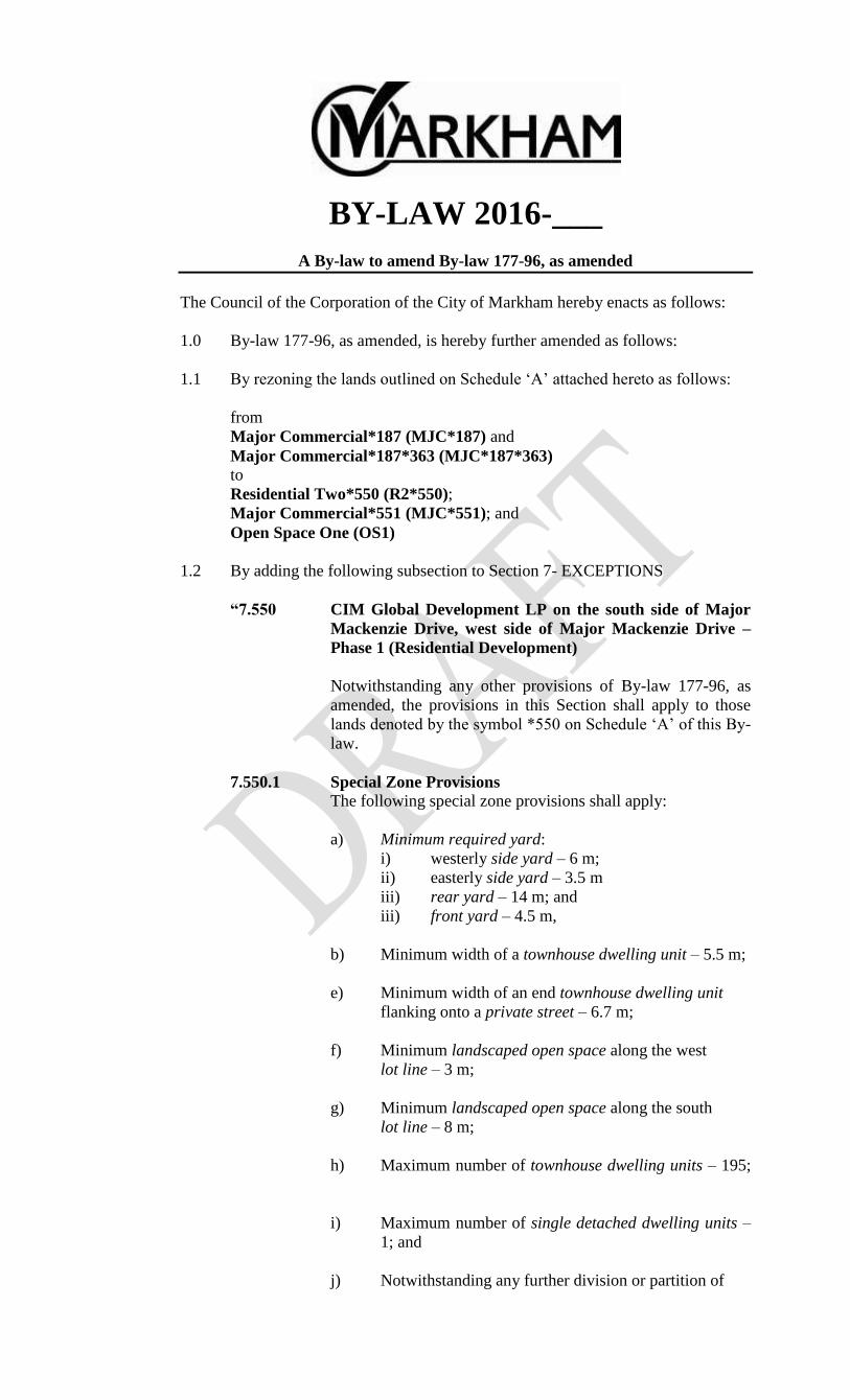
BY-LAW 2016-___
A By-law to amend By-law 177-96, as amended
The Council of the Corporation of the City of Markham hereby enacts as follows:
1.0 By-law 177-96, as amended, is hereby further amended as follows:
1.1 By rezoning the lands outlined on Schedule „A‟ attached hereto as follows:
from
Major Commercial*187 (MJC*187) and
Major Commercial*187*363 (MJC*187*363)
to
Residential Two*550 (R2*550);
Major Commercial*551 (MJC*551); and
Open Space One (OS1)
1.2 By adding the following subsection to Section 7- EXCEPTIONS
“7.550 CIM Global Development LP on the south side of Major
Mackenzie Drive, west side of Major Mackenzie Drive –
Phase 1 (Residential Development)
Notwithstanding any other provisions of By-law 177-96, as
amended, the provisions in this Section shall apply to those
lands denoted by the symbol *550 on Schedule „A‟ of this By-
law.
7.550.1 Special Zone Provisions
The following special zone provisions shall apply:
a) Minimum required yard:
i) westerly side yard – 6 m;
ii) easterly side yard – 3.5 m
iii) rear yard – 14 m; and
iii) front yard – 4.5 m,
b) Minimum width of a townhouse dwelling unit – 5.5 m;
e) Minimum width of an end townhouse dwelling unit
flanking onto a private street – 6.7 m;
f) Minimum landscaped open space along the west
lot line – 3 m;
g) Minimum landscaped open space along the south
lot line – 8 m;
h) Maximum number of townhouse dwelling units – 195;
i) Maximum number of single detached dwelling units –
1; and
j) Notwithstanding any further division or partition of

By-law 2016-_____
Page 2
any of the lands subject to this Section, all lands zoned
R2*550 shall be deemed to be one lot for the purposes
of this By-law.”
“7.551 CIM Global Development LP on the south side of Major
Mackenzie Dive, west side of Markham Road – Phase 2
(Commercial Development)
Notwithstanding any other provisions of By-law 177-96, as amended,
the provisions in this Section shall apply to those lands denoted by the
symbol *551 on Schedule „A‟ of this By-law.
7.551.1 Special Zone Provisions
The following special zone provisions shall apply:
a) Minimum landscaped open space along the west lot line –
10m; and
b) Minimum required yard:
i) rear yard – 10 m;
ii) northerly side yard – 4 m”.
Read a first, second and third time and passed on __________________, 2016.
______________________________ ___________________________
Kimberley Kitteringham Frank Scarpitti
City Clerk Mayor
AMANDA File No.: _____________________________

Drawn By: CPW Checked By: SMDEVELOPMENT SERVICES COMMISSION
BOUNDARY OF AREA COVERED BY THIS SCHEDULEBOUNDARY OF ZONE DESIGNATION(S)
DATE: 13/04/2016NOTE: This Schedule should be read in conjunction with the signed original By-Law filed with the City of Markham Clerk's Office
RESIDENTIAL TWOMAJOR COMMERCIAL OPEN SPACE ONE
EXCEPTION SECTION NUMBER
FROM MJC*187*363TO R2*550
FROM MJC*187TO R2*550
FROM MJC*187TO MJC*551
OS1
FROM MJC*187TO OS1 OS1
Markh
am R
d
Major Mackenzie Dr E
Maca
dam
Rd
Hartmoor St
Ralph
Cha
lmers
Ave
Hwy 4
8
Hammersly Blvd
Q:\Geomatics\New Operation\By-Laws\SU\SU_ZA14130863\SU_ZA14130863.mxd40 0 4020
Meters
³AMENDING BY-LAW 177-96 DATED SCHEDULE "A" TO BY-LAW
R2MJC
OS1*No.

By-law 2016-_____
Page 3
EXPLANATORY NOTE
BY-LAW 2016-_______
A By-law to amend By-law 177-96, as amended
CIM Global Development LP
5899 Major Mackenzie Dr E, 5899 Major Mackenzie Drive and the abutting
property to the east
CON 7 PT LOT 20
Lands Affected
The proposed by-law amendment applies to 6.6 hectares (16.3 acres) of land
comprised of three (3) properties located on the south side of Major Mackenzie
Drive, west side of Markham Road and municipally known as 9900 Markham Road,
5899 Major Mackenzie Drive and the abutting property to the east.
Existing Zoning
By-law 177-96, as amended, currently zoned the subject lands as Major Commercial
*187 (MJC*187) Zone, Major Commercial *187*363 (MJC*187*363) Zone and
Open Space One (OS1) Zone.
Purpose and Effect
The purpose and effect of this By-law is to amend By-law 177-96, as amended, to
rezone the subject property to “Residential Two*550 (R2*550)”, “Major
Commercial*551 (MJC*551)” and “Open Space One (OS1)”, in order to facilitate
townhouse development and future commercial development on the subject lands,
including the introduction of site-specific development standards.