chapter 4 global climates and biomes - parkway schools apes chapter 04... · chapter 4 global...
TRANSCRIPT
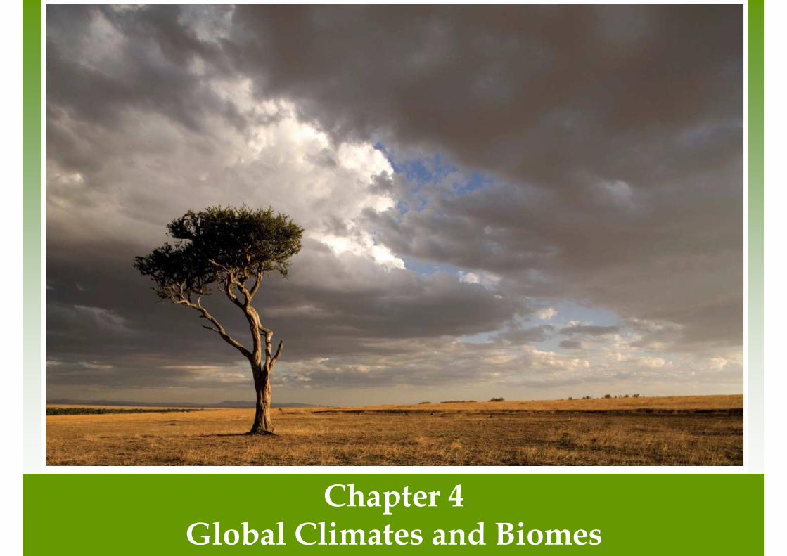
Chapter 4Global Climates and Biomes

Global Processes Determine Weather and Climate
• Weather- the short term conditions of the atmosphere in a local area. These include temperature, humidity, clouds, precipitation, wind speed and atmospheric pressure.
• Climate- The average weather that occurs in a given region over a long period-typically several decades.

Earth's Atmosphere
• Troposphere- the layer closest to Earth's surface extending roughly 16 km (10 miles) above Earth.
• Stratosphere- above the troposphere, this extends from roughly 16 to 50 km (10-31 miles).


Unequal Heating of Earth
• As the Sun's energy passes through the atmosphere and strikes land and water, it warms the surface of Earth. But this warming does not occur evenly across the planet.

Unequal Heating of Earth
• This unequal heating is because:
• The variation in angle at which the Sun's rays strike
• The amount of surface area over which the Sun's rays are distributed
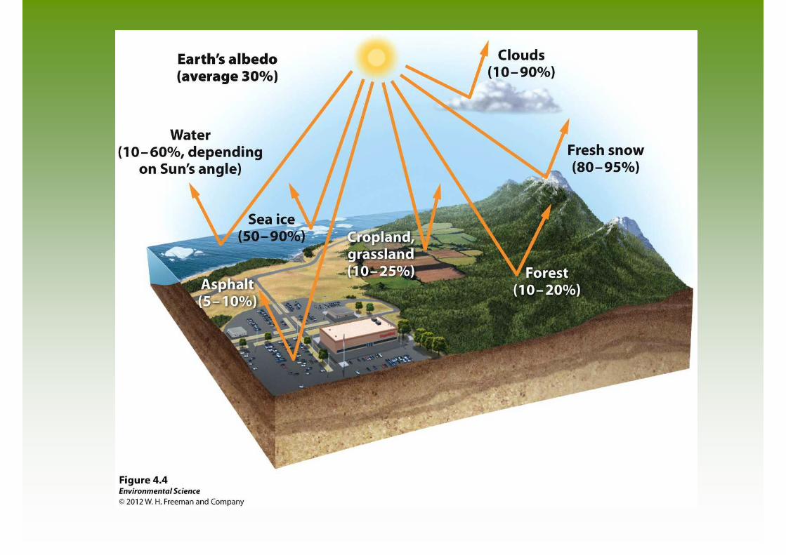
• Some areas of Earth reflect more solar energy than others. (Albedo)

Atmospheric Convection Currents
• Air has four properties that determines its movement:
• Density- less dense air rises, denser air sinks.
• Water vapor capacity- warm air has a higher capacity for water vapor than cold air.
• Adiabatic heating or cooling- as air rises in the atmosphere its pressure decreases and the air expands. Conversely, as air sinks, the pressure increases and the air decreases in volume.
• Latent heat release- when water vapor in the atmosphere condenses into liquid water and energy is released.

Formation of Convection Currents
Formation of Convection Currents
• Atmospheric convection currents are global patterns of air movement that are initiated by the unequal heating of Earth.
• Hadley cells- the convection currents that cycle between the equator and 30˚ north and south.
• Intertropical convergence- the area of Earth that receives the most intense sunlight and where the ascending branches of the two Hadley cells converge.
• Polar cells- the convection currents that are formed by air that rises at 60˚ north and south and sinks at the poles (90˚ north and south)

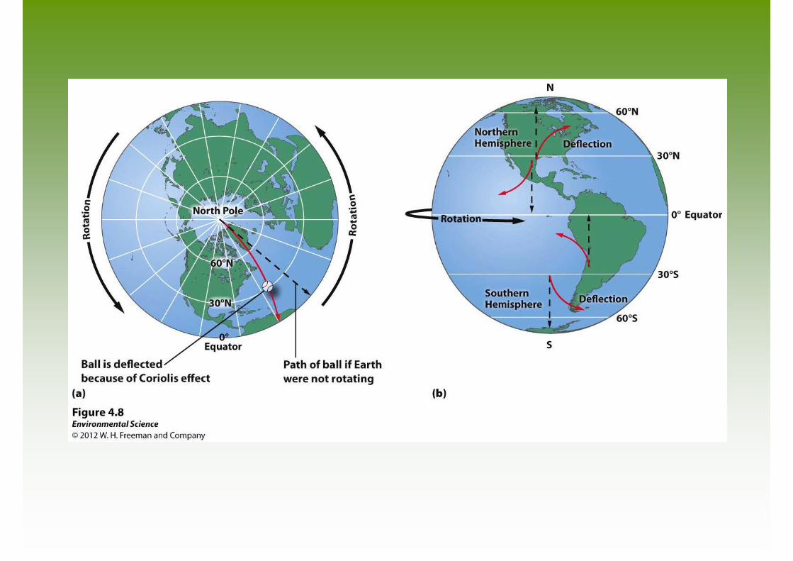
Earth's Rotation and the Coriolis Effect
• As Earth rotates, its surface moves much faster at the equator than in mid-latitude and polar regions.
• The faster rotation speeds closer to the equator cause a deflection of objects that are moving directly north or south.
Earth's Rotation and the Coriolis Effect
• Coriolis Effect- the deflection of an object's path due to Earth's rotation.
• The prevailing winds of the world are produced by a combination of atmospheric convection currents and the Coriolis effect.


Earth's Tilt and the Seasons
• The Earth's axis of rotation is tilted 23.5 ˚.
• When the Northern Hemisphere is tilted toward the Sun, the Southern Hemisphere is tilted away from the Sun, and vice versa.


Ocean Currents
• Ocean currents are driven by a combination of temperature, gravity, prevailing winds, the Coriolis effect, and the locations of continents.
• Warm water, like warm air, expands and rises.
• Gyres- the large-scale patterns of water circulation. The ocean surface currents rotate in a clockwise direction in the Northern Hemisphere and a counterclockwise direction in the Southern Hemisphere.

Upwelling
• Upwelling- as the surface currents separate from one another, deeper waters rise and replace the water that has moved away.
• This upward movement of water brings nutrients from the ocean bottom that supports the large populations of producers, which in turn support large populations of fish.

Thermohaline Circulation
• Thermohaline circulation- another oceanic circulation that drives the mixing of surface water and deep water.
• Scientists believe this process is crucial for moving heat and nutrients around the globe.
• Thermohaline circulation appears to be driven by surface waters that contain unusually large amounts of salt.

Thermohaline Circulation

Thermohaline Circulation
• Some of the water that flows from the Gulf of Mexico to the North Atlantic freezes or evaporates, and the salt that remains behind increases the salt concentration of the water.
• This cold, salty water is relatively dense, so it sinks to the bottom of the ocean, mixing with deeper ocean waters.
• These two processes create the movement necessary to drive a deep, cold current that slowly moves past Antarctica and northward to the northern Pacific Ocean.

Heat Transport
• Ocean currents can affect the temperature of nearby landmasses.
• For example, England's average winter temperature is approximately 20 ˚ C (36˚F) warmer than Newfoundland, Canada, which is located at a similar latitude.

El Nino-Southern Oscillation
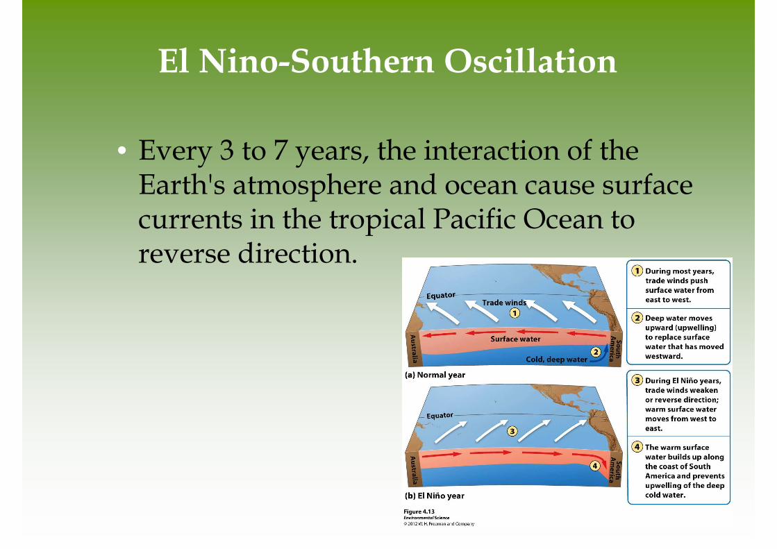
• Every 3 to 7 years, the interaction of the Earth's atmosphere and ocean cause surface currents in the tropical Pacific Ocean to reverse direction.

El Nino-Southern Oscillation
• First, the trade winds near South America weaken.
• This weakening allows warm equatorial water from the western Pacific to move eastward toward the west coast of South America.
• The movement of warm water and air toward South America suppresses upwelling off the coast of Peru and decreases productivity there, reducing fish populations near the coast.
• These periodic changes in wind and ocean currents are collectively called the EL Nino-Southern Oscillation, or ENSO.

Rain Shadows

Rain Shadows
• When air moving inland from the ocean that contains a large amount of water vapor meets the windward side of a mountain range (the side facing the wind), it rises and begins to experience adiabatic cooling.
• Because water vapor condenses as air cools, clouds form and precipitation falls.
• The presence of the mountain range causes large amounts of precipitin to fall on its windward side.
• The cold, dry air then travels to the other side of the mountain range (the leeward side), where it descends and experiences higher pressures, which cause adiabatic heating.
• This air is now war and dry and process arid conditions on the leeward side forming the region called a rain shadow.

Variations in Climate Determine the Dominant Plant Growth Forms of
Terrestrial Biomes
• Climate affects the distribution of species around the globe.
• Organisms possess distinct growth forms due to adaptations to local temperature and precipitin patterns.
• Biomes- The presence of similar plant growth forms in areas possessing similar temperature and precipitation patterns.

Tundra
• Cold, treeless biome with low-growing vegetation. In winter, the soil is completely frozen.
• The tundra's growing season is very short, usually only about 4 months during summer.
• The underlying subsoil, known as permafrost is an impermeable, permanently frozen layer that prevents water from draining and roots from penetrating.

Tundra

Boreal Forest
• Forests made up primarily of coniferous (cone-bearing) evergreen trees that can tolerate cold winters and short growing seasons.
• Boreal forests are found between about 50˚ and 60˚ N in Europe, Russia and North America.
• This subarctic biome has a very cold climate, and plant growth is more constrained by temperature than precipitation.
• The soil is nutrient-poor due to slow decomposition.

Boreal Forest

Temperate Rainforest
• Moderate temperatures and high precipitation typify the temperate rainforest.
• The temperate rainforest is a coast biome and can be found along the west coast of North America from northern California to Alaska, in southern Chile, on the west coast of New Zealand, and on the island of Tasmania.
• The ocean currents help moderate temperature fluctuations and provide a source of water vapor.
• This biome has a nearly 12-month growing season where winters are rainy and summers are foggy.
• The mild temperatures and high precipitation supports the growth of very large trees.

Temperate Rainforest

Temperate Seasonal Forest
• Receive over 1 m (39 inches) of precipitation annually.
• Found in the eastern United States, Japan, China, Europe, Chile and eastern Australia.
• Dominated by broadleaf deciduous trees such as beech, male, oak and hickory.
• Warmer summer temperatures favor decomposition so soils generally contain more nutrients than those of boreal forests.

Temperate Seasonal Forest

Woodland/Shrubland
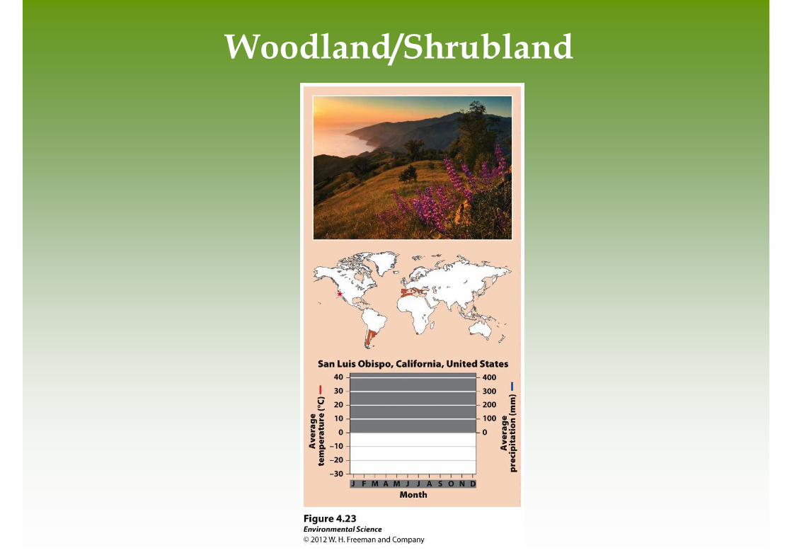
• Found on the coast of southern California, southern Australia, southern Africa and in the area surrounding the Mediterranean Sea.
• Hot, dry summers and mild, rainy winters are characteristic of this biome.
• There is a 12-month growing season, but plant growth is constrained by low precipitin in summer and by relatively low temperatures in winter.
• Wildfires are common and plants of this biome are well adapted to both fire and drought.
Woodland/Shrubland

Temperate Grassland/Cold Desert
• This biome has the lowest average annual precipitation of any temperate biome.
• These are found in the Great Plains of North America, in South America, and in central Asia and eastern Europe.
• Cold, harsh winters and hot, dry, summers characterize this biome.
• Plant growth is constrained by both insufficient precipitation in summer and cold temperatures in winter.
• Plants include grasses and non woody flowering plants that are well adapted to wildfires and frequent grazing by animals.

Temperate Grassland/Cold Desert

Tropical Rainforest
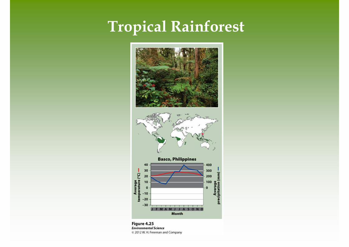
• In the tropics, average annual temperatures exceed 20˚C.
• This biome is located approximately 20˚ N and S of the equator.
• They are found in Central and South America, Africa, Southeast Asia, and northeastern Australia.
• Precipitation occurs frequently and this biome is warm and wet with little temperature variation.
• Tropical rain forests have more biodiversity per hectare than any other terrestrial biome and contain up to two-thirds of Earth's terrestrial species.
Tropical Rainforest

Tropical Seasonal Forest/Savanna
• Warm temperatures and distinct wet and dry seasons characterize this biome.
• Tropical seasonal forests are common in much of Central America, on the Atlantic coast of South America, in southern Asia, in northwestern Australia, and in sub-Saharan Africa.
• Soil in this biome is fairly fertile and can be farmed due to high decomposition rates, but the low amount of precipitation constrains plants from using the soil nutrients that are released.
• Grasses and scattered deciduous trees are common.

Tropical Seasonal Forest/Savanna

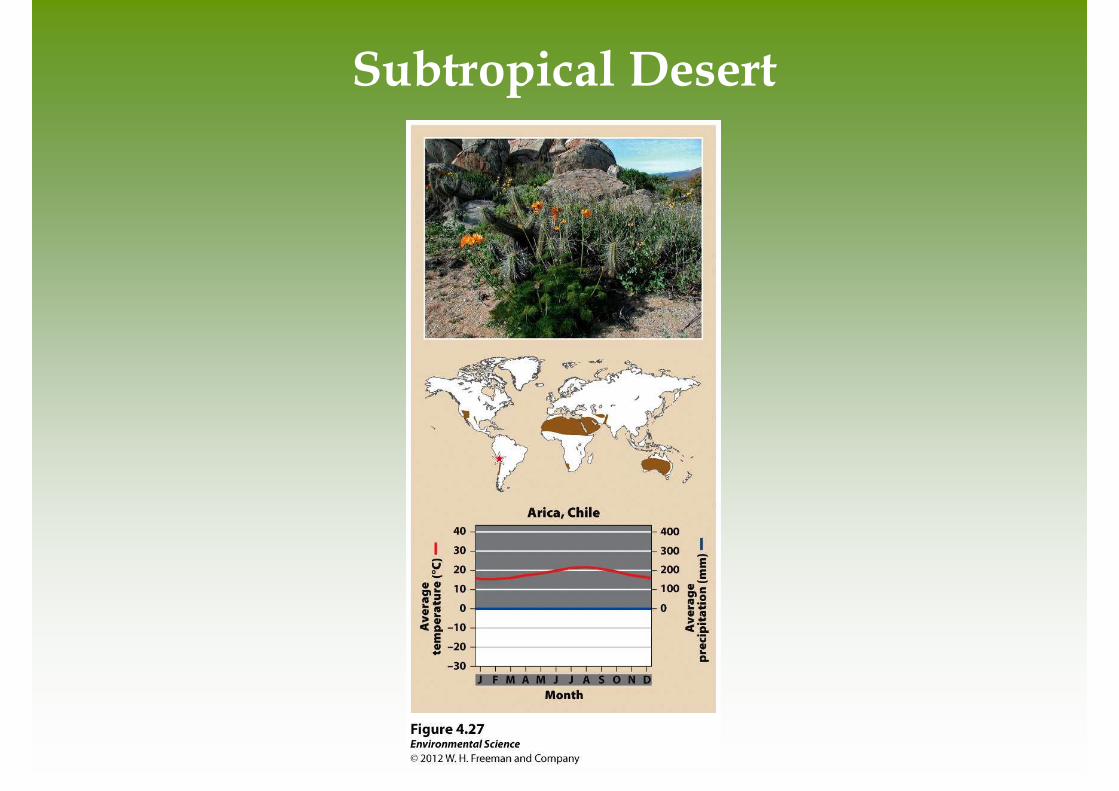
Subtropical Desert
• This biome is found at 30˚ N and S with hot temperatures and extremely dry conditions.
• The Mojave Desert in the southwestern United States, the Sahara in Africa, the Arabian Desert of the Middle East and the GReat Victoria Desert of Australia are all subtropical deserts.
• Cacti, euphorbs and succulent plants are well adapted to this biome.
Subtropical Desert

Aquatic Biomes are Categorized by Salinity, Depth, and Water Flow

Streams and Rivers
• Flowing fresh water that may originate from underground springs or as runoff from rain or melting snow.
• Streams are typically narrow and carry relatively small amounts of water where rivers are usually wider and carry larger amounts of water.

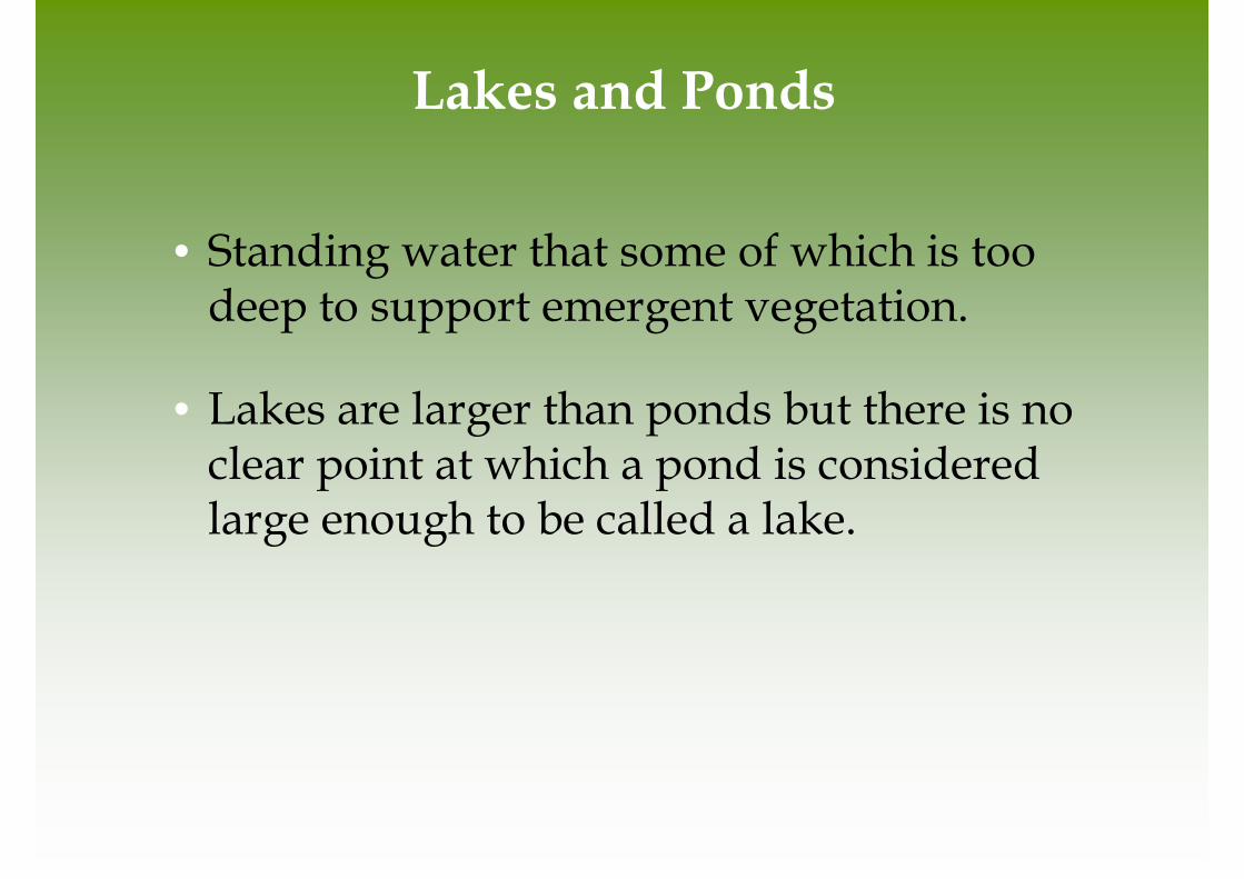
Lakes and Ponds
• Standing water that some of which is too deep to support emergent vegetation.
• Lakes are larger than ponds but there is no clear point at which a pond is considered large enough to be called a lake.

Lakes and Ponds

Lakes and Ponds
• Littoral zone- the shallow area of soil and water near the shore where algae and emergent plants grow.
• Limnetic zone- open water, where rooted plants can no longer survive. Phytoplankton are the only photosynthetic organisms. This zone extends to as deep as sunlight can penetrate.
• Profundal zone- the zone where sunlight cannot penetrate and therefore producers cannot survive.
• Benthic zone- the muddy bottom of a lake or bond beneath the limnetic and profundal zone.
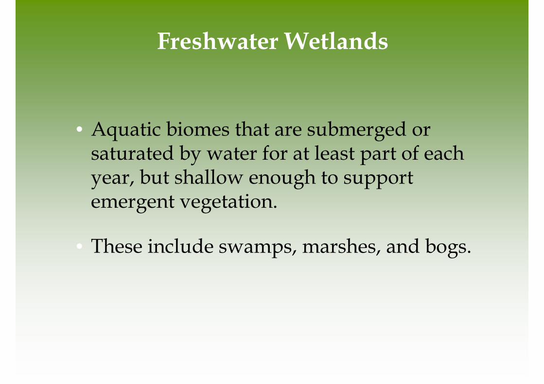
Freshwater Wetlands
• Aquatic biomes that are submerged or saturated by water for at least part of each year, but shallow enough to support emergent vegetation.
• These include swamps, marshes, and bogs.


Salt Marshes
• Found along the coast in temperate climates and contain non woody emergent vegetation.
• The salt marsh is one of the most productive biomes in the world.

Mangrove Swamps
• Found along tropical and subtropical coasts and contain trees whose roots are submerged in water.
• Mangrove trees are salt tolerant and help protect the coastlines from erosion and storm damage.

Figure 4.32

Intertidal Zone
• Narrow band of coastline that exists between the levels of high tide an low tide.
• Waves that crash onto the shore in this biome can make it a challenge for organisms to hold on and not get washed away.

Figure 4.33

Coral Reefs
• Found in warm, shallow waters beyond the shoreline.
• Earth's most diverse marine biome even though coral reefs are found in water that is relatively poor in nutrients and food.
• Coral bleaching- when the algae inside the coral dies. Scientists believe this is due to a combination of disease and environmental change.


The Open Ocean
• The depth that light can penetrate in the open ocean is dependent on the amount of sediment and algae suspended in the water.
• Photic zone- the zone that receives enough light to allow photosynthesis to occur.
• Aphotic zone- the deeper water that lacks sufficient light for photosynthesis.
• Chemosynthesis- The process that occurs in the aphotic zone when some species of bacteria use methane and hydrogen sulfide to generate energy.