city of griffin stormwater utility
TRANSCRIPT
CITY OF GRIFFINSTORMWATER UTILITY
Annual Report 2003
Dear Fellow Citizens:
The past three years have been very exciting for theCity of Griffin Stormwater Utility. We have attainedmany of the goals we set in 1998 with the completionof several capital improvement projects, floodplainmapping and storm-drain inventory projects, watershedassessments, and compliance with the NPDES(National Pollutant Discharge Elimination System)Phase II permit standards to name but a few. We havebeen very busy responding to individual customer’sdrainage problems and maintaining the drainage systemon a daily basis. We have also received numerousgrants for flood control projects and we have been rec-ognized nationally with several awards.
In addition we have seen the crippling effects thedrought had on water supplies in Griffin. The droughthas reinforced the long standing vision of the City ofGriffin that stormwater, wastewater, and drinking waterare all interconnected and must be managed in a holis-tic and non-traditional approach. The City of GriffinStormwater Utility has been, and will continue to be, aproactive leader in the State of Georgia to change theway we think of and handle stormwater.
I am very excited to be a part of this nationally recog-nized program. I would like to share the followinginformation with you to demonstrate the things thatyour user fees have done to improve water quality, miti-gate flooding, comply with Federal and StateRegulations, and improve the quality of life in Griffin.I also want to impart with you where we still need toimprove our program and leave you with a sense ofpride, ownership, and accomplishment.
Thank you for the time and interest in your StormwaterUtility.
Sincerely,
Brant D. Keller Ph.D.Director of Public Works and Utilities
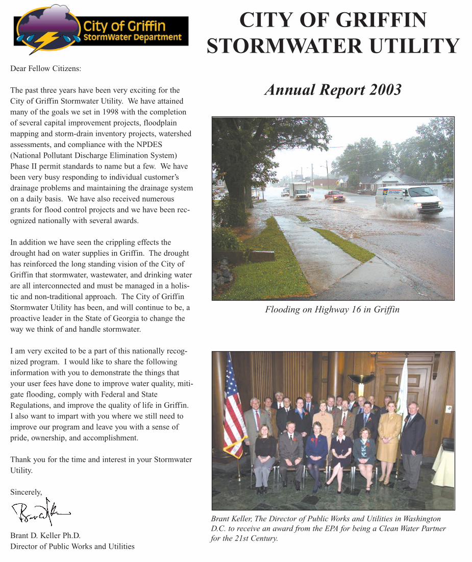
Flooding on Highway 16 in Griffin
Brant Keller, The Director of Public Works and Utilities in WashingtonD.C. to receive an award from the EPA for being a Clean Water Partnerfor the 21st Century.
Accomplishments
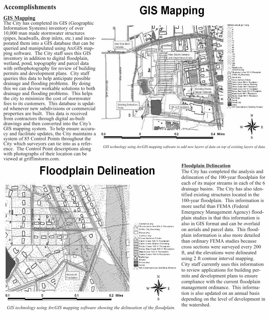
GIS MappingThe City has completed its GIS (GeographicInformation Systems) inventory of over10,000 man made stormwater structures(pipes, headwalls, drop inlets, etc.) and incor-porated them into a GIS database that can bequeried and manipulated using ArcGIS map-ping software. The City staff uses this GISinventory in addition to digital floodplain,wetland, pond, topography and parcel datawith orthophotography for review of buildingpermits and development plans. City staffqueries this data to help anticipate possibledrainage and flooding problems. By doingthis we can devise workable solutions to bothdrainage and flooding problems. This helpsthe city to minimize the cost of stormwaterfees to its customers. This database is updat-ed whenever new subdivisions or commercialproperties are built. This data is receivedfrom contractors through digital as-builtdrawings and then converted into the City’sGIS mapping system. To help ensure accura-cy and facilitate updates, the City maintains asystem of 85 Control Points throughout theCity which surveyors can tie into as a refer-ence. The Control Point descriptions alongwith photographs of their location can beviewed at griffinstorm.com.
Floodplain DelineationThe City has completed the analysis anddelineation of the 100-year floodplain foreach of its major streams in each of the 6drainage basins. The City has also iden-tified existing structures located in the100-year floodplain. This information ismore useful than FEMA (FederalEmergency Management Agency) flood-plain studies in that this information isalso in GIS format and can be overlaidon aerials and parcel data. This flood-plain information is also more detailedthan ordinary FEMA studies becausecross sections were surveyed every 200ft, and the elevations were delineatedusing 2 ft contour interval mapping.City staff currently uses this informationto review applications for building per-mits and development plans to ensurecompliance with the current floodplainmanagement ordinance. This informa-tion is also updated on an annual basisdepending on the level of development inthe watershed.
GIS technology using ArcGIS mapping software to add new layers of data on top of existing layers of data.
GIS technology using ArcGIS mapping software showing the delineation of the floodplain.
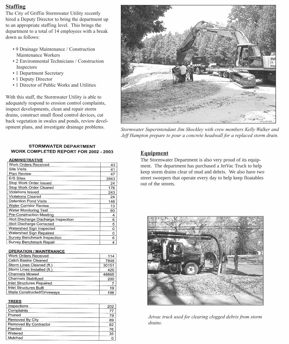
StaffingThe City of Griffin Stormwater Utility recentlyhired a Deputy Director to bring the department upto an appropriate staffing level. This brings thedepartment to a total of 14 employees with a breakdown as follows:
• 9 Drainage Maintenance / Construction Maintenance Workers
• 2 Environmental Technicians / ConstructionInspectors
• 1 Department Secretary• 1 Deputy Director • 1 Director of Public Works and Utilities
With this staff, the Stormwater Utility is able toadequately respond to erosion control complaints,inspect developments, clean and repair stormdrains, construct small flood control devices, cutback vegetation in swales and ponds, review devel-opment plans, and investigate drainage problems. Stormwater Superintendant Jim Shockley with crew members Kelly Walker and
Jeff Hampton prepare to pour a concrete headwall for a replaced storm drain.
EquipmentThe Stormwater Department is also very proud of its equip-ment. The department has purchased a JetVac Truck to helpkeep storm drains clear of mud and debris. We also have twostreet sweepers that operate every day to help keep floatablesout of the streets.
Jetvac truck used for clearing clogged debris from stormdrains.
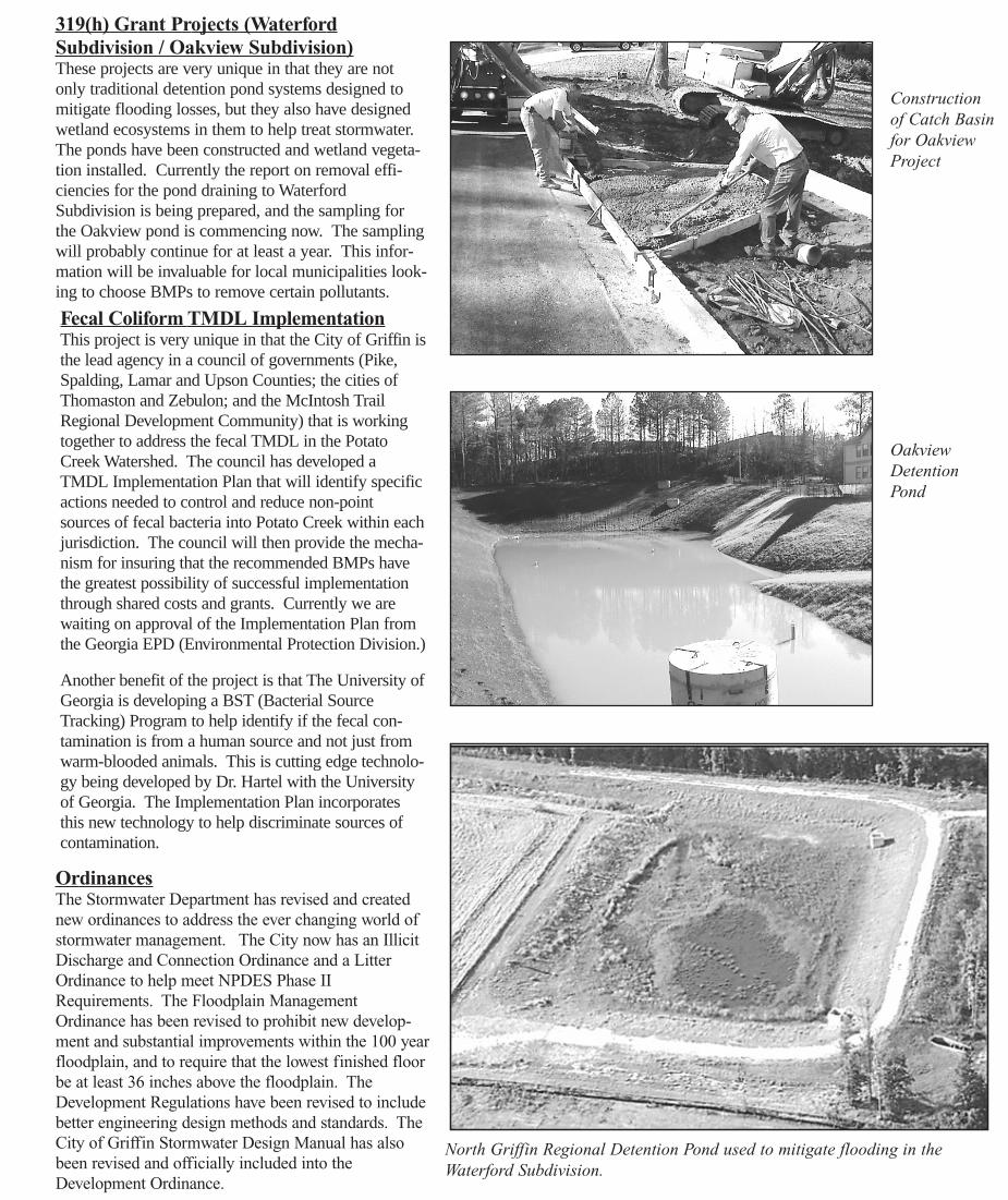
319(h) Grant Projects (WaterfordSubdivision / Oakview Subdivision)These projects are very unique in that they are notonly traditional detention pond systems designed tomitigate flooding losses, but they also have designedwetland ecosystems in them to help treat stormwater.The ponds have been constructed and wetland vegeta-tion installed. Currently the report on removal effi-ciencies for the pond draining to WaterfordSubdivision is being prepared, and the sampling forthe Oakview pond is commencing now. The samplingwill probably continue for at least a year. This infor-mation will be invaluable for local municipalities look-ing to choose BMPs to remove certain pollutants.
Fecal Coliform TMDL ImplementationThis project is very unique in that the City of Griffin isthe lead agency in a council of governments (Pike,Spalding, Lamar and Upson Counties; the cities ofThomaston and Zebulon; and the McIntosh TrailRegional Development Community) that is workingtogether to address the fecal TMDL in the PotatoCreek Watershed. The council has developed aTMDL Implementation Plan that will identify specificactions needed to control and reduce non-pointsources of fecal bacteria into Potato Creek within eachjurisdiction. The council will then provide the mecha-nism for insuring that the recommended BMPs havethe greatest possibility of successful implementationthrough shared costs and grants. Currently we arewaiting on approval of the Implementation Plan fromthe Georgia EPD (Environmental Protection Division.)
Another benefit of the project is that The University ofGeorgia is developing a BST (Bacterial SourceTracking) Program to help identify if the fecal con-tamination is from a human source and not just fromwarm-blooded animals. This is cutting edge technolo-gy being developed by Dr. Hartel with the Universityof Georgia. The Implementation Plan incorporatesthis new technology to help discriminate sources ofcontamination.
Constructionof Catch Basinfor OakviewProject
OakviewDetentionPond
North Griffin Regional Detention Pond used to mitigate flooding in theWaterford Subdivision.
OrdinancesThe Stormwater Department has revised and creatednew ordinances to address the ever changing world ofstormwater management. The City now has an IllicitDischarge and Connection Ordinance and a LitterOrdinance to help meet NPDES Phase IIRequirements. The Floodplain ManagementOrdinance has been revised to prohibit new develop-ment and substantial improvements within the 100 yearfloodplain, and to require that the lowest finished floorbe at least 36 inches above the floodplain. TheDevelopment Regulations have been revised to includebetter engineering design methods and standards. TheCity of Griffin Stormwater Design Manual has alsobeen revised and officially included into theDevelopment Ordinance.
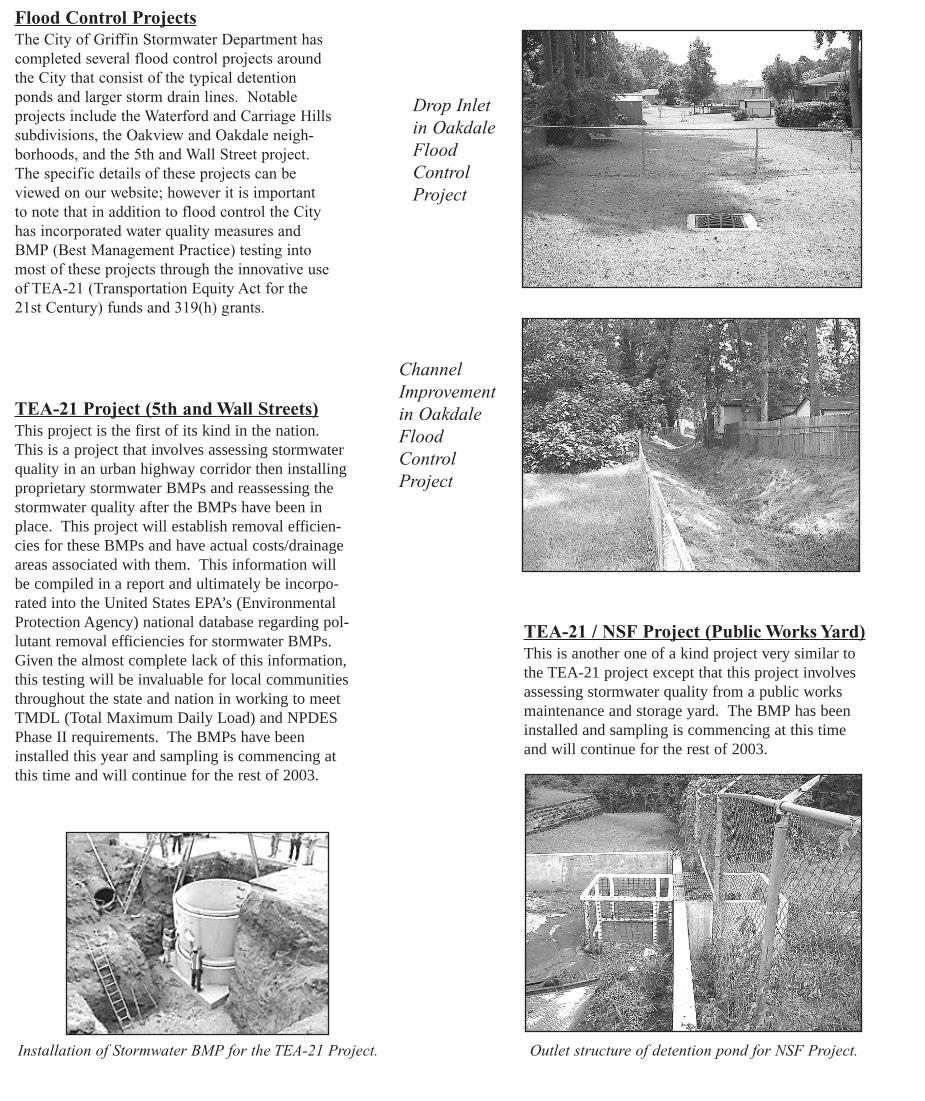
Flood Control ProjectsThe City of Griffin Stormwater Department hascompleted several flood control projects aroundthe City that consist of the typical detentionponds and larger storm drain lines. Notableprojects include the Waterford and Carriage Hillssubdivisions, the Oakview and Oakdale neigh-borhoods, and the 5th and Wall Street project.The specific details of these projects can beviewed on our website; however it is importantto note that in addition to flood control the Cityhas incorporated water quality measures andBMP (Best Management Practice) testing intomost of these projects through the innovative useof TEA-21 (Transportation Equity Act for the21st Century) funds and 319(h) grants.
TEA-21 Project (5th and Wall Streets)This project is the first of its kind in the nation.This is a project that involves assessing stormwaterquality in an urban highway corridor then installingproprietary stormwater BMPs and reassessing thestormwater quality after the BMPs have been inplace. This project will establish removal efficien-cies for these BMPs and have actual costs/drainageareas associated with them. This information willbe compiled in a report and ultimately be incorpo-rated into the United States EPA’s (EnvironmentalProtection Agency) national database regarding pol-lutant removal efficiencies for stormwater BMPs.Given the almost complete lack of this information,this testing will be invaluable for local communitiesthroughout the state and nation in working to meetTMDL (Total Maximum Daily Load) and NPDESPhase II requirements. The BMPs have beeninstalled this year and sampling is commencing atthis time and will continue for the rest of 2003.
Drop Inletin OakdaleFloodControlProject
ChannelImprovementin OakdaleFloodControlProject
TEA-21 / NSF Project (Public Works Yard)This is another one of a kind project very similar tothe TEA-21 project except that this project involvesassessing stormwater quality from a public worksmaintenance and storage yard. The BMP has beeninstalled and sampling is commencing at this timeand will continue for the rest of 2003.
Outlet structure of detention pond for NSF Project.Installation of Stormwater BMP for the TEA-21 Project.

WebsiteThe Stormwater Department has devel-oped a website (griffinstorm.com) that isthe premier website of StormwaterUtilities in Georgia receiving over60,000 hits a month. This website hasinvaluable information ranging fromhow to start a utility to downloadableordinances and current project informa-tion. The current NPDES Phase II NOI(Notice of Intent) is also available forviewing on the website.
The City of Griffin’s Stormwater web site: www.griffinstorm.com
Ecomasters – An interactivegame for children used to teachabout water pollution.
NPDES Phase II PermitThe City of Griffin Stormwater Utility was thefirst municipality in the Nation to write a draftNOI. The final version submitted to the GeorgiaEPD is an interactive CD that allows the reader toview pictures of the BMPs and other itemsdescribed in the permit.
Most importantly, in this NOI the City dedicatedthousands of dollars to educate the public onstormwater issues. The highlights of the educa-tion and involvement portion of the NOI include:
• Lending miniature pollution models(Enviroscape Models) for schools to show
students the effects of pollution
• Providing 3rd and 4th graders copies of theEcoMasters CD (an interactive game showingwhat pollution does to the environment as well asto the sewers and stormsewers)
• Establishing a stake holders committee ofpeople from every watershed
• Mailing brochures to all utility customers onvarious issues
• Placing curb markers on storm drains toadvise against dumping
• Setting up a display stand with videos, pic-tures and other stormwater information
• Developing an erosion control test site totest new BMPs and educate builders and CityEmployees on the proper installation of erosioncontrol measures
ScholarshipsThe City of Griffin has awarded two scholarshipsto deserving high-school graduates in the amountof $1500. The graduates must maintain a 2.0grade-point average and pursue a degree in a sci-ence or engineering field. The scholarships alsoprovide the students with a summer job with theCity of Griffin where they will learn about water,wastewater, stormwater, and GIS mapping in agovernment setting. This year the scholarshipswere awarded to Mr. Wayne Bailey and Ms.Jacoya Clinkscales.
Enviroscape – A model used to teachabout the effects of nonpoint sourcepollution.
Watershed AssessmentsWatershed assessments have been complet-ed for all watersheds in Griffin. Theassessments have quantified the City’simpact to water quality leaving its jurisdic-tional boundary (based on numerous sam-ple points within each watershed), and theyhave identified water quality issues thathave not necessarily been transmitteddownstream.
The purpose of these assessments was todevelop comprehensive watershed basedplans to improve water quality leaving theCity and to adequately address regulatoryrequirements such as NPDES permits andTMDLs. The most significant projectidentified in the plans was to develop astream restoration project. The streamrestoration project is a joint project withthe Army Corps of Engineers and will bediscussed in more detail later in this report.
A GIS based Watershed Planning Modelhas also been created that will help theCity decide which controls to implementand where to place them to have the mosteffect on water quality.
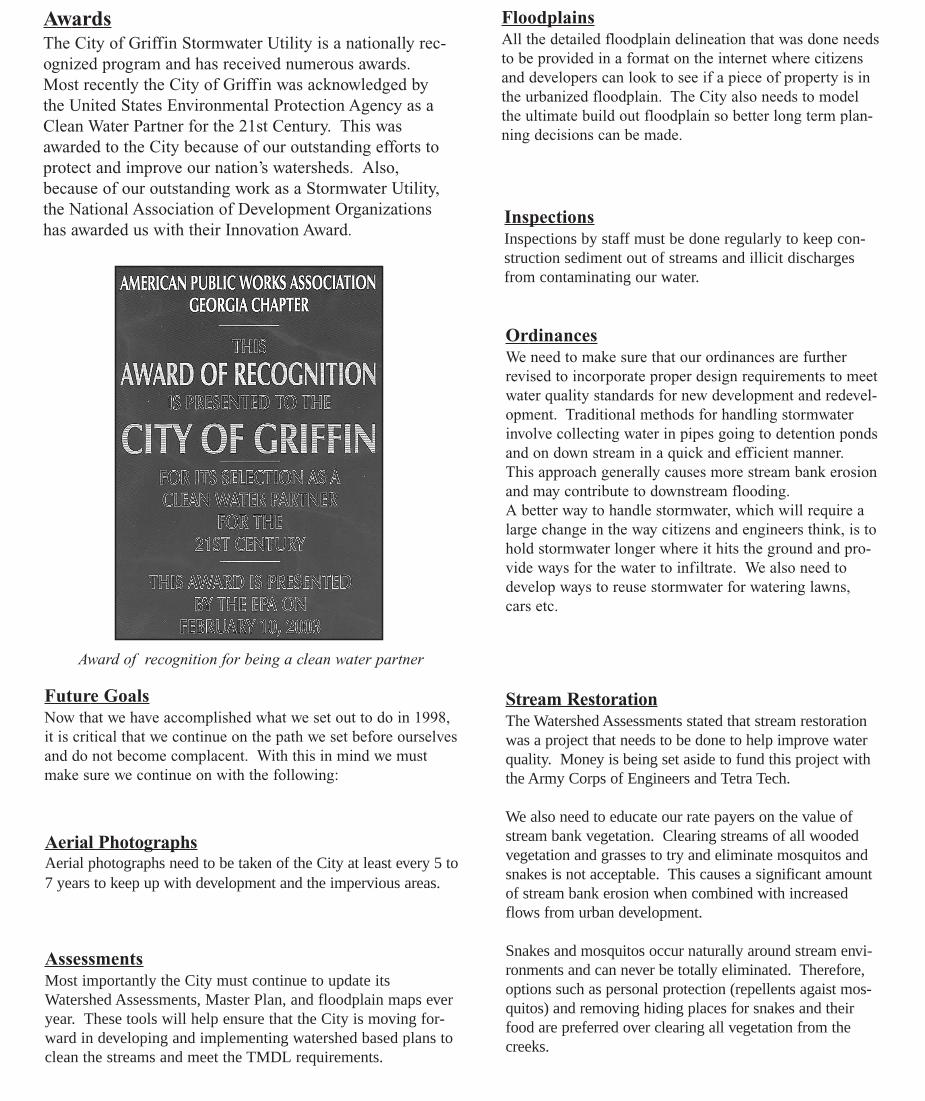
AwardsThe City of Griffin Stormwater Utility is a nationally rec-ognized program and has received numerous awards.Most recently the City of Griffin was acknowledged bythe United States Environmental Protection Agency as aClean Water Partner for the 21st Century. This wasawarded to the City because of our outstanding efforts toprotect and improve our nation’s watersheds. Also,because of our outstanding work as a Stormwater Utility,the National Association of Development Organizationshas awarded us with their Innovation Award.
FloodplainsAll the detailed floodplain delineation that was done needsto be provided in a format on the internet where citizensand developers can look to see if a piece of property is inthe urbanized floodplain. The City also needs to modelthe ultimate build out floodplain so better long term plan-ning decisions can be made.
InspectionsInspections by staff must be done regularly to keep con-struction sediment out of streams and illicit dischargesfrom contaminating our water.
Future GoalsNow that we have accomplished what we set out to do in 1998,it is critical that we continue on the path we set before ourselvesand do not become complacent. With this in mind we mustmake sure we continue on with the following:
Aerial PhotographsAerial photographs need to be taken of the City at least every 5 to7 years to keep up with development and the impervious areas.
AssessmentsMost importantly the City must continue to update itsWatershed Assessments, Master Plan, and floodplain maps everyear. These tools will help ensure that the City is moving for-ward in developing and implementing watershed based plans toclean the streams and meet the TMDL requirements.
Award of recognition for being a clean water partner
OrdinancesWe need to make sure that our ordinances are furtherrevised to incorporate proper design requirements to meetwater quality standards for new development and redevel-opment. Traditional methods for handling stormwaterinvolve collecting water in pipes going to detention pondsand on down stream in a quick and efficient manner.This approach generally causes more stream bank erosionand may contribute to downstream flooding. A better way to handle stormwater, which will require alarge change in the way citizens and engineers think, is tohold stormwater longer where it hits the ground and pro-vide ways for the water to infiltrate. We also need todevelop ways to reuse stormwater for watering lawns,cars etc.
Stream RestorationThe Watershed Assessments stated that stream restorationwas a project that needs to be done to help improve waterquality. Money is being set aside to fund this project withthe Army Corps of Engineers and Tetra Tech.
We also need to educate our rate payers on the value ofstream bank vegetation. Clearing streams of all woodedvegetation and grasses to try and eliminate mosquitos andsnakes is not acceptable. This causes a significant amountof stream bank erosion when combined with increasedflows from urban development.
Snakes and mosquitos occur naturally around stream envi-ronments and can never be totally eliminated. Therefore,options such as personal protection (repellents agaist mos-quitos) and removing hiding places for snakes and theirfood are preferred over clearing all vegetation from thecreeks.

What Can You Do?Water pollution is everyone’s problem, and itwill take everyone working together toreduce the impact on our water resources anddecrease the amount of non-point source pol-lution. How can we help? This list is only afew ways that we all can help:
Deputy Director’s Corner….
I would like to take this opportunity to thank the City of Griffin, andyou the ratepayers, for giving me the opportunity to work for such aprestigious stormwater program. The whole reason I left my previ-ous employer of six years was because of the City of Griffin’sStormwater Utility’s national recognition, and the City’s proactiveand holistic approach to stormwater.
So many communities have taken a “hands off ” approach tostormwater problems and will not spend money to fix problems thatare not within the street right of way. However, in Griffin, if it is aproblem generated from stormwater coming from City streets orproperty then we will fix it. It may not be tomorrow or the next day,but it will be prioritized and fixed as funding becomes available.This may seem like a trivial thing, but Griffin is unique in workingto resolve these types of problem.
Therefore, I trust that I leave you with a sense of pride in your com-munity and I hope you enjoy living and working in Griffin as muchas I do!
Thank You,
David A. Borkowski, P.E.Deputy Director of Stormwater
TERMINOLOGY:
ARCGIS Mapping software used to view overlapping layers of mapdata.
BMP Best Management Practices
BST Bacterial Source Tracking
CATCH BASIN Opening in curb to let in stormwater.
CONTROL POINTS Marked points that have been located by Global PositioningSatellites to serve as a reference point for contractors.
DETENTION POND Used for stormwater runoff collection to control flooding.
DROP INLET Opening for stormwater. Usually in depressed area in yard.
EPA Environmental Protection Agency
FEMA Federal Emergency Management Agency
FLOODPLAIN The natural area to where flooding may occur during a highprecipitation event.
GEORGIA EPD Environmental Protection Division
GIS Geographic Information Systems
ILLICIT DISCHARGE Any non-stormwater discharge that is in the street or thestorm drain.
NPDES PHASE II National Pollutant Discharge Elimination System
NOI Notice of Intent
OUTLET STRUCTURE Opening in detention pond to let out stormwater at anacceptable pace.
TEA-21 Transportation Equity Act for the 21st Century.
TMDL Total Maximum Daily Load
WATERSHED Area that drains to a specified point in a creek or stream.