existing conditions from tripoli road, woodstock - the northern pass
TRANSCRIPT
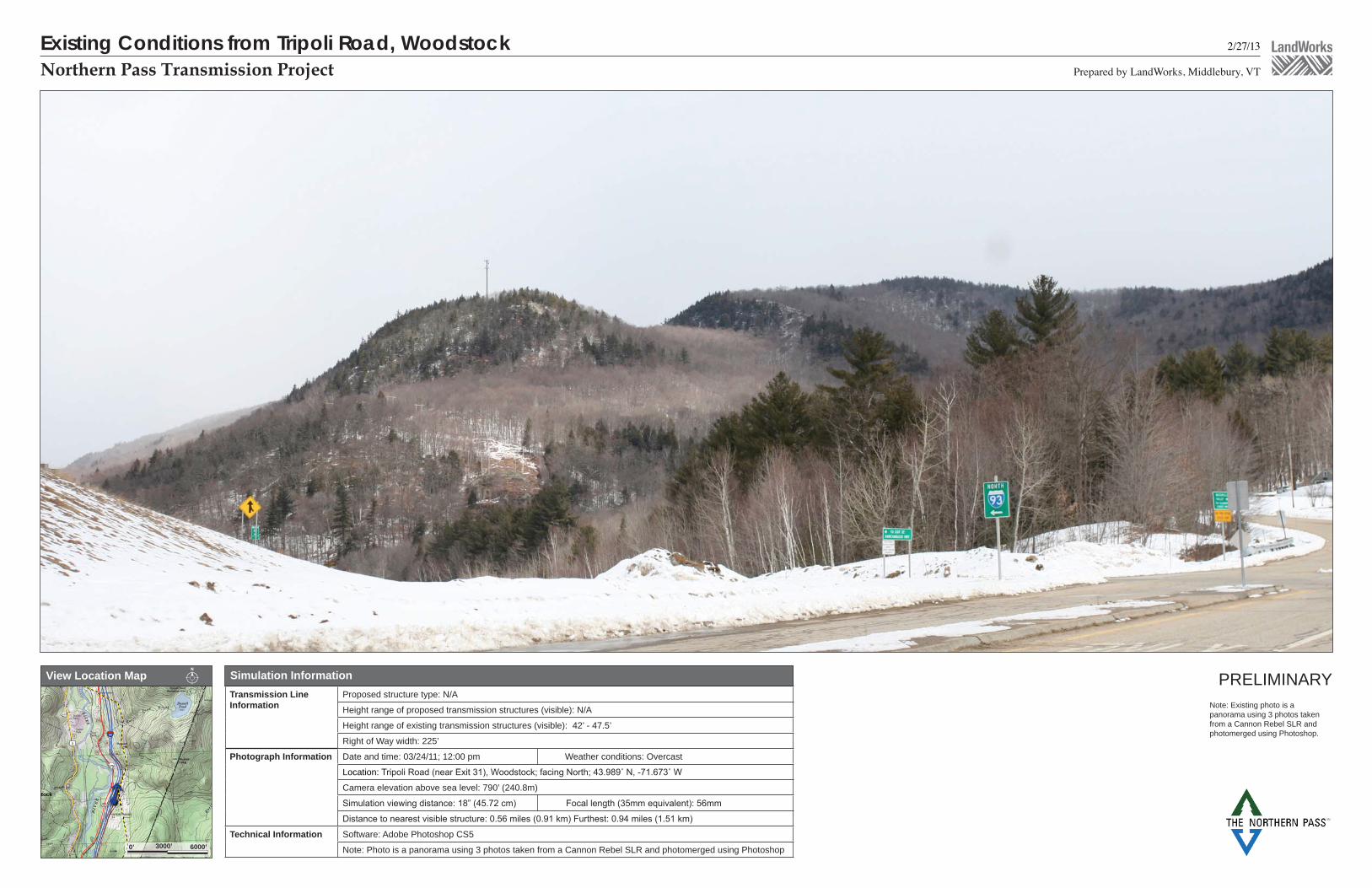
2/27/13
Prepared by LandWorks, Middlebury, VTNorthern Pass Transmission Project
PRELIMINARY
Existing Conditions from Tripoli Road, Woodstock
!(
£3
¬«175
§̈¦93
stock
Simulation InformationView Location Map
(((((!!!!!!!!!!!!!!!!!!!!!!!!!!!!!!!!
6000’ 0’ 3000’
Transmission Line Information
Proposed structure type: N/A
Height range of proposed transmission structures (visible): N/A
Height range of existing transmission structures (visible): 42’ - 47.5’
Right of Way width: 225’
Photograph Information Date and time: 03/24/11; 12:00 pm Weather conditions: Overcast
Location:
Camera elevation above sea level: 790’ (240.8m)
Technical Information Software: Adobe Photoshop CS5
Note: Photo is a panorama using 3 photos taken from a Cannon Rebel SLR and photomerged using Photoshop
Note: Existing photo is a panorama using 3 photos taken from a Cannon Rebel SLR and photomerged using Photoshop.

Visual Simulation from Tripoli Road, Woodstock - Lattice 2/27/13
Prepared by LandWorks, Middlebury, VTNorthern Pass Transmission Project
Note: Simulation is based upon a preliminary design. Exact structure height, location and color will be
and permitting process.
PRELIMINARY
!(
£3
¬«175
§̈¦93
stock(((((!!!!!!!!!!!!!!!!!!!!!!!!!!!!!!!!!
Existing Conditions Photograph Simulation InformationView Location Map
6000’ 0’ 3000’
Transmission Line Information Height range of proposed transmission structures (visible): 80’ - 105’
Height range of existing transmission structures (visible): 42’ - 47.5’
Right of Way width: 225’, no additional width, 75’ of additional clearing within existing ROW
Photograph Information Date and time: 03/24/11; 12:00 pm Weather conditions: Overcast
Location:
Camera elevation above sea level: 790’ (240.8m)
Technical Information Software: Nemetschek VectorWorks 2008; SketchUp Pro 8; Adobe Photoshop CS5
Digital elevation data source: USGS National Elevation Dataset 1/3 Arc-Second (NED 1/3)
Existing communications tower

Visual Simulation from Tripoli Road, Woodstock - Monopole 2/27/13
Prepared by LandWorks, Middlebury, VTNorthern Pass Transmission Project
Note: Simulation is based upon a preliminary design. Exact structure height, location and color will be
and permitting process.
PRELIMINARY
!(
£3
¬«175
§̈¦93
stock
Existing Conditions Photograph Simulation InformationView Location Map
(((((!!!!!!!!!!!!!!!!!!!!!!!!!!!!!!!!!
6000’ 0’ 3000’
Existing communications tower
Transmission Line Information Height range of proposed transmission structures (visible): 80’ - 105’
Height range of existing transmission structures (visible): 42’ - 47.5’
Right of Way width: 225’, no additional width, 75’ of additional clearing within existing ROW
Photograph Information Date and time: 03/24/11; 12:00 pm Weather conditions: Overcast
Location:
Camera elevation above sea level: 790’ (240.8m)
Technical Information Software: Nemetschek VectorWorks 2008; SketchUp Pro 8; Adobe Photoshop CS5
Digital elevation data source: USGS National Elevation Dataset 1/3 Arc-Second (NED 1/3)