michael j. sauter spanning the poles: spatial thought and ... · nÚmero 77 michael j. sauter...
TRANSCRIPT
NÚMERO 77
MICHAEL J. SAUTER
Spanning the Poles: Spatial Thought and the ‘Global’ Backdrop to our Globalized World,
1450-1850
www.cide.edu
JUNIO 2012
Importante Los Documentos de Trabajo del CIDE son una herramienta para fomentar la discusión entre las comunidades académicas. A partir de la difusión, en este formato, de los avances de investigación se busca que los autores puedan recibir comentarios y retroalimentación de sus pares nacionales e internacionales en un estado aún temprano de la investigación. De acuerdo con esta práctica internacional congruente con el trabajo académico contemporáneo, muchos de estos documentos buscan convertirse posteriormente en una publicación formal, como libro, capítulo de libro o artículo en revista especializada.

D.R. © 2012, Centro de Investigación y Docencia Económicas A.C. Carretera México Toluca 3655, Col. Lomas de Santa Fe, 01210, Álvaro Obregón, México DF, México. www.cide.edu Dirección de Publicaciones [email protected] Tel. 5081 4003
Abstract
This essay illuminates the historical context of the contemporary language of globalization. It argues that the key concepts of the “global” began in ancient Greek thought about unseen space, before being reified through the Renaissance invention of the terrestrial globe. With the production of globes, early-modern Europe fixed our planet and its environs in a material culture that spread rapidly across the continent and around our world. In many ways this material culture of globes remains the foundation of contemporary global thought, which means that a “globalization” that is normally understood in terms of the free movement of goods, capital, and people, rests on the Renaissance reification of classical spatial knowledge in globes.
Resumen
El presente ensayo esclarece el contexto histórico del término contemporáneo de globalización. Se argumenta que los conceptos clave de “lo global” comenzaron en el pensamiento desarrollado en la antigua Grecia sobre el espacio no visto, antes de materializarse en la invención renacentista del globo terráqueo. Con la producción de globos, la Europa moderna fija nuestro planeta y sus alrededores en una cultura material que se esparció rápidamente a través del continente y alrededor del mundo. En muchos sentidos, en esta cultura material de globos yacen los fundamentos del pensamiento global contemporáneo, lo que significa que la “globalización”, que es comúnmente entendida en términos de un libre tránsito de bienes, capital y personas, se basa en la materialización renacentista del conocimiento espacial clásico en globos.


Spanning the Poles : Spat ia l Thought and the ‘Global’ Backdrop to our Global i zed Wor ld, 1450-1850
D I V I S I Ó N D E H I S T O R I A 1
Introducción
On a round ball A workman that has copies by, can lay An Europe, Afrique, and an Asia, And quickly make that, which was nothing, All.1 John Donne, “A Valediction of Weeping” (1633)
The concept “globalization” is more than ubiquitous in our contemporary culture, having become a dominant metaphor for many public debates, with terms such as “one world,” “shared planet” and “global responsibility” becoming pervasive. Historians have participated enthusiastically in the game of making all things global, producing over the past two decades a bevy of “global” histories, in which human activity is framed against a common vision of our planet.2 Nor has the fondness for taking a global view remained within world history, but it permeates sub-disciplines, too. Scholars of the eighteenth century have decreed that the era under their care was, in addition to being the crucible of modernity, a global age.3 Indeed, the flagship journal for the period, Eighteenth-Century Studies, has taken to putting on its cover a top-down map of the world that was drawn in 1713 by the great French astronomer Jacques Cassini. One may, thus, be forgiven for believing that modernity and globalization were born twins.
A striking aspect of globalization’s role in contemporary discourse is how little scrutiny its intellectual foundations have received. In general the historical literature assumes global space to be a transparent phenomenon and concentrates its analysis on whether globe makers got the image “right.” There are some exceptions to this rule. The historian of geography Dennis Cosgrove has emphasized that the discovery of the earth was a murky process of imagination, rather than a transparent one of discovery, given that human
1 Charles M. Coffin, ed., The Complete Poetry and Selected Prose of John Donne (New York: The Modern Library, 2001), 30. 2 A sample: Shigeru Akita, Gentlemanly Capitalism, Imperialism, and Global History (New York, 2002); Bruce Mazlish and Ralph Buultjens, Conceptualizing Global History, Global History (Boulder, 1993); Richard W. Bulliet, The Earth and Its Peoples : A Global History (Boston, Mass., 1997); Marc Ferro, Colonization : A Global History (Quebec, 1997); David Chidester, Christianity : A Global History, 1st U.S. ed. (San Francisco, California, 2000); Ramachandra Guha, Environmentalism : A Global History, Longman World History Series (New York, 2000); Michael S. Neiberg, Fighting the Great War : A Global History (Cambridge, Mass., 2005); Gerhard L. Weinberg, A World at Arms : A Global History of World War Ii, 2nd ed. (Cambridge ; New York, 2005); Barry K. Gills and William R. Thompson, Globalization and Global History, Rethinking Globalizations ; (London ; New York, 2006); Pamela Kyle Crossley, What Is Global History? (Cambridge, UK ; Malden, MA, 2008); Robert W. Strayer, Ways of the World : A Brief Global History, 1st ed. (Boston, Mass., 2009). 3 Felicity Nussbaum, The Global Eighteenth Century (Baltimore, MD, 2003).

Michael J . Sauter
C I D E 2
beings have imagined our planet for millennia before any one physically saw it. The historian of cartography David Harlan, meanwhile, has repeatedly argued that maps must be understood as ideological statements and not as simple mimetic devices.45 Neither critique goes far enough. Cosgrove’s work remains rooted in a generally progressive narrative —i.e., over time human beings still learned to get it right— and ignores the broader thought in which such projections became possible. Meanwhile, Harlan’s attacks on the ideological nature of maps are too attached to the history of early-modern states, especially given that it was societies without New World colonies that produced the earliest world maps. The first map to include the New World appeared in 1507 in Saint-Dié-des-Vosges, in the Duchy of Lorraine, which was then part of the Holy Roman Empire, a political entity that had Universalist aspirations, but no overseas empire.
That some of the first drawings of our global space emerged in the Vosges mountains, far from centers of trade or politics, suggests that the tradition of projecting space was as important to the emergence of global images as an exploitative colonial ideology. The tradition of spatial projection has a long pedigree and remains vital today. Consider that only two-dozen humans have physically seen our entire planet, yet every educated person knows the Earth to be a sphere and can imagine him- or herself in a position above it. Our ability to project massive space so easily is a product of a tradition that dates back to the classical world. Thanks to figures such as Euclid of Alexandria (fl. 300 B.C.) and Claudius Ptolemy (90-168), as well as their heirs in the medieval and early-modern world, including John of Holywood, aka Sacrobosco (1195-1256) and Peter Apian (1495-1552), we moderns can imagine a sphere, give it an equator and an axis, and also put it into space. Moreover, with these projections in mind we can (and still do) locate both our planet and ourselves with respect to the many and varied things that we have not seen.
Both this realm’s power and reach are associated with the emergence of a material culture of space. Repeatedly, from at least the early medieval period onward, European thinkers fashioned instruments that represented unseen space, such as astrolabes, armillary spheres, and celestial and terrestrial globes. As a result, when anyone from the Western tradition thinks globally, it is against the backdrop of an array of objects that were produced by a network of specialists. Simon Schaffer has named the process by which different groups come together to construct knowledge an information order.6 Schaffer’s work highlights for us how old this system is, as he has delineated how dependent Isaac Newton was on reports from others —which in this case
4 Denis E. Cosgrove, Apollo's Eye: A Cartographic Genealogy of the Earth in the Western Imagination (Baltimore, MD, 2001). 5 Ibid. 6 Simon Schaffer, "Newton on the Beach: The Information Order of Principia Mathematica," History of Science xlvii(2009): 243-276.

Spanning the Poles : Spat ia l Thought and the ‘Global’ Backdrop to our Global i zed Wor ld, 1450-1850
D I V I S I Ó N D E H I S T O R I A 3
were the astronomers at the Royal Observatory in Greenwich. Not coincidentally, these astronomers provided crucial information to the mapmakers who inscribed the sheets that globe makers pasted on round balls. The widespread effects of this early-modern system of knowledge production reverberate into our own day. Recent research indicates that people unconsciously believe trips to the north to take longer than those to the south, and that they are more likely to visit a store, if they believe it to be to the south of them.7 Our planet is not part of humanity’s daily experience, but many of us act as if it were.
The contemporary sense of global space is, thus, in the peculiar position of being both beyond normal experience and, nonetheless, integral to it. Neither this phenomenon nor the material culture on which it is based is new. In “Good Friday 1613 Riding Westward,” for example, the poet John Donne (1572-1631) connected his sense of local space directly to a much larger and unseen realm. As the poem goes, while travelling westward in a carriage on the day that marked the anniversary of his savior’s resurrection, which had occurred somewhere to the east, Donne noted:
Could I behold those hands which span the Poles, And turn all spheres at once, pierced with those holes? Could I behold that endlesse height which is Zenith to us, and to’our Antipodes Humbled below us?8
Donne’s poem is merely one highlight of a transformation in spatial thought that had occurred over the previous two centuries. The European sense of global space had long been anchored in east, where Europeans understood Jerusalem to lie. Donne did not, however, stop in Jerusalem, but projected his mind upward and surveyed a realm that belonged to God alone. Although God himself was notoriously difficult to imagine, his space was another matter—and as the European mind developed the tools with which to imagine this unseen realm, it also learned to locate both its planet and itself.
The cultural significance of spatial culture is even more clearly on display in the epigraph above, which is taken from another poem by Donne, “A Valediction of Weeping.” Written two decades after “Good Friday,” the “Valediction” equates the world that lovers make for themselves with the globes that artisans make for the marketplace —or as Donne put it, “make that, which was nothing, All.” Donne’s global metaphor is but an echo of an old intellectual innovation. Euclid’s Elements, the most important spatial text
7 Leif D. Nelson and Joseph P. Simmons, "On Southbound Ease and Northbound Fees: Literal Consequences of the Metaphoric Link between Vertical Position and Cardinal Direction," Journal of Marketing Research 46, no. 6 (2009): 715-724. I would like to thank Michael P. Finn of the U.S. Geological Survey for recommending this article to me. 8 Charles M. Coffin, ed. The Complete Poetry and Selected Prose of John Donne (New York: The Modern Library, 2001), Pages.
Michael J . Sauter
C I D E 4
in the history of the world, begins with the words, “A point is that which has no part,” before explaining how points define the ends of lines, which in turn define other geometric figures, including circles and, ultimately, spheres.9 Donne’s idea that artisans made everything from nothing descended, in this respect, from classical geometry’s having constructed space with nonentities. Imagined points yielded imagined spheres that, in turn, became the basis for round balls —which, with a little help from London’s artisans, became globes.
Donne’s imagery draws attention to the crucial aspect of early-modern Europe’s spatial aesthetic, the transformation of venerable traditions of spatial thought into terrestrial globes.10 This instrument appeared in Italy in the second half of the fifteenth century, before diffusing rapidly through every corner of the early-modern world. Early globe makers included the German Johannes Schöner (1477-1577), the Dutchman Gerard Mercator (1512-1594), and the Englishman Emery Molyneux (d.1598). Nor was global space limited to the production of actual globes, as images of globes multiplied in other realms, too. Artists, such as Raphael (1480-1520), Hans Holbein the Younger (1497-1543), and Jan Vermeer (1632-1675) depicted globes in their paintings.11 Cosmographers and mapmakers such as Martin Waldseemüller (1470-1520) and Peter Apian (1495-1552) included images of globes in their atlases. Clockmakers, such as Georg Roll (1546-1592), one of whose clocks decorated Peter the Great’s library, and Jost Bürgi (1552-1632), whose works were coveted by everyone, incorporated globes in their designs.
By 1572, the year of Donne’s birth, “global” space was already pervasive, having penetrated every aspect of European culture. One of the first items that Thomas Bodley (1545-1613) acquired when he re-founded the University of Oxford’s collection of books (now known as the Bodleian Library) was a pair of globes made in London by Emery Molyneux.12 William Sanderson, a benefactor to both Oxford and Cambridge Universities, also provided each with globes that he had commissioned. We cannot say whether Donne saw these globes, but he did attend both institutions at a time, when a growing web of material culture was redefining humanity’s relationship to its planet and even broader environs. Equally important, the English interest in globes was merely one aspect of a European phenomenon, as globes spread across the continent, reframing knowledge everywhere as they went. Consider the example provided in Figure 1, the cover image from an encyclopedia of 9 Euclid, Euclid's Elements: All Thirteen Books Complete in One Volume, trans. Thomas L. Heath (Santa Fe, NM, 2002). 10 Jan V. Golinski, Science as Public Culture: Chemistry and Enlightenment in Britain, 1760-1820 (Cambridge, 1992); Stephen Gaukroger, The Emergence of a Scientific Culture: Science and the Shaping of Modernity, 1210-1685 (Oxford, 2006); Margaret C. Jacob, The Cultural Meaning of the Scientific Revolution, 1st ed., New Perspectives on European History (New York, 1988). 11 James Sykes, "Der Erdglobus in Raphaels 'Die Schule Von Athen'," Der Globusfreund: Wissenschaftliche Zeitschrift für Globenkunde 55/56(2009): 53-73; Elly Dekker and P. C. J. van der Krogt, Globes from the Western World (London, 1993), 24; Elly Dekker, "The Globes in Holbein's Painting the Ambassadors," Der Globusfreund: Wissenschaftliche Zeitschrift für Globenkunde 47/48(1999): 19-36. 12 Helen Wallis, "Further Light on the Molyneux Globes," The Geographical Journal 121, no. 3 (1955): 304-311.
Spanning the Poles : Spat ia l Thought and the ‘Global’ Backdrop to our Global i zed Wor ld, 1450-1850
D I V I S I Ó N D E H I S T O R I A 5
farming published in Hannover in 1766 by Otto von Münchhausen, a distant cousin of the first rector of the University of Göttingen.13 This image displays Münchausen’s ideal for the home office of the educated peasant farmer, which includes a collection of books, instruments, and natural specimens. Above everything, however, veritably crowning the collection and also framing the peasant farmer’s desk, stand a pair of celestial and terrestrial globes. By the second half of the eighteenth century, even people in the countryside were supposed to know where they were.
Early-modern Europe’s global culture is the chief precondition for our contemporary “globalization.” We moderns rely on the same spatial concepts, use the same material objects, and live in much the same cultural space, as did our predecessors. Consider Figure 2, which contains an image from NASA that is entitled “The Blue Marble.” The image is presented incorrectly, of course. Yet, how can any of us know this orientation to be incorrect, given that we (likely) have never seen our own planet? The answer is that we mature within a material culture to gives the Earth its place. What modern reader did not encounter at least one terrestrial globe in the course of his or her primary education?14 In this sense the global space that undergirds Donne’s lovesickness, Münchhausen’s ideal office, and NASA’s marble did not simply make the world; it was (and remains) the world.
The First Globalization
The Earth was invented in 1477. In that year, the cartographer Nicolaus Germanus (1420-1490), a German who worked in Rome, completed the first known terrestrial globe produced in Europe.15 Now lost, the significance of Germanus’ globe cannot be overstated —and not simply because it was the first such globe, but also because it was paired with a celestial globe. I emphasize this point, because the literature often highlights the first surviving terrestrial globe, Martin Behaim’s “Erdapfel,” which was built in 1492 in Nuremberg (where it still resides). For all its antiquarian value, however, this globe was built alone and this fact has obscured the power of pairing.
The significance of pairing may be difficult to grasp, since a terrestrial globe is sufficient, today, to define “global” space. It was not always so. From Germanus’ time until the middle of the nineteenth century extraterrestrial and terrestrial globes were almost always produced in pairs. In the early-modern world pairing was global thought’s cornerstone, because the system of 13 Otto von Münchhausen, ed. Der Hausvater. Erster Theil, 2 ed., 6 vols., vol. 1 (Hannover: Verlag seel. Nic. Försters und Sohns Erben Hof-Buchhandlung, 1766), Pages. 14 Helen Wallis, "The Place of Globes in English Education, 1600 - 1800," Der Globusfreund: Wissenschaftliche Zeitschrift für Globenkunde 25-27(1978): 103-110. 15 Jósef Babicz, "The Celestial and Terrestrial Globes of the Vatican Library, Dating from 1477, and Their Maker Donnus Nicolaus Germanus (Ca 1420- Ca 1490)," Der Globusfreund: Wissenschaftliche Zeitschrift für Globenkunde 35/37(1987): 155-166.

Michael J . Sauter
C I D E 6
latitude and longitude was expressly projected downward from the celestial sphere. This was, in effect, a closed system of thought, because terrestrial space was imagined with reference to a conceptually defined celestial realm. Hence, although the faces of paired globes changed, in conjunction with Europe’s reconnaissance and advances in astronomy, for four centuries, the space within which heaven and earth were imagined and presented did not.
The literature on globes has overlooked pairing and concentrates instead on the superficial accuracy of their cartographic information. Edward Stevenson’s magisterial Terrestrial and Celestial Globes (1921), the classic work in the field and still very much worth reading, discusses the information that was inscribed on both celestial and terrestrial globes, but derives no lessons from their pairing.16 The same holds true for Oswald Muris and Gert Saarmann’s The Globe Through the Ages (1961), as well as Alois Fauser’s The World to Hand (1967).17 Only Elly Dekker and Peter van der Krogt’s more recent and extremely valuable work, Globes from the Western World (1993), recognizes pairing as an issue, but understands it primarily as a production method, rather than as the cornerstone of global thought.18
The pairing of globes reified an emerging spatial unity in Renaissance Europe. We can better understand the change that was involved by looking back to the medieval world. As the works of John of Holywood, Robert Grosseteste (1175-1253), and Nicole Oresme (1320-1382) amply demonstrate, medieval thinkers were well versed in projections of spherical space.19 Surprisingly, however, medievals only applied this knowledge to the celestial realm, as there is neither documentary nor physical evidence of a terrestrial globe ever having been produced in Latin Europe before the fifteenth century.20 (There is evidence that at least one terrestrial globe was produced in the Medieval Islamic world, but it did not inspire any successors, let alone a broader material culture of space.) There is, in contrast, documentary evidence from as early as the ninth century that Latin medievals knew of celestial globes, although it is not clear whether any were built at that early time. Evidence from the later medieval period suggests, however, that celestial spheres were built and used in the teaching of astronomy.
The key aspect of medieval celestial globes is that they offered the viewer a top-down perspective on the heavens. In short, the stars appeared as they would to someone who was on the other side of the celestial sphere and 16 Edward Luther Stevenson, Terrestrial and Celestial Globes: Their History and Construction, Including a Consideration of Their Value as Aids in the Study of Geography and Astronomy (New Haven, CT, 1921). 17 Oswald Muris and Gert Saarmann, Der Globus Im Wandel Der Zeiten; Eine Geschichte Der Globen (Berlin, 1961); Alois Fauser, Die Welt in Händen: Kurze Kulturgeschichte Des Globus (Stuttgart, 1967). 18 Dekker and Krogt, Globes from the Western World. 19 Lynn Thorndike, The Sphere of Sacrobosco and Its Commentators (Chicago, 1949). 20 There is evidence that one terrestrial globe was made in the Islamic world in the thirteenth century, but it seems to have had no successor. Willy Hartner, "The Astronomical Instruments of Cha-Ma-Lu-Ting, Their Idnetification, and Their Relations to the Instruments of the Observatory of Maragha," Isis 41, no. 2 (1950): 184-194, here 190-191.

Spanning the Poles : Spat ia l Thought and the ‘Global’ Backdrop to our Global i zed Wor ld, 1450-1850
D I V I S I Ó N D E H I S T O R I A 7
looked down. The outside-in presentation of celestial space placed stark limits on medieval projections of terrestrial space. Although the medieval world accepted the doctrine of a spherical cosmos, it projected terrestrial space without reference to an abstract spherical center. I will illustrate this point via the history of cartography. Rather than assume a center from which a line could be run up to the Pole Star, medieval maps were drawn with reference to a ritual center, Jerusalem. Among the oldest surviving examples of this kind of map is the Hereford world map (mappa mundi), which dates to around 1300 (See Figure 3). In this environment, orientation remained true to the original meaning of the term: to find the east. As this map shows, however, medieval projections of terrestrial space lacked the depth that was associated with spherical projections, which means that east and “up” existed on different planes. Hence, medieval cartographers did not put the world onto a sphere, but inscribed it within a circle.21
The terrestrial globe only appeared after Europeans applied spherical space to projections of unseen realms. This point is underscored by the medieval world’s material culture. A primary example is the astrolabe, a device that was imported in the tenth century from the Muslim world, which had in turn inherited it from the Greeks. The astrolabe is a small disk that served as an imaginary window onto the celestial globe from the perspective of the polar axis. It has the following parts, the alidade, a rotating arm with which the user could measure angles, the rete, which represents in highly schematic form the position of certain stars, and a “geographic” disk that slides under the rete and contains a series of latitudinal lines whose positions are arranged with respect to the Earth’s axis.22 The arrangement of the disk is the key, because it compressed the terrestrial and celestial spheres, thus trapping three-dimensional space within a two-dimensional instrument, and also relied on the user to bring projected space to the object.
The invention of globes was but one effect of a massive change in European ways of projecting space that had occurred in the course of the fifteenth century. In an astrolabic world, the Earth is not a whole that is suspended within a larger realm, but is primarily a surface.23 The difference between this approach and paired globes becomes clearer, if we note that early-modern celestial globes did not put the viewer above the celestial realm, but below it. That is, their position was not defined by a top-down view, but and inside-out one. Since Germanus’ globes no longer exist, we do not know whether his celestial globe was inside out or outside in. We do know, however, that by the middle of the sixteenth century globe makers 21 David Woodward, "Reality, Symbolism, Time, and Space in Medieval World Maps," Annals of the Association of American Geographers 75, no. 4 (1985): 510-521; Evelyn Edson, The World Map, 1300-1492: The Persistence of Tradition and Transformation (Baltimore, MD, 2007). 22 Michael A. Hoskin, The Cambridge Illustrated History of Astronomy, Cambridge Illustrated History (Cambridge, 1997); John D. North, Cosmos: An Illustrated History of Astronomy and Cosmology (Chicago, IL, 2008). 23 North, Cosmos: 97-98; 130-133.
Michael J . Sauter
C I D E 8
almost exclusively put a mirror image of the heavens on their celestial globes. This switch was a direct outcome of the earth’s invention: in a system that was based on terrestrial latitude and longitude, the calculation of one’s global position was only possible with reference to an accurate image of the night sky. Hence, celestial globes had to present images as they appeared to the viewer who was ostensibly inside the outer sphere. The history of globes is, in fact, the history of the European’s discovery of a three-dimensional spatial imagination.
Written Space and Material Culture
The literature on globes traditionally takes a progressive line, beginning its story with the invention of the first terrestrial globe and paying particular attention to the growing accuracy of the geographic images that appeared with each new generation. There is, however, another way to construct this story, and that is to see the first terrestrial globe as a specific and crucial product of a change in the structures of the spatial imagination. As I noted above, the European medieval world never produced a terrestrial globe, in spite of its having a mature and highly developed literature on spatial projection. Between 1450 and 1550, however, something fundamental changed that led not only to the invention of the terrestrial globe but also the reconfiguration of celestial globes. What caused this shift?
The chief cause of the conceptual change was the return to the Latin west of Claudius Ptolemy’s Geography, which all histories of geography accept as the origin of the contemporary discipline. The translation of this work into Latin of this work revolutionized the conceptual structure of imagined space. Medieval thinkers knew of the Geography, but none had read the whole text, since the only extant copies lay in Byzantium or in the Muslim world. In 1406, however, the Florentine humanist Jacobus Angelus translated into Latin a Greek copy of the Geography that he had encountered while in Byzantium. Angelus’ translation proved a sensation, as multiple manuscript versions of the original soon appeared and circulated throughout Italy.24 One well-known example is a manuscript copy, complete with hand-drawn maps, that was done in Florence circa 1460 by Nicolaus Germanus and is now part of the collection of the New York Public Library.25
In the second half of the century, the Geography diffused rapidly as multiple print editions appeared. In 1475, the first print edition of Angelus’ translation was published in Vicenza, although without maps.26 Other versions appeared in Bologna (1477), Rome (1478 and 1490), Florence (1482), and Ulm 24 Jim Bennett, "Practical Geometry and Operative Knowledge," Configurations 6, no. 2 (1998): 195-222. 25 Claudius Ptolemy, "Geographia," (Florence: The New York Public Library, Manuscripts and Archives Division, 1460-1470). 26 Claudius Ptolemy, Cosmographia, trans. Jacobus Angelus (Vicenza, 1475).

Spanning the Poles : Spat ia l Thought and the ‘Global’ Backdrop to our Global i zed Wor ld, 1450-1850
D I V I S I Ó N D E H I S T O R I A 9
(1482 and 1486),27 Not all of these translations were into Latin; the Florentine edition of 1482 was into Italian, and its appearance merely opened the floodgates for more vernacular editions. As a result scholars in western and central Europe gained complete access in multiple languages to a text that had been lost to them for 1000 years. The two editions published in Ulm marked a particularly important moment in this process of diffusion. First, they included maps that had been drawn by Germanus. Second, they were the first editions to be printed north of the Alps. This moment initiated something of a breakout, as other editions appeared in Strasbourg (1513, 1520, 1522, and 1525), Nuremberg (1514) Basle (1533), Louvain (1535), Lisbon (1537), Paris (1546) and Cologne (1578 and 1597).28 And these northern editions were printed in addition to others that appeared throughout Italy.
In short order, early-modern Europeans produced a complicated tapestry of the Geography that extended from the Mediterranean into central Europe. This pattern of publication tracks closely with the history of another key spatial text, Euclid’s Elements. Multiple print editions appeared in Italy, beginning in 1482, before springing up on the other side of the Alps in places such as Basel (1533), Wittenberg (1536), Paris (1549), Augsburg (1555), Strasbourg (1566), London (1570), and Seville (1576).29 We must, therefore, understand the Geography’s return as part of a process of reappraisal that occurred within a web of spatial works. With respect to the Geography, this process continued beyond the sixteenth century, as publication numbers were robust well into the eighteenth. Indeed, by 1730 over fifty editions of this 27 Claudius Ptolemy, Geographia, trans. Jacobus Angelus (Bologna, 1477); Claudius Ptolemy, Geographia, trans. Jacobus Angelus (Rome, 1478); Claudius Ptolemy, Claudii Ptholomei Viri Alexandrini Cosmographie Liber . trans. Jacobus Angelus (Vlme, 1482); Claudius Ptolemy, Geographia, trans. Francesco Berlinghieri (Florence, 1482); Claudius Ptolemy, Claudii Ptolemaei Viri Allexandrini Geographiae . trans. Jacobus Angelus (Rome, 1490). 28 Claudius Ptolemy, Claudii Ptolemei Viri Alexandrini Mathematic Discipline Philosophi Doctissimi Geographie Opus Nouissima Traductione E Grcorum Archetypis Castigatissime Pressum: Cteris Ante Lucubratorum Multo Prstantius. Pro Prima Parte Continens Cl. Ptolemei Geographiam Per Octo Libros Partitam ... Quam Brevis Et Doctissima Gregorii Lilii Subsequitur Instructio De Graecorum Numerali Supputatione, in Traductio Graeca ... Tabularum Dein Auctoris Xxvii. Pars Secunda Moderniorum Castrationum Xx Tabulis. ... Adnexo Ad Finem Tractatus ... De Variis Moribus Et Ritibus Gentium, Eorundemque Ac Localium Nominum Originibus (Argentine, 1513); Claudius Ptolemy, Nova Translatio Primi Libri Geographiae Cl. Ptolomaei ... Joanne Vernero Interprete. In Eundem 1. Libr. Geographiae Cl. Ptolomaei Argumenta ... Joannis Veneri, trans. Johannes Werner (Norenbergae, 1516); Claudius Ptolemy, Clavdii Ptolomaei Alexandrini ... Opus Geographie, Nouiter Castigatum ̃ & Emaculatum ̃ Additiõibus. Raris Et Inuisis. Necnon Cum ̃ Tabularum in Dorso Iucunda Explicatione ... , ed. Lorenz Fries (Argentorati, 1522); Claudius Ptolemy, De Geographia Libri Octo, trans. Desiderius Erasmus (Basle, 1533); Claudius Ptolemy, Claudii Ptolemaei Alexandrini Geographicae Enarrationis Libri Octo ; Adiecta Insuper Ab Eodem Scholia, Quibus Exoleta Urbium Nomina ... Exponuntur / Ex Bilibaldi Pirckeymheri Translationem Sed Ad Graeca Et Prisca Exemplaria À Michaele Villanovano Iam Primum Recogniti ... ed. Michael Servetus, trans. Willibald Pirckheimer (Lugduni, 1535); Claudius Ptolemy, Primeiro Livro Da Geographia (Lixboa, 1537); Claudius Ptolemy, Geographia Vniversalis, Vetvs Et Nova, Complectens Clavdii Ptolemæi Alexandrini Enarrationis Libros Viii. Quorum Primus Noua Translatione Pirckheimeri Et Accessione Commentarioli Illustrior Quàm Hactenus Fuerit, Redditus Est. Reliqui. Castigatiores Facti Sunt. Addita Sunt Insuper Scholia ... Succedunt Tabulæ Ptolemaic[a]E, Opera Sebastiani Munsteri Nouo Paratæ Modo. His Adiectæ Sunt Plurim[a]E Nouæ Tabulæ, Moderna[] Orbis Faciem . Explicantes ... Vltimo Annexum Est Compendium Geographic[a]E Descriptionis, in Quo Uarij Gentium & Regionum Ritus & Mores Explicantur. Pr[a]Efixus Est ... Index ... (Basileae, 1540). 29 John Murdoch, "Euclid: Transmission of the Elements," in Charles Coulston Gillispie, ed., Dictionary of Scientific Biography, 16 vols. (New York, NY, 1971), 437-459.

Michael J . Sauter
C I D E 1 0
text had appeared across early-modern Europe.30 Together with the spread of the Elements, this diffusion exposed thinkers across early-modern Europe to a common spatial lexicon that gave a place to their world.
Oddly, historians have largely overlooked the significance of the Geography for early-modern intellectual history.31 We can, however, get a sense for the level of interest among the intellectual elite by considering some of the people who produced new editions in northern Europe. The most prominent figure is the Dutch humanist Desiderius Erasmus (1466-1536), who translated and edited the Basle edition of 1533. That a figure of Erasmus’ stature produced a version of the Geography tells us a good deal about the value that both he and his contemporaries ascribed to the text. Less well known today, but extremely significant at the time, is Willibald Pirckheimer (1470-1530), who translated and edited the 1525 edition from Strasbourg. Pirckheimer was an important figure within humanist circles in Nuremberg and was a close friend of Albrecht Dürer (1471-1528). Other important figures are the cosmographer Sebastian Münster (1488-1552), who edited the Basel edition of 1540, and the cartographer Gerard Mercator (1512-1594), who did the same for the Cologne edition of 1578. Both men are of unparalleled significance to the history of global space. Münster published many well- known maps of Europe, and Mercator’s contributions to both map- and globe making are too numerous to be listed.
From the perspective of this essay, the most important person associated with a new edition of the Geography is Nicolaus Germanus. Unfortunately, we do not know much about him, beyond his having worked in Rome as a cartographer.32 Germanus’ significance for the history of the Geography emerges from his having produced the earliest of the maps that accompanied Angelus’ translation. He also edited the Ulm edition of 1482 and, as I noted above, his maps appeared in the edition of 1486, which was edited by someone else. Access to Ptolemy’s work set in motion a new intellectual process. Germanus did not simply follow Ptolemy’s recommendations, but also invented a new method of projecting maps, namely the presentation of latitudinal lines in parallel, with the longitudinal ones tapering at the top and bottom of the image. Indeed, this method was used in Martin Waldseemüller’s famous world map by that appeared in Saint-Dié-des-Vosges in 1507 and is now in the National Archives in Washington, D.C. tolemy, before moving into more complicated realms.
30 Henry Newton Stevens and Edward Everett Ayer, Ptolemy's Geography: A Brief Account of All the Printed Editions Down to 1730, with Notes on Some Important Variations Observed in That of Ulm 1482, Including the Recent Discovery of the Earliest Printed Map of the World yet Known on Modern Geographical Conceptions in Which Some Attempt Was Made to Depart from Ancient Tradition, 2d ed. (London, 1908). 31 Bennett, "Practical Geometry." 32 Babicz, "The Celestial and Terrestrial Globes of the Vatican Library, Dating from 1477, and Their Maker Donnus Nicolaus Germanus (Ca 1420- Ca 1490)."

Spanning the Poles : Spat ia l Thought and the ‘Global’ Backdrop to our Global i zed Wor ld, 1450-1850
D I V I S I Ó N D E H I S T O R I A 1 1
Germanus’ role in the republication of the Geography turns our attention to how spatial thought moved from print into material culture in the early-modern period. It is one thing to draw a globe on a flat piece of paper; it is quite another to draw the same item on a paper that is, in turn, pasted on a sphere. In order to understand this process more clearly, I turn to Ptolemy’s Geography. It is a long work, consisting of eight books, among which three (Books 1, 2, and 7) have specific instructions on how to envision space. The other five books comprise a catalogue of known cities and their coordinates in latitude and longitude. (Germanus based his maps on these lists of coordinates.) The first of the three theoretical books —as the recent translators of the Geography describe them— is most important to the projection of global space. I will, therefore, limit my comments to this book.
Book I contains all the doctrines necessary for projecting the earth’s spherical space onto a plane. It is composed of twenty-four chapters, with the first five serving as a methodological preface. Ptolemy began this first book with a distinction that became the cornerstone of all early-modern geographic thought, the difference between geography and chorography. According to Ptolemy, the former relates to the entire earth, while the latter relates to direct human experience of regions. As he wrote:
For these reasons, [regional cartography] has no need of mathematical method, but here [in world cartography] this element takes absolute precedence. Thus the first thing that one has to investigate is the earth’s shape, size, and position with respect to its surroundings [i.e., the heavens], so that it will be possible to speak of its known part, how large it is and what it is like, and moreover [so that it will be possible to specify] under which parallels of the celestial sphere each of the localities in this [known part] lies. From this last, one can also determine the lengths of nights and days, which stars reach the zenith or are always borne above or below the horizon, and all the things that we associate with the subject of habitations.33
Human beings can travel to various parts of the earth and report on the information that their senses have acquired, but this information is unreliable. Geography, however, is immune to this problem, since it is based on observations of the heavens. It is, therefore, not an empirical science, but a mathematical exercise whose data come from people trained in celestial observation. (This provides us with a clue to why so many of the early producers of space came from parts of Europe that were far from the sea: direct experience of unseen geographic realms was not privileged in this emerging discipline). Ptolemy then concluded that since astronomical knowledge was superior to experience of travelers, maps should be based on
33 J. L. Berggren, Alexander Jones, and Ptolemy, Ptolemy's Geography: An Annotated Translation of the Theoretical Chapters (Princeton, 2000), 58.

Michael J . Sauter
C I D E 1 2
observation of the heavens and not travel reports, although he added that the information contained in the latter should never be ignored.
Ptolemy highlights the conceptual situatedness of spatial knowledge, as local knowledge was inferior to knowledge of spatial realms that no human being could see. Extending this point, he also noted how the understanding of relative distance between two places is anchored in a larger understanding of space:
For, in the first place, in either procedure one has to assume as known the absolute direction of the interval between the two localities in question, since it is necessary to know not merely how far this [place] is from that, but also in which direction, that is, to the north, say, or to the east, or more refined directions than these. But one cannot find this out accurately without observation by means of the aforesaid instruments, from which the direction of the meridian line [with respect to one’s horizon], and thereby [the absolute directions] of the traversed intervals, are easily demonstrated at any place and time.34
This quote highlights the interplay between seen and unseen that ran up through the early-modern period. In projected space, knowledge of the earth is secure, because it is not seen directly.
For Ptolemy spatial knowledge was situated via the projection of inaccessible realms. Consider how terrestrial space is sandwiched between space above and an imagined center below. Ptolemy wrote:
For it has already been mathematically determined that the continuous surface of land and water is (as regards its broad features) spherical and concentric with the celestial sphere [Almagest 1.4-5], so that every plane produced through the [common] center makes as its intersections with the aforesaid surfaces [of the terrestrial and celestial spheres] great circles on [the spheres], and angles in [this plane] at the center cut off similar arcs on the [celestial and terrestrial great] circles.35
This projection, which is also anchored in the text by the allusion to the Almagest, works from the outside in, in so far as it relates the center of the earth directly to the limits of the outermost sphere. (This approach also offers us a clue to why Euclid was so important to early spatial thinkers.) Hence, the Geography served as one bookend for the early-modern spatial imagination, with the other being the great Almagest.
In Books six through twenty Ptolemy underscores his point about the unity of spatial thought in a thorough discussion of latitude and longitude. Ptolemy ascribed full credit for the invention of this system to another Greco-Roman
34 Ibid., 59. 35 Ibid., 60.

Spanning the Poles : Spat ia l Thought and the ‘Global’ Backdrop to our Global i zed Wor ld, 1450-1850
D I V I S I Ó N D E H I S T O R I A 1 3
mathematician, Marinus of Tyre (70-130). Marinus essentially invented mathematical cartography by building on the work of earlier figures, such as Hipparchus (190 BC–120 BC) and Posidonius (135 BC–51 BC), who had developed methods for estimating the size of the earth. This intellectual genealogy underscores the extent to which knowledge of terrestrial space was anchored in realms that human beings would not see for the next 2,000 years. One could not know where anything was on the earth without some sense for the earth’s dimensions —and these could only be calculated if one knew how to project spaces that could not be seen from the Earth’s surface. Ptolemy evaluated Marinus’ work —disagreeing with him on the location of some cities and regions— but confirmed the essential utility of his method. To know terrestrial space, one had to use unseen space as an anchor.
Against this backdrop the crucial chapter in Book I is the twenty-second, which Ptolemy’s modern editors have subtitled “On how one should make a map of the oikoumene on a globe.”36 In this chapter Ptolemy explains how one should build a sphere on which a map of the globe may be pasted. Early-modern globe makers read this part carefully and often alluded to it when explaining in print how their globes worked. The chapter begins:
The size of the [globe] should be determined by the number of things that the map-maker intends to inscribe [on it]; and this depends on his competence and ambition, since the larger the globe is, the more detailed and at the same time the more reliable [the map] will prove to be. Whatever size it may be, we are to take its poles and accurately attach through them a semicircle very slightly separated from the [globe’s] surface, so that it only just avoids rubbing against it when it is turned. Let the semicircle be narrow in order not to obstruct many localities; and let one of its edges pass precisely through the points [representing] the poles, so that we can use it to draw the meridians. We divide [this edge] into 180 parts and label them with the [corresponding] numbers, starting from the middle division, which is going to be at the equator. Similarly, we draw the equator and divide one of its semicircles into the same number, 180, of divisions, and inscribe [their] numbers on this [semicircle] too, starting from the endpoint through which we are going to draw the most western meridian.37
This paragraph sketched the mental gateway through which Germanus and other Renaissance globe makers passed. The explicit connection of a global image with methods of organizing space is the foundation of all subsequent globes and pointed the way for spatial thinkers who journeyed from texts to material culture.
36 Ibid., 83-84. 37 Ibid.

Michael J . Sauter
C I D E 1 4
Globes in Print
Early-modern paired globes reified ongoing changes in Europe’s systems of spatial thought. This system originated in texts, as the methods for projecting global space were produced in manuscript and printed before they were transferred to globes. Even after paired globes appeared, however, the production of space in print continued, as dozens of books dedicated specifically to the use of globes (so-called De usu globi) were published between 1500 and 1850.
Globes were never simply built, but were written down. Between 1477 and 1850 around eighty books on the use of globes appeared in Europe —and this group does not include cosmographies and geographies that were printed during that period. There is, therefore, no shortage of works on paired globes, which means that a full review is not possible here. I propose, therefore, to examine guides from three writers whose careers spanned the period between Germanus and the end of paired globes. They are the German mathematician Johannes Schöner (1477-1547), the French instrument maker Nicholas Bion (1652-1733), and the German mathematician Johann Wolfgang Müller (1765-?). Given how dispersed these men are in time, an overview of their works will highlight not only the four centuries of continuity in globe making but also some changes in spatial thought that, over time, altered the meaning of paired globes within the European and Western culture, even if global space remained the same.
The first of the three, Johannes Schöner, was a typical Renaissance mathematician. Born in the Franconian city of Karlstadt, which lies near Frankfurt, he studied in Erfurt, before moving to Bamberg to serve in a clerical capacity. He is important to the history of globes, because in 1515, he produced the second known (and also first surviving) pair of globes.38 In the context of this section of this essay, he is also important for his direct connection to Germanus and his publications. On the former point, we know that Schöner possessed two editions of the Geography, both of which were edited by Germanus. On the latter, consider that in 1517, only two years after his first globe pair was completed, he published a work on celestial spheres with the stultifying title, Solid and Spherical Bodies, or Rules of the Astronomical Globe: Use and Unimpeded Practice of their Production.39 Schöner was in the business of producing space —sometimes in word, at other times in deed. He was, however, also important for where he did this work, namely in German Franconia. A relatively well-developed region in the early-modern period, Franconia boasted a vibrant network of comfortable trading 38 Dekker and Krogt, Globes from the Western World. 39 Johannes Schöner, Solidi Ac Sphaerici Corporis Sive Globi Astronomici Canones: Usum Et Expeditam Praxim Eiusdem Expromentes (Noribergae, 1517).

Spanning the Poles : Spat ia l Thought and the ‘Global’ Backdrop to our Global i zed Wor ld, 1450-1850
D I V I S I Ó N D E H I S T O R I A 1 5
cities, whose crown jewel was Nuremberg. This city was woven tightly into a larger economic network that included northern Italy, central Germany, and the Low Countries —and within which it served as an entrepôt for manufactured items, commodities, financial services and, of course, ideas.40
Nuremberg’s unique situation highlights both the breadth and interconnection of emerging spatial disciplines in which Schöner was implicated. In 1474, the astronomer and mathematician Johannes Regiomontanus (1436-1476), who had studied in Vienna and worked for many years in Rome, set up an observatory in Nuremberg. Regiomontanus had been a student of the astronomer Georg Peurbach (1423-1461), whose work became the foundation of new astronomical works. The problem of projecting the universe was, thus, an essential part of his education. A few years after arriving in Nuremberg, and based partly on his observational work and the work of Peurbach, Regiomontanus published the first astronomy textbook to appear in Europe since classical times.41 He was also an important translator of classical works, especially those of Claudius Ptolemy, having produced an epitome of Ptolemy’s astronomical work Almagest that remained in regular use for over a century and guaranteed, through its brevity and ubiquity, the rapid expansion of direct contact with Ptolemy’s astronomical thought. Regiomontanus’ writings on geometry and mathematics were considered so important that they were republished well into the sixteenth century, including versions that were edited by Johannes Schöner.42
Thanks to its economic strength and its favorable geographic position, sixteenth-century Nuremberg was Europe’s most important center of spatial thought north of the Alps. In 1526, Schöner moved there, in order to join the faculty at the respected Aegidius-Gymnasium, where he taught mathematics, in addition to producing globes and writing pedagogical works.43 Among his more important publications for this essay are two guides on globes that appeared in Nuremberg in 1533. Published as a pair, the volumes were entitled, Celestial Globes, or Use of Fixed Stellar Spheres, and 40 Gerald Strauss, Nuremberg in the Sixteenth Century: City Politics and Life between Middle Ages and Modern Times, Rev. ed. (Bloomington, IA, 1976). 41 Rudolf Mett, Regiomontanus: Wegbereiter Des Neuen Weltbildes (Stuttgart, 1996). 42 Johannes Regiomontanus, Scripta Clarissimi Mathematici M. Ioannis Regiomontani, De Torqueto, Astrolabio Armillari, Regula Magna Ptolemaica, Baculoq[Ue] Astronomico, & Obseruationibus Cometarum / Aucta Necessarijs, Ioannis Schoneri Carolostadij Additionibus. Item Obseruationes Motuum Solis, Ac Stellarum Tam Fixarum ... Item Libellus M. Georgij Purbachij De Quadrato Geometrico (Norimbergae, 1544). 43 Johann Gabriel Doppelmayr, Historische Nachricht Von Den Nürnbergischen Mathematicis Und Künstlern, Welche Fast Von Dreyen Seculis Her Durch Ihre Schrifften Und Kunst-Bemühungen Die Mathematic Und Mehreste Künste in Nürnberg Vor Andern Trefflich Befördert/ Und Sich Um Solche Sehr Wohl Verdient Gemacht/ Zu Einem Guten Exempel, Und Zur Weitern Rühmlichen Nachahmung / in Zweyen Theilen an Das Liecht Gestellet, Auch Mit Vielen Nützlichen Anmerckungen Und Verschiedenen Kupffern Versehen Von Johann Gabriel Doppelmayr, Der Kayserl. Leopoldino-Carolinischen Academiæ Naturæ Curiosorum, Auch Der Königl. Preußischen Societät Der Wissenschaften Mitgliedt Und Professore Publ. Mathematum (Nürnberg, 1730), 45-50; Sven Hauschke, "Kurfürst Johann Friedrich Von Sachsen Und Der Astronom Und Mathematiker Johannes Schöner: Das Globenpaar Von 1533/1534 in Weimar," Der Globusfreund: Wissenschaftliche Zeitschrift für Globenkunde 51/52(2005): 9-19; Lynn Thorndike, A History of Magic and Experimental Science, 8 vols., vol. 5 (New York, 1923), 354-365.
Michael J . Sauter
C I D E 1 6
Explanations…, and Little Work of Geography, Diligently Collected with Great Care from a Variety of Books and Maps.44 Although not the first manual on globes published by a globe maker —that honor probably belongs to Gemma Frisius— these books deserve much greater attention from historians, since they were among the first such guides to have been printed in early-modern Europe.45
Schöner’s guides have three characteristics that are reflected through all of the globe manuals. First, both volumes begin with idealized space and end with real space. Second, both volumes begin from the outside and work inward. Finally, both assume that the human mind can imagine unseen space and, more importantly, derive knowledge from this process. Hence, the people who observe globes can understand the earth as a large sphere, even if they cannot see the thing on which their global vision is based.
Schöner built his knowledge-space on very simple foundations, a collection of definitions. He began with spheres in general:
We understand the globe or sphere to be a solid and round body. The ancients, who revealed best the revolutions of the heavens, set forth, both direct and magic circles that also rotate on their axis.46
Two points are important. First, all the basic concepts of generic space are present in this paragraph, including sphere, axis, and pole, and these rapidly became universal, as subsequent works made use of them, even to the point of including full-scale tutorials on geometry. Second, the overall plan of the work derives from two older works, the Geography by Claudius Ptolemy, which I have already discussed, and a medieval work by John of Holywood, On the Sphere.
Having already discussed Ptolemy, I will concentrate my comments on Sacrobosco. A gloss on both Euclid’s Elements and Aristotle’s cosmological works, Sacrobosco’s On the Sphere was written around 1230 and was widely read in manuscript for the next two centuries. Its popularity did not wane with the coming of print, as the first print edition appeared in 1472, with dozens more following in the next half century.47 A quote from early in this text reveals how much Schöner owed to Sacrobosco:
44 Johannes Schöner, Opusculum Geographicum Ex Diversorum Libris Ac Cartis Summa Cura & Diligentia Collectum, Accomodatum Ad Recenter Elaboratum Ab Eodem Globum Descriptionis Terrenae (Nürnberg, 1533); Johannes Schöner, Globi Stelliferi, Sive Sphaerae Stellarum Fixarum Usus, & Explicationes, Quibus Quicquid De Primo Mobili Demonstrari Solet, Id Uniuersum Prope Continetur, Directionum Autem Ipsarum Quas Uocant, Ratio Accuratis, Est Exposita. Autore Ioanne Schonero Carolostadio, Atque Haec Omnia Multò Quâm Ante Emendatiora & Copiosiora Singulari Ac Studio in Lucem Edita Fuere Anno Christi M. D. Xxxiii (Norimbergae, 1533). 45 Gemma Frisius, Principiis Astronomiae Et Cosmographiae: Deque Usu Globi Ab Eodem Editi. Item De Orbis Divisione, & Insulis, Rebúsq; Nuper Inventis. Eiusdem Libellus De Locorum Describendorum Ratione. Et De Eorum Distantiis Inveniendi, Nunquam Antehac Visus (Paris, 1547). This work originally appeared in 1530. I had access to the later edition. 46 Schöner, Globi Stelliferi. 47 Olaf Pedersen, "In Quest of Sacrobosco," Journal for the History of Astronomy 16, no. 3 (1985): 175-220.

Spanning the Poles : Spat ia l Thought and the ‘Global’ Backdrop to our Global i zed Wor ld, 1450-1850
D I V I S I Ó N D E H I S T O R I A 1 7
By accident the sphere is divided into the sphere right and the sphere oblique. For those who are said to have the right who dwell at the equator, if anyone can live there. And it is called “right” because neither pole is elevated more for them than the other, or because their horizon intersects the equinoctial circle and is intersected by it at spherical right angles. Those are said to have the sphere oblique who live this side of the equator or beyond it. For them one pole is always raised above the horizon, and the other is always depressed below it. Or it is because their artificial horizon intersects the equinoctial at oblique and unequal angles.48
The basic spatial reference points in the paragraph above are all present in Schöner’s work. Even more, in his text Sacrobosco followed the same conceptual progression from the outside in, moving from large circles to smaller ones, from the heavens to the Earth, before discussing how to calculate the time and to locate the Earth’s climates. After having used many of Sacrobsco’s concepts in his explication of spheres, Schöner turned to how they were translated into celestial globes. He wrote:
Our globe wants first a hollow space to be put upon it, to which is affixed the meridian circle, adapted and rotating, and with reference to which whatever region is located.49
This quote makes clear the assumed presence of a larger spatial realm, as the frame of the globe is separate from the globe itself. Equally important, this way of constructing globes was, as I noted above, described precisely within Ptolemy’s work.
Once having established the connections between spatial concepts and the physical characteristics of globes, Schöner turned to the latter’s application to the natural world. Of primary interest was to show how a celestial sphere allows us to track the changing position of the Sun and the stars, which are the heavenly bodies of most interest to average users. According to Schöner, his celestial globe allows us to find the sun’s position within the ecliptic —which is the line one imagines being drawn on both the celestial and terrestrial spheres by the sun’s movement— information that is essential to tracking the passage of the seasons. In addition, the globe also allows us to locate stars with respect to celestial coordinates, a practice that yields information about the calendar year. Schöner’s celestial spheres allowed the viewer, thus, to use the heavens as a giant clock with which to regulate their lives.
Schöner’s second book, the Little Work of Geography, picked up where the Celestial Globes left off. Divided into two parts, this book also progressed
48 Thorndike, The Sphere of Sacrobosco: 119. 49 Schöner, Globi Stelliferi.

Michael J . Sauter
C I D E 1 8
from abstract space to real space. I will illustrate this point with an overview of the titles of the first five chapters: “That the earth is round” “Either the earth moves or remains in place, disputation of Johannes Regiomontanus,” “What the axis and pole of the world are” “On the ten circles of the sphere, now understood in the imagination in the terrestrial globe,” and “Of the five zones of the sphere, distinguished through four parallels, or minor circles of the sphere, now considered in their circuit of the earth”50 With the exception of his discussion of the Nuremberg mathematician Regiomontanus’ geocentric ideas, a doctrine that Schöner fully endorsed, the entire first part of the text was dedicated to elaborating the conceptual space that made the Earth thinkable.
As in the Celestial Globes, Schöner put the key spatial concepts at the beginning of the book. The first paragraph reads:
The earth is spherical and rounded from east to west, revealing the eastern and western stars. While on account of the earth’s shape, there appear first to us the stars from the east, which turn toward the west. From the north and toward the true south, the globosity of the earth hides the stars near the Antarctic pole, which is always hidden from us, whereas from the land we inhabit the Boötes, the two Ursas [Major and Minor], and other stars near the Arctic pole are always visible to us and are never hidden, but also remain perpetually hidden from our Antipodes.51
The knowledge of the Earth’s sphericity and of its role in shaping our experience are essential to making sense of what we see in the sky. As Schöner noted, we can always see the stars to the north, which gives us a rough idea of where we are on the globe.
Moreover, Schöner also shows us why celestial globes had to change, with the coming of terrestrial ones. He noted that to understand our global position by using a terrestrial globe, we had to orient it correctly with reference to the horizon:
Place the globe on the plane of the horizon, and attach the compass to the quadrangle of the mobile meridian, turning the hollow cavity with the globe here and there, while the magnet remains immobile directly above the sign itself, and seeing that you will then have the four cardinal directions of the world correctly positioned: thereafter, the sphere will remain in place and you will raise up the mobile meridian circle toward the arctic pole, in the northern part above the horizon, while the graduated numbers of latitude note on the eastern part of the globe your position; having your latitude above the equatorial horizon, by this fashion, turn the globe here and there,
50 Schöner, Opusculum Geographicum: (unpaginated). 51 Ibid.

Spanning the Poles : Spat ia l Thought and the ‘Global’ Backdrop to our Global i zed Wor ld, 1450-1850
D I V I S I Ó N D E H I S T O R I A 1 9
as far as the adjoining meridian rings move, then you will have correctly identified your own place of residence.52
Hence, Schöner put both the user and globes into a larger space, within which proper orientation was possible, and in doing so he provided the conceptual tools with which the global and the local could be connected. The practical result was paired globes.
For almost four hundred years paired globes relied on (and produced) a certain understanding of global space. This continuity persisted even though early-modern Europe witnessed radical changes in cosmological thought. That is to say, although the physical situation of the Earth changed, the spatial tools with which our planet and its surrounding space were imagined did not. A primary example of the deep continuity that underlay global thought is the work of the French instrument maker Nicholas Bion. He lived and worked in Paris, which in the second half of the seventeenth century was one of Europe’s two most important centers of spatial thought (the other being London) where disciplines such as globe making, cartography, astronomy, and mathematics were reaching a collective height.53 Even more important, Bion was also the official instrument maker to Louis XIV, the King of France, which meant he had regular contact with an array of leading minds in multiple fields, including the Cassini family of astronomers. Given the richness of his surroundings, it is not surprising that Bion’s globes were extremely up to date in terms of their geography and astronomy.54 Yet, for all of their advanced knowledge, Bion’s globes continued to appear in pairs.
We can see the profound continuity in early-modern spatial thought in the manual on globes that Bion published in 1699, The Use of Celestial and Terrestrial Globes and On the Spheres. Although it was published as a single volume, Bion’s text reveals the same conceptual progression that appeared in Schöner’s work: he began with abstract space, before projecting geographic space.55 The text is divided into three books. Book I deals with cosmography —or, the use of circles to project both the celestial and terrestrial realms. Book II covers geography and hydrography, two disciplines that were of great significance to a state that had an overseas empire. Book III comprises exercises. In the introduction to the third book Bion described the logic of this arrangement, thus:
52 Ibid. 53 Anne Marie Claire Godlewska, Geography Unbound: French Geographic Science from Cassini to Humboldt (Chicago, 1999). Albert van Helden, "The Beginnings, from Lipperhey to Huygens and Cassini," Experimental Astronomy: Astrophysical Instrumentation and Methods 25(2009): 3-16; North, Cosmos; James E. McClellan and Friançois Regourd, "The Colonial Machine: French Science and Colonization in the Ancien Régime," Osiris 15(2000): 31-50. 54 Dekker and Krogt, Globes from the Western World; Stevenson, Terrestrial and Celestial Globes. 55 Nicholas Bion, L'usage Des Globes Celestes Et Terrestres, Et Des Spheres, Suivant Les Differens Systems Du Mondes. Prédedé D'un Traité De Cosmographie, Où Est Expliqué Avec Order Tour De Qu'il Y a De Plus Curieux Dans La Description De L'univers, Suivant Les Memoires & Observations Des Plus Habiles Astronomes & Geographes (Paris, 1699).

Michael J . Sauter
C I D E 2 0
After having presented as precisely as possible in the first book of this cosmography, the cosmos and the movements of the heavenly bodies according to the different systems, and in the second book geography, it remains for us to explain in the this third and final volume the use of artificial spheres and of celestial and terrestrial globes, which are essential for a more perfect understanding of the things that were previously explained.56
As did Schöner, Bion began with a much larger and imagined spatial realm before producing the terrestrial space to which human beings had access.
Although Bion worked with the traditions that the sixteenth century had bequeathed to him, the intellectual foundations of his work also betray subtle shifts whose origins date back to the late fifteenth century. The nature of the change is most clear in the main text’s first words:
Definitions Essential for this Treatise: 1. The Sphere, which is also called a globe or ball, is a solid figure that comprises a curved surface, in which all straight lines driven from the center to the surface are equal among them. 2. The center of the sphere is the same point from which all lines drawn to the surface are equal. 3. The diameter of a sphere is a straight line that passes through the center and ends at one part and the other of the surface. 4. The axis or axle of a sphere is a diameter around which it turns.57
Rather than use only Sacrobosco, whose work was a bare sketch of classical spatial thought, Bion borrowed directly from Euclid. The Elements expressly began with simple definitions, before progressing to ever more difficult spatial concepts. Hence, Bion began with the terms that anchored the projection of spheres, before making spheres into something real. In one of the more interesting examples of how abstract space was transferred, step by step, into material culture, Bion then helpfully added that one might illustrate his definitions by slicing an orange in half.58
Once having completed his tutorial in abstract space, Bion constructed the realm in which the Earth could appear. Unlike Schöner, however, he added a cosmological discussion to his work, holding that the Earth’s exact position with reference to other celestial bodies was a matter of dispute. Bion then noted that there were three competing cosmological systems:
In this system the earth is in the middle or at the center of the cosmos, and around it revolve the moon, the sun and the fixed stars, as according to Tycho and Ptolemy: the three superior planets, Saturn, Jupiter and Mars make their eccentric orbits around the earth, taking into account the centers of their
56 Ibid., 1 (Book 3). 57 Ibid., 1. 58 Ibid., 2.

Spanning the Poles : Spat ia l Thought and the ‘Global’ Backdrop to our Global i zed Wor ld, 1450-1850
D I V I S I Ó N D E H I S T O R I A 2 1
epicycles, around which these three planets revolve, as suggested in system of Ptolemy.59
In the early-modern period a vigorous debate emerged about the structure of the cosmos. Ptolemy’s system was geocentric; it assumed that the earth was at the center of the universe, with a system of concentric spheres surrounding it that ended with the celestial sphere. The sixteenth century produced two new systems. One was the heliocentric system of Nicolaus Copernicus (1473-1543), in which the Sun was at the center of the universe, with the planets circling around it. The other was invented by the Danish astronomer Tycho Brahe (1546-1601) and is best described as geoheliocentric, because it held that although the sun travelled around the Earth, the other planets in our system circled around the Sun. In the case of the former, the planets probably remained embedded in crystalline spheres; in the latter, the spheres were gone.
It is a measure of the utility of early-modern generic space that, although Bion was not a Copernican (he favored the Tychonic system) he incorporated all three systems within his projection. Regardless of what system a person favored, Bion’s understanding of space made his globes useful tools for orientation here on Earth. The second part of Bion’s book turned toward geography and began with an idea taken straight from Ptolemy:
The terrestrial globe is composed of earth and water. The science that pertain to the earth is called geography, that is, the description of the earth, and the science that takes water as its object is called hydrography, which is to say, the description of water.60
Once having laid the foundation for speaking of our planet’s topography, Bion put this sphere into a larger spatial realm:
The axis of the terrestrial globe is an element of the axis of the cosmos, which passes through the globe, via its center and ending at its surface. The two points at the surface, which mark the end of this axis, are the two poles of the earth, with the one being the Arctic pole, which is located under the arctic pole of the cosmos, and the other the Antarctic pole, which is under the Antarctic pole of the heavens.61
We see in Bion, therefore, that a broad continuity in global thought perdured against the backdrop of two important changes. The first is the move away from Sacrobosco and toward Euclid in the construction of abstract thought. The second is the inclusion of different cosmological systems within the
59 Ibid. 60 Ibid., 215. 61 Ibid., 219.

Michael J . Sauter
C I D E 2 2
conceptual space of globes. The fact is, as Bion tells us, regardless of whether one is a geocentrist or a heliocentrist, paired globes help us better to understand our terrestrial realm.
Bion’s cosmological latitudinarianism did not survive the first half of the eighteenth century, as the victory of Newtonian physics on the Continent wiped out all doubts about the real structure of the universe. Nonetheless, paired space perdured in even the newest globes. In this context, I turn to Johann Wolfgang Müller. Like Schöner, Müller was a professor of mathematics at the Aegidius-Gymnasium in Nuremberg who published widely on methods of spatial projection, including works on geometry, parallel lines, and ancient mathematics.62 His work Instruction in the Knowledge and Use of Artificial Celestial and Terrestrial Globes…. appeared in two volumes that were published separately in 1791 and 1792. Although Müller wrote the books, he did not make the globes, which were produced by his Nuremberg publisher, Johann Georg Klinger.
Müller was a direct heir to the mathematical traditions that had been cultivated in Nuremberg since the Renaissance. We can see this already in the overall structure of the work. As one may expect, the first volume discussed the celestial sphere, while the second covered the terrestrial. Moreover, volume one followed the established rhythm in almost every sense, beginning with abstract space, before examining the celestial realm. It, in turn, is divided into an introduction and three parts. The introduction is very short (six pages) and is dedicated entirely to the projection of Euclidian space, beginning with points, lines and angles, before turning to circles, radii, circumferences, diameters, midpoints, and spheres. As with Bion, Müller began his work with projections of Euclidian space and left Sacrobosco out almost completely.
Part I of the book discussed the celestial sphere and explained how the stars are organized. From the stars the book then moves inward, explaining the Copernican structure of our solar system, before considering the Moon as the Earth’s satellite. Part II is a technical discussion of the coordinate system that human beings have developed for use in orientation with respect to the heavens. Its main goal is to explain how celestial coordinates can be used to measure heavenly motion. Central is, therefore, the explanation of things such as meridian, equator, poles, longitude, and latitude. Part III then turns to the practical application of the celestial sphere, with the first step being to orient the globe with respect to the horizon. It is only with reference to this correct orientation that one can understand where the stars are in relation to lines that people have drawn on the globe.
62 Johann Wolfgang Müller, Ausführlich Evidentetheorie Der Parallellinien (Nuremberg, 1819); Johann Wolfgang Müller, Repertorium Der Mathematischen Literatur in Alphabetischer Ordnung, 3 vols. (Augsburg un Leipzig, 1820); Johann Wolfgang Müller and Johann Ludwig Hocker, Einleitung Zur Erkenntniss Und Gebrauch Der Erd- Und Himmels-Kugeln (1801); Johann Wolfgang Müller, Bearbeitung Des Ersten Buchs Der Elemente Euklid's (Nuremberg, 1821).

Spanning the Poles : Spat ia l Thought and the ‘Global’ Backdrop to our Global i zed Wor ld, 1450-1850
D I V I S I Ó N D E H I S T O R I A 2 3
Müller’s work highlights the final stage of a profound change in European cosmological thought. Whereas, Schöner (and Bion, to a degree) thought that globes represented something real, Müller held that the entire apparatus was a human fiction:
Because the celestial globe shows on its surface the position of the fixed stars [in a way] that is proportional to their respective positions in the heavens, and additionally through its turning represents the apparent motion of the heavens before one’s eyes, and through the varied positions that one can give this sphere with reference to the horizon, with the changes in the position of the primary celestial circles, from which one can determine the apparent locations of the heavenly bodies at a given moment, thus by this means can only those questions be answered that relate to the apparent motion and location. Thus, is retained the notion of the ancients, through which the entire heavenly sphere, along with all the stars, rotates every 24 hours about the earth, which stands at the midpoint, even if in modern times one is taught the opposite.63
As both a post-Copernican and post-Newtonian, Müller was aware of how the spatial realm Schöner had once cultivated was now destroyed by the new cosmology, even if the material culture of space remained unchanged. Thus, Müller’s globes remained in pairs, a continuity that suggests that the history of globes must include how new themes in spatial thought affected the meaning of global thought. Initially, human space coincided with the universe as it was. Over time, however, Europeans understood that the universe was quite different in structure than it appeared to the human eye.
Predictably, Müller’s second volume extends the space of the first downward to the Earth. It begins with a geometrical construction of our planet, announcing that although it can be understood as a sphere, it is really only alike to a sphere (kugelähnlich). In this manner, Müller was able to present his Newtonian bona fides, by explaining how Isaac Newton had first hypothesized that the Earth was not an exact sphere and also added that astronomers had proved this to be true with readings taken in different parts of the globe.64 Müller then underscored that it was good idea, nonetheless, to assume the terrestrial globe to be a perfect sphere, because this made it easier to use terrestrial globes. He also discussed the basic concepts of the Earth's surface, including the location of the various oceans and continents, before describing the many mountains ranges on the Earth’s surface and then discussing Europe, Africa, Asia, and America.
63 Johann Wolfgang Müller, Anweisung Zur Kenntnis Und Dem Gebrauch Der Künstlichen Himmels- Und Erdkugeln Besonders in Rücksicht Auf Die Neuesten Nürnberger Globen, Für Die Höhern Classen Der Schulen Und Liebhaber Der Sphaerologie, 2 vols., vol. 1 (Nuremberg, 1791), 63. 64 Mary Terrall, The Man Who Flattened the Earth: Maupertuis and the Sciences in the Enlightenment (Chicago, 2002).

Michael J . Sauter
C I D E 2 4
In the second chapter of this second volume Müller then put his geographic knowledge into a more clearly defined projection. He explained what the equator is and what meridians are, before discussing how these lines can be used in spatial orientation. One’s position on the globe determines how much sun one gets and this, in turn, determines the nature of the local climate. This way of situating human being began with Ptolemy and ran through the sixteenth- and seventeenth centuries. Indeed, the early-modern world’s broad envelope of space became the primary means by which the diversity of life on the Earth’s surface was explained, even becoming the foundation for a form of racial thought in the eighteenth century, when racial differences were seen as a product of environment.
Müller’s abstract space served as the precursor to globes’ actual use. This is, perhaps, the most important theme that runs through all the early-modern works on globes: everyone assumed that globes would be used, rather than simply admired. The third chapter, for instance, discusses the individual parts of the terrestrial globe and explains how the axis, the horizon ring, and the lines printed on the globe itself represent the shape of the real thing.65 The final chapter then presents the reader with a series of exercises that teach the user to apply global spatial sense to his or her own location, and then to understand the relationship of other locations to each other. For instance, some exercises asked the user to calculate the difference in latitude and longitude between different cities. None of this was particularly new; such exercises appeared routinely in seventeenth century works on globes. The point, however, is that users were encouraged to understand global space by manipulating the material object before them.
The works of these three authors highlight both the structural continuity of human space and the conceptual changes that altered what projected space meant. Over time, global thinking began to lose its status as a core principle and began to shift toward the status of heuristic tool, as globe makers emphasized the generic nature of their spatial thought over claims to truth. But even the heuristic meaning of globes began to change as early-moderns realized that the both the inner and outer sphere were unreal. When Isaac Newton made the Earth flat at the poles, he undermined the final faith anyone could have that globes represented more than the power of the human imagination to create its world —and with this step globes went from being heuristic tools to pedagogical ones.
65 Johann Wolfgang Müller, Anweisung Zur Kenntnis Und Dem Gebrauch Der Künstlichen Himmels- Und Erdkugeln Besonders in Rücksicht Auf Die Neuesten Nürnberger Globen, Für Die Höhern Classen Der Schulen Und Liebhaber Der Sphaerologie, 2 vols., vol. 2 (Nuremberg, 1792), 35.

Spanning the Poles : Spat ia l Thought and the ‘Global’ Backdrop to our Global i zed Wor ld, 1450-1850
D I V I S I Ó N D E H I S T O R I A 2 5
Conclusions
Paired globes defined an epoch in European intellectual history. They appeared in a specific moment, the second half of the fifteenth century, and reified a conceptual shell that dominated the material culture of space for four hundred years. Paired globes ceased to be important, however, by the middle of the nineteenth century. This occurred for many reasons, but the most important was that the Renaissance tradition of spatial thought has become less significant to our understanding of unseen space. What we now call physics undermined the possibility of the external shell that appeared in the early-modern world as a celestial sphere. We still see the earth within space, but that space is no longer limited conceptually in the way that is once was.
This does not mean, however, that the early modern sense of global space is gone. Indeed, the root concepts with which we orient ourselves on earth —axis, sphere, etc.— are still in daily use in our classrooms. A permanent classical inheritance, the language of spatial thought is, therefore, the cornerstone of the language of globalization. We can understand the profound influence of this space more clearly by considering the early-modern Euclid. In 1570, the first English translation of Euclid appeared in London. Its first definition began in the usual way: “A signe or point is that, which has no part.”66 Once again, spatial thought began in nothing. More significant, however, is the text’s frontispiece (see Figure 3) because it highlights the fundamental interconnectedness of the key early-modern spatial disciplines —in this case geometry’s connection to astronomy and geography.
Beginning at the bottom, we see personifications of the quadrivium, which is a sub-group of four mathematical disciplines within the classical grouping of seven liberal arts. The disciplines are geometry, arithmetic, astronomy, and music. In the classical tradition these four disciplines were associated with the trivium, which consisted of grammar, rhetoric, and dialectic.67 Whereas, the latter group was most heavily emphasized within the medieval educational system, the former became ever more significant in the post-Renaissance period, with astronomy coming to occupy the most august position among them all by the end of the sixteenth century. This is, in essence, a pictorial representation of the knowledge structures that once made projected space possible.
66 Euclid, The Elements of Geometrie of the Most Auncient Philosopher Euclide of Megara: Faithfully (Now First) Translated into the English Toung, by H. Billingsley, Citizen of London. Whereunto Are Annexed Certaine Scholies, Annotations, and Inventiones, of the Best Mathematiciens, Both of Time Past, and in This Our Age, trans. Henry Billingsley (London, 1570), Folio 1 (recto). 67 Marcia L. Colish, Medieval Foundations of the Western Intellectual Tradition, 400-1400, Yale Intellectual History of the West (New Haven, CT, 1997).

Michael J . Sauter
C I D E 2 6
The truly significant aspect of this frontispiece lies, however, in the collection of images that are above the quadrivium. In total there are six portraits of classical figures: Polybius (203-120 BC), the historian; Strabo (63 BC-AD 24), the geographer; Marinus (70-130), the geographer; Ptolemy (90-168), the astronomer/geographer; Aratus (315-240 BC), the cosmological poet; Hipparchus (190-120 BC) the astronomer. Two issues are important. First, every one of these figures was Greek-speaking, and the inclusion of each in this array signals the growth in knowledge of the Greek language that had occurred across Renaissance Europe. Without the acquisition of Greek by Europe’s Latin speaking elite, there would have been no new editions of Ptolemy or Euclid after 1450. Second, the two figures at the top —and nearest to the terrestrial globe— are Ptolemy and Marinus. Sitting crowned on the European conception of space, these two men in particular made possible the Renaissance invention of the globe.
This collection of figures would be unremarkable in a frontispiece for a work on geography —which, of course, the Elements is not. Their inclusion here suggests, however, that we need to see geometry and the other disciplines in a different way. In short, we need to take this image as a conceptual skeleton for early-modern spatial thought, and doing so will help us to identify better the source of both the continuities and the changes in the spatial imagination. In the early-modern period spatial thought was located inter-textually, that is, between Euclid, Ptolemy, and the rest of the Greek cohort. The positioning of Ptolemy and Marinus at the top of the image reveals the key aspects of the textual infrastructure on which all early-modern global thought was based, namely Ptolemy’s Geography and Almagest, with Euclid’s Elements filling in the space that lay between.
This frontispiece suggests, therefore, that a fully formed image of the Earth emerged within a closed system of homogeneous space that was borrowed from the classical world. Here, I want to explore further the effect of homogenous space in the work of one of Ptolemy’s heirs, the Renaissance mathematician and cosmographer Peter Apian (1495-1552). Apian was an enormously significant scholar. A professor at the University of Ingolstadt, he published widely on spatial issues, including his fundamental Introduction to Cosmography, along with the Principles of Geometry and Astronomy and Necessary Things, which appeared in Ingolstadt in 1529. His work was widely respected and is particularly notable for how it cemented geometry’s place within global thought. The Cosmography, for instance, included an extensive primer on Euclid that began with, “Primary Definition: A point is that which is indivisible,” before running through another twenty-two Euclidian definitions.68 Second, Apian’s influence spread even further through the republication in 1584 of an annotated version of an earlier (and shorter) work, 68 Petrus Apian, Cosmographiae Introductio: Cum Quibusdam Gaeometriae Ac Astronomiae Principiis Ad Aem Rem Necessariis (Ingoldstadt, 1529), 4 (recto).

Spanning the Poles : Spat ia l Thought and the ‘Global’ Backdrop to our Global i zed Wor ld, 1450-1850
D I V I S I Ó N D E H I S T O R I A 2 7
Book of Cosmography (1524), by the Dutch globe maker Gemma Frisius.69 Frisius was also a major innovator in the field of spatial thought, being the first to explain triangular methods in surveying, and also counted among his own students Gerard Mercator. There is, thus, a clear genealogy of thought that runs from Apian into early-modern globe making.
Consistent with what we saw in Germanus, Apian did not merely accept Ptolemy, but applied the latter’s ideas to a new way of understanding space. In this Apian was not alone, as others were doing the same thing. The implications for European thought of this new understanding of space are, however, most clear in his work. Here, I turn to Figure 4, which comes from Book of Cosmography.70 The first image to appear in this text, it projects a generic spatial realm in which are placed images of three globes. This arrangement alone represented an important change, as Europeans had gone, within fifty years, from producing no terrestrial globes to manipulating terrestrial globes and celestial ones together within a generic space. Second, the image also highlights how generic space changed the ontological status of the viewer. Apian’s image expressly includes a god-like viewer, who sees both the celestial and terrestrial spheres and also assumes a human viewer, the text’s reader, who could see not only the image of the terrestrial globe depicted in the corner but also would have had access to real ones. Thus (implicitly, at least) Apian’s image suggests that all knowledge, human and divine, is anchored within space, and that this space is not only imaginable but also manipulable by the human mind.
Although our modern spatial sense has evolved a good deal, we still imagine a planet that we cannot see, and cut and splice its space as did our forebears. The now hackneyed exhortation that we “should think globally and act locally” relies on a spatial aesthetic that was invented more than two thousand years ago in a city that had been founded by Alexander the Great. Globes and global space are, as I noted at the start of this essay, echoes of a much older world and, in many respects, are nothing more than a series of footnotes to the thought of the ancient Greeks
69 Petrus Apian, Cosmographia, Sive Descriptio Universi Orbis, Petri Apiani & Gemmae Frisii, Mathematicorum Insignium, Iam Demum Integritati Suae Restituta (Antuerpiae, 1584). 70 Petrus Apian, Cosmographicus Liber Petri Apiana Mathematici Studiose Collectus (Landshut, 1524).

Michael J . Sauter
C I D E 2 8
FIGURE 1. MÜNCHHAUSEN, DER HAUSVATER (1766) (Image removed due to copyright restrictions)
FIGURE 2. BLUE MARBLE71
71 Image courtesy of NASA’s website “Visible Earth: A catalog of NASA images and animations of our home planet,” <http://visibleearth.nasa.gov/view.php?id=57723>.

Spanning the Poles : Spat ia l Thought and the ‘Global’ Backdrop to our Global i zed Wor ld, 1450-1850
D I V I S I Ó N D E H I S T O R I A 2 9
FIGURE 3. HEREFORD WORLD MAP (CA. 1300)
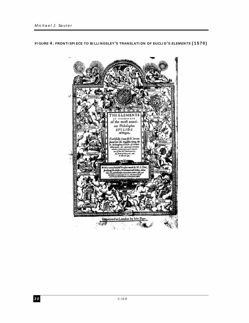
Michael J . Sauter
C I D E 3 0
FIGURE 4. FRONTISPIECE TO BILLINGSLEY’S TRANSLATION OF EUCLID’S ELEMENTS (1570)

Spanning the Poles : Spat ia l Thought and the ‘Global’ Backdrop to our Global i zed Wor ld, 1450-1850
D I V I S I Ó N D E H I S T O R I A 3 1
FIGURE 5. APIAN, COSMOGRAPHY, OR DESCRIPTION OF THE UNIVERSAL ORB (1524)

Michael J . Sauter
C I D E 3 2
References
Akita, Shigeru. Gentlemanly Capitalism, Imperialism, and Global History. New York: Palgrave Macmillan, 2002.
Apian, Petrus. Cosmographia, Sive Descriptio Universi Orbis, Petri Apiani & Gemmae Frisii, Mathematicorum Insignium, Iam Demum Integritati Suae Restituta. Antuerpiae: Ioannis Withagii, 1584.
_____. Cosmographiae Introductio: Cum Quibusdam Gaeometriae Ac Astronomiae Principiis Ad Aem Rem Necessariis. Ingoldstadt, 1529.
_____. Cosmographicus Liber Petri Apiana Mathematici Studiose Collectus. Landshut: Johannes Weyssenburger, 1524.
Babicz, Jósef. "The Celestial and Terrestrial Globes of the Vatican Library, Dating from 1477, and Their Maker Donnus Nicolaus Germanus (Ca 1420- Ca 1490)." Der Globusfreund: Wissenschaftliche Zeitschrift für Globenkunde 35/37 (1987): 155-166.
Bennett, Jim. "Practical Geometry and Operative Knowledge." Configurations 6, no. 2 (1998): 195-222.
Berggren, J. L., Alexander Jones, and Ptolemy. Ptolemy's Geography: An Annotated Translation of the Theoretical Chapters. Princeton: Princeton University Press, 2000.
Bion, Nicholas. L'usage Des Globes Celestes Et Terrestres, Et Des Spheres, Suivant Les Differens Systems Du Mondes. Prédedé D'un Traité De Cosmographie, Où Est Expliqué Avec Order Tour De Qu'il Y a De Plus Curieux Dans La Description De L'univers, Suivant Les Memoires & Observations Des Plus Habiles Astronomes & Geographes. Paris: Laurent D'Houry 1699.
Bulliet, Richard W. The Earth and Its Peoples : A Global History. Boston, Mass.: Houghton Mifflin, 1997.
Chidester, David. Christianity: A Global History. 1st U.S. ed. San Francisco, California: HarperSanFrancisco, 2000.
Coffin, Charles M., ed. The Complete Poetry and Selected Prose of John Donne. New York: The Modern Library, 2001.
Colish, Marcia L. Medieval Foundations of the Western Intellectual Tradition, 400-1400. Yale Intellectual History of the West. New Haven, CT: Yale University Press, 1997.
Cosgrove, Denis E. Apollo's Eye: A Cartographic Genealogy of the Earth in the Western Imagination. Baltimore, MD: Johns Hopkins University Press, 2001.
Crossley, Pamela Kyle. What Is Global History? Cambridge, UK ; Malden, MA: Polity, 2008.
Dekker, Elly. "The Globes in Holbein's Painting the Ambassadors." Der Globusfreund: Wissenschaftliche Zeitschrift für Globenkunde 47/48 (1999): 19-36.
Dekker, Elly, and P. C. J. van der Krogt. Globes from the Western World. London: Zwemmer, 1993.
Doppelmayr, Johann Gabriel. Historische Nachricht Von Den Nürnbergischen Mathematicis Und Künstlern, Welche Fast Von Dreyen Seculis Her Durch Ihre Schrifften Und Kunst-Bemühungen Die Mathematic Und Mehreste Künste in

Spanning the Poles : Spat ia l Thought and the ‘Global’ Backdrop to our Global i zed Wor ld, 1450-1850
D I V I S I Ó N D E H I S T O R I A 3 3
Nürnberg Vor Andern Trefflich Befördert/ Und Sich Um Solche Sehr Wohl Verdient Gemacht/ Zu Einem Guten Exempel, Und Zur Weitern Rühmlichen Nachahmung / in Zweyen Theilen an Das Liecht Gestellet, Auch Mit Vielen Nützlichen Anmerckungen Und Verschiedenen Kupffern Versehen Von Johann Gabriel Doppelmayr, Der Kayserl. Leopoldino-Carolinischen Academiæ Naturæ Curiosorum, Auch Der Königl. Preußischen Societät Der Wissenschaften Mitgliedt Und Professore Publ. Mathematum. Nürnberg: Peter Conrad Monath, 1730.
Edson, Evelyn. The World Map, 1300-1492: The Persistence of Tradition and Transformation. Baltimore, MD: Johns Hopkins University Press, 2007.
Euclid. The Elements of Geometrie of the Most Auncient Philosopher Euclide of Megara: Faithfully (Now First) Translated into the English Toung, by H. Billingsley, Citizen of London. Whereunto Are Annexed Certaine Scholies, Annotations, and Inventiones, of the Best Mathematiciens, Both of Time Past, and in This Our Age. Translated by Henry Billingsley. London: John Daye, 1570.
_____. Euclid's Elements: All Thirteen Books Complete in One Volume. Translated by Thomas L. Heath. Santa Fe, NM: Green Lion Press, 2002.
Fauser, Alois. Die Welt in Händen: Kurze Kulturgeschichte Des Globus. Stuttgart: Schuler, 1967.
Ferro, Marc. Colonization: A Global History. Quebec: World Heritage Press, 1997. Frisius, Gemma. Principiis Astronomiae Et Cosmographiae: Deque Usu Globi Ab
Eodem Editi. Item De Orbis Divisione, & Insulis, Rebúsq; Nuper Inventis. Eiusdem Libellus De Locorum Describendorum Ratione. Et De Eorum Distantiis Inveniendi, Nunquam Antehac Visus. Paris: Thomas Richard, 1547.
Gaukroger, Stephen. The Emergence of a Scientific Culture: Science and the Shaping of Modernity, 1210-1685. Oxford: Clarendon Press 2006.
Gills, Barry K., and William R. Thompson. Globalization and Global History. Rethinking Globalizations. London; New York: Routledge, 2006.
Godlewska, Anne Marie Claire. Geography Unbound: French Geographic Science from Cassini to Humboldt. Chicago: University of Chicago Press, 1999.
Golinski, Jan V. Science as Public Culture: Chemistry and Enlightenment in Britain, 1760-1820. Cambridge: Cambridge University Press, 1992.
Guha, Ramachandra. Environmentalism: A Global History. Longman World History Series. New York: Longman, 2000.
Hartner, Willy. "The Astronomical Instruments of Cha-Ma-Lu-Ting, Their Idnetification, and Their Relations to the Instruments of the Observatory of Maragha." Isis 41, no. 2 (1950): 184-194.
Hauschke, Sven. "Kurfürst Johann Friedrich Von Sachsen Und Der Astronom Und Mathematiker Johannes Schöner: Das Globenpaar Von 1533/1534 in Weimar." Der Globusfreund: Wissenschaftliche Zeitschrift für Globenkunde 51/52 (2005): 9-19.
Hoskin, Michael A. The Cambridge Illustrated History of Astronomy. Cambridge Illustrated History. Cambridge: Cambridge University Press, 1997.
Jacob, Margaret C. The Cultural Meaning of the Scientific Revolution. New Perspectives on European History. 1st ed. New York: A.A. Knopf, 1988.

Michael J . Sauter
C I D E 3 4
Mazlish, Bruce, and Ralph Buultjens. Conceptualizing Global History. Global History. Boulder: Westview Press, 1993.
McClellan, James E., and Friançois Regourd. "The Colonial Machine: French Science and Colonization in the Ancien Régime." Osiris 15 (2000): 31-50.
Mett, Rudolf. Regiomontanus: Wegbereiter Des Neuen Weltbildes. Stuttgart: B. G. Teubner, 1996.
Müller, Johann Wolfgang. Anweisung Zur Kenntnis Und Dem Gebrauch Der Künstlichen Himmels- Und Erdkugeln Besonders in Rücksicht Auf Die Neuesten Nürnberger Globen, Für Die Höhern Classen Der Schulen Und Liebhaber Der Sphaerologie. 2 vols. Vol. 1, Nuremberg: Johann Georg Klinger, 1791.
_____. Anweisung Zur Kenntnis Und Dem Gebrauch Der Künstlichen Himmels- Und Erdkugeln Besonders in Rücksicht Auf Die Neuesten Nürnberger Globen, Für Die Höhern Classen Der Schulen Und Liebhaber Der Sphaerologie. 2 vols. Vol. 2, Nuremberg: Johann Georg Klinger, 1792.
_____. Ausführlich Evidentetheorie Der Parallellinien. Nuremberg: J. L. G. Lechnerischen Buchhandlung, 1819.
_____. Bearbeitung Des Ersten Buchs Der Elemente Euklid's Nuremberg: Riegel und Wießner, 1821.
_____. Repertorium Der Mathematischen Literatur in Alphabetischer Ordnung. 3 vols Augsburg un Leipzig: Jenisch und Stageschen Buchhandlung, 1820.
Müller, Johann Wolfgang, and Johann Ludwig Hocker. Einleitung Zur Erkenntniss Und Gebrauch Der Erd- Und Himmels-Kugeln. Monath und Kusslerischen Buchhandlung, 1801.
Münchhausen, Otto von, ed. Der Hausvater. Erster Theil. 2 ed. 6 vols. Vol. 1. Hannover: Verlag seel. Nic. Försters und Sohns Erben Hof-Buchhandlung, 1766.
Murdoch, John. "Euclid: Transmission of the Elements." In Dictionary of Scientific Biography, edited by Charles Coulston Gillispie. 437-459. New York, NY: Charles Scribner's Sons, 1971.
Muris, Oswald, and Gert Saarmann. Der Globus Im Wandel Der Zeiten; Eine Geschichte Der Globen. Berlin: Columbus Verlag, 1961.
Neiberg, Michael S. Fighting the Great War: A Global History. Cambridge, Mass.: Harvard University Press, 2005.
Nelson, Leif D., and Joseph P. Simmons. "On Southbound Ease and Northbound Fees: Literal Consequences of the Metaphoric Link between Vertical Position and Cardinal Direction." Journal of Marketing Research 46, no. 6 (2009): 715-724.
North, John D. Cosmos: An Illustrated History of Astronomy and Cosmology. Chicago, IL: University of Chicago Press, 2008.
Nussbaum, Felicity. The Global Eighteenth Century. Baltimore, MD: Johns Hopkins University Press, 2003.
Pedersen, Olaf. "In Quest of Sacrobosco." Journal for the History of Astronomy 16, no. 3 (1985): 175-220.
Ptolemy, Claudius. Claudii Ptholomei Viri Alexandrini Cosmographie Liber . Translated by Jacobus Angelus. Vlme: Leonardus Hol, 1482.
_____. Claudii Ptolemaei Alexandrini Geographicae Enarrationis Libri Octo ; Adiecta Insuper Ab Eodem Scholia, Quibus Exoleta Urbium Nomina ...

Spanning the Poles : Spat ia l Thought and the ‘Global’ Backdrop to our Global i zed Wor ld, 1450-1850
D I V I S I Ó N D E H I S T O R I A 3 5
Exponuntur / Ex Bilibaldi Pirckeymheri Translationem Sed Ad Graeca Et Prisca Exemplaria À Michaele Villanovano Iam Primum Recogniti ... Translated by Willibald Pirckheimer. edited by Michael Servetus Lugduni: Trechsel, 1535.
_____. Claudii Ptolemaei Viri Allexandrini Geographiae . Translated by Jacobus Angelus. Rome: Petrus de Turre, 1490.
_____. Claudii Ptolemei Viri Alexandrini Mathematic� Discipline Philosophi Doctissimi Geographie� Opus Nouissima Traductione E Gr�corum Archetypis Castigatissime Pressum: C�teris Ante Lucubratorum Multo Pr�stantius. Pro Prima Parte Continens Cl. Ptolemei Geographiam Per Octo Libros Partitam ... Quam Brevis Et Doctissima Gregorii Lilii Subsequitur Instructio De Graecorum Numerali Supputatione, in Traductio Graeca ... Tabularum Dein Auctoris Xxvii. Pars Secunda Moderniorum Castrationum Xx Tabulis. ... Adnexo Ad Finem Tractatus ... De Variis Moribus Et Ritibus Gentium, Eorundemque Ac Localium Nominum Originibus. Argentine: Schottus, 1513.
_____. Clavdii Ptolomaei Alexandrini ... Opus Geographie�, Nouiter Castigatum ̃ & Emaculatum ̃ Additiõibus. Raris Et Inuisis. Necnon Cum ̃ Tabularum in Dorso Iucunda Explicatione ... . edited by Lorenz Fries Argentorati: Grieninger, 1522.
_____. Cosmographia. Translated by Jacobus Angelus. Vicenza: Hermanus Levilapis, 1475.
_____. De Geographia Libri Octo. Translated by Desiderius Erasmus. Basle: Hieron. Froben Nic. Episcopius, 1533.
_____. Geographia. Translated by Francesco Berlinghieri. Florence: Nicolo Todescho, 1482.
_____. Geographia. Translated by Jacobus Angelus. Rome: Arnoldus Buckinck, 1478.
_____. Geographia. Translated by Jacobus Angelus. Bologna1477. _____. "Geographia." Florence: The New York Public Library, Manuscripts and
Archives Division, 1460-1470. _____. Geographia Vniversalis, Vetvs Et Nova, Complectens Clavdii Ptolemæi
Alexandrini Enarrationis Libros Viii. Quorum Primus Noua Translatione Pirckheimeri Et Accessione Commentarioli Illustrior Quàm Hactenus Fuerit, Redditus Est. Reliqui .� Castigatiores Facti Sunt. Addita Sunt Insuper Scholia ... Succedunt Tabulæ Ptolemaic[a]E, Opera Sebastiani Munsteri Nouo Paratæ Modo. His Adiectæ Sunt Plurim[a]E Nouæ Tabulæ, Moderna[] Orbis Faciem .� Explicantes ... Vltimo Annexum Est Compendium Geographic[a]E Descriptionis, in Quo Uarij Gentium & Regionum Ritus & Mores Explicantur. Pr[a]Efixus Est ... Index ... Basileae: Heinrich Petri, 1540.
_____. Nova Translatio Primi Libri Geographiae Cl. Ptolomaei ... Joanne Vernero Interprete. In Eundem 1. Libr. Geographiae Cl. Ptolomaei Argumenta ... Joannis Veneri. Translated by Johannes Werner. Norenbergae: Stuchs, 1516.
_____. Primeiro Livro Da Geographia. Lixboa: Galharde, 1537. Regiomontanus, Johannes. Scripta Clarissimi Mathematici M. Ioannis
Regiomontani, De Torqueto, Astrolabio Armillari, Regula Magna Ptolemaica, Baculoq[Ue] Astronomico, & Obseruationibus Cometarum / Aucta Necessarijs, Ioannis Schoneri Carolostadij Additionibus. Item Obseruationes Motuum Solis,

Michael J . Sauter
C I D E 3 6
Ac Stellarum Tam Fixarum ... Item Libellus M. Georgij Purbachij De Quadrato Geometrico. Norimbergae: Johannes Montanus & Ulrich Neuber, 1544.
Schaffer, Simon. "Newton on the Beach: The Information Order of Principia Mathematica." History of Science xlvii (2009): 243-276.
Schöner, Johannes. Globi Stelliferi, Sive Sphaerae Stellarum Fixarum Usus, & Explicationes, Quibus Quicquid De Primo Mobili Demonstrari Solet, Id Uniuersum Prope Continetur, Directionum Autem Ipsarum Quas Uocant, Ratio Accuratis, Est Exposita. Autore Ioanne Schonero Carolostadio, Atque Haec Omnia Multò Quâm Ante Emendatiora & Copiosiora Singulari Ac Studio in Lucem Edita Fuere Anno Christi M. D. Xxxiii. Norimbergae: Petreius, 1533.
_____. Opusculum Geographicum Ex Diversorum Libris Ac Cartis Summa Cura & Diligentia Collectum, Accomodatum Ad Recenter Elaboratum Ab Eodem Globum Descriptionis Terrenae. Nürnberg: Johann Petreius, 1533.
_____. Solidi Ac Sphaerici Corporis Sive Globi Astronomici Canones: Usum Et Expeditam Praxim Eiusdem Expromentes. Noribergae: Ioannes Stuchs, 1517.
Stevens, Henry Newton, and Edward Everett Ayer. Ptolemy's Geography: A Brief Account of All the Printed Editions Down to 1730, with Notes on Some Important Variations Observed in That of Ulm 1482, Including the Recent Discovery of the Earliest Printed Map of the World yet Known on Modern Geographical Conceptions in Which Some Attempt Was Made to Depart from Ancient Tradition. 2d ed. London: H. Stevens, Son and Stiles, 1908.
Stevenson, Edward Luther. Terrestrial and Celestial Globes: Their History and Construction, Including a Consideration of Their Value as Aids in the Study of Geography and Astronomy. New Haven, CT: Pub. for the Hispanic society of America by the Yale university press, 1921.
Strauss, Gerald. Nuremberg in the Sixteenth Century: City Politics and Life between Middle Ages and Modern Times. Rev. ed. Bloomington, IA: Indiana University Press, 1976.
Strayer, Robert W. Ways of the World: A Brief Global History. 1st ed. Boston, Mass.: Bedford/St. Martin's, 2009.
Sykes, James. "Der Erdglobus in Raphaels 'Die Schule Von Athen'." Der Globusfreund: Wissenschaftliche Zeitschrift für Globenkunde 55/56 (2009): 53-73.
Terrall, Mary. The Man Who Flattened the Earth: Maupertuis and the Sciences in the Enlightenment. Chicago: The University of Chicago Press, 2002.
Thorndike, Lynn. A History of Magic and Experimental Science. 8 vols. Vol. 5, New York: Macmillan, 1923.
_____. The Sphere of Sacrobosco and Its Commentators. Chicago: The University of Chicago Press, 1949.
van Helden, Albert. "The Beginnings, from Lipperhey to Huygens and Cassini." Experimental Astronomy: Astrophysical Instrumentation and Methods 25 (2009): 3-16.
Wallis, Helen. "Further Light on the Molyneux Globes." The Geographical Journal 121, no. 3 (1955): 304-311.
_____. "The Place of Globes in English Education, 1600 - 1800." Der Globusfreund: Wissenschaftliche Zeitschrift für Globenkunde 25-27 (1978): 103-110.

Spanning the Poles : Spat ia l Thought and the ‘Global’ Backdrop to our Global i zed Wor ld, 1450-1850
D I V I S I Ó N D E H I S T O R I A 3 7
Weinberg, Gerhard L. A World at Arms: A Global History of World War II. 2nd ed. Cambridge ; New York: Cambridge University Press, 2005.
Woodward, David. "Reality, Symbolism, Time, and Space in Medieval World Maps." Annals of the Association of American Geographers 75, no. 4 (1985): 510-521.

Novedades
DIVISIÓN DE ADMINISTRACIÓN PÚBLICA
Dolores Luna et al., Índice de Gobierno Electrónico Estatal: La medición 2010, DTAP-264
Gabriel Purón Cid y J. Ramón Gil-García, Los efectos de las características tecnológicas en los sitios web del gobierno, DTAP-263
Ana Elena Fierro y J. Ramón Gil-García, Más allá del acceso a la información, DTAP-262
Gabriel Purón Cid, Resultados del “Cuestionario sobre la reforma Presupuesto basado en Resultados…”, DTAP-261
Guillermo Cejudo y Alejandra Ríos, El acceso a la información gubernamental en América Central y México: Diagnóstico y propuestas, DTAP-260
Rodolfo De la Torre and Patricia López-Rodríguez, Closing the Gap: The Link between Social Capital and Microfinance Services, DTAP-259
Ma. Amparo Casar, Representation and Decision Making in the Mexican Congress, DTAP-258
Guillermo Cejudo y Dirk Zavala, Procesos y prácticas del acceso a la información: un ejercicio de usuario simulado, DTAP-257
Ernesto Flores-Roux y Judith Mariscal, The Development of Mobile Money Systems, DTAP-256
David Arellano, Walter Lepore, Laura Zamudio e Israel Aguilar, Control de los conflictos de interés, DTAP-255
DIVISIÓN DE ECONOMÍA
Brasil Acosta et al., Evaluación de los resultados de la Licitación del Espectro Radioeléctrico de la COFETEL, DTE-525
Eva Arceo-Gómez and Raymundo M. Campos-Vázquez, ¿Quiénes son los NiNis en México?, DTE-524
Juan Rosellón, Wolf-Peter Schill and Jonas Egerer, Regulated Expansion of Electricity Transmission Networks, DTE-523
Juan Rosellón and Erix Ruíz, Transmission Investment in the Peruvian Electricity Market: Theory and Applications, DTE-522
Sonia Di Giannatale et al., Risk Aversion and the Pareto Frontier of a Dynamic Principal-Agent Model: An Evolutionary Approximation, DTE-521
Víctor Carreón and Jorge L. García, Trivariate Probit with Double Sample Selection: Theory and Application, DTE-520
Alejandro Castañeda y Pedro Ibarra, Entrada de supermercados en México, DTE-519 Julio César Leal, Combate a la informalidad: ¿Más monitoreo fiscal o menos
monopolios?, DTE-518 Julio Leal and Jorge Alonso, Taxes, Transfers and the Distribution of Employment in
Mexico, DTE-517 Eva Arceo and Raymundo M. Campos-Vázquez, Teenage Pregnacy in Mexico:
Evolution and Consequences, DTE-516

DIVISIÓN DE ESTUDIOS INTERNACIONALES
Covadonga Meseguer and Gerardo Maldonado, Kind Resistance: Attitudes toward
Immigrants in Mexico and Brazil, DTEI-227 Guadalupe González et al., The Americas and the World 2010-2011. Public Opinion
and Foreign Policy in Brazil, Colombia, Ecuador, Mexico and Peru, DTEI-226 Guadalupe González et al., Las Américas y el mundo 2010-2011: Opinión pública y
política exterior en Brasil, Colombia, Ecuador, México y Perú, DTEI-225 Álvaro Morcillo Laiz, Un vocabulario para la modernidad. Economía y sociedad de
Max Weber (1944) y la sociología en español, DTEI-224 Álvaro Morcillo Laiz, Aviso a los navegantes. La traducción al español de Economía y
sociedad de Max Weber, DTEI-223 Gerardo Maldonado, Cambio electoral, anclaje del voto e intermediación política en
sistemas de partidos de baja institucionalización, DTEI-222 James Ron and Emilie Hafner-Burton, The Latin Bias: Regions, the Western Media
and Human Rights, DTEI-221 Rafael Velázquez, La política exterior de Estados Unidos hacia México bajo la
administración de Barack Obama, DTEI-220 Rafael Velázquez y Jorge Schiavon, La cooperación internacional descentralizada
para el desarrollo en México, DTEI-219 Kimberly A. Nolan García, Whose Preferences?: Latin American Trade Promotion
Pacts as a Tool of US Foreign Policy, DTEI-218
DIVISIÓN DE ESTUDIOS JURÍDICOS
Ana Laura Magaloni, La Suprema Corte y el obsoleto sistema de jurisprudencia constitucional, DTEJ-57
María Mercedes Albornoz , Cooperación interamericana en materia de restitución de menores, DTEJ-56
Marcelo Bergman, Crimen y desempleo en México: ¿Una correlación espuria?, DTEJ-55
Jimena Moreno, Xiao Recio y Cynthia Michel, La conservación del acuario del mundo. Alternativas y recomendaciones para el Golfo de California, DTEJ-54
María Solange Maqueo, Mecanismos de tutela de los derechos de los beneficiarios, DTEJ-53
Rodolfo Sarsfield, The Mordida´s Game. How institutions incentive corruption, DTEJ-52
Ángela Guerrero, Alejandro Madrazo, José Cruz y Tania Ramírez, Identificación de las estrategias de la industria tabacalera en México, DTEJ-51
Estefanía Vela, Current Abortion Regulation in Mexico, DTEJ-50 Adriana García and Alejandro Tello, Salaries, Appelate Jurisdiction and Judges
Performance, DTEJ-49 Ana Elena Fierro and Adriana García, Design Matters: The Case of Mexican
Administrative Courts, DTEJ-48

DIVISIÓN DE ESTUDIOS POLÍTICOS
Carlos Elizondo, Stuck in the Mud: The Politics of Constitutional Reform in the Oil Sector in Mexico, DTEP-235
Joy Langston and Francisco Javier Aparicio, Gender Quotas are not Enough: How Background Experience and Campaigning Affect Electoral Outcomes, DTEP-234
Gilles Serra, How Could Pemex be Reformed? An Analytical Framework Based on Congressional Politics, DTEP-233
Ana Carolina Garriga, Regulatory Lags, Liberalization, and Vulnerability to Systemic Banking Crises, DTEP-232
Rosario Aguilar, The Tones of Democratic Challenges: Skin Color and Race in Mexico, DTEP-231
Rosario Aguilar, Social and Political Consequences of Stereotypes Related to Racial Phenotypes in Mexico, DTEP-230
Raúl C. González and Caitlin Milazzo, An Argument for the ‘Best Loser’ Principle in Mexico, DTEP-229
Francisco Javier Aparicio and Covadonga Meseguer, Supply or Demand? Politics and the 3x1 Program for Migrants, DTEP-228
Ana Carolina Garriga and Brian J. Phillips, Foreign Aid and Investment in Post-Conflict Countries, DTEP-227
Allyson Benton, The Origins of Mexico's Municipal Usos y Costumbres Regimes, DTEP-226
DIVISIÓN DE HISTORIA
Adriana Luna, La reforma a la legislación penal en el siglo XVIII: Notas sobre el aporte de Cesare Beccaria y Gaetano Filangieri, DTH-76
Michael Sauter, Human Space: The Rise of Euclidism and the Construction of an Early-Modern World, 1400-1800, DTH-75
Michael Sauter, Strangers to the World: Astronomy and the Birth of Anthropology in the Eighteenth Century, DTH-74
Jean Meyer, Una revista curial antisemita en el siglo XIX: Civiltá Cattolica, DTH-73 Jean Meyer, Dos siglos, dos naciones: México y Francia, 1810- 2010, DTH-72 Adriana Luna, La era legislativa en Nápoles: De soberanías y tradiciones, DTH-71 Adriana Luna, El surgimiento de la Escuela de Economía Política Napolitana, DTH-70 Pablo Mijangos, La historiografía jurídica mexicana durante los últimos veinte años,
DTH-69 Sergio Visacovsky, “Hasta la próxima crisis”. Historia cíclica, virtudes genealógicas y
la identidad de clase media entre los afectados por la debacle financiera en la Argentina (2001-2002), DTH-68
Rafael Rojas, El debate de la Independencia. Opinión pública y guerra civil en México (1808-1830), DTH-67

ESTUDIOS INTERDISCIPLINARIOS
Ugo Pipitone, México y América Latina en la tercera oleada (crecimiento, instituciones y desigualdad), DTEIN-02
Eugenio Anguiano, El estudio de China desde cuatro enfoques: histórico, político, internacionalista y económico, DTEIN-01

Ventas
El CIDE es una institución de educación superior especializada particularmente en las disciplinas de Economía, Administración Pública, Estudios Internacionales, Estudios Políticos, Historia y Estudios Jurídicos. El Centro publica, como producto del ejercicio intelectual de sus investigadores, libros, documentos de trabajo, y cuatro revistas especializadas: Gestión y Política Pública, Política y Gobierno, Economía Mexicana Nueva Época e Istor. Para adquirir cualquiera de estas publicaciones, le ofrecemos las siguientes opciones:
VENTAS DIRECTAS: VENTAS EN LÍNEA:
Tel. Directo: 5081-4003 Tel: 5727-9800 Ext. 6094 y 6091 Fax: 5727 9800 Ext. 6314 Av. Constituyentes 1046, 1er piso, Col. Lomas Altas, Del. Álvaro Obregón, 11950, México, D.F.
Librería virtual: www.e-cide.com
Dudas y comentarios: [email protected]
¡¡Colecciones completas!!
Adquiere los CDs de las colecciones completas de los documentos de trabajo de todas las divisiones académicas del CIDE: Economía, Administración Pública, Estudios Internacionales, Estudios Políticos, Historia y Estudios Jurídicos.
¡Nuevo! ¡¡Arma tu CD!!
Visita nuestra Librería Virtual www.e-cide.com y selecciona entre 10 y 20 documentos de trabajo. A partir de tu lista te enviaremos un CD con los documentos que elegiste.