mississauga liiijii
TRANSCRIPT
Contact:
MISSISSAUGA ,., liiiJii
AGENDA
SESSION 20
SPECIAL MEETING OF
THE COUNCIL OF
THE CORPORATION OF THE CITY OF MISSISSAUGA (www.mississauga.ca)
WEDNESDAY, December 4, 2013 ~ 9:00 A.M.
COUNCIL CHAMBER 300 CITY CENTRE DRIVE
MISSISSAUGA, ONTARIO L5B 3Cl
Telephone: Carmela Radice, Legislative Coordinator, Office of the City Clerk 905-615-3200 Ext. 5426; [email protected]
Meetings of Council streamed live and archived at mississauga.ca/videos
Council Agenda 1 December 4, 2013
1. CALL TO ORDER
2. APPROVAL OF AGENDA
3. DECLARATIONS OF CONFLICT OF INTEREST
4. PUBLIC QUESTION PERIOD-15 Minnte Limit (in accordance with Section 36 of the City of Mississauga Procedure By-law 0139-2013 - Council may grant permission to a person who is present and at Council and wishes to address Council on a matter on the Agenda. Public Question Period is limited to a total of 15 minutes. Persons addressing Council with a guestion should limit preamble to a maximum of two statements sufficient to establish the context for the guestion. For any other matter, leave must be granted by Council to deal with a matter not on the agenda).
5. CLOSED SESSION
(a) Pursuant to the Municipal Act, Section 239 (2)
(i) Litigation or potential, including matters before administrative tribunals, affecting the municipality or local board re: Update and Legal Advice
Regarding Official Plan Amendment No. 8 and Zoning By-law 0050-2013 Appeals and Proposed Partial Settlement with OMERS Realty Management Corporation and 156 Square One Limited.
6. MATTERS ARISING OUT OF CLOSED SESSION
R-1 A report dated December 2, 2013, from the Commissioner of Planning and Building re: Information Status and Removal of "H" Holding Symbol Report To permit the southwest addition to Square One Mall, private open space plaza with public access easement and new public road network, 100 City Centre Drive, Northeast of City Centre Drive and Duke of York Boulevard Owner/Applicant: OMERS Realty Management Corp. and 156 Square One Limited Bill 51, (HOZ 13/004 W4) (Ward 4).
Recommendation
That the Report dated December 2, 2013, from the Commissioner of Planning and Building outlining the details of the proposed development and recommending approval of the removal of the "H" holding symbol application, to permit the southwest addition to Square One Mall and new road network under file H-OZ 13/004 W4, OMERS Realty Management Corp. and 156 Square One Limited, 100 City Centre Drive, be received for information, and that the Planning and Building Department be authorized to prepare the necessary byclaw for Council's passage.
Motion
Council Agenda 2 December 4, 2013
7. MOTIONS
(a) To approve the Report dated December 2, 2013, from the Commissioner of
Planning and Building outlining the details of the proposed development and recommending approval of the removal of the "H" holding symbol application, to permit the southwest addition to Square One Mall and new road network under file H-OZ 13/004 W4, OMERS Realty Management Corp. and 156 Square One Limited, 100 City Centre Drive, be received for information, and that the Plauning and Building Department be authorized to prepare the necessary by-law for Council's passage.
Corporate Report R-1
8. INTRODUCTION AND CONSIDERATION OF BY-LAWS
B-1 A By-law to authorize the execution of a Development Agreement between OMERS Realty Management Corp & 156 Square One Limited and the Corporation of the City of Mississauga North of City Centre Drive between Duke of York Boulevard and Kariya Gate (H-OZ 13/004 W4) Owner/Applicant: OMERS Realty Management Corp & 156 Square One Limited (Ward 4).
Corporate Report R-1
B-2 A by-law to amend the Zoning By-law 0225-2007 to remove the 'H' Holding symbol for the lands located at 100 City Centre Drive for the lands in the northeast corner of City Centre Drive and Duke of York Boulevard, OMERS Realty Management Corp. and 156 Square One Limited (Ward 4).
Corporate Report R-1
9. CONFIRMATORY BILL
A by-law to confirm the proceedings of the Council of The Corporation of the City of Mississauga at its meeting held on December 4, 2013.
11. ADJOURNMENT
Corporate Report
Clerk's Fiies
Originator's
Files H-OZ 13/004 W4
COUNCJ.L A.Gl!.~DA
Q- l
L::ie_c_ L.( 1 20 I 3
DATE:
TO:
FROM:
SUBJECT:
December 2, 2013
Mayor and Members of Council Meeting Date: December 4, 2013
Edward R. Sajecki Commissioner of Plarming and Building
Information Status and Removal of "H" Holding Symbol Report To permit the southwest addition to Square One Mall, private open space plaza with public access easement and new public road network 100 City Centre Drive Northeast of City Centre Drive and Duke of York Boulevard Owner/Applicant: OMERS Realty Management Corp and 156 Square One Limited Bill 51
Ward4
RECOMMENDATION: That the Report dated December 2, 2013, from the Commissioner of Plarming and Building outlining the details of the proposed development and recommending approval of the removal of the "H" holding symbol application, to permit the southwest addition to Square One Mall and new road network under file H-OZ 13/004 W 4, OMERS Realty Management Corp. and 156 Square One Limited, I 00 City Centre Drive, be received for information, and that the Planning and Building Department be authorized to prepare the necessary by-law for Council's passage.
Council
REPORT HIGHLIGHTS:
BACKGROUND:
- 2 -File: H-OZ 13/004 W4
December 2 2013
• The "H" holding symbol is proposed to be removed from the
southwest side of Square One mall and the lands north of
City Centre Drive and east of Duke of York Boulevard in
order to permit an addition to the mall, private open space plaza with public access easement and allow for the
construction of a new public road network upon execution of a Development Agreement;
• The "H" holding symbol is to be re-instated over the
undeveloped blocks once the road network is constructed and
the surface parking lots are re-configured accordingly;
• A Site Plan application (SP 12/218 W4) has been received and
is currently under review for an addition to the southwest
portion of the mall, between Old Navy and Hudson's Bay, to include a Holt Renfrew store, retail shops, a private open space
plaza with public access easement, and a grand entrance to the
mall, along with the new network of public roads;
• This report is provided as information for Council to outline
the details of the proposal and to seek Council's permission to
prepare the by-law to lift the "H" holding symbol to allow for
development of the subject lands.
On July 2, 2008, City Council adopted PDC Recommendation
PDC-0053-2008 which requires that prior to approval of an
application to remove the "H" holding symbol for all lands located
within the downtown, the Planning and Building Department
prepare an Information Status Report for consideration by Planning
and Development Committee and Council, outlining the details of
the development proposal.
The proposal is for an addition to the southwest portion of Square
One mall (between the existing Old Navy and Hudson's Bay)
which includes a Holt Renfrew store, retail shops, a private open
space plaza with public access easement, and a grand entrance to
the mall. Also forming part of this application are the lands north
of City Centre Drive and east of Duke of York Boulevard, of
Council
COMMENTS:
- 3 -File: H-OZ 13/004 W4
December 2 2013
which portions will be gratuitously dedicated to the City for a new
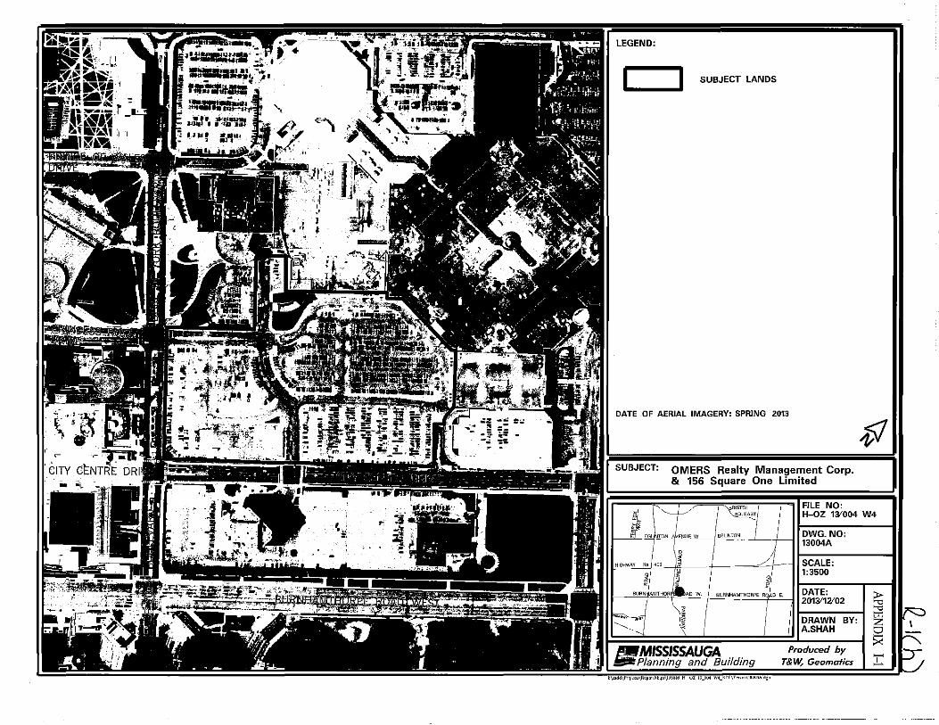
network of public roads (See Appendices I-1 to I-7).
The Site Plan (SP 12/218 W4) for the proposed southwest mall
addition was submitted December 21, 2012 and the current
proposed site plan is shown in Appendix I-5, with the elevations
shown in Appendix I-6. The Downtown Interim Control By-law
was in effect upon submission of the site plan. The Interim Control
By-law Amendments (MOPA 8, By-law 0050-2013, and the
Downtown Built Form Standards) which sought to implement the
vision within the Downtown21 Master Plan were approved by
Council on March 6, 2013 and were subsequently appealed by a
number of the Downtown landowners including OMERS Realty
Management Corp. and 156 Square One Limited on April 9, 2013.
There have been on-going discussions between the City of
Mississauga and Oxford Properties (OMERS Realty Management
Corp. and 156 Square One Limited) to attempt to resolve their
proposal with the amendments.
The Removal of the "H" Holding Provision application
(H-OZ 13/004 W4) was submitted on October 29, 2013. This
application has been circulated for technical comments and once
the Development Agreement has been approved and executed, the
requirements for lifting of the "H" holding symbol will have
been met.
Typically the Information Status Report is prepared in advance of
the report to seek permission to prepare the by-law to lift the "H"
holding symbol, however, due to the timing of a related Ontario
Municipal Board pre-hearing on December 10th, the two reports
have been combined herein.
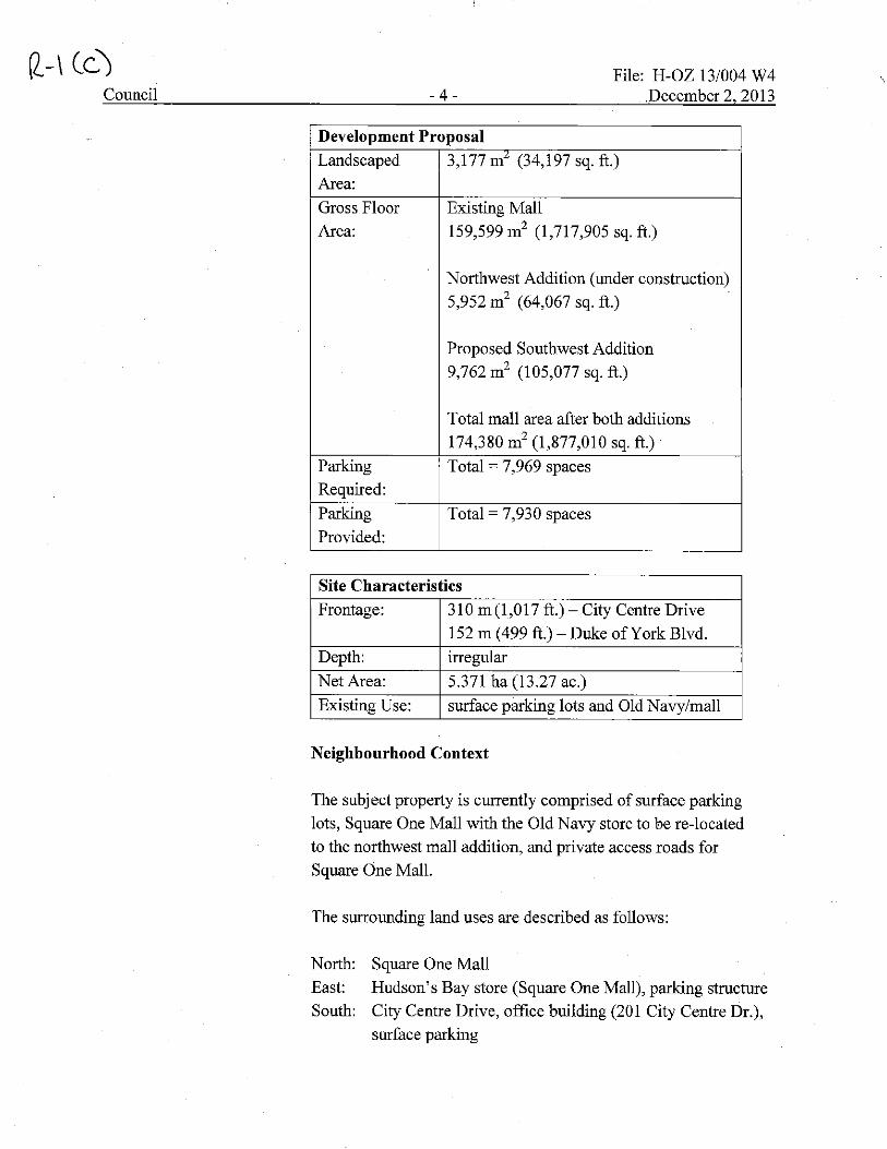
Details of the proposal are as follows:
Development Proposal
Application October 29, 2013
submitted:
Height: 1 and 2 storeys (tallest point is 18.5 m
( 60 ft.) appearing as 3 storeys)
Q-ICb)
Council - 4 -File: H-OZ 13/004 W4
December 2 2013
Development Proposal
Landscaped 3,177 m7 (34,197 sq. ft.)
Area:
Gross Floor Existing Mall
Area: 159,599 m2 (1,717,905 sq. ft.)
Northwest Addition (under construction)
5,952 m2 (64,067 sq. ft.)
Proposed Southwest Addition
9,762 m2 (105,077 sq. ft.)
Total mall area after both additions
174,380 m2 (1,877,010 sq. ft.)
Parking Total = 7 ,969 spaces
Required:
Parking Total= 7,930 spaces
Provided:
Site Characteristics
Frontage: 310 m(l,017 ft.)-City Centre Drive
152 m (499 ft.)-Duke of York Blvd.
Depth: irregular
NetArea: 5.371 ha (13.27 ac.)
Existing Use: surface parking lots and Old Navy/mall
Neighbourhood Context
The subject property is currently comprised of surface parking
lots, Square One Mall with the Old Navy store to be re-located
to the northwest mall addition, and private access roads for
Square One Mall.
The surrounding land uses are described as follows:
North: Square One Mall
East:
South: Hudson's Bay store (Square One Mall), parking structure City Centre Drive, office building (201 City Centre Dr.),
surface parking
Council - 5 -File: H-OZ 13/004 W4 Q-) Cd)
December 2 2013
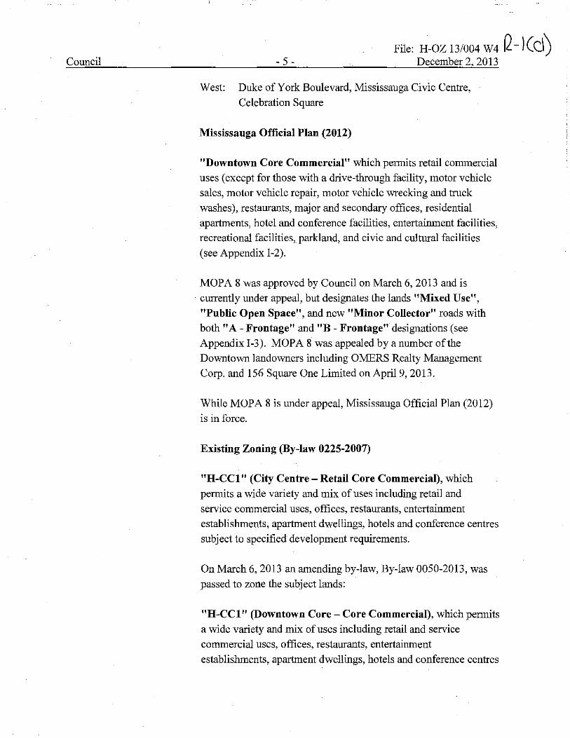
West: Duke of York Boulevard, Mississauga Civic Centre,
Celebration Square
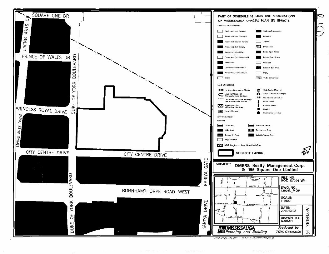
Mississauga Official Plan (2012)
"Downtown Core Commercial" which permits retail commercial
uses (except for those with a drive-through facility, motor vehicle
sales, motor vehicle repair, motor vehicle wrecking and truck
washes), restaurants, major and secondary offices, residential
apartments, hotel and conference facilities, entertainment facilities,
recreational facilities, parkland, and civic and cultural facilities
(see Appendix I-2).
MOPA 8 was approved by Council on March 6, 2013 and is
currently under appeal, but designates the lands "Mixed Use", "Public Open Space", and new "Minor Collector" roads with
both "A- Frontage" and "B - Frontage" designations (see
Appendix I-3). MOPA 8 was appealed by a number of the
Downtown landowners including OMERS Realty Management
Corp. and 156 Square One Limited on April 9, 2013.
While MOPA 8 is under appeal, Mississauga Official Plan (2012)
is in force.
Existing Zoning (By-law 0225-2007)
"H-CCl" (City Centre - Retail Core Commercial), which
permits a wide variety and mix of uses including retail and
service commercial uses, offices, restaurants, entertainment
establishments, apartment dwellings, hotels and conference centres
subject to specified development requirements.
On March 6, 2013 an amending by-law, By-law 0050-2013, was
passed to zone the subject lands:
"H-CCl" (Downtown Core - Core Commercial), which permits
a wide variety and mix of uses including retail and service
commercial uses, offices, restaurants, entertainment
establishments, apartment dwellings, hotels and conference centres

~-\Ce) Council - 6 -
File: H-OZ 13/004 W4 December 2 2013
subject to specified development requirements including design
requirements and a minimum building height of 3 storeys.
"H-CCOS" (Downtown Core - Open Space), which permits
only active and passive recreational uses, and below grade
parking structures.
The By-law also zones the lands with "A Street Frontage", "B Street Frontage", "75% Retail Activation Frontage", and "50% Retail Activation Frontage" requirements and
"Build-to Areas".
This By-law is currently under appeal.
A minor variance application has been submitted under file
'A' 454/13 to permit the construction of a one and two storey
addition extending from the site of the existing Old Navy to
Hudson's Bay. The variance is scheduled to the December 5, 2013
Committee of Adjustment.
The application is seeking variances for the following:
• Reduced building height;
• To permit retail uses in the CCOS Open Space zone;
• Reduction in the amount of first storey streetwall glazing;
• Increased width of a retail unit within a retail
activation area;
• Encroachment of an underground parking structure below a
street; and,
• Reduction in the amount of parking required
The variances will accommodate the proposed development.
Site Plan
The site plan for the southwest expansion of Square One mall
(SP 12/218 W 4) proposes an addition between the existing Old
Navy store (to be re-located) and Hudson's Bay on the south side
of the mall within 1 and 2 storeys. The addition will contain a Holt
Council -7-File: H-OZ 13/004 W4
December 2 2013
Renfrew store, retail stores, grand entrance to the mall, and a
private open space plaza with public access easement and new
public road network (see Appendices I-5 and I-6).
The "H" holding symbol must be removed prior to the issuance of site plan approval for any building permit.
Removal of Holding Symbol
Section 36 of the Planning Act provides the legislative framework for the removal of the "H" holding symbol and allows
municipalities to amend a by-law to remove the "H" holding
symbol. A formal public meeting is not required; however notice
of Council's intention to pass the amending by-law must be given
to all land owners within 120 m (400 ft.) to which the proposed
amending by-law would apply. Notice was given to all affected land owners by pre-paid first class mail.
The conditions for removing the "H" holding provision will be
fulfilled as follows:
1. The owner will execute and enter into a Development
Agreement, satisfactory to The Corporation of the City of
Mississauga, addressing and agreeing to, amongst other things,
the installation or placement of all required municipal works,
municipal walkways, land dedications and the provision of required securities. This agreement must be complete and
approved by Council prior to Council's approval of the By-law
to remove the "H" holding symbol.
2. The lands comprising the future road network will be
constructed by OMERS Realty Management Corp. and
156 Square One Limited to municipal standards and
gratuitously dedicated to the City of Mississauga and assumed
as Public Highway. Some of the roads will be stratified (eastern portion of Princess Royal Drive and the future Main
Street) with the City owning the surface road, and OMERS
Realty Management Corp. and 156 Square One Limited
owning the below grade portion to be used for private
Q-1ct)
FINANCIAL IMPACT:
CONCLUSION:
ATTACHMENTS:
underground parking. The design of the new roads will be
determined through a future Environmental Assessment
process undertaken by the City.
Upon completion of construction of the roads and the alterations to
the remaining surface parking, the applicant has agreed in the Development Agreement to have the "H" holding symbol re
instated upon the undeveloped lands (surface parking lots), and
these lands will require a separate application to remove the "H"
holding symbol upon there being a proposal for a Phase 2
redevelopment consistent with the approved policies, zoning, and vision for the Main Street District.
Not applicable.
The conditions to remove the "H" holding symbol are anticipated to be fulfilled through the approval of the Development Agreement
at this same special meeting of Council. These items must be
completed prior to enactment of the By-law to lift the "H" holding
symbol, and the by-law shall only be approved after the
Development Agreement is approved.
Appendix I-1: Aerial Photograph
Appendix I-2: Excerpt of Downtown Core Land Use Map
(Mississauga Official Plan - In Effect)
Appendix I-3: Excerpt of Downtown Core Land Use Map
(MOPA 8- Under Appeal) Appendix I-4: Excerpt of Existing Land Use Map
Appendix I-5: Proposed Site Plan
Appendix I-6: Elevations
Appendix I-7: General Context Map
Edward R. Sajecki
Commissioner of Planning and Building
Prepared By: Jonathan Famme, Development Planner
K:\PLAN\DEVCONTL\GROUP\WPDATA\COUNCIL\HOZ 13.004 W4 lnfoRemoval ofHReport.pm.jf.so.docx
LEGEND:
I I SUBJECT LANDS
DATE OF AERIAL IMAGERY: SPRING 2013
OMERS Realty Management Corp. & 156 Square One Limited
FILE NO:
$
H-OZ 131004 W4
'ENUE W EGLINTON
i DWG.NO: 13004A
SCALE: 1:3500 ,1 11 I ,,
BUR:JAMTHOAJaAD w. BURNHAMTHORPE Rlo E. DATE: 2013i1V02
1'~ '>
-MISSISSAUGA Jiiiii Planning and Building ;,\=lrl\Pcaj"~\R,ponMap•\li!"6 H uz ,,_UM W4_Rl'f\\'octo;\1''""'~·"~"
DRAWN BY: A.SHAH
Produced by T& W, Geomafics
I :c
Ir::> I
r::T
··~SQUARE ONE DR 0
PRINCE OF WALES DR
PRINCESS ROYAL DRIVE lLJ > ii: 0
CITY CENTRE DRIVE
··1 ...... ........ 0 0::
~ -' ::i 0 OJ
'<'. 0:: 0 >-LJ... 0 w
... , .. .......
3.., ___ _, 0
......... ....... ........
........ ........
\
.......................
·· .............. ........ ..
w !;;: ('J
~ 0:: ;2
PART OF SCHEDULE 10 LAND USE DESIGNATIONS
OF MISSISSAUGA OFFICIAL PLAN {IN EFFECT)
LAND USE DESIGNATIONS
c:::::J Residen,ial Low Densrw I
c:::::J Residentlol Low Density II
- Residential Medium Density
- Rosidonriol High Densiiy
- Down,own Mixed Use
D Downtown Core Commercial
- Mi••dUso
- Convenience Commeroiol
- Motor Vehicle Commercial
C::J Office
LAND USE LEGEND
•••• Heritage Conservation District
c; ig;~P~;l:~2~~i~eN~~n1ouro LSPIA Operating Area Boundary See Airorolc Noise Policies
l'lZJ t~~A~~~i.u~~~re• E NoturalHazords
CIT'!' STRUCTURE
Elem ems
- Business Employment
- lndu>lrial
c::::J ATrport
~ ln<liru1ionol
- Public Open Spece
- Private Open Space
CJ Greenbelt
- Parkway Belt West
D Utility
~ To Be Determined
• .. -~~ • • • •
Civio Cent.a (Chy Halli
Cicy Conrr0Transi1 T•rmTnol
GO Roil Transil Slalion
Public School
CalhOITO Sol'iool
Hospfral
Communicy Faoilities
~ Downtown
~ MajorNode
~ Community Node
c::::J Neighbourhood
~ Corpor•to Cen\fo
~ Employmenl Area
~ Special Purpose Area
~ CZZJ ND2 Region of Peel Nori-Decision
I I SUBJECT LANDS
SUBJECT: OMERS Realty Management Corp. & 156 Square One Limited
T >1 ,,
HIGHWAY No./'-<lO
BUl\Nf<AMTHol!Pc
~"-ii
·~
~ f
:----.__§l .. M
' >/ >- .1AVENUE
g
";:;{"
BURNHAMTHOnfe I ROAD iE.
·-ONJ 19"MISSISSAUGA ltiiii Planning and Building
i'\e.clJ\l'~"'"'\Rc)W'1'1•P>\l.'.l>IB!O H Ol IB_OO·l \H_Rl'l\\·octo;\lJUll<J._"01'.dgn
FILE NO: HOZ 131004 W4
DWG.NO: 13004L_MOP
SCALE: 1:2000
DATE: 20U'W02
DRAWN BY: A.SHAH
Produced by T& W, Geomatics
I ;c
I~ -I!' -·
PART OF SCHEDULE 10 LAND USE DESIGNATIONS DOWNTOWN CORE LOCAL AREA PLAN OF MISSISSAUGA OFFICIAL PLAN (MOPA#B - UNDER APPEAL)
LAND USE DESIGNATIONS
• Mixed Use
D Office
• Public Open Space
D Greenbelt
D Parkway Belt West
• Residential High Density
D Utility
LAND USE LEGEND
1996 NEP / 2000 NEF - - Composrte Noise Contours
1:0 Natural Hazards
Option 1, (!) Conceptual Cenne View Drive conn•ction
ta EB Hwy. 403 cancepl,
·:2.J Concopcual N-W ramp lerm1nal relocalion
@ Future Road - For addilionol lnforma<Ton ••• Schedule 5: Long Term Road Network and Table 8-2; Road Classification - Major Collectors
@ The lmerim Bus RopTd Transfr Corridor depiocs the interim alignment of tho Bus Ropid Transi< as per 2010 Environmental Assessment Approvels.
SUBJECT LANDS
TRANSPORTATION LEGEND #- Provincial Highway and Interchange
- • Northern Distribution Road
-Arterial
- Major Collector
- Minor Collector
• - Local Road
11 - Bus Rapid Transit Corridor
1 1 - ~~~{ii~rBus Rapid Transit
·-(_f)
.Q _, fJll < • ... • -
Light Rail Transit Corridor
Proposed Grade Separated Crossing
Proposed Roundabout
Anchor Hub
Civic Centre (City Hall)
Public School
City Centre Transit Terminal
Community Facilities
Local Area Plan Boundary
Area of Amendment No. B
NOT A PLAN OF SURVEY. $ OMERS Realty Management Corp.
& 156 Square One Limited
~ FILE NO: HOZ 131004 W4 ,11
~!P "- EGll!liT~ llVENUE WEST DWG.NO:
No./403 ,j
13004 Downtown Core 1.U
HIGfiWAY
1l WEST 19 I BURN><AMTHORPE
SCALE: 1:4000
-I -t-J'-~"'i " J DATE: §/ 2013112102
i/ DRAWN BY: g . A.SHAH
Produced by T& W, Geomatics
_,MISSISSAUGA liifii Planning and Building
;,\~•dd\l'rojoc<•\Jkpoo1M•l''\l!.'"" H OZ 1'_0(~ W<_RJ'"T\Y"'"""\1'0"4_0nwnmwn a,,~ LLdHn
2d '"" ~ t:l :xi :I:
~---------~ r------ -------- -------------1-------\ LEGEND:
PROPOSED REZONING FROM "H-CCI"
Cc, I I TO "CCI" TO REMOVE THE HOLDING
CC2(1) . . ZONE PARKING RETAJL-U/C PARKING
INSTITUTIONAL
PRINCE OF WALES DRIVE
- 0
\ OPEN ~ - SPACE (i:j it- 1- -.J RETAIL
-z ' :::J N '!<! •• I 0 H CC1 u~ I o::i -
U§: ~ - =L I " / r- o :::c w ~J >-
.. <Jo "" I 0 .... (j OPEN ~
I SPACE 6 PRINCESS ROYAL ,_ ____ ,, DRIVE
CC2(1) PARKING
CIVIC CENTRE I H-CC1 RETAIL
- .. -., I
: OPEN I c-1 ccos I SPACE I' THIS IS NOT A PLAN OF SURVEY. ~f)/ OPEN ""V SPACE .. ___) PARKING
CITY CENTRE DRIVE CITY CENTRE DR V SUBJECT: OMERS Realty Mana\le~ent Corp.
I I E & 156 Square One L1m1ted
' r (,/'J : ;:::" : I "'- 1 / l ~~s;o~sr/ FILE NO: 0 I - ~ I : VACANT ~ I fl '---L-/ /', ~ HOZ 131004 W4
U - UN <( PARKING H-CC2(2) PARKING I I H CC2(2) <3 " I 1------- G'j I I - I " '°'''°" '"" w. '°"ITT'" ' DWG. NO: u1u1 5 1 1 ;;: "/ 13004R OPEN .. OPEN I 0 OFFICE I I OFFICE C2 I ]£ / 1-------SPACE ; SPACE CO / ' c:::( HIGHWAY No 40'.l ;;J SCALE:
~-----------~" , ::::s::::: 0 /,• I 1:3500 ::::s::::: 6 "c;! ~ 1-----~-o::: a; 0 ii? 0 BURNIAMTHOAJ•AD w. j BLIRNHAMTHORPE RO DE. DATE: ~ >- BURNHAMTHORPE ROAD WEST - I I 2013112/02 ""'
"'" ' I m 0 ~-1 ! DRAWN BY: Z l.J.J ............._,__ ~ 1
1 A.SHAH sz CC2(1} \ ~ ( CC2(2} H_:---: (,------------------.., lJ!,MISSISSAUGA Produced by ~
APARTMENT I / APARTMENT Sf)l2} 1 : VACANT H-CC2(2} / __.Planning and Building T&W, Geomotics .h. ;, =ld\P,·010=\Rop°'Ll>fap> JC.;JS1" 11 OZ 1i 0<11 W•I RPT\V•<!<"'\l.'OO<Rdgo
~
1IT.f
~
" ~
" "
Y'. 0:: 0 >-
lL 0
1'111 //.!L_ / \. ~/ I \ "'I
~ l" .
" • •
111111 ~ ,, I H "' - I '0'""--· ..... rt
k;;;;...,~'.:;".:;'.:;".:;~'.::'~::'.."'..~~'1
SOUTH EXPANSION· SITE PLAN Square One Shopping Centre· Mississauga, Ontario
FTF~'l"- ' Y I ~ ti B 1-il L ~ r I / ~e
~ ~ ;,~ 0 ,11 7 ,/ ~ ( I Ill
·-·-·-· . I BB 11 I~ I ~ .
•
CITY CENTRE DRIVE
DECEMBER 02,2013
/ ~~~ .:!
~
~~
olxlFlolRID -
~ ~ 70 OI $< -_c v, ___...,
~-\(m) APPENDIX 1-6
~~P!!LL\Y·_ ,,, I ,,
~"*~ -1-1----r----i I I I I i i i i i ' i i i i i ---+-ik=--=-=--=-=--=--=l=iF"'""""'-----1 -~-~-~-~-~-~-~-~- - -~-~-~-~-~-~-~-~-
I
®PARTIAL SOUTH ELEVATION ,_,,, ''""'"'iiii
Bililiilllil-Im-------~-------Bi'=-4/i> ' I
""" !'!'.!!!'!~
ELEVATIONS
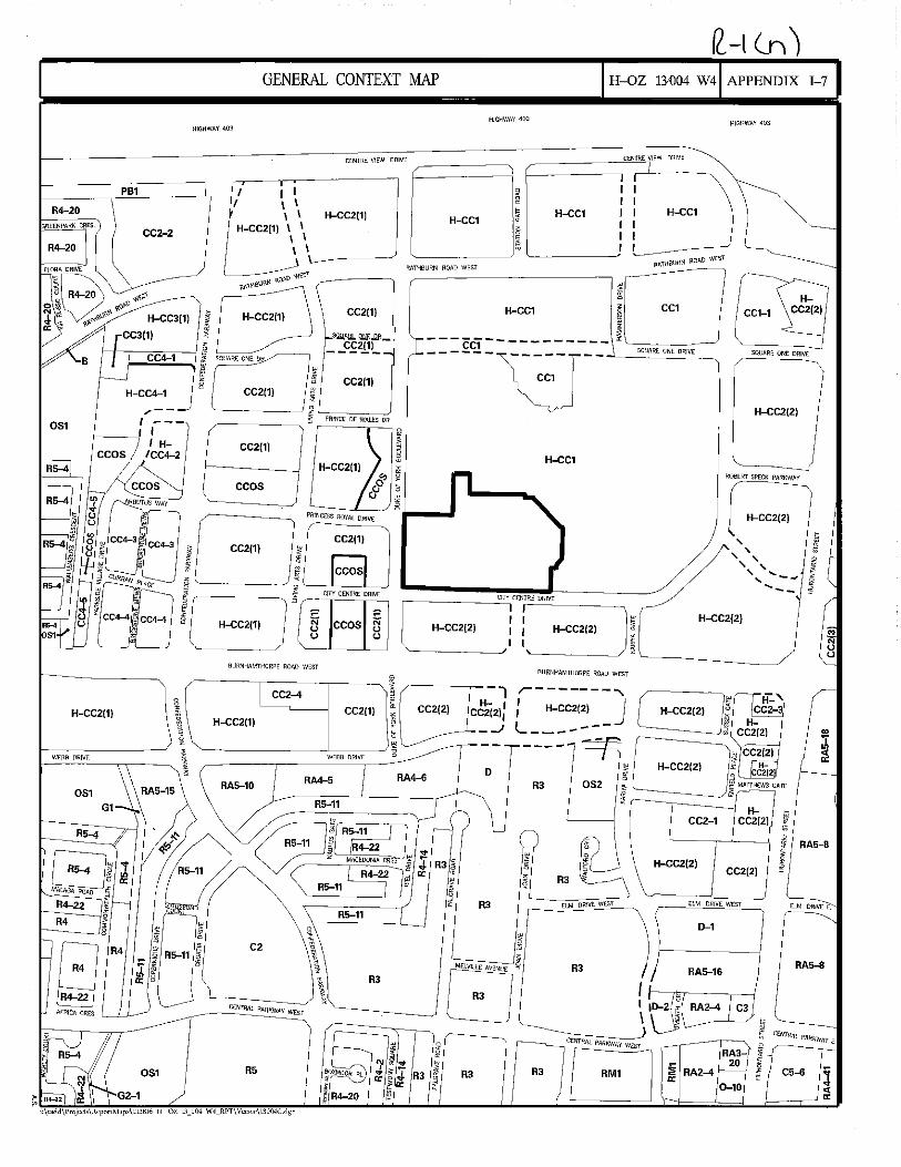
GENERAL CONTEXT MAP H-OZ 13-004 W4 APPENDIX 1-7
PB1
R4-20
CC2-2
HIGHWAY 403
I I I \ \
' \ H-CC2{1) \ \
' '
HIGHWAY 403 HIGHWAY 403
CENTRE VIEW DRIVE ---------'''""~''-iE VIEW DRIVE
H-CC1 H-CC2(1) H-CC1 H-CC1
' ' I-------'
051
,.__,c"c"'""'"'''-..J I ""'" °'' , 8
CC2(1) H-CC4-1
/--
I /
I I I H-
ICC4-2 CC2(1)
CC05
r~J r~=] :3 CC4-3 tJ ~ CC4-3 $ CC2(1) ~ ~ ~ ~ .!!] s if l:"-
;B'"""B""" '2; .'Ji "' it' "- CC4-4 ""
~ CC4-4 8 H-CC2(1)
CC2(1)
CC2(1)
I • ~
' ~--~'----' ~ PRINCESS RDYAl DRIVE
CC2(1)
ccos CITY CENTRE DRIVE
ii " CC05 N
" " "
RATHBURN ROAD WEST
H-CC1
---c5-----------
"[ ~·"'"~"" "'°] "" i CC1
' CC1-1
HCC2(2)
SQUARE ONE DRIVE
------l-~=-T--
0 SQUARE ONE DRIVE
H-CC2{2)
H-CC1
ROBERT SPECK PARKWAY
.._ _ _, H-CC2(2)
' 9 ' ' a '' ii: ''.... ;::; ' .... -.., I -- -
H-CC2(2) H-CC2(2)
~--------''C':ITY CENTRE PRIVE
~w
I H-CC2(2) ~
BURNHAMTl-JORPE ROAD WEST I l'--~~~~~~
BURNKAMTHORPE ROAD WEST
CC2-4
CC2(1) H-CC2(1) ' I ; --'
r-------, : H-CC2{2) J L ______ _ 1C:"Joi.1
'---------'---~ ~ - -WEBB DRIVE
RA5-10 RA4-6
D R3 052
R5-11
CC2-1
RA5-8
~ ~ ' I R5-11 i 7
~ rr
Bn~ MAU\GA ROAD jE
R4-22 ~ R4 I
~ AfRICll CRES I / J_~
R4
R3 ~
I RS-11
C2 \ • ' 3 ,
\ R3
' C!:NfRAl PARKWAY WEST
R3
EW DRIVE E.
RA5-a
RA2-4 C3
CC2(2) H-CC2(2)
R3
R3 ELM DRIVE WEST ELM DnlVE WEST
RAS-16
D-1
8
~ ~ "' . i ~ J; R3 R3 ci:~ ~
" r:J " CENTRAL PARKWAY €
RA3- < , ~
20 I ~ R3 RA2-4 C5-6
"' 0-10
"'